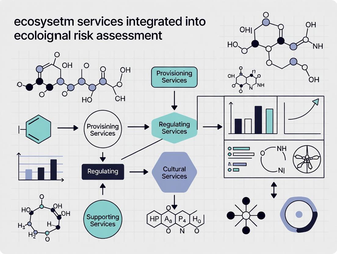
Integrating Ecosystem Services into Ecological Risk Assessment: A Next-Generation Framework for Environmental and Biomedical Research
This article provides a comprehensive exploration of the integration of ecosystem services (ES) into ecological risk assessment (ERA), tailored for researchers, scientists, and drug development professionals.
Integrating Ecosystem Services into Ecological Risk Assessment: A Next-Generation Framework for Environmental and Biomedical Research
Abstract
This article provides a comprehensive exploration of the integration of ecosystem services (ES) into ecological risk assessment (ERA), tailored for researchers, scientists, and drug development professionals. It traces the paradigm shift from traditional, stressor-focused ERA to a holistic approach that centers on protecting the benefits humans derive from nature. The scope encompasses the foundational theory and necessity of this integration, reviews advanced methodological frameworks and computational tools for application, addresses key challenges in implementation and optimization, and evaluates the validation and comparative performance of ES-integrated assessments. By synthesizing current research and case studies, this article aims to equip scientific professionals with the knowledge to develop more ecologically relevant, societally meaningful, and predictive risk assessments for environmental and biomedical applications.
From Stressors to Services: Laying the Foundation for Ecosystem-Centric Risk Assessment
The escalating impact of human activities on natural systems necessitates a fundamental shift in how we assess environmental risk. Traditional Ecological Risk Assessment (ERA) has primarily focused on narrow endpoints like the survival, growth, and reproduction of individual test species, often overlooking the broader, system-wide consequences of environmental degradation [1]. This approach is increasingly recognized as insufficient for informing sustainable management decisions that must balance ecological health with human well-being.
Integrating Ecosystem Services (ES)—the benefits people obtain from ecosystems—into ERA frameworks represents this critical paradigm shift [1]. This integration moves the focus from reductionist endpoints to holistic system functions, directly linking ecological change to human welfare. The goal is to transition ERA from a tool that identifies potential harm into one that evaluates trade-offs and synergies between risks and benefits, supporting more transparent and value-driven environmental decision-making [1] [2]. This article provides detailed application notes and experimental protocols to operationalize this integrated Ecosystem Service-based Risk Assessment (ESRA), aimed at researchers and professionals seeking to implement this advanced approach.
Application Notes: Operationalizing the ES-ERA Framework
This section details the practical components for implementing an ESRA, including core definitions, quantitative metrics, and illustrative case study results.
Foundational Classifications and Methods
The successful integration of ES into ERA requires a clear classification of service types and appropriate methodologies for their quantification. A robust ESRA connects changes in ecological structure and function to impacts on human well-being.
Table 1: Ecosystem Service Categories and Associated Assessment Methods for ERA Integration
| Ecosystem Service Category | Description & Examples | Common Quantification Methods & Proxies | Primary Data Sources |
|---|---|---|---|
| Provisioning Services | Tangible goods obtained from ecosystems (e.g., food, water, raw materials). | Yield metrics (e.g., fish catch, crop tonnage), water flow and quality measurements, resource stock assessments. | Agricultural/forestry inventories, fisheries data, remote sensing of biomass [2]. |
| Regulating Services | Benefits from regulation of ecosystem processes (e.g., climate, water, disease). | Process rates (e.g., sediment denitrification, carbon sequestration), pollutant filtration capacity, flood attenuation models. | In-situ sensor networks, biogeochemical modeling, landscape analysis [1]. |
| Cultural Services | Non-material benefits (e.g., recreation, aesthetic, spiritual). | Visitor use statistics, property value hedonics, survey-based willingness-to-pay, social media geotag analysis. | Social surveys, economic studies, participatory mapping [3]. |
| Supporting Services | Underpin all other services (e.g., nutrient cycling, soil formation). | Net Primary Productivity (NPP), soil organic matter, habitat structure and connectivity indices. | Remote sensing (e.g., NDVI), soil sampling, habitat mapping [1]. |
Core Quantitative Metrics for ESRA
The ESRA framework introduces specific metrics to quantify both the risks of ES loss and the benefits of ES enhancement resulting from human activities or environmental stressors.
Table 2: Core Risk and Benefit Metrics for ESRA (Based on the Cumulative Distribution Function Approach) [1]
| Metric | Definition | Calculation | Interpretation |
|---|---|---|---|
| Risk of ES Degradation | Probability that an activity reduces ES supply below a critical minimum threshold ((Th_{min})). | (P(ES < Th_{min})) | A value of 0.3 indicates a 30% chance the activity will unacceptably degrade the service. |
| Magnitude of Risk | Expected severity of loss if degradation occurs. | (E[Th{min} - ES \mid ES < Th{min}]) | Quantifies the average shortfall relative to the threshold when a risk manifests. |
| Benefit of ES Enhancement | Probability that an activity increases ES supply above a target benefit threshold ((Th_{max})). | (P(ES > Th_{max})) | A value of 0.6 indicates a 60% chance the activity will enhance the service to a desired level. |
| Magnitude of Benefit | Expected level of enhancement if benefit occurs. | (E[ES - Th{max} \mid ES > Th{max}]) | Quantifies the average surplus relative to the target when a benefit is realized. |
| Net Risk-Benefit Outcome | Integrated metric weighing probabilities and magnitudes of risks vs. benefits. | Context-specific integration (e.g., weighted sum). | Supports holistic comparison of management scenarios. |
Case Study Application: Offshore Developments
The following data illustrates the application of the ESRA framework to assess waste remediation (via sediment denitrification) for offshore development scenarios in the Belgian North Sea [1].
Table 3: Case Study Results for Waste Remediation ES in Offshore Scenarios [1]
| Development Scenario | Baseline Denitrification Rate (µmol N m⁻² h⁻¹) | Post-Impact Denitrification Rate (µmol N m⁻² h⁻¹) | Risk of Degradation (P(ES < Th_min)) | Benefit Potential (P(ES > Th_max)) | Key Driver of Change |
|---|---|---|---|---|---|
| Offshore Wind Farm (OWF) | 25.5 ± 3.2 | 37.8 ± 4.1 (Increase) | Low (0.05) | High (0.85) | Increased Total Organic Matter (TOM) from biological colonization. |
| Mussel Longline Culture | 25.5 ± 3.2 | 18.2 ± 2.7 (Decrease) | Moderate (0.40) | Low (0.10) | Organic enrichment exceeding optimal levels, reducing efficiency. |
| Multi-Use (OWF + Mussel) | 25.5 ± 3.2 | 30.1 ± 3.5 (Increase) | Very Low (0.02) | Moderate (0.55) | Synergistic effect: OWF structures provide habitat, stabilizing organic input from mussels. |
Experimental Protocols for ESRA Implementation
Protocol 1: Problem Formulation and Assessment Endpoint Selection
Objective: To define the scope, ecological entities, and specific ecosystem service endpoints for the assessment [4].
- Convene Stakeholders: Collaborate with risk managers, decision-makers, and scientific experts to align the assessment with management goals [4].
- Define the Stressor and Scenario: Clearly identify the human activity or environmental stressor (e.g., chemical release, land-use change, infrastructure project) and the scenarios to be evaluated (e.g., "before/after," "with/without project") [4].
- Select Valued Ecosystem Components (VECs): Identify ecological entities (species, habitats, functional groups) that are ecologically relevant, susceptible to the stressor, and valued by society [4].
- Define ES Assessment Endpoints: For each VEC, specify the measurable ecosystem service it provides (e.g., "Water purification by wetland sediment microbial communities"). The endpoint must be an ecologically relevant service that is susceptible to the stressor and meaningful to stakeholders [1] [4].
- Develop a Conceptual Model: Create a diagram (see Section 4.1) illustrating the pathways from the stressor source to exposure, to effects on ecological structures/functions, and finally to changes in ES delivery and human well-being [4].
- Set Risk and Benefit Thresholds: Establish quantitative thresholds for each ES endpoint:
- (Th{min}): The minimum acceptable level of service provision (degradation threshold).
- (Th{max}): The target level for enhanced service provision (benefit threshold) [1].
- Develop an Analysis Plan: Specify the data requirements, methodologies for exposure and effects assessment, and the models to be used for ES quantification.
Protocol 2: Quantitative ESRA Using Cumulative Distribution Functions (CDF)
Objective: To probabilistically quantify the risks and benefits to ES supply following the ERA-ES method [1].
- Quantify Baseline ES Supply: Using field studies, models, or literature data, estimate the baseline (pre-stressor) level of the ES. Represent this as a distribution (e.g., mean ± SD) to account for spatial/temporal variability.
- Model Stressor-Induced Change: Develop or apply a model (statistical, mechanistic, or ecological) to predict the change in the ES metric due to the stressor. For example, use a multiple linear regression linking sediment TOM and FSF to denitrification rates [1]. Run the model probabilistically (e.g., via Monte Carlo simulation) to generate a post-impact distribution of possible ES outcomes.
- Construct Cumulative Distribution Functions (CDFs): Plot the CDFs for both the baseline and post-impact ES supply distributions.
- Calculate Risk and Benefit Metrics: From the post-impact CDF:
- Risk of Degradation: Read the cumulative probability at (Th{min}). This is (P(ES < Th{min})).
- Magnitude of Risk: For the subset of simulations where (ES < Th{min}), calculate the average difference (E[Th{min} - ES]).
- Benefit Potential: Calculate 1 minus the cumulative probability at (Th{max}). This is (P(ES > Th{max})).
- Magnitude of Benefit: For the subset where (ES > Th{max}), calculate the average difference (E[ES - Th{max}]) [1].
- Compare Scenarios: Calculate metrics for different management scenarios (e.g., different development designs, remediation options) to enable comparative risk-benefit analysis and inform decision-making.
Protocol 3: Integrative Field Assessment for Chemical Stressors
Objective: To assess the impact of chemical contaminants (e.g., Total Petroleum Hydrocarbons - TPH, metals) on ecosystem services in a field setting [5] [6].
- Site Characterization & Stratified Sampling: Segment the study area based on land use/cover (using remote sensing) and suspected contamination gradients [5]. Collect stratified, composite soil/sediment/water samples.
- Chemical Analysis: Analyze samples for target contaminants (e.g., TPH fractions, heavy metals like As, Pb, Cd). Use standard methods (e.g., EPA 8015 for TPH, ICP-MS for metals) [6].
- Ecological Process Measurement: At each sampling location, measure key ES-related processes:
- Soil/Sediment Function: Nutrient cycling rates (e.g., nitrogen mineralization, denitrification potential), microbial respiration, enzyme activities.
- Primary Productivity: Plant biomass (in terrestrial sites), chlorophyll-a concentration (in aquatic sites).
- Decomposition: Standardized litter bag decomposition rates.
- Biotic Community Assessment: Conduct surveys of key biotic groups (e.g., benthic macroinvertebrates, soil arthropods, plant diversity) as indicators of ecosystem health and functional redundancy.
- Data Integration and Modeling: Use multivariate statistics (e.g., PCA, RDA) to link contaminant levels to changes in process rates and community structure. Employ spatial modeling or machine learning (e.g., Random Forest) with remote sensing covariates to predict ES degradation risk across the landscape [5].
- Risk Characterization: Integrate chemical concentrations with toxicological benchmarks (e.g., sediment/soil screening values from Table 7-1 in [6]) and observed ecological effects to characterize risks to specific ES.
Framework Visualization and Workflows
Visualization 1: Integrated ESRA Workflow and Conceptual Model
Visualization 2: Ecological Pathway from Stressor to Service Benefit
Visualization 3: ESRA Decision Matrix for Scenario Prioritization
Table 4: Key Research Reagents, Models, and Tools for ESRA Implementation
| Tool/Resource Name | Category | Function in ESRA | Example/Reference |
|---|---|---|---|
| Sediment/Soil Core Samplers | Field Equipment | Collecting undisturbed samples for analyzing contaminant levels (e.g., TPH, metals) and measuring in-situ process rates (e.g., denitrification). | Standard piston corers; Used in offshore and terrestrial case studies [1] [5]. |
| Multispectral/Hyperspectral Sensors | Remote Sensing | Land cover classification, monitoring vegetation health (NDVI), and identifying contamination hotspots over large spatial scales. | Landsat, Sentinel-2; Used to model spatial distribution of soil contaminants [5]. |
| Random Forest & Other ML Algorithms | Software/Model | Analyzing complex, non-linear relationships between multiple stressors (environmental covariates) and ES endpoints. Predicts risk across landscapes. | Used to map Potentially Toxic Elements (PTEs) with high precision [5]. |
| Eco-Health Relationship Browser | Decision Support Tool | Interactive tool to explore linkages between ecosystems, the services they provide, and potential human health outcomes. | U.S. EPA tool for educating and scoping assessments [3]. |
| CADDIS (Causal Analysis/Diagnosis Decision Information System) | Decision Support Tool | Online resource to help investigators systematically evaluate potential causes of observed biological impairments in stream ecosystems. | U.S. EPA framework for structured causal assessment [3]. |
| EnviroAtlas | Decision Support Tool | Provides interactive maps and tools to explore ES metrics (e.g., pollutant removal, carbon storage) for specific geographic areas. | U.S. EPA tool for incorporating ES benefits into planning [3]. |
| PETROTOX Model | Ecotoxicological Model | Predicts the toxicity of complex petroleum hydrocarbon mixtures to aquatic organisms, supporting the derivation of TPH screening values. | Cited in Canadian TPH ERA guidance [6]. |
| Final Ecosystem Goods & Services (FEGS) Scoping Tool | Conceptual Tool | Provides a structured process to identify and prioritize stakeholders and the specific ES relevant to a decision context. | Used in planning phase to define assessment endpoints [3]. |
Application Notes: Quantitative Assessments of Integrated Ecosystem Service Risk
Integrating ecosystem services (ES) into ecological risk assessment (ERA) shifts the focus from mere structural landscape changes to the functional implications for human well-being. The following quantitative summaries from contemporary studies demonstrate the application of this integrated framework, highlighting mismatches between supply and demand and their spatiotemporal dynamics.
Table 1: Spatiotemporal Dynamics of Ecosystem Service Supply and Demand (2000-2020) in Xinjiang [7]
| Ecosystem Service | Supply (2000) | Demand (2000) | Supply (2020) | Demand (2020) | Key Trend (2000-2020) |
|---|---|---|---|---|---|
| Water Yield (WY) | 6.02 × 10¹⁰ m³ | 8.60 × 10¹⁰ m³ | 6.17 × 10¹⁰ m³ | 9.17 × 10¹⁰ m³ | Supply and demand both increased; deficit expanded. |
| Soil Retention (SR) | 3.64 × 10⁹ t | 1.15 × 10⁹ t | 3.38 × 10⁹ t | 1.05 × 10⁹ t | Supply and demand decreased; high-risk deficit areas remain. |
| Carbon Sequestration (CS) | 0.44 × 10⁸ t | 0.56 × 10⁸ t | 0.71 × 10⁸ t | 4.38 × 10⁸ t | Demand grew nearly 8x faster than supply; risk intensified. |
| Food Production (FP) | 9.32 × 10⁷ t | 0.69 × 10⁷ t | 19.8 × 10⁷ t | 0.97 × 10⁷ t | Supply increased significantly; surplus expanded (low risk). |
Table 2: Integrated Risk Zoning Based on Landscape Ecological Risk (LER) and Ecosystem Services (ES) in the Wuling Mountain Area (2000-2020) [8]
| Ecological Zone Type | Defining Characteristics (LER vs. ES) | Primary Management Strategy | Spatial Trend (2000-2020) |
|---|---|---|---|
| Ecological Conservation Zone | Low LER, High ES Capacity | Strict protection, limit human disturbance. | Zone area expanded. |
| Ecological Enhancement Zone | Moderate LER, Moderate ES Capacity | Active restoration, improve ecosystem structure. | Zone area remained stable. |
| Ecological Reshaping Zone | High LER, Low ES Capacity | Structural landscape reshaping, control risk sources. | Zone area contracted. |
| Ecological Control Zone | High LER, Variable ES | Targeted interventions, regulate intensive human activity. | Localized increases in peri-urban zones. |
Experimental Protocol: Integrated Assessment of Ecosystem Service Supply-Demand Risk (ESSDR)
This protocol details the methodology for assessing ecological risk based on the mismatch between ecosystem service supply and demand, applicable to regional and watershed scales [7].
Study Design and Data Requirements
- Objective: To quantify the spatiotemporal mismatch between the provision (supply) and human utilization (demand) of key ecosystem services and to map associated ecological risks.
- Scale: Regional (e.g., autonomous region, basin, urban agglomeration).
- Temporal Frame: Multi-decadal analysis (e.g., 2000, 2010, 2020) to capture trends.
- Core Data Inputs:
- Land Use/Land Cover (LULC) Maps: High-resolution, time-series data derived from satellite imagery (e.g., Landsat, Sentinel).
- Biophysical Data: Digital Elevation Models (DEM), soil type and depth maps, precipitation and evapotranspiration data, net primary productivity (NPP) data.
- Socioeconomic Data: Population density grids, statistical yearbook data (e.g., grain production, water consumption), location of urban centers and infrastructure.
Ecosystem Service Quantification
- 2.1 Model Selection: Utilize the InVEST (Integrated Valuation of Ecosystem Services and Tradeoffs) model suite. It is a spatially explicit, open-source toolset for mapping and valuing ES [8] [7].
- 2.2 Key Service Modules:
- Water Yield (WY): Run the InVEST Annual Water Yield model. Requires precipitation, evapotranspiration, soil depth, plant available water content, and LULC data.
- Soil Retention (SR): Run the InVEST Sediment Delivery Ratio model. Requires rainfall erosivity, soil erodibility, DEM, and LULC data.
- Carbon Sequestration (CS): Run the InVEST Carbon Storage and Sequestration model. Requires carbon pool data (above/belowground biomass, soil, dead organic matter) for each LULC class.
- Food Production (FP): Model as the biophysical potential of crop production. Can be derived from NPP data or calculated using crop yield statistics allocated spatially based on cultivated land maps.
Supply-Demand Dynamics and Risk Index Calculation
- 3.1 Spatial Explicit Supply & Demand Mapping:
- Supply: Direct outputs from InVEST models are normalized and mapped on a grid-cell basis.
- Demand: Model based on population density, economic activity, and resource consumption patterns. For example, water demand is allocated via population grids; food demand via regional consumption statistics.
- 3.2 Calculate Supply-Demand Ratio (ESDR):
ESDR = (Supply - Demand) / SupplyorESDR = Supply / Demand- ESDR > 0 indicates a surplus (low risk).
- ESDR < 0 indicates a deficit (high risk).
- 3.3 Trend Analysis: Calculate the Supply Trend Index (STI) and Demand Trend Index (DTI) using linear regression slopes of supply/demand values over the time series.
- 3.4 Integrated ESSDR Classification: Create a risk classification matrix by cross-referencing ESDR status (deficit/surplus) with ESDR trend (improving/worsening). This yields four risk classes: Persistent Deficit (High Risk), Expanding Deficit (High Risk), Shrinking Surplus (Moderate Risk), and Stable Surplus (Low Risk).
Risk Bundling and Spatial Planning
- 4.1 Cluster Analysis: Apply a Self-Organizing Feature Map (SOFM), an unsupervised neural network, to cluster grid cells based on their ESDR profiles for all studied services (WY, SR, CS, FP) [7].
- 4.2 Identify Risk Bundles: The SOFM output identifies spatially contiguous "bundles" of areas sharing similar multi-service risk profiles (e.g., "Water-Soil High-Risk Bundle").
- 4.3 Management Zoning: Overlay risk bundles with administrative boundaries and protected areas to delineate zones for tailored management interventions, as demonstrated in Table 2.
Visualizing the Integrated Assessment Framework
Protocol: Geographically Weighted Analysis of LER-ES Relationships
This protocol employs advanced spatial statistics to diagnose local, non-stationary relationships between landscape ecological risk (LER) and ecosystem services (ES), guiding targeted management [8].
Preparation of LER and ES Indices
- 1.1 Calculate Landscape Ecological Risk Index (LERI):
- Based on landscape pattern indices (e.g., fragmentation, isolation, dominance).
- Use a moving window or watershed approach to compute a composite LERI for each spatial unit.
- 1.2 Calculate Ecosystem Service Index (ESI):
- Normalize and weight multiple, co-assessed ES (e.g., Habitat Quality, Soil Conservation, Water Yield from InVEST) [8].
- Aggregate into a single Modified Ecosystem Service Life Index (MESLI) or similar composite ESI for each corresponding spatial unit.
Geographically and Temporally Weighted Regression (GTWR)
- 2.1 Model Rationale: GTWR captures how the relationship between LER (independent variable) and ES (dependent variable) varies across space and time, unlike global models that assume a uniform relationship [8].
- 2.2 Software Implementation: Execute in Python (using
mgwrorGTWRpackages) or R. - 2.3 Model Execution:
- Input: Panel data with ESI, LERI, spatial coordinates, and time identifier for each unit (e.g., 2000, 2010, 2020).
- Set spatial and temporal bandwidth parameters (optimized via AICc or cross-validation).
- Run GTWR to obtain local regression coefficients (β) for each spatial unit at each time point.
- 2.4 Interpretation of Results:
- A negative local β coefficient indicates that increased LER degrades ES at that location (a expected, punitive relationship).
- A positive or non-significant β indicates a decoupled or complex relationship, highlighting areas where ES are resilient to LER or driven by other factors.
- Map the spatial distribution of β coefficients to identify "relationship hotspots."
Quadrant Analysis for Ecological Zoning
- 3.1 Create a 2-D Scatter Plot: Plot each spatial unit based on its LERI (x-axis) and ESI (y-axis) values.
- 3.2 Delineate Quadrants:
- Quadrant I (High ES, Low LER): Ecological Conservation Zone. Priority for strict protection.
- Quadrant II (High ES, High LER): Ecological Enhancement Zone. Focus on risk source control to protect high-value services.
- Quadrant III (Low ES, High LER): Ecological Reshaping Zone. Requires major restoration or landscape restructuring.
- Quadrant IV (Low ES, Low LER): Ecological Control Zone. Potential for sustainable development under strict regulation.
- 3.3 Integrate GTWR Insights: Overlay the map of GTWR β coefficients onto the quadrant zones. Areas in Quadrants II/III with strong negative β are immediate priorities, as risk directly degrades services.
Workflow for Integrated Ecological Zoning and Scenario Simulation
Table 3: Core Research Tools and Models for Integrated ES-ERA
| Tool/Resource Name | Category | Primary Function in Research | Key Application |
|---|---|---|---|
| InVEST Model Suite | Ecosystem Service Modeling | Spatially explicit quantification and valuation of multiple ecosystem services (e.g., water yield, carbon, habitat) [8] [7]. | Generating supply maps for ES used in supply-demand mismatch and risk calculations. |
| QGIS / ArcGIS Pro | Geographic Information System (GIS) | Platform for spatial data management, analysis, and visualization; essential for processing input data and mapping results. | Calculating landscape indices, performing spatial overlay, and creating final risk and zoning maps. |
| Geographically Weighted Regression (GWR/GTWR) | Spatial Statistics | Models spatially varying relationships between variables, identifying local hotspots of correlation or impact [8]. | Analyzing non-stationary relationships between LER and ES to inform localized management. |
| Self-Organizing Feature Map (SOFM) | Machine Learning / Clustering | Unsupervised neural network for pattern recognition and clustering of multi-dimensional data [7]. | Identifying bundles of areas with similar multi-ecoservice risk profiles for grouped management. |
| FLUS / PLUS / CA-Markov | Land Use Change Simulation | Models future land use and cover change under different socioeconomic and climate scenarios [9]. | Projecting future LULC to assess long-term ecological risk and ecosystem health trajectories. |
| R / Python (with spatial libraries) | Statistical Programming | Environment for advanced statistical analysis, custom model scripting, and automating geospatial workflows. | Executing GTWR analysis, calculating complex indices, and batch-processing spatial data. |
Abstract This article provides detailed application notes and protocols for the integrated use of the Ecosystem Services (ES) Cascade framework, the Social-Ecological Systems (SES) framework, and Ecological Risk Assessment (ERA). Framed within the context of advancing ecosystem services integration into ecological risk research, the content outlines standardized methodologies, quantitative assessment tools, and practical workflows. Designed for researchers and applied professionals, it synthesizes current frameworks for assessing risks arising from the mismatch between ES supply and demand within complex, human-dominated systems. Protocols for geospatial analysis, predictive modeling, and participatory foresight are detailed, supported by comparative data tables and visualizations of integrated assessment pathways.
Traditional Ecological Risk Assessment (ERA) has predominantly focused on stressors and their impacts on ecological structures and functions, often overlooking the ultimate benefits these systems provide to human well-being [7]. Concurrently, the Ecosystem Services (ES) Cascade framework effectively maps the flow of benefits from biophysical structures to people but may not systematically account for the governance and social dynamics that mediate risk [10]. The Social-Ecological Systems (SES) framework addresses this gap by diagnosing the complex interdependencies between resource systems, governance, actors, and resource units [11].
Integrating these three core frameworks addresses a critical gap: enabling a comprehensive risk assessment that links ecological degradation to its socio-economic consequences and identifies leverage points within governance systems for risk mitigation [12]. This synthesis is particularly urgent for managing risks in vulnerable regions like coastal deltas, arid zones, and mountainous areas, where climate change and human pressures amplify disparities between ES supply and demand [7] [13]. This article details the operational protocols and analytical tools to execute this integrated approach.
Core Frameworks and Their Synthesis
2.1 The Ecosystem Services (ES) Cascade Framework The ES Cascade model standardizes the benefit delivery process into core, measurable components: Supply (ecosystem's capacity to provide a service), Flow (the actual use or movement of the service), and Demand (human needs or desires for that service) [10]. A concise, operational version of this framework is essential for avoiding terminological confusion and for structuring assessments [10]. Research categories based on this framework include Supply-Demand assessments (Category 1), Supply-Flow-Demand assessments (Category 2), and spatial ES flow analyses that map interregional transfers (Category 3) [10]. This framework directly informs risk identification by highlighting where and when demand outstrips supply or flow.
2.2 The Social-Ecological Systems (SES) Framework Elinor Ostrom’s SES framework provides a diagnostic tool for analyzing the complex interactions within systems where human societies are intertwined with natural resources [11]. Its core first-tier components are the Resource System (RS), Resource Units (RU), Governance System (GS), and Actors (A) [11]. Each component is characterized by second-tier variables (e.g., clarity of system boundaries for RS, mobility for RU, property-rights systems for GS, and socio-economic attributes of A) that determine sustainability outcomes [11]. This structure is critical for moving beyond biophysical risk analysis to understand how institutional rules, actor behaviors, and governance interactions can amplify or mitigate ecological risk [12].
2.3 Ecological Risk Assessment (ERA) Based on ES Supply-Demand Modern ERA is evolving from landscape pattern analysis towards a focus on ES supply-demand balance (SDB) [7] [14]. Risk is conceptualized as the potential for a deficit where ES demand exceeds sustainable supply, leading to losses in human well-being [7]. This approach allows for the spatial identification of high-risk areas and the projection of risk trends under future scenarios [14]. Integrating the ES cascade into this process allows for a more nuanced risk characterization that considers both the capacity of ecosystems and the societal dependency on their services [15].
2.4 Synthesized Framework: From ES Flow to SES Risk Governance The integrated framework connects the ES Cascade (the what of risk) with the SES components (the why and how of risk manifestation and management). A change in a biophysical structure (affecting ES supply) or in human demand patterns creates a potential risk. Whether this potential manifests as an actual impact depends on the mediating filters of the Governance System and the attributes of the Actors within the SES [12] [11]. This synthesis enables a systematic analysis of risk drivers across ecological and social domains and guides the development of targeted, context-specific risk management interventions.
Table 1: Core Components of the Integrated ES-SES-Risk Assessment Framework.
| Framework | Core Component | Role in Integrated Risk Assessment | Key Diagnostic Question |
|---|---|---|---|
| ES Cascade | Supply (Capacity) | Quantifies the ecosystem's ability to provide a service under pressure. | What is the maximum sustainable yield of the service? |
| Flow (Actual Use) | Measures the realized service provision and spatial transfer. | How much of the service is actually mobilized and who benefits? | |
| Demand (Human Need) | Quantifies societal dependency and consumption of the service. | What is the current and projected need for this service? | |
| SES Framework | Resource System (RS) | Defines the ecosystem boundaries and productivity facing pressures. | What are the system's characteristics and resilience? |
| Governance System (GS) | Analyzes the rules and institutions managing the resource system. | How do property rights and policies affect resource use? | |
| Actors (A) | Identifies the stakeholders who affect or are affected by ES risk. | Who are the relevant users, managers, and beneficiaries? | |
| Risk Assessment | Supply-Demand Balance (SDB) | Identifies spatial mismatches and quantifies deficit/surplus. | Where does demand exceed sustainable supply? |
| Risk Characterization | Evaluates the severity and likelihood of ES loss impacts. | What are the consequences of an ES deficit for well-being? |
Integrated Application and Quantitative Assessment
3.1 Quantifying ES Supply-Demand for Risk Identification Operationalizing integrated risk assessment requires quantifying ES supply and demand. The InVEST (Integrated Valuation of Ecosystem Services and Tradeoffs) model suite is a premier tool for spatially modeling ES supply, including water yield, carbon sequestration, habitat quality, and soil retention [7] [16]. Demand is often modeled using socio-economic data (population, GDP, land use intensity) or consumption statistics [7].
Table 2: Example ES Supply-Demand Dynamics and Risk from Xinjiang (2000-2020) [7].
| Ecosystem Service | Supply (2000) | Demand (2000) | Supply (2020) | Demand (2020) | Key Risk Trend (2000-2020) |
|---|---|---|---|---|---|
| Water Yield (WY) | 6.02 × 10¹⁰ m³ | 8.60 × 10¹⁰ m³ | 6.17 × 10¹⁰ m³ | 9.17 × 10¹⁰ m³ | Persistent, expanding deficit. High risk. |
| Soil Retention (SR) | 3.64 × 10⁹ t | 1.15 × 10⁹ t | 3.38 × 10⁹ t | 1.05 × 10⁹ t | Supply decline, demand stable. Moderate risk. |
| Carbon Sequestration (CS) | 0.44 × 10⁸ t | 0.56 × 10⁸ t | 0.71 × 10⁸ t | 4.38 × 10⁸ t | Supply increase overwhelmed by surging demand. Very high risk. |
| Food Production (FP) | 9.32 × 10⁷ t | 0.69 × 10⁷ t | 19.80 × 10⁷ t | 0.97 × 10⁷ t | Significant surplus. Low risk. |
Spatial analysis, often in a Geographic Information System (GIS), then calculates indices like the Supply-Demand Ratio (SDR) or Coupling Coordination Degree to classify areas into risk levels (e.g., deficit, balanced, surplus) [7] [14]. A study in Southwest China demonstrated that an LER evaluation based on ES supply-demand balance was more reasonable and reliable than traditional landscape pattern indices, as it directly reflects human pressure on ecosystems [14].
Table 3: Comparison of Landscape Ecological Risk (LER) Evaluation Methods [14].
| Evaluation Method | Basis of Risk | Key Strengths | Key Limitations |
|---|---|---|---|
| Traditional LER Index | Landscape pattern (fragmentation, disturbance). | Easy to calculate with land use data; good for structural analysis. | Does not link ecological structure to human well-being or service flow. |
| ES Supply-Demand Balance (SDB) Method | Mismatch between ES capacity and societal demand. | Directly relevant to human welfare; identifies functional risk hotspots. | Requires more complex data on both ecosystem functions and socio-economics. |
3.2 From Single Services to Risk Bundles Because ES interact through trade-offs and synergies, risk must be assessed for multiple services simultaneously. The Self-Organizing Feature Map (SOFM), an artificial neural network for clustering, can identify "risk bundles"—geographic areas with similar, co-occurring ES supply-demand risk profiles [7]. For example, in Xinjiang, four dominant bundles were identified: B1 (high-risk for WY, SR, CS), B2 (high-risk for WY, SR), B3 (integrated high-risk), and B4 (integrated low-risk) [7]. Managing for risk bundles is more efficient than managing single-service risks.
3.3 Integrating Foresight and Scenario Planning Static risk assessment must be complemented with dynamic scenario analysis to evaluate future risk under different governance and development pathways. This integrates the SES framework's focus on governance with predictive modeling. The PLUS (Patch-generating Land Use Simulation) model can project land-use change under scenarios like Natural Development, Planning-Oriented, and Ecological Priority [16]. These future land-use maps then feed back into the InVEST model to project ES supply and resulting risk profiles [16]. Participatory foresight workshops, which combine the SES framework with megatrend analysis (e.g., climate change, demographic shifts), can help define plausible and relevant scenarios by engaging local actors and stakeholders [11].
Detailed Methodological Protocols
4.1 Protocol 1: Spatial ES Supply-Demand Risk Assessment Objective: To spatially quantify and map ecological risk based on the supply-demand mismatch for multiple ecosystem services. Workflow:
- Define Scope & Services: Select the study region and 3-5 key ES (e.g., Water Yield, Carbon Sequestration, Habitat Quality) based on local socio-ecological context [7] [16].
- Model ES Supply: For each service and time point (e.g., 2000, 2010, 2020), run corresponding InVEST models. Required inputs include land use/cover maps, biophysical data (soil, DEM, precipitation, evapotranspiration), and species distribution data for habitat quality [7] [16].
- Model ES Demand: Spatialize demand indicators. For Water Yield, demand can be represented by population density or agricultural/industrial water use data [7]. For Carbon Sequestration, demand can be represented by regional carbon emission inventories [7].
- Calculate Supply-Demand Ratio (SDR): Perform a pixel-by-pixel calculation: SDR = Supply / Demand. Normalize results to a 0-1 scale. Values <1 indicate deficit (risk), >1 indicate surplus [7].
- Classify Risk Levels: Classify SDR results into discrete risk levels (e.g., Low, Medium, High, Very High) using natural breaks or percentile methods.
- Cluster Risk Bundles: Use the SOFM algorithm in tools like MATLAB or R. Input the multi-service SDR layers for the final time point. The algorithm will cluster pixels into distinct risk bundles based on the similarity of their multi-service risk profiles [7].
- Validate & Interpret: Ground-truth risk hotspots with local environmental data. Interpret bundle characteristics by overlaying them with land use, population, and infrastructure data to identify driving factors.
4.2 Protocol 2: Participatory SES Foresight for Risk Scenario Development Objective: To develop socially relevant, long-term risk scenarios by integrating local SES knowledge with global megatrends. Workflow (Based on a 3-4 hour workshop) [11]:
- SES Diagnostic: Prior to the workshop, analysts apply Ostrom's SES framework to the region. Draft initial descriptions of the Resource System, Governance System, Actors, and Resource Units. Identify key interactions and known vulnerabilities [11].
- Stakeholder Assembly: Convene a diverse group of 15-25 participants representing key Actor groups (e.g., farmers, local officials, business owners, conservationists).
- Megatrend Prioritization: Present participants with cards describing 14 global megatrends (e.g., "Climate Change," "Increasing Demographic Imbalances," "Aggravating Resource Scarcity") [11]. Through structured discussion and voting, prioritize 3-4 trends deemed most impactful and least considered for the local SES.
- Scenario Narrative Building: For each prioritized megatrend, facilitate groups to develop qualitative "what if" narratives exploring how the trend could interact with local SES variables over a 20-30 year horizon. For example: "If Climate Change leads to prolonged droughts (affecting RU mobility), and the Governance System fails to update water rights, how might Actor conflicts intensify, altering the ES flow of water?"
- Pathways & Risk Identification: For each narrative, discuss potential adaptation pathways and decision points. Identify key leverage points in the GS and among Actors that could mitigate future ES risks or, conversely, lead to maladaptation.
- Output for Modeling: Translate the qualitative scenario narratives into quantitative assumptions (e.g., rates of land-use change, policy implementation levels, population shifts) to parameterize models like PLUS for predictive risk assessment [16].
4.3 Protocol 3: Predictive Risk Modeling with Machine Learning & Land-Use Simulation Objective: To project future ES supply and risk under multiple socio-economic and policy scenarios. Workflow:
- Historical Driver Analysis: Use a machine learning regression model (e.g., Random Forest, Gradient Boosting) to identify key drivers of historical ES changes. Input drivers include natural factors (precipitation, slope) and human factors (distance to roads, population density, land use intensity). The model ranks the importance of each driver [16].
- Scenario Definition: Define 3-4 future scenarios (e.g., Business-As-Usual, Ecological Conservation, Rapid Urbanization). Quantify the demand projections and policy constraints for each based on Protocol 2 outputs or regional plans.
- Land Use Simulation: Use the PLUS model. Input historical land use maps, driver variable layers (from Step 1), and scenario-specific development restrictions and demand targets. The model will simulate the spatial probability of land use change and generate projected land use maps for the target year (e.g., 2035) [16].
- Future ES & Risk Projection: Run the InVEST models using the projected land use maps and projected climate data (if available) to estimate future ES supply. Calculate future SDR using projected demand data. Compare risk maps across scenarios to evaluate which future pathway minimizes ES risk [16].
The Scientist's Toolkit: Essential Models, Data, and Software
Table 4: Key Research Reagent Solutions for Integrated ES-SES-Risk Assessment.
| Tool/Model | Type | Primary Function in Integration | Key Inputs | Source/Reference |
|---|---|---|---|---|
| InVEST Model Suite | Biophysical Modeling | Quantifies and maps the supply of multiple ecosystem services (e.g., water yield, carbon, habitat). | LULC maps, DEM, soil, precipitation, species data. | [7] [16] |
| PLUS Model | Land-Use Simulation | Projects future land-use changes under different scenarios, providing input for future ES supply modeling. | Historical LULC, driver variables, scenario rules. | [16] |
| Self-Organizing Feature Map (SOFM) | Machine Learning / Clustering | Identifies spatial clusters ("bundles") of co-occurring ES supply-demand risks for targeted management. | Raster layers of ES supply-demand ratios. | [7] |
| GIS Software (e.g., ArcGIS, QGIS) | Spatial Analysis Platform | Essential for data integration, spatial calculation of indices, map algebra, and final visualization. | All geospatial data layers. | [7] [14] |
| CICES Classification | Conceptual Framework | Provides a standardized taxonomy for defining and categorizing ecosystem services consistently. | N/A (Conceptual). | [15] |
| Megatrend Assessment Workshop Kit | Participatory Foresight Protocol | Structures stakeholder engagement to link global drivers with local SES dynamics for scenario building. | Megatrend cards, facilitator guides. | [11] |
Integrated Framework Visualization
Diagram 1: Integrated ES Cascade, SES, and Risk Assessment Framework. The workflow shows how ES components inform SES states, how SES components define and manage risk, and how risk outcomes feedback into the system.
Diagram 2: ES Supply-Demand Risk Assessment and Projection Workflow. A four-phase protocol from data collection, through spatial risk analysis and clustering, to future scenario projection.
Diagram 3: Participatory Foresight Protocol for SES and Scenario Development. A stakeholder-driven process to translate global megatrends and local SES knowledge into parameters for predictive risk modeling.
The integration of the ES Cascade, SES, and Risk Assessment frameworks provides a robust, transdisciplinary foundation for addressing the complex ecological risks of the Anthropocene. This article has outlined the conceptual synthesis, provided comparative data from applied studies, and detailed step-by-step protocols for executing integrated assessments. The key advancement lies in moving from diagnosing single-service deficits to understanding the systemic, socially mediated nature of risk, and finally to the proactive evaluation of risk management pathways through participatory foresight and scenario modeling. For researchers and practitioners, the tools and protocols presented here offer a actionable roadmap for generating science that is not only rigorous but also decision-relevant, ultimately supporting the governance of social-ecological systems towards greater resilience and sustainability.
Application Notes & Conceptual Integration
The integration of Natural Capital, Ecosystem Service (ES) Supply-Demand Imbalance, and Ecological Vulnerability into a unified framework provides a robust, spatially explicit foundation for modern ecological risk assessment (ERA). This paradigm shift moves beyond organism-level toxicity to assess risks to ecosystem structure, function, and the services they provide to human well-being [17]. Natural capital forms the foundational stock, yielding a flow of ES. The imbalance between the biophysical supply and the anthropogenic demand for these services acts as a critical pressure indicator, revealing systems under stress [18]. Vulnerability analysis determines a system's susceptibility to harm from these pressures, integrating exposure, sensitivity, and adaptive capacity [17] [19]. Synthesizing these concepts allows researchers to prioritize risks not merely based on contaminant concentration, but on the potential degradation of valuable services and the resilience of the social-ecological system [20].
Foundational Concepts for ERA Integration
- Natural Capital: The stock of natural assets (e.g., soil, water, vegetation, biodiversity) that yields a flow of ecosystem services. In ERA, it defines the asset at risk.
- ES Supply-Demand Imbalance: A spatial mismatch where the demand for services (e.g., clean water, flood regulation) in a beneficiary area exceeds the supply from proximate or distal natural capital [18] [21]. This imbalance is a key metric for identifying areas of high pressure and potential risk.
- Ecological Vulnerability: The degree to which a natural or social-ecological system is susceptible to, and unable to cope with, adverse effects of multiple stressors. It is a function of exposure to stress, sensitivity to that stress, and adaptive capacity or recovery potential [17] [19].
Quantitative Framework for Integrated Assessment
The quantitative synthesis of these concepts enables spatially informed risk prioritization. The following metrics are central to the framework.
Table 1: Key Quantitative Metrics for Integrated ES-Vulnerability Assessment
| Metric Category | Specific Metric | Description & Calculation | Application in ERA |
|---|---|---|---|
| Supply-Demand Balance | Ecological Supply-Demand Ratio (ESDR) [18] | ESDR = (Service Supply) / (Service Demand). Values <1 indicate a deficit, >1 indicate a surplus. | Identifies regions where natural capital is overburdened, signaling high exposure to degradation risk. |
| Ecosystem Service Value (ESV) [21] | Monetized value of service surplus/deficit (e.g., CNY/year for carbon sequestration, soil conservation). | Quantifies the economic magnitude of imbalance, supporting cost-benefit analysis of risk mitigation. | |
| Vulnerability Components | Exposure Index | Magnitude, frequency, and duration of stressor contact (e.g., pollutant concentration, land-use change intensity). | Derived from ESDR deficits and direct stressor measurements [20]. |
| Sensitivity Index | Innate propensity of a system to be affected by exposure (e.g., based on species traits, habitat fragility) [17]. | Assessed via species sensitivity distributions (SSD) or trait-based analysis. | |
| Adaptive Capacity Index | System's ability to adjust, learn, and recover (e.g., based on biodiversity, connectivity, management efficacy). | Often the most qualitative component, incorporating social and ecological resilience factors [19]. | |
| Spatial Flow | Comparative Ecological Radiation Force (CERF) [21] | Characterizes the direction and magnitude of ES flows from surplus to deficit areas. | Informs transboundary risk and responsibility, crucial for watershed or airshed-scale ERA. |
Table 2: Multi-Scale Analysis of ES Bundles and Drivers (Illustrative Data) [18]
| Spatial Scale | Dominant ES Supply-Demand Bundle (BSDRES) | Key Trade-off Identified | Primary Driver Identified | Implication for Risk Management |
|---|---|---|---|---|
| Fine Scale (3 km grid) | High Food Provision, Low Regulation Services | Strong trade-off between food provision and other ES (water, soil, carbon). | Anthropogenic factors (land use) more prominent. | Targeted, local land-use planning is critical to mitigate trade-offs. |
| County Scale | Reconfigured bundles showing regional specialization. | Trade-offs observed only between specific service pairs. | Mixed natural and anthropogenic drivers. | Zonal management strategies can be effective. |
| Regional Scale | Large surplus zones for regulation services, deficit zones for provisioning. | Spatial decoupling of supply (remote areas) and demand (population centers). | Natural factors (climate, topography) are primary controllers. | Requires regional policy and ecological compensation mechanisms [21]. |
Detailed Experimental Protocols
Protocol 1: Mapping ES Supply-Demand Imbalance
Objective: To quantify and spatially map the balance between ecosystem service supply and societal demand at multiple scales [18] [21].
Workflow Steps:
- Define Study System & Scales: Delineate the study area (e.g., watershed, administrative region). Define nested analysis scales (e.g., regional, county, fine-grid [3 km]).
- Select ES Indicators: Choose 4-5 key ES representing provisioning (e.g., Food Supply), regulating (e.g., Water Yield, Carbon Sequestration/Net Primary Production, Soil Conservation), and cultural services.
- Quantify Biophysical Supply:
- Food Provision (FP): Use crop yield statistics or net primary production (NPP) models.
- Water Yield (WY): Apply the Integrated Valuation of Ecosystem Services and Trade-offs (InVEST) Annual Water Yield model or similar, using precipitation, evapotranspiration, and soil data.
- Carbon Sequestration: Model Net Primary Production (NPP) using MODIS or Landsat data with light-use efficiency models [21].
- Soil Conservation (SC): Use the InVEST Sediment Retention Model or Revised Universal Soil Loss Equation (RUSLE).
- Quantify Societal Demand:
- Map demand indicators: population density (for WY, FP), fertilizer use/erosion risk (for SC), carbon emissions (for NPP).
- Normalize supply and demand metrics to a comparable scale (0-1).
- Calculate Imbalance Metrics:
- Compute the Ecological Supply-Demand Ratio (ESDR) for each ES and pixel/grid:
ESDR = Supply / Demand[18]. - Classify zones as surplus (ESDR>1), balanced (~1), or deficit (ESDR<1).
- Optionally, monetize deficits/surpluses using valuation methods (e.g., shadow pricing for carbon, replacement cost for soil) [21].
- Compute the Ecological Supply-Demand Ratio (ESDR) for each ES and pixel/grid:
- Spatial Analysis & Bundling:
- Perform cluster analysis (e.g., K-means) on multiple ESDR layers to identify Bundles of Supply-Demand Relationships (BSDRES) [18].
- Analyze scale effects by comparing bundle composition and driver importance across your predefined scales.
Protocol 2: Assessing Habitat-Level Ecological Vulnerability
Objective: To evaluate the vulnerability of key habitats to anthropogenic stressors, linking exposure to consequences for ecosystem service delivery [20].
Workflow Steps:
- Habitat and Stressor Inventory:
- Map the distribution of key habitats (e.g., wetlands, forests, seagrass beds) using remote sensing and GIS.
- Map the distribution and intensity of current and future anthropogenic stressors (e.g., urban land use, agricultural runoff, fishing pressure, climate change projections).
- Exposure Assessment:
- For each habitat-stressor pair, develop criteria to score exposure (E) on an ordinal scale (e.g., Low=1, Med=2, High=3). Criteria include spatial overlap, frequency, and intensity of stressor occurrence.
- Consequence Assessment:
- For each habitat-stressor pair, develop criteria to score the habitat-specific consequence (C) of exposure. Criteria include:
- Resistance: Habitat's ability to maintain structure/function when stressed.
- Regeneration Time: Time for habitat to recover post-disturbance.
- Service Impact: Expected degradation in key ES (e.g., fishery nurseries, water filtration).
- For each habitat-stressor pair, develop criteria to score the habitat-specific consequence (C) of exposure. Criteria include:
- Risk Calculation:
- Calculate a relative risk score per habitat-stressor combination:
Risk = E × C. - Aggregate scores across all stressors for a total risk per habitat unit [20].
- Calculate a relative risk score per habitat-stressor combination:
- Spatial Prioritization:
- Map cumulative risk scores.
- Identify high-risk habitats where multiple stressors converge and/or consequences are severe.
Protocol 3: Framework for Species/Population Vulnerability Assessment
Objective: To assess the climate change vulnerability of species or populations by integrating projected exposure with intrinsic sensitivity and adaptive capacity traits [19].
Workflow Steps:
- Attribute Selection: Select species attributes across three categories:
- Exposure (Future Climate): Projected changes in temperature, precipitation, ocean acidification, etc., within the species' range.
- Sensitivity: Biological traits conferring susceptibility (e.g., thermal tolerance, narrow diet, specific habitat requirements, high contaminant bioaccumulation).
- Adaptive Capacity: Traits enabling response (e.g., dispersal ability, genetic diversity, population growth rate, phenotypic plasticity).
- Scoring and Weighting:
- Develop expert-informed scoring guidelines for each attribute (e.g., High, Moderate, Low vulnerability contribution).
- Assign quantitative scores (e.g., 1-3) and relative weights to attributes based on perceived importance.
- Vulnerability Index Calculation:
- Classification and Uncertainty:
- Classify species into vulnerability categories (e.g., Very High to Low).
- Conduct sensitivity analysis on weights and scores to evaluate result robustness.
Visualizations: Conceptual and Methodological Pathways
Diagram 1: Conceptual Framework Linking Key Concepts for ERA
Diagram 2: Multi-Scale ES Supply-Demand Assessment Workflow [18]
Diagram 3: Component-Based Vulnerability Assessment Framework [17] [19]
Table 3: Key Research Reagent Solutions & Analytical Tools
| Tool/Resource Category | Specific Name/Example | Function in Research | Key Application Reference |
|---|---|---|---|
| Ecosystem Service Modeling Suite | InVEST (Integrated Valuation of Ecosystem Services and Trade-offs) | A suite of spatially explicit models for mapping and valuing ES (e.g., water yield, carbon storage, habitat risk). Core tool for quantifying supply. | Habitat Risk Assessment [20]; Water Yield & Sediment Retention modeling. |
| Biophysical Supply Model | CASA (Carnegie-Ames-Stanford Approach) or MODIS NPP Products | Models terrestrial Net Primary Production (NPP), a key metric for carbon sequestration and ecosystem productivity. | Quantifying carbon sequestration service supply and value [21]. |
| Spatial Statistical Analysis Platform | R (with raster, sf, spdep packages) or ArcGIS Pro |
Performs spatial calculations, cluster analysis for ES bundles, and driver analysis (e.g., Geographically Weighted Regression). | Multi-scale ESDR calculation and BSDRES identification [18]. |
| Vulnerability Assessment Framework | NOAA Fisheries Climate Vulnerability Assessment Methodology | Provides a structured attribute-scoring framework to assess species vulnerability to climate change based on exposure, sensitivity, and adaptive capacity. | Assessing vulnerability of fish stocks, habitats, and communities [19]. |
| Socio-Ecological Data | Gridded Population Data (GPW, WorldPop), Land Use Maps (FROM-GLC, ESRI) | Quantifies anthropogenic demand for ES and maps exposure to human stressors. | Mapping ES demand and exposure for imbalance and vulnerability indices [18] [21]. |
| Valuation Database | Ecosystem Service Valuation Database (ESVD) or Country-Specific Shadow Prices | Provides monetary value coefficients for various ES to translate biophysical deficits/surpluses into economic metrics. | Monetizing ES imbalances for ecological compensation analysis [21]. |
Conventional ecological risk assessment (ERA) frameworks have historically focused on evaluating the likelihood of adverse effects on plants, animals, and ecosystems from exposure to environmental stressors like chemicals or land-use change [22]. While this approach is foundational, it often operates in isolation from human well-being endpoints, creating a critical gap between ecological science and societal protection goals. The emerging imperative is to integrate the assessment of ecosystem services (ES)—the benefits nature provides to people—directly into the ERA paradigm [7]. This integration shifts the focus from protecting ecological structures alone to safeguarding the functions and services that underpin human health, economic stability, and community resilience.
This synthesis presents application notes and detailed protocols to operationalize this integration. It provides a methodological bridge for researchers and risk assessors to move from theory to practice, ensuring that environmental management decisions are informed by a complete understanding of both ecological and societal risks.
Application Notes & Integrated Protocols
Foundational Protocol: The EPA Ecological Risk Assessment Framework
The U.S. Environmental Protection Agency’s (EPA) established ERA process provides a robust, three-phase structure adaptable for ES integration [4] [22]. The integrated workflow is delineated in the following diagram.
Diagram 1: ERA-ES Integrated Assessment Workflow.
Phase 1: Planning & Scoping with ES Stakeholders. The planning phase establishes the assessment's purpose, scope, and participants [4]. For ES integration, this must expand beyond traditional risk managers to include a broader set of interested parties and stakeholders who represent the beneficiaries of ecosystem services [4]. This includes municipal planners, agricultural boards, public health officials, and community representatives. The collaborative goal is to identify which ES are valued in the specific context and to link management goals directly to their protection (e.g., "maintain groundwater recharge capacity to ensure municipal water supply") [4].
Phase 2: Problem Formulation with ES Assessment Endpoints. This phase refines assessment objectives and identifies the ecological entities at risk and their attributes important to protect [4]. An integrated approach explicitly defines ES Assessment Endpoints. These are precise expressions of the specific service to be protected, combining the relevant ecological entity (e.g., wetland complex, pollinator community, soil microbial community) with its service-providing attribute (e.g., water filtration capacity, pollination rate, nutrient cycling) [4]. A conceptual model must then diagram the pathways from stressors (e.g., pesticide runoff, urban sprawl) through the ecological receptor to the resultant effect on both the ecosystem and the flow of the ES to human beneficiaries [4].
Phase 3: Analysis of Exposure and ES Effects. The analysis phase evaluates exposure of receptors to stressors and the stressor-response relationship [4] [22]. For ES integration, the exposure assessment must characterize the spatial and temporal dynamics of both ES supply (the ecosystem's capacity to provide a service) and ES demand (human consumption or need for that service) [23] [7]. The effects assessment investigates how the magnitude of a stressor alters the ecological functions that underpin the service. This requires moving beyond standard ecotoxicological data to models that quantify service provision (e.g., InVEST models for water yield or carbon sequestration) [7].
Phase 4: Risk Characterization for ES. Risk characterization synthesizes the analysis to estimate risk [22]. An integrated characterization describes the likelihood and severity of adverse effects on the ES Assessment Endpoints. It interprets the adversity not only in ecological terms but also in terms of diminished service flow to society—such as increased flood damage, reduced crop yields, or impairment of recreational opportunities [4]. The communication of risk must articulate consequences for human well-being to effectively inform risk management decisions.
Advanced Protocol: Quantitative ES Supply-Demand Risk Assessment
This protocol operationalizes the integrated framework by quantifying mismatches between ES supply and demand—a direct measure of risk to societal well-being [23] [7].
Objective: To spatially identify and classify areas of ecological risk based on the imbalance between ecosystem service supply and societal demand.
Methodological Workflow:
- Service Quantification: Select key ES (e.g., water yield, carbon sequestration, soil retention, habitat provision). Quantify biophysical supply using models like InVEST or primary data. Quantify demand using socioeconomic data (e.g., water consumption, population density) [23] [7].
- Supply-Demand Ratio (SDR) Calculation: Calculate the spatialized ratio: SDR = Supply / Demand. Values <1 indicate a deficit (demand exceeds supply), representing potential risk [7].
- Trend Analysis: Calculate indices for supply trend (STI) and demand trend (DTI) over time to understand dynamics [7].
- Risk Classification: Integrate static SDR with dynamic STI/DTI to classify areas into risk categories (e.g., sustainable surplus, stable deficit, expanding deficit) [7].
- Spatial Clustering & Driver Analysis: Use spatial autocorrelation (e.g., Local Moran’s I) to identify significant clusters of high-risk areas. Employ statistical tools like GeoDetector to identify the primary environmental (e.g., land use, vegetation cover) and social drivers of these risk patterns [23].
Table 1: Key Quantitative Findings from Integrated ES Risk Assessment Case Studies.
| Study Region & Reference | Key Ecosystem Services Analyzed | Core Finding: Supply-Demand Imbalance | Identified Primary Risk Drivers |
|---|---|---|---|
| Beijing, China [23] | Biodiversity, Carbon Sequestration, Water Conservation, Food Production, Landscape Recreation | Significant negative correlation between ES supply-demand ratio and landscape ecological risk. Imbalance coupled with high risk in 31.9% of the area. | Land use type, Distance to settlements, Vegetation cover |
| Xinjiang, China (2000-2020) [7] | Water Yield (WY), Soil Retention (SR), Carbon Sequestration (CS), Food Production (FP) | WY & SR: Large, expanding deficit areas. CS & FP: Small, shrinking deficit areas. Clear spatial differentiation: supply along rivers, demand in urban oases. | Water scarcity, Land use change, Climate factors, Population concentration |
Application Protocol: Spatial Prioritization for Management
The output of an integrated ERA-ES assessment is a spatial risk portfolio that directs targeted management [23].
Objective: To translate ES risk maps into prioritized zones for protection, restoration, or intervention.
Procedure:
- Bundle Risk Classes: Use cluster analysis (e.g., Self-Organizing Feature Maps - SOFM) to group geographic areas with similar ES risk profiles into ES Risk Bundles [7]. For example, a "Water-Soil High-Risk Bundle" or an "Integrated Low-Risk Bundle."
- Define Priority Areas: Overlay spatial clusters of high ES deficit with high landscape ecological risk indices. Areas where high-deficit and high-risk clusters coincide are designated Priority Restoration Zones. Areas of high supply and low risk are designated Priority Protection Zones [23].
- Develop Bundle-Specific Management Prescriptions: Tailor strategies to each bundle's dominant risk profile. For example:
- Urban/Peri-urban High-Deficit Bundles: Prioritize green infrastructure, compact urban design, and riparian restoration [23].
- Agricultural High-Deficit Bundles: Promote biodiversity-friendly farming, soil conservation practices, and efficient water use [23].
- Remote High-Supply Bundles: Focus on protected area management and prevention of habitat fragmentation.
The following conceptual model visualizes the causal pathways from anthropogenic stressors to ultimate risks in human well-being, which guides the problem formulation and analysis phases.
Diagram 2: ES Risk Conceptual Model Pathway.
The Scientist's Toolkit: Research Reagent Solutions
Table 2: Essential Models, Tools, and Data for Integrated ERA-ES Research.
| Tool/Reagent Category | Specific Tool/Model | Primary Function in Integrated Assessment | Key Reference/Source |
|---|---|---|---|
| Ecosystem Service Modeling Suite | InVEST (Integrated Valuation of Ecosystem Services and Tradeoffs) | A core suite of spatially explicit models for quantifying and mapping the supply of multiple ES (e.g., water yield, sediment retention, habitat quality). | Used as primary quantification method [7]. |
| Spatial Statistical Analysis Package | GeoDetector | Statistically identifies spatial stratified heterogeneity and detects the explanatory power of environmental driving factors (e.g., land use, elevation) on ES risk patterns. | Used for driver analysis [23]. |
| Spatial Autocorrelation & Clustering Tool | Local Moran’s I / Getis-Ord Gi* | Identifies statistically significant spatial clusters (hotspots/coldspots) of high or low ES supply-demand ratios and ecological risk indices. | Used for identifying priority areas [23]. |
| Risk Classification & Bundling Algorithm | Self-Organizing Feature Maps (SOFM) | An unsupervised neural network for clustering complex, multidimensional data (e.g., multiple ES SDRs and trends) into distinct ES risk bundles for management. | Used for bundle identification [7]. |
| Conceptual Modeling & Workflow Standard | EPA Ecological Risk Assessment Guidelines | Provides the authoritative phased framework (Planning, Problem Formulation, Analysis, Risk Characterization) into which ES components are integrated. | Foundational assessment structure [4] [22]. |
| Data Synthesis & Visualization Platform | Geographic Information System (GIS) | The essential platform for managing, analyzing, and visualizing all spatial data layers: land use, soil, climate, population, model outputs, and final risk maps. | Implicitly required for all spatial analyses [23] [7]. |
Building the Toolkit: Methodologies and Models for Applied ES-Integrated Risk Assessment
The integration of ecosystem services into ecological risk assessment represents a paradigm shift from traditional contaminant-focused evaluations toward a holistic framework that recognizes nature's contributions to human well-being [24]. This integration is critical for addressing complex, multi-stressor environmental challenges, where chemical pressures interact with landscape alteration and climate change [24]. Biophysical modeling tools like InVEST (Integrated Valuation of Ecosystem Services and Tradeoffs) and ARIES (ARtificial Intelligence for Environment & Sustainability) provide the quantitative spatial data necessary to express assessment endpoints as ecosystem services [25] [26]. They enable risk assessors to map and measure services such as water purification, habitat quality, and carbon sequestration, thereby linking ecological changes to impacts on human welfare [27] [28]. This approach directly supports adaptive management strategies, allowing decision-makers to evaluate trade-offs, identify areas of high ecological value and risk, and plan for resilient landscapes under changing environmental conditions [29] [24].
Tool Suites for Service Quantification: Frameworks and Applications
The InVEST Model Suite
Developed by the Natural Capital Project, InVEST is a suite of open-source models that map and value ecosystem services in biophysical or economic terms [27]. Its modular, spatially explicit design uses production functions to model how changes in ecosystem structure affect service flows [25]. The suite's 19 modules are grouped into eight categories supporting diverse analyses in terrestrial, freshwater, and marine systems [25]. Its global application is significant, with over 350 peer-reviewed publications in 2023 alone [25].
Table 1: Prominent InVEST Modules and Their Primary Applications in Risk Contexts
| Module Group/Name | Key Ecosystem Service(s) Quantified | Primary Application in Risk Assessment & Research |
|---|---|---|
| Habitat Quality (HQ) | Habitat provision, biodiversity support | Assessing habitat degradation risk from land-use change and stressors; a dominant module in published studies (29.5% of 2023 articles) [25]. |
| Annual Water Yield (AWY) / Seasonal Water Yield (SWY) | Water supply, water yield | Modeling water provisioning services and scarcity risks under land-use and climate change; used in 22.3% of 2023 studies [25]. |
| Carbon Storage & Sequestration (CS) | Climate regulation, carbon storage | Quantifying carbon sequestration capacity and loss risks from deforestation or degradation; focus of 19.9% of recent studies [25]. |
| Nutrient Delivery Ratio (NDR) | Water purification, nutrient retention | Evaluating non-point source pollution risk and impacts on water quality services [25]. |
| Sediment Delivery Ratio (SDR) | Erosion control, sediment retention | Assessing soil erosion risk and its impact on waterways and reservoirs [25]. |
| Coastal Vulnerability | Storm protection, flood mitigation | Modeling physical risk to coastlines from storms and sea-level rise, highlighting protective service of habitats [25]. |
The ARIES Framework
The ARIES framework is a semantic modeling technology designed for integrated environmental assessments [26]. It uses artificial intelligence and the semantic web paradigm to rapidly assemble the most appropriate models from a knowledge base, connecting local data with global models to trace ecosystem service flows from sources to beneficiaries [26]. Unlike InVEST's predetermined models, ARIES specializes in context-aware integration, identifying and modeling service-specific pathways (e.g., how a wetland protects a particular downstream community). It supports nearly 6,000 users worldwide and is applied across scales, from urban to global assessments [26].
Comparative Analysis: InVEST vs. ARIES
Choosing between InVEST and ARIES depends on the assessment's goals, resources, and required flexibility.
- InVEST is ideal for well-defined questions on specific services (e.g., carbon stocks or water yield). It offers transparent, reproducible models with a lower technical barrier for users with GIS skills [27] [30]. However, it can be less flexible for modeling novel service flows or complex interdependencies [25].
- ARIES excels in complex, data-rich scenarios requiring the integration of multiple services and the explicit mapping of flows to beneficiaries. Its adaptive, AI-assisted assembly is powerful but may present a steeper learning curve and act as more of a "black box" [26].
Table 2: Comparative Overview of InVEST and ARIES
| Feature | InVEST | ARIES |
|---|---|---|
| Core Approach | Pre-defined, modular production function models [27]. | AI-assisted, semantic assembly of model components [26]. |
| Key Strength | Transparency, reproducibility, strong user community [25]. | Flexibility, integration of multiple services and flows to beneficiaries [26]. |
| Data Handling | User-provided input data; sensitivity to data quality [30]. | Can integrate diverse data sources via semantic technology [26]. |
| Best for Risk Assessment... | When endpoints align with core modules (e.g., habitat, water, carbon). | When analyzing complex service dependencies, flows, and beneficiary exposure. |
| Primary Limitation | Simplified hydrology/biogeochemistry; pattern-oriented habitat modules [25]. | Complexity and less direct user control over model assembly logic. |
Diagram 1: Augmenting ERA with Ecosystem Services (97 chars)
Application Notes: Protocols for Model Implementation in Risk Contexts
Protocol 1: Evaluating Watershed Service Risk with InVEST
This protocol applies the Seasonal Water Yield Model (SWY) to assess risks to water provisioning services from land-use change, providing a quantified basis for risk scenarios [30].
1. Objective: To model baseline and future water yield under land-use change scenarios and evaluate the risk to water supply services for downstream communities. 2. Materials & Input Data: - Land Use/Land Cover (LULC) Maps: For baseline (e.g., 2020) and future scenarios (e.g., 2030 under deforestation policy). Resolution: 30m recommended [30]. - Precipitation Data: Monthly average rainfall grids for the study period, ideally from local stations or bias-corrected global products (e.g., WorldClim) [30]. - Soil Data: Soil depth and plant-available water content maps from global soil databases (e.g., SoilGrids) [30]. - Watershed Boundaries: Digital delineation of sub-basins. - Observed Streamflow Data (for validation): Monthly discharge records from gauging stations within the study basins [30]. 3. Procedure: a. Data Pre-processing: Reclassify LULC maps to match InVEST class codes. Convert all raster data to a common projection and resolution. Use the InVEST "Clip and project raster" helper tool. b. Model Parameterization: - Assign a curve number (CN) and biophysical table to each LULC class based on literature values (e.g., USDA NRC standards). - Define the sub-watershed vector and the LULC raster in the model interface. - Set the seasonality parameters (monthly rainfall grids, evapotranspiration coefficient). c. Model Execution: Run the SWY model for the baseline and each future scenario. d. Validation (Critical for Risk Credibility): Compare modeled annual and monthly water yield outputs against observed streamflow data at gauge locations. Calculate performance metrics (e.g., Pearson's r², Nash-Sutcliffe Efficiency) [30]. Note: InVEST SWY typically performs better for annual vs. monthly estimates and in rainier regions [30]. e. Risk Analysis: Calculate the percent change in water yield (m³) for each sub-watershed between scenarios. Overlay with data on dependent populations to map areas of high service provision risk. 4. Interpretation & Integration into ERA: A significant decrease in water yield in a sub-watershed translates to a heightened risk of water scarcity for downstream beneficiaries. This biophysical risk can be combined with exposure data for human communities or sensitive ecological assets to complete a service-oriented risk characterization.
Protocol 2: Climate-Adjusted Ecosystem Service Valuation
This protocol, adapted from regional calibration studies, enhances standard Equivalent Factor Method (EFM) valuations by incorporating climate drivers, providing a more dynamic value basis for risk-cost analyses [31].
1. Objective: To calculate spatially explicit Ecosystem Service Values (ESV) adjusted for local climate variables (temperature, precipitation, NPP) as a baseline for assessing economic risk from service loss. 2. Materials & Input Data: - LULC Maps (as in Protocol 1). - Net Primary Productivity (NPP) Data: Annual MODIS MOD17A3HGF product (1km resolution), processed via Google Earth Engine [31]. - Climate Data: Gridded annual mean temperature and total precipitation data. - Socioeconomic Data: Regional statistics for major crop types (area, yield, market price) to calculate the value of one standard equivalent factor [31]. 3. Procedure: a. Calculate Base Equivalent Factor Value: Use regional crop statistics to determine the economic value (e.g., CNY/ha) of one standard unit of ecosystem service equivalent [31]. b. Develop Dynamic Adjustment Coefficients: - NPP Adjustment Factor (β): β = (NPPlocal / NPPnationalaverage). Accounts for regional productivity differences [31]. - Precipitation Adjustment Factor (γ): γ = (Plocal / Pnationalaverage). Accounts for water availability role [31]. - Temperature Adjustment (Conceptual): Incorporate transpiration cooling effect valuation for climate regulation service, based on energy consumption avoided [31]. c. Calculate Adjusted ESV: For each LULC grid cell, ESVadj = ESVbase × β × γ. Apply LULC-specific equivalent coefficients from published value tables (e.g., Xie et al. 2017). d. Spatial Analysis & Aggregation: Sum ESV_adj across a region to get total value. Map ESV density (value/ha) to identify high-value, high-priority areas for conservation in risk mitigation. 4. Interpretation & Integration into ERA: The climate-adjusted ESV map provides a spatially refined baseline of natural capital stocks. In a risk context, the projected loss of ESV due to a proposed land-use change or pollution event can be quantified as an economic risk metric, directly feeding into a cost-benefit or mitigation analysis within the ERA.
Table 3: Research Reagent Solutions for Ecosystem Service Modeling
| Tool/Resource | Function in ES Modeling & Risk Assessment | Key Source/Example |
|---|---|---|
| InVEST Software Suite | Core modeling platform for quantifying and mapping a suite of ecosystem services using production functions. | Stanford Natural Capital Project [27]. |
| ARIES k.LAB Platform | Semantic modeling environment for assembling integrated, service-flow-aware models. | ARIES Integrated Modeling [26]. |
| QGIS / ArcGIS | Geographic Information System software essential for preparing spatial inputs, running InVEST, and visualizing results. | Open Source (QGIS) / Esri (ArcGIS). |
| Google Earth Engine (GEE) | Cloud platform for accessing and processing global remote sensing data (e.g., Landsat, MODIS) for LULC and NPP inputs. | Google [31]. |
| MODIS Land Products | Source for key biophysical parameters, particularly the MOD17A3HGF product for Net Primary Productivity (NPP). | NASA LP DAAC [31]. |
| WorldClim / CHELSA | Source of global, high-resolution climate grids (precipitation, temperature) for climate-informed modeling. | Historical and future scenario data available. |
| SoilGrids | Global, spatially explicit predictions of soil properties (depth, water content) required for hydrological models. | ISRIC World Soil Information. |
| Global Land Cover Maps | Pre-processed LULC datasets (e.g., ESA WorldCover, FROM-GLC) for regions lacking local maps. | Various spatial and temporal resolutions. |
Diagram 2: Tool Selection Workflow for ES-Integrated ERA (97 chars)
Synthesis and Integration into Ecological Risk Assessment
Effectively integrating biophysical modeling into Ecological Risk Assessment requires aligning the strengths of tools like InVEST and ARIES with the seven key principles for ERA under global change [24]. The quantitative outputs from these models directly address Principle 2 by defining assessment endpoints as quantifiable ecosystem services. For instance, an endpoint could be "the water purification service of the riparian zone," measured by InVEST's Nutrient Delivery Ratio model [25] [24].
This integration is vital for managing multiple stressors (Principle 4). A model like InVEST can simulate how combined stressors—such as agricultural expansion (increased fertilizer load) and climate change (altered rainfall)—interact to affect water quality and quantity services non-linearly [25] [24]. The spatial outputs from these tools are fundamental for adaptive management (Principle 7), allowing managers to visualize high-risk, high-service-value areas and prioritize interventions. Finally, mapping service provision and beneficiaries reduces spatial uncertainty (Principle 6), making risks to human well-being more concrete and actionable for stakeholders [26] [24].
The integration of ecosystem service (ES) supply-demand dynamics with Landscape Ecological Risk (LER) assessment represents a critical advancement in ecological research, moving beyond traditional, single-dimensional risk frameworks. This synthesis addresses a core challenge in the broader thesis of embedding ES into risk assessment: the need for spatially explicit, multi-scale methodologies that link ecological structure to human wellbeing. Contemporary research demonstrates that imbalances in ES supply and demand frequently co-locate with high landscape ecological risk, revealing a significant negative correlation where mismatches in services like carbon sequestration and water yield exacerbate regional vulnerability [23]. The imperative for integrated frameworks is particularly acute in rapidly urbanizing regions, ecologically fragile mountain areas, and arid zones, where anthropogenic pressures intensify the decoupling of natural supply from societal demand [32] [8] [7].
This document consolidates the latest protocols and analytical pathways for concurrently mapping ES supply-demand ratios (ESDR) and the Landscape Ecological Risk Index (LERI). By bridging these two paradigms, researchers can transition from assessing pattern-based risks to understanding function-based vulnerabilities, thereby providing a robust scientific foundation for targeted ecological zoning, priority restoration, and sustainable land-use planning [8] [33].
Quantitative Synthesis of ES and LERI Dynamics
The following tables synthesize key quantitative findings and methodological components from recent integrated assessments across diverse Chinese ecosystems, providing a basis for comparison and protocol design.
Table 1: Quantification of Ecosystem Service Supply-Demand Dynamics Across Case Studies
| Study Region & Period | Key ES Quantified | Major Findings on Supply-Demand Ratio (ESDR) | Primary Driving Factors Identified | Source |
|---|---|---|---|---|
| Zhejiang Province (2000–2020) | Water Yield, Leisure, Soil Conservation, Food Production, Carbon Storage | Supply lagged behind demand for most ES. Comprehensive ESDR declined then increased. | Nighttime lighting, GDP per capita, precipitation, NDVI [32]. | [32] |
| Wuling Mountain Area (2000–2020) | Habitat Quality (HQ), Soil Conservation (SC), Water Yield (WY) | HQ remained high; SC improved; WY varied. Strong negative correlation between LER and HQ/SC. | Land use/cover change (LUCC), vegetation recovery policies [8]. | [8] |
| Beijing Plain Area | Biodiversity, Carbon Sequestration, Water Conservation, Food Production, Landscape Recreation | Significant overall imbalance (supply < demand). Negative correlation and spatial aggregation with LER. | Land use, distance to settlements, vegetation cover [23]. | [23] |
| Loess Plateau (Multi-scale) | Carbon Sequestration, Water Yield, Food Supply, Soil Conservation | Mismatches weaken from fine to coarse scale. Trade-offs in ESDRs mainly at municipality/watershed scale. | Population & GDP (for most ES); Natural factors (for Soil Conservation) [34]. | [34] |
| Xinjiang Uygur AR (2000–2020) | Water Yield (WY), Soil Retention (SR), Carbon Sequestration (CS), Food Production (FP) | Large, expanding deficit areas for WY & SR. Smaller, shrinking deficits for CS & FP. Demand concentrated in oasis urban centers. | Water scarcity, urbanization, climate factors [7]. | [7] |
Table 2: Components and Calculation of the Landscape Ecological Risk Index (LERI)
| Index Component | Description & Typical Metrics | Calculation Formula (Example) | Application Context |
|---|---|---|---|
| Landscape Disturbance Index (Ei) | Measures human/natural disruption to landscape pattern. Often based on land use type vulnerability and pattern metrics (e.g., fragmentation). | Often a weighted composite of indices like Fragmentation (Ci), Isolation (Ni), and Dominance (Di). Ei = aCi + bNi + cDi (a,b,c are weights) [35]. |
Harbin city [35]; Cities along Lower Yellow River [36]. |
| Landscape Vulnerability Index (Vi) | Assigns relative susceptibility to different land use/cover classes (e.g., water > woodland > grassland > cropland > built-up). | Determined a priori and normalized (e.g., 0-1). Often integrated into a Landscape Loss Degree index. | Wuling Mountain Area [8]; Loess Plateau studies. |
| Landscape Ecological Risk Index (LERI) | Integrates disturbance and vulnerability over a spatial unit (e.g., watershed grid). | LERIₖ = ∑(Ei * (Aiₖ / Aₖ)) Where Aiₖ/Aₖ is the area ratio of land use i in risk unit k [35] [36]. |
Regional assessment and zoning (e.g., Harbin, CLRYR) [35] [36]. |
| Integrated Ecological Risk Index (ERI) | Couples LERI with Landscape Ecological Quality Index (LEQI) for a two-dimensional assessment. | ERI = w₁*LERI + w₂*LEQI LEQI integrates RS indices (greenness, wetness, heat, dryness) [37]. |
Coastal zone assessment (Northeast Asia) [37]. |
Table 3: Frameworks for Integrating ES Supply-Demand and LER Assessment
| Framework Name/Study | Core Integration Logic | Key Analytical Methods | Outcome for Management |
|---|---|---|---|
| Status-Relationship-Factor Framework [23] | 1. Identify ES & LER status.2. Analyze spatial correlation.3. Detect driving factors. | Spatial autocorrelation (Moran's I), GeoDetector. | Delineates protection/restoration priority areas (e.g., 10.39% protection, 19.94% restoration in Beijing). |
| Supply-Demand Risk (SDRES) Framework [38] | Characterizes risk levels using ESDR, its trend, ES supply trend, and trade-offs/synergies. | Overlay analysis, trend analysis. | Identifies eight risk levels to optimize management and protect high-risk priority areas. |
| Water-Food-Ecosystem Nexus Zoning [33] | Integrates ES trade-offs and supply-demand matching for spatial zoning. | Trade-off analysis (correlation), supply-demand matching, cluster analysis. | Divides region into ten management zones with tailored strategies for each. |
| Multi-Scale Analysis [34] | Analyzes ESDR and its drivers across six spatial scales (pixel to watershed). | Statistical comparison, Geographically Weighted Regression (GWR). | Suggests management consider large-scale overall situation and fine-scale influencing factors. |
| Ecological Zoning via GTWR [8] | Captures spatiotemporal non-stationary relationships between LER and ES. | Geographically and Temporally Weighted Regression (GTWR), quadrant analysis. | Delineates four ecological zones (e.g., Ecological Conservation, Ecological Reshaping) with tailored strategies. |
Experimental Protocols for Integrated Assessment
Protocol 1: Quantifying Ecosystem Service Supply and Demand Ratios
Objective: To spatially quantify the supply, demand, and supply-demand ratio (ESDR) for multiple ecosystem services. Materials: Land use/cover maps, digital elevation models (DEM), soil maps, climate data (precipitation, temperature), vegetation index (NDVI) data, and socioeconomic statistics (population, GDP, consumption data). Procedure:
- ES Selection & Model Choice: Select ES relevant to the study region (e.g., Water Yield, Carbon Sequestration, Habitat Quality). Use standardized models like the InVEST suite (e.g., Annual Water Yield, Carbon Storage, Habitat Quality modules) to model biophysical supply [8] [7].
- Demand Quantification: Define demand spatially. Methods include:
- Biophysical Proxy: Use human population density or impervious surface area as a proxy for general ES demand [23].
- Consumption-Based: For provisioning services (e.g., food, water), allocate statistical consumption data (e.g., grain, water use per capita) to populated settlements [7].
- Spatial Proximity: For cultural services, demand may be mapped based on distance to recreational features or population centers.
- Calculate ESDR: Compute the ratio for each grid cell or administrative unit. A common formula is:
ESDR = (Supply - Demand) / Supplyor a normalizedSupply / Demandratio. Values <0 indicate deficit, >0 indicate surplus. - Spatial Aggregation & Trend Analysis: Aggregate ESDRs to a comprehensive index (CESDR) using techniques like weighted summation or principal component analysis. Analyze temporal trends (2000-2020) to identify improving or degrading areas [32].
Protocol 2: Assessing Landscape Ecological Risk Index (LERI)
Objective: To evaluate ecological risk based on landscape pattern dynamics and land use change. Materials: Multi-temporal land use/cover maps (e.g., 2000, 2010, 2020) at high resolution (e.g., 30m). Procedure:
- Landscape Classification and Metrics Calculation: Reclassify land use maps into landscape types (e.g., forest, grassland, cropland, urban, water). Using Fragstats or similar software, calculate landscape pattern indices for the entire region and/or for sampling grids. Key indices include:
- Patch Density (PD) & Landscape Division Index (DIVISION): For fragmentation.
- Euclidean Nearest-Neighbor Distance (ENN_MN): For isolation.
- Aggregation Index (AI): For connectivity.
- Construct Landscape Disturbance Index (Ei): For each landscape type i, construct a composite disturbance index from selected pattern metrics (e.g., Fragmentation Ci, Isolation Ni, Dominance Di), often via weighted summation:
Ei = a*Ci + b*Ni + c*Di[35]. - Assign Landscape Vulnerability (Vi): Assign a relative vulnerability weight (e.g., 1-5) to each landscape type based on literature and expert knowledge, then normalize to 0-1. Typically: Water body > Woodland > Grassland > Cropland > Construction Land.
- Calculate LERI per Risk Unit: Overlay a fishnet grid (e.g., 1km x 1km or watershed-based) on the study area. For each risk unit k, compute the LERI value:
LERIₖ = ∑ (Ei * Vi * (Aiₖ / Aₖ))Where(Aiₖ / Aₖ)is the area proportion of landscape type i within unit k. Higher LERI indicates greater ecological risk [35] [36]. - Spatial Autocorrelation Analysis: Apply Global and Local Moran's I to detect the spatial clustering pattern (High-High, Low-Low, etc.) of LERI [35].
Protocol 3: Integrated Analysis of ESDR-LERI Coupling
Objective: To analyze the spatiotemporal relationship between ecosystem service balance and landscape ecological risk and identify driving factors. Materials: Raster layers of ESDR and LERI for multiple time points, layers of potential driving factors (natural: DEM, slope, precipitation; social: population density, GDP, distance to roads/settlements). Procedure:
- Spatial Correlation & Overlay: Perform spatial overlay analysis of ESDR and LERI maps. Use bivariate spatial autocorrelation (e.g., Bivariate Moran's I) to statistically assess their spatial correlation (negative correlation is commonly observed) [23].
- Coupling Zoning: Classify the region into coupled zones based on the quintiles or standard deviations of ESDR and LERI values. For example:
- High Risk-Low Supply (Priority Restoration): High LERI, Low ESDR.
- Low Risk-High Supply (Priority Conservation): Low LERI, High ESDR.
- High Risk-High Supply & Low Risk-Low Supply (Stabilization Monitoring): Other combinations [23].
- Driving Force Detection: Use Geodetector (q-statistic) to quantify the explanatory power of each driving factor (X) on the spatial heterogeneity of ESDR and LERI (Y). Perform interaction detection to identify if the combined effect of two factors is stronger than their individual effects [23] [35].
- Advanced Spatiotemporal Modeling: To capture non-stationary relationships, apply Geographically and Temporally Weighted Regression (GTWR) with LERI as independent variable and key ES (e.g., Habitat Quality) as dependent variable [8].
- Multi-Scenario Simulation (Forward-Looking): Integrate with land use simulation models (e.g., PLUS model) to project future LERI and ESDR under different scenarios (e.g., Natural Growth, Ecological Priority, Economic Development). This supports proactive risk management [35].
Figure 1: Integrated ESDR-LERI Assessment Workflow.This diagram outlines the three-phase protocol for conducting a coupled assessment, from data preparation and index calculation to integrated spatial analysis and management zoning.
Conceptual and Analytical Visualizations
Figure 2: The LERI-ESDR Coupling Pathway.This diagram illustrates the logical chain from land use change driving increased landscape ecological risk (LERI), to the subsequent impairment of ecosystem service (ES) supply capacity, culminating in heightened ES supply-demand risk (ESDR) when coupled with rising human demand.
Figure 3: LERI Calculation Methodology.This diagram details the component-based calculation process of the Landscape Ecological Risk Index, integrating pattern indices and landscape vulnerability.
The Scientist's Toolkit: Essential Research Reagents & Materials
Table 4: Key Tools, Models, and Data for Integrated ESDR-LERI Research
| Tool/Model/Index | Type | Primary Function in Integrated Assessment | Example Application in Literature |
|---|---|---|---|
| InVEST Model Suite | Software Model | Quantifies the biophysical supply of multiple ES (e.g., water yield, carbon storage, habitat quality). Foundation for ESDR calculation. | Used in Wuling Mountain [8], Beijing [23], and Xinjiang [7] for ES supply modeling. |
| Fragstats | Software | Calculates a wide array of landscape pattern metrics (e.g., patch density, edge density) essential for computing landscape disturbance in LERI. | Applied in Harbin [35] and CLRYR [36] to derive landscape indices. |
| PLUS Model | Land Use Simulation Model | Projects future land use change under multiple scenarios, enabling forward-looking assessment of LERI and ESDR. | Used to simulate 2030 scenarios for Harbin to assess future LER [35]. |
| GeoDetector | Statistical Software | Detects spatial stratified heterogeneity and quantifies the explanatory power (q-statistic) of driving factors on ESDR and LERI. | Applied in Beijing to identify key factors (land use, vegetation cover) [23] and in Harbin for LER drivers [35]. |
| Google Earth Engine (GEE) | Cloud Computing Platform | Enables large-scale processing of remote sensing data for land cover classification and calculation of ecological indices (e.g., NDVI, RSEI). | Used for land classification and index calculation in coastal zone study [37]. |
| Normalized Difference Vegetation Index (NDVI) | Remote Sensing Index | Serves as a proxy for vegetation productivity and health, influencing ES supply models and acting as a potential driving factor. | Identified as a key factor influencing comprehensive ESDR in Zhejiang [32]. |
| Modified Ecosystem Service Life Index (MESLI) | Composite Index | Provides a standardized measure of overall regional ES supply capacity by integrating multiple service flows. | Used to measure overall ES capacity in the Wuling Mountain Area [8]. |
| Self-Organizing Feature Map (SOFM) | Neural Network Algorithm | Identifies ES risk bundles by clustering regions with similar multi-ES risk profiles, aiding in zoning management. | Used to classify ESSD risk bundles in Xinjiang [7]. |
| Geographically and Temporally Weighted Regression (GTWR) | Spatial Statistics Model | Captures non-stationary, spatiotemporal relationships between variables (e.g., LER's impact on ES). | Applied to analyze the spatiotemporal effects of LER on ES in Wuling Mountain [8]. |
This application note details a framework and specific protocols for integrating ecosystem services (ES) into next-generation ecological risk assessment (ERA). Framed within a thesis on advancing the ecological relevance of ERA, this work addresses the critical gap between measured sub-organismal toxicological responses and the protection of valued ecosystem service delivery [39] [40]. We present a mechanistic modeling pathway that links molecular initiating events (e.g., via Adverse Outcome Pathways, AOPs) and organismal energy dynamics (Dynamic Energy Budget, DEB theory) to population-level outcomes and, ultimately, to the provision of final ES [41] [42]. A detailed protocol using an individual-based model (IBM) for trout exposed to an endocrine disruptor illustrates the application [43]. The integration of quantitative ES supply-demand risk assessment, as demonstrated in a contemporary landscape study [7], is highlighted as an essential component for spatially explicit management. This synthesis provides researchers and risk assessors with actionable methodologies to predict chemical impacts across biological scales, thereby connecting what is typically measured in the lab to what society aims to protect.
Contemporary ecological risk assessment (ERA) faces a fundamental challenge: standard endpoints (e.g., LC50, growth inhibition) are distant from the protection goals of populations, communities, and the ecosystem services (ES) they support [39] [40]. An ES framework, which defines the benefits people derive from ecosystems, offers a more ecologically and socially relevant endpoint for ERA [44] [45]. A core thesis in modern ecotoxicology posits that for ERA to be predictive and management-relevant, it must establish quantitative, mechanistic links across biological scales [41].
This requires integrating two parallel modeling philosophies: 1) Bottom-up models that extrapolate from molecular and organismal responses, and 2) Top-down ES valuation frameworks that define protection goals based on human well-being [39] [2]. The conceptual bridge is the Ecological Production Function (EPF), which quantifies how ecosystem structures and processes (e.g., a fish population) generate a measurable ES output (e.g., harvestable fish) [39]. The key predictive task is to understand how chemical stressors alter the Service Providing Unit (SPU)—the species, community, or habitat that delivers the service—through cascading effects initiated at the sub-organismal level [44].
Mechanistic Modeling Framework: Linking Biological Scales
The predictive framework involves a sequence of interconnected models, each addressing a specific scale of biological organization. This integrated approach was championed by coordinated working groups at the National Institute for Mathematical and Biological Synthesis (NIMBioS) [42].
The Integrated Modeling Pathway
The logical flow from molecular perturbation to ecosystem service impact is depicted below.
Diagram 1: Pathway from Molecules to Ecosystem Services (75 chars)
Key Model Components and Protocols
A. From Molecules to Organisms: Integrating AOPs with DEB Theory
- Objective: To quantitatively translate molecular or cellular key event responses into impacts on organismal life-history traits (growth, reproduction, survival).
- Protocol: Use Dynamic Energy Budget (DEB) theory as an integrative platform [41] [42].
- Define the AOP: Identify the Molecular Initiating Event (MIE) and subsequent key events leading to an organism-level adverse outcome (e.g., reduced vitellogenin production -> impaired egg viability) [40].
- Parameterize the DEB Model: For the target species, establish a standard DEB model (with states for reserve, structure, maturity, and reproduction) using control data on growth, development, and reproduction under various feeding conditions [42].
- Link Key Event to DEB Parameters: Formulate a mathematical function that links the intensity of a key event (e.g., concentration of a bound receptor) to one or more DEB model parameters. For example, chemical binding may increase the somatic maintenance cost, effectively reducing the energy allocation to growth and reproduction [42] [40].
- Calibration & Validation: Calibrate the linked AOP-DEB model using dose-response data from chronic toxicity tests. Validate predictions against independent datasets not used in calibration.
B. From Organisms to Populations: Individual-Based Models (IBMs)
- Objective: To project impacts on life-history traits (from DEB) to population-level consequences (abundance, size/age structure, extinction risk), accounting for individual variation, behavior, and environmental drivers.
- Protocol: Implement a population IBM, such as
inSTREAMfor fish [39] [43].- Define Individual State Variables: For each simulated organism, track attributes like age, length, weight, condition, and location. The DEB model can govern individual growth and reproductive scheduling.
- Implement Environment & Stressors: Spatially explicit habitat with dynamic variables (flow, temperature, food). Introduce chemical exposure as a time-varying concentration field.
- Define Individual Rules: Program rules for foraging, movement, mortality, and reproduction based on individual state and local conditions.
- Link Toxicological Effects: Modify individual rules or vital rates based on the output of the AOP-DEB model. For instance, reduce the probability of successful spawning or the quality/quantity of gametes for individuals experiencing endocrine disruption [43].
- Simulate & Analyze: Run multiple stochastic simulations under control and exposure scenarios. Compare population trajectories, abundance, and recovery times.
C. From Populations to Services: Ecological Production Functions (EPFs)
- Objective: To map changes in population (or community) state to quantifiable metrics of ES delivery.
- Protocol:
- Define the Final ES and SPU: Identify a final ES (e.g., recreational fishing catch) and its SPU (e.g., population of catch-sized trout) [39] [44].
- Develop the EPF: Create a function where ES output = f(SPU state). For recreational fishing, this could be:
Catchable Fish-Days per Year = f(Population Abundance of Fish > 25 cm, Seasonal Accessibility). - Connect Model Output to EPF: Use the output from the population IBM (e.g., annual abundance of size classes) as the direct input to the EPF to calculate the ES metric under different exposure scenarios [43].
- Valuation (Optional): The ES metric can be translated into economic or social value (e.g., willingness-to-pay for fishing days, cost of replacement) to inform trade-off analysis [39] [45].
The Scientist's Toolkit: Key Research Reagents & Models
Table 1: Essential Tools for Mechanistic Modeling in ERA.
| Tool Category | Specific Tool/Reagent | Function in Predictive Workflow | Key Reference/Source |
|---|---|---|---|
| Conceptual Framework | Adverse Outcome Pathway (AOP) | Organizes knowledge on the chain of events from molecular initiation to organism-level adverse outcome. | [40] |
| Physiological Model | Dynamic Energy Budget (DEB) Theory | Provides a common mechanistic currency to model energy allocation for growth, maintenance, and reproduction across species. | [41] [42] |
| Population Model | Individual-Based Model (IBM) (e.g., inSTREAM, ALMaSS) |
Projects organism-level effects to population consequences, incorporating individual variation, behavior, and environmental complexity. | [39] [43] |
| Ecosystem Model | AQUATOX | Simulates fate and effects of chemicals in aquatic ecosystems, linking multiple trophic levels to system-level endpoints. | [39] |
| Ecosystem Service Tool | InVEST Model Suite | Spatially explicit models to quantify and map ecosystem service supply (e.g., water yield, carbon sequestration). | [7] |
| Data Integration | Geographic Information System (GIS) | Essential for spatial analysis, overlaying stressor maps with habitat and ES supply-demand maps. | [38] [7] |
Application Notes & Detailed Protocols
Protocol: Assessing Endocrine Disruptor Impacts on Trout Fisheries
This protocol is adapted from the NIMBioS case study [43] and demonstrates the full modeling chain.
1. Research Question & Protection Goal
- Question: How does seasonal exposure to 17α-ethinylestradiol (EE2) affect the long-term viability of a trout population and the recreational fishing service it provides?
- Protection Goal: Maintain a sustainable catch of native trout for recreational anglers [43].
2. Experimental & Modeling Workflow
Diagram 2: Trout Endocrine Disruptor Assessment Workflow (80 chars)
3. Detailed Methodology
- Step 1 – Laboratory Testing: Expose male trout to a gradient of EE2 concentrations. Measure plasma vitellogenin (VTG) as a biomarker, gonadosomatic index (GSI), and sperm motility/viability. Establish dose-response curves [43].
- Step 2 – AOP-DEB Integration:
- AOP: MIE = EE2 binding to estrogen receptor. Key Events = VTG induction, altered 17β-HSD activity. Adverse Outcome = Reduced fertilization success.
- DEB Linkage: Parameterize the DEB model for trout. Relate the measured reduction in sperm viability (from Step 1) to a reduction in the
κ_R(reproduction efficiency) parameter or an increase in reproduction cost in the DEB model.
- Step 3 – IBM Parameterization:
- Configure the
inSTREAMIBM for the target river reach. Input data on: bathymetry, flow and temperature regimes (daily time series), food production dynamics, and initial trout population structure. - Incorporate the toxicological response from Step 2: For simulated male trout, reduce the probability of successful egg fertilization based on their estimated EE2 exposure dose and the linked AOP-DEB relationship.
- Configure the
- Step 4 – Scenario Simulation:
- Run simulations for 20+ years under multiple scenarios: a) Control (no EE2), b) Constant low EE2 exposure, c) Seasonal (pulse) EE2 exposure, d) Scenarios b & c combined with varying levels of angling harvest pressure [43].
- Output key population metrics: annual spawning stock biomass, number of age-1+ juveniles, total population abundance.
- Step 5 – EPF & Risk Characterization:
- Define EPF:
Annual Angler Catch Potential = Σ (Monthly Abundance of Trout > 25 cm * Accessibility Factor). - Calculate this metric for each simulation scenario. Express the impact as a percentage loss of catchable fish-days relative to the control.
- Risk Characterization: A >20% sustained loss in catch potential may be deemed unacceptable. Analyze interactions; e.g., may find that moderate angling can offset competitive pressure from a more EE2-resilient species, indirectly benefiting the service [43].
- Define EPF:
Protocol: Integrating ES Supply-Demand Risk into Landscape ERA
Modern ERA must account for spatial mismatches between service supply and beneficiary demand [38] [7]. This protocol uses the InVEST model and spatial analysis.
1. Define ES and Spatial Units:
- Select final ES relevant to the assessment (e.g., Water Yield, Soil Retention, Food Production) [7].
- Define the assessment region and its spatial grid or hydrological units.
2. Quantify ES Supply and Demand:
- Supply: Use biophysical models (e.g., InVEST Water Yield, Sediment Retention, Crop Production) to map the capacity of ecosystems to provide the service. Inputs include land use/cover, soil, climate, and topographic data [7].
- Demand: Map the beneficiary demand. For water, this could be population and agricultural water use; for soil retention, it could be the location of downstream assets (reservoirs, settlements) vulnerable to sedimentation [38] [7].
3. Calculate Supply-Demand Risk Indicators:
- Supply-Demand Ratio (SDR):
SDR = Supply / Demand. SDR < 1 indicates a deficit (high risk) [7]. - Trend Analysis: Calculate the temporal trend in both supply and demand over a historical period (e.g., 2000-2020) [7].
- Risk Classification: Combine SDR and trends to classify risk. For example [7]:
- High Risk: Current deficit (SDR<1) with decreasing supply or increasing demand trend.
- Medium Risk: Current deficit with stable trends, or current balance with worsening trends.
- Low Risk: Current surplus (SDR>1) with stable or improving trends.
Table 2: Quantitative ES Supply-Demand Analysis (Sample Data from Xinjiang, 2000-2020) [7].
| Ecosystem Service | Year | Supply (Units) | Demand (Units) | Supply-Demand Ratio (SDR) | Implied Risk Trend |
|---|---|---|---|---|---|
| Water Yield (WY) | 2000 | 6.02 × 10¹⁰ m³ | 8.6 × 10¹⁰ m³ | 0.70 (Deficit) | Increasing deficit by 2020 |
| 2020 | 6.17 × 10¹⁰ m³ | 9.17 × 10¹⁰ m³ | 0.67 (Deficit) | ||
| Soil Retention (SR) | 2000 | 3.64 × 10⁹ t | 1.15 × 10⁹ t | 3.17 (Surplus) | Stable surplus, demand decreasing |
| 2020 | 3.38 × 10⁹ t | 1.05 × 10⁹ t | 3.22 (Surplus) | ||
| Carbon Sequestration (CS) | 2000 | 0.44 × 10⁸ t | 0.56 × 10⁸ t | 0.79 (Deficit) | Supply increasing, but demand growing faster, deficit worsens |
| 2020 | 0.71 × 10⁸ t | 4.38 × 10⁸ t | 0.16 (Large Deficit) |
4. Integrate with Mechanistic Models:
- The spatial risk map identifies where ES are most vulnerable.
- For high-risk areas, targeted mechanistic modeling (as in Protocol 4.1) can be deployed to assess how specific chemical stressors might further degrade the vulnerable SPU in that location, providing a tiered, spatially informed assessment.
Discussion: Applications and Challenges
Regulatory and Management Applications
- Deriving Specific Protection Goals (SPGs): The ES framework forces the explicit definition of what to protect (which service), at what magnitude (level of service delivery), and over what spatial/temporal scale, directly informing SPGs for regulation [44].
- Site-Specific Risk Assessment: Mechanistic models like IBMs are ideal for assessing risks in specific, valued ecosystems, such as a river supporting a native fishery [43].
- Evaluating Trade-offs: The approach allows for comparing management options. For example, modeling can reveal trade-offs between agricultural productivity (using pesticides) and water quality or pollination services [39] [45].
Current Challenges and Research Needs
- Data Intensity & Validation: Mechanistic models require extensive parameterization and validation data, which are often lacking [40].
- Uncertainty Propagation: Uncertainty multiplies when linking models across scales. Robust uncertainty and sensitivity analysis are critical but challenging [39].
- Valuation of Cultural ES: While provisioning and regulating services are more readily quantified, integrating cultural ES (aesthetic, spiritual) into the modeling chain remains difficult [44].
- Cross-Scale Integration: Seamlessly coupling fine-scale molecular/organismal models with broad-scale landscape ES models is a non-trivial computational and conceptual hurdle [42].
The protocols outlined herein provide a concrete roadmap for executing a next-generation ERA that is firmly grounded in ecosystem service protection. By coupling the predictive power of mechanistic models (AOP-DEB-IBM) with the societal relevance of ES supply-demand analysis, researchers can bridge the historical divide between toxicological measurement and ecological protection goals [39] [2]. Although challenges of complexity and uncertainty persist, this integrated approach is essential for moving towards more predictive, transparent, and environmentally relevant risk assessments that effectively balance chemical benefits with the protection of nature's benefits to people.
Ecological Risk Assessment (ERA) is a formal, scientific process used to evaluate the likelihood and magnitude of adverse ecological effects resulting from human activities or stressors, such as chemical contaminants [46]. The foundational framework, established by the U.S. Environmental Protection Agency (USEPA), structures this process into three primary phases: Problem Formulation, Analysis, and Risk Characterization [47] [48]. This framework was designed to be iterative and adaptable, serving as the basis for subsequent, more detailed guidelines [47].
The broader thesis of contemporary ERA research argues for the critical integration of ecosystem services (ES)—the benefits humans derive from nature—into the assessment paradigm [48] [7]. Traditional ERA approaches have often focused on structural endpoints (e.g., species survival) or landscape patterns, potentially overlooking the functional attributes of ecosystems that directly contribute to human well-being [7]. Incorporating ES endpoints, such as water purification, soil retention, carbon sequestration, and food production, can bridge this gap. It enhances the relevance of assessments for risk managers and stakeholders by explicitly linking ecological changes to societal values, thereby improving risk communication and supporting more informed management decisions [48] [7]. This guide details the implementation of the ERA framework through this integrative lens, providing application notes and protocols for researchers and assessors.
The Core Framework: Phases and Processes
The USEPA's ERA framework provides a standardized yet flexible structure for organizing scientific information. The following workflow diagram illustrates the primary phases and key decision points, updated to include the integration of ecosystem services considerations.
Phase 1: Problem Formulation – Scoping and Planning
Problem Formulation establishes the foundation for the entire assessment. It is a planning process where risk assessors, risk managers, and other interested parties collaborate to define the scope, goals, and methodology [48].
Key Components and Protocols
- Assessment Endpoint Selection: This involves defining the specific ecological entity (e.g., a valued species, functional group, or habitat) and its attribute (e.g., reproduction, biomass, service provision) that are to be protected [48]. A critical advancement is defining endpoints in terms of Ecosystem Service (ES) supply and demand. For example, an assessment endpoint could be "the provision of clean drinking water (service) from a watershed (entity)" [7].
- Conceptual Model Development: Create a diagram and narrative describing the predicted relationships between the stressor(s), the ecological receptors, and the ecosystem services. The model should illustrate exposure pathways (how the stressor reaches the receptor) and effect pathways (how exposure leads to an effect on the assessment endpoint) [48].
- Analysis Plan: Develop a plan detailing the data requirements, analytical methods, and models to be used in the Analysis phase. This includes specifying whether a simple screening-level (Tier I) or a more refined (Tier II-IV) assessment is appropriate based on the initial management questions and available resources [46].
Application Note: Integrating Ecosystem Services
During scoping, explicitly identify the ecosystem services provided by the system under assessment. Use existing classifications (e.g., from the Millennium Ecosystem Assessment). Engage stakeholders to prioritize which services are most valued. Transform these valued services into operational assessment endpoints. For instance, "soil retention" can be an endpoint measured in tons per hectare per year, protecting the service of maintaining agricultural productivity and preventing siltation in waterways [7].
Phase 2: Analysis – Exposure and Ecological Response
The Analysis phase involves two parallel lines of scientific inquiry: characterizing exposure and characterizing ecological effects. The results are expressed as an exposure profile and a stressor-response profile [48].
Exposure Characterization Protocol
The goal is to estimate the co-occurrence, magnitude, and duration of contact between the stressor and the ecological receptors [49].
- Stressor Identification & Measurement: Quantify the source, form, and pattern of release of the stressor (e.g., chemical concentration, physical disturbance).
- Environmental Fate & Transport Modeling: Use models to predict the distribution of the stressor in the environment over time and space (e.g., pesticide runoff models, atmospheric dispersion models).
- Exposure Estimation: Combine fate and receptor location data to estimate the magnitude, frequency, and duration of exposure. Outputs can be point estimates (e.g., a single Expected Environmental Concentration - EEC) or probabilistic distributions [49] [50].
Ecological Effects Characterization Protocol
The goal is to identify and quantify the causal relationship between the stressor and the assessment endpoint.
- Laboratory Toxicity Testing: Conduct standardized single-species tests to generate dose-response data. Common measurement endpoints include LC50 (lethal concentration for 50% of the population), EC50 (effect concentration), and NOAEC/NOAEL (No-Observed-Adverse-Effect Concentration/Level) [49].
- Modeling for Extrapolation: Use models to extrapolate from measurement endpoints to assessment endpoints.
- Tier I: Risk Quotient (RQ): A simple deterministic calculation:
RQ = Exposure Estimate (EEC) / Toxicity Value (e.g., LC50). An RQ > 1 indicates potential risk, triggering a higher-tier assessment [49]. - Higher Tiers: Mechanistic Models: Implement models like GUTS (General Unified Threshold model of Survival) for toxicokinetic-toxicodynamic predictions under variable exposure, or population models to extrapolate individual-level effects to population sustainability [50] [51].
- Tier I: Risk Quotient (RQ): A simple deterministic calculation:
- Field & Mesocosm Studies: (Tier III/IV) Conduct semi-field or field studies to observe effects in more complex, community-level systems [46].
Table 1: Tiered Approach to Ecological Risk Assessment [46]
| Tier | Description | Risk Metric | Typical Data & Methods |
|---|---|---|---|
| I | Screening-Level | Risk Quotient (RQ) | Conservative exposure estimates; standard laboratory toxicity tests (LC50, NOAEC); deterministic models. |
| II | Refined Analysis | Probability of Effect | Incorporates variability in exposure and effects; probabilistic exposure models; species sensitivity distributions (SSDs). |
| III | Probabilistic & Complex | Magnitude & Probability of Effect | Spatially explicit models; population models; refined ecological scenarios. |
| IV | Site-Specific | Multiple Lines of Evidence | Field observations; mesocosm studies; ecosystem monitoring data. |
Advanced Protocol: The GUTS Modeling Framework
For refined effects assessment of chemicals under time-variable exposure, the GUTS modeling framework is a state-of-the-art tool [51].
GUTS-RED Model Calibration & Validation Protocol [51]:
- Data Collection: Obtain survival data from standard toxicity tests with the species of interest, preferably under multiple constant exposure concentrations.
- Model Calibration: Use a computational implementation (e.g.,
openGUTSormorseR package) to fit the GUTS-RED model parameters to the experimental data. Choose between the Individual Tolerance (IT) or Stochastic Death (SD) model variant. - Performance Evaluation: Assess the model fit using a combination of:
- Visual Assessment: Plot predicted vs. observed survival over time to check for plausible dynamic patterns.
- Quantitative Goodness-of-Fit (GoF) Metrics: Calculate metrics such as the Normalized Root-Mean-Square Error (NRMSE) and perform Posterior Predictive Checks (PPC). A model is generally considered acceptable if, for example, NRMSE < 0.5 and the PPC interval contains the majority of observed data points [51].
- Independent Validation (if data available): Test the calibrated model against a separate dataset not used in calibration, using the same evaluation criteria.
Application Note: Prospective ERA Based on Scenarios
For situations where chemical sampling is not yet feasible, a prospective ERA can be conducted using scenario analysis [52]. This method uses indicators to predict risk levels before field investigation.
- Construct Exposure Scenarios: Select indicators related to the stressor's potential for release and distribution (e.g., for mining areas: mine type, mining method, mining duration) [52].
- Construct Ecological Scenarios: Select indicators related to the vulnerability of the receiving ecosystem (e.g., ecosystem type, soil properties, background biodiversity) [52].
- Multi-Criteria Decision Analysis (MCDA): Use methods like the Analytic Hierarchy Process (AHP) to assign weights to different indicators based on expert judgment, and Fuzzy Comprehensive Evaluation (FCE) to integrate scores and classify overall risk (e.g., Low, Medium, High) [52].
Table 2: Example Scenario Indicators for a Prospective ERA of Mining Areas [52]
| Scenario Layer | Indicator | Weight (Example) | Risk Grading Factors |
|---|---|---|---|
| Exposure Scenario | Mine Type | 36% | Non-ferrous metal > Ferrous metal > Non-metal |
| Mining Method | 17% | Underground > Opencast | |
| Mining Duration | 12% | Long-term > Short-term | |
| Annual Output | 10% | Large > Medium > Small | |
| Surrounding Population Density | 8% | High > Medium > Low | |
| Ecological Scenario | Ecosystem Type | 49% | Farmland/Residential > Forest > Grassland > Unused land |
| Soil pH | 4% | Low (acidic) > Neutral > High (alkaline) | |
| Soil Organic Matter | 8% | Low > High |
Phase 3: Risk Characterization – Integration and Synthesis
Risk Characterization is the final, integrative phase. It combines the exposure and stressor-response profiles to produce a comprehensive estimate of risk, complete with a discussion of uncertainties [48] [49].
Core Methodology and Protocol
- Risk Estimation: Integrate the outputs from the Analysis phase.
- For deterministic assessments, calculate final Risk Quotients (RQs) for all relevant receptors and exposure pathways [49]. See formulas in Table 3.
- For probabilistic assessments, generate a distribution of possible outcomes (e.g., the probability that 20% of species in a community will be affected).
Table 3: Common Risk Quotient (RQ) Calculations in Deterministic ERA [49]
| Receptor Group | Assessment Type | Exposure Estimate (EEC) | Effects Estimate | RQ Formula |
|---|---|---|---|---|
| Aquatic Animals | Acute | Peak water concentration | Lowest LC/EC50 (most sensitive species) | RQ = EEC / LC50 |
| Chronic | 21-day (invertebrate) or 60-day (fish) avg. conc. | Lowest Chronic NOAEC | RQ = EEC / NOAEC | |
| Terrestrial Birds & Mammals | Acute - Dietary | Concentration in diet (mg/kg-diet) | Lowest LD50 (oral) | RQ = EEC / LD50 |
| Acute - Dose-Based | Adjusted intake (mg/kg-bw) | Weight-scaled LD50 | RQ = (EEC / bw) / (LD50 * bw_test) | |
| Chronic | Concentration in diet | Lowest Reproduction NOAEC | RQ = EEC / NOAEC | |
| Terrestrial Plants | Acute (Non-listed) | Spray drift + runoff deposition | EC25 (seedling emergence) | RQ = EEC / EC25 |
- Risk Description: Interpret the risk estimates in the context of the assessment endpoints defined in Problem Formulation [49].
- Evaluate Lines of Evidence: Weigh the evidence from different tests, models, and studies. Are the conclusions consistent across multiple lines of evidence?
- Discuss Adversity: Judge the ecological significance of the predicted effects. Consider the nature, intensity, spatial and temporal scale of effects, and the potential for recovery [48].
- Describe Uncertainties: Systematically identify and explain sources of uncertainty (e.g., parameter uncertainty, model uncertainty, scenario uncertainty) and their potential impact on the risk conclusions [48].
- Report Preparation: Synthesize findings into a Risk Characterization Report. This report must be transparent, clear, consistent, and reasonable (TCCR principles) to effectively inform risk managers [49].
Application Note: Characterizing Risk to Ecosystem Services
Risk description must explicitly articulate what the estimated risks mean for the delivery of key ecosystem services [7].
- Quantitative Translation: Convert traditional risk outputs (e.g., 30% reduction in mayfly abundance) into ES-relevant terms (e.g., potential 10% decrease in organic matter processing, affecting water quality).
- Spatial Explicit Mapping: Use GIS to map areas of high ES supply, high human demand, and high ecological risk. Identify areas where supply-demand mismatches coincide with high stressor exposure, denoting "high-risk bundles" [7]. For example, an area identified as a "WY-SR high-risk bundle" has high risk to both water yield and soil retention services [7].
- Communicate Trade-offs: Clearly explain if risk management actions to protect one service (e.g., food production via pesticides) might inadvertently degrade another (e.g., pollination or water quality).
The Scientist's Toolkit: Essential Reagents and Models
Table 4: Key Research Reagent Solutions for Integrated ERA
| Item/Tool Name | Category | Primary Function in ERA | Relevance to Ecosystem Services |
|---|---|---|---|
| Standard Toxicity Test Organisms (e.g., Daphnia magna, fathead minnow, earthworms) | Biological Reagent | Provide standardized measurement endpoints (LC50, NOEC) for effects characterization in Tiers I-II. | Serve as proxies for functional groups that underpin services (e.g., decomposers, primary consumers). |
| InVEST (Integrated Valuation of Ecosystem Services and Tradeoffs) Model Suite | Software Model | Quantitatively maps and values the supply and demand of multiple ecosystem services (e.g., water yield, carbon storage) under different land-use scenarios. | Core tool for defining ES-based assessment endpoints, establishing baselines, and projecting changes due to stressors [7]. |
| GUTS (General Unified Threshold model of Survival) Software (e.g., openGUTS, morse package) | Software Model | A toxicokinetic-toxicodynamic framework for predicting time-variable survival of species exposed to chemicals. Enables refined Tier II-III effects assessment. | Allows more accurate prediction of population-level impacts on service-providing species, moving beyond static endpoints [51]. |
| Species Sensitivity Distribution (SSD) Generators | Statistical Tool | Fits a distribution to toxicity data from multiple species to estimate the concentration protecting a chosen percentage (e.g., 95%) of species. | Helps estimate risks to biodiversity, a key supporting service for ecosystem resilience and multifunctionality. |
| Multi-Criteria Decision Analysis (MCDA) Software (e.g., for AHP/FCE) | Analytical Framework | Supports the weighting and integration of diverse, often qualitative, indicators in prospective or scenario-based ERA. | Enables the structured incorporation of social and ecological indicators when assessing risks to ES bundles [52]. |
This application note provides a detailed protocol for assessing the ecological risks of pharmaceuticals, integrating the Adverse Outcome Pathway (AOP) framework with the valuation of ecosystem services. The core hypothesis is that early molecular interactions—Molecular Initiating Events (MIEs)—initiate cascades that can culminate in the impairment of critical regulating services, such as water purification and soil retention [53] [54]. Traditional Environmental Risk Assessment (ERA) for pharmaceuticals, mandated by agencies like the European Medicines Agency (EMA), often evaluates hazard and exposure but may not explicitly link mechanistic toxicology to the degradation of these ecosystem functions [55] [56]. This protocol bridges that gap, offering a structured approach for researchers and drug development professionals to forecast and quantify risks to ecosystem services from the earliest stages of compound development.
Foundational Framework: From Molecular Initiating Events to Ecosystem Services
The assessment is built upon a linear causal chain, formalized in the AOP framework. An AOP is a sequence of biologically plausible events, starting from a Molecular Initiating Event (MIE), progressing through key cellular and organ-level responses, and culminating in an adverse outcome at the organism or population level [53]. For ecosystem services risk assessment, this pathway must be extended to consider how population-level effects impact ecological structures and processes that underpin services.
- Molecular Initiating Event (MIE): The initial specific interaction of a pharmaceutical (or its metabolite) with a biological target (e.g., receptor, enzyme) within an organism [53]. This interaction is chemically specific and forms the foundation for all subsequent predicted effects.
- Ecosystem Service Impairment: The final stage in the extended pathway, where population- or community-level changes degrade an ecosystem's capacity to provide a service. For example, the feminization of fish populations via estrogen receptor activation impairs reproductive success, which can alter aquatic community structure and reduce the ecosystem's resilience and functional capacity [57] [54].
The logical relationship between the AOP and ecosystem service assessment is visualized below.
Diagram 1: Extended AOP Framework to Ecosystem Service Impairment
Application Notes and Experimental Protocols
Phase I: Identification and Characterization of Molecular Initiating Events (MIEs)
Objective: To predict and empirically verify the primary molecular interaction of a pharmaceutical candidate that could initiate an ecotoxicological pathway.
Protocol 1: In Silico Prediction of MIEs for Prioritization
- Method: Utilize quantitative structure-activity relationship (QSAR) models and machine-learning-based toxicity predictors.
- Procedure:
- Input the chemical structure of the pharmaceutical candidate.
- Use a platform like the Toxicity Predictor to calculate predicted activity values against a library of biological targets, including nuclear receptors (e.g., estrogen, androgen, glucocorticoid receptors) and stress response pathway elements [58].
- Prioritize targets with high prediction scores for experimental testing. For example, a compound predicted to antagonize the estrogen receptor would be prioritized for assays detailed in Protocol 2.
- Data Interpretation: This method, as demonstrated in studies linking specific MIEs to drug-induced side effects, is effective for generating mechanistic hypotheses for ecological screening [58].
Protocol 2: In Vitro Confirmation of High-Priority MIEs
- Method: Cell-based reporter gene assays.
- Procedure:
- Cell Line: Use engineered cell lines (e.g., human osteosarcoma U2-OS cells) stably transfected with a reporter construct (e.g., luciferase gene under control of a hormone response element) and expressing a specific human nuclear receptor.
- Exposure: Expose cells to a logarithmic concentration range of the pharmaceutical (e.g., 1 nM to 10 µM) for 24 hours.
- Control: Include a vehicle control and a known agonist/antagonist control for the receptor.
- Measurement: Lyse cells and measure luminescence. Normalize data to cell viability (e.g., via MTT assay).
- Key Output: Concentration-response curve and determination of EC50/IC50 for receptor activation/inhibition.
Phase II: Integrating MIEs into the Environmental Risk Assessment (ERA) Workflow
The standard regulatory ERA follows a tiered approach [55] [56]. MIE data from Phase I should inform and refine testing strategies in Phase II.
Integrated ERA-MIE Workflow:
Diagram 2: MIE-Informed Tiered Environmental Risk Assessment Workflow
Protocol 3: MIE-Informed Standard Ecotoxicity Testing (Tier II-A)
- Objective: To conduct standard tests with organisms most relevant to the identified MIE.
- Rationale: If a pharmaceutical targets a highly evolutionarily conserved pathway (e.g., microtubule polymerization via β-tubulin binding by benzimidazoles), standard test species across trophic levels are appropriate [55]. If the target is more specific, test species selection should be guided by phylogenetic analysis of target conservation.
- Procedure: Follow OECD guidelines for chronic testing.
- Algae Growth Inhibition (OECD 201): 72-hour test with Pseudokirchneriella subcapitata.
- Daphnia Reproduction (OECD 211): 21-day test with Daphnia magna.
- Fish Early Life Stage (OECD 210): Test with zebrafish (Danio rerio) or fathead minnow for 28-32 days post-fertilization [56].
- Endpoint Integration: The lowest No Observed Effect Concentration (NOEC) from these tests is used to calculate the Predicted No-Effect Concentration (PNEC).
Phase III: Assessing Impacts on Ecosystem Services
Objective: To translate organism-level adverse outcomes into quantitative or qualitative measures of ecosystem service impairment.
Focus Service 1: Water Purification This service involves the removal of pollutants, excess nutrients, and pathogens via physical filtration, chemical transformation, and biological uptake by aquatic plants, biofilms, and sediment communities [59] [54].
Protocol 4: Assessing Impacts on Microbial Water Purification Functions
- Method: Sediment-water microcosm assay.
- Procedure:
- Establish microcosms with natural sediment and water from a freshwater system.
- Spike with a model pollutant (e.g., nitrate, a reference pharmaceutical) to establish a baseline purification rate.
- Expose microcosms to the pharmaceutical at the PEC and 10x PEC.
- Key Endpoints:
- Pollutant Removal Rate: Measure concentration of the model pollutant over time.
- Microbial Community Function: Measure dehydrogenase activity (DHA) or perform metagenomic sequencing.
- Biofilm Integrity: Assess chlorophyll-a content and dry weight of periphyton.
- Link to AOP: A pharmaceutical causing population decline in detrivorous invertebrates (an adverse outcome) would be predicted to slow organic matter breakdown, leading to reduced nutrient processing and impaired purification [57].
Focus Service 2: Soil Retention This service involves the stabilization of soil against water and wind erosion by plant root systems and soil biota [60] [54]. Pharmaceuticals enter soil via manure from treated livestock, sewage sludge application, or irrigation with contaminated water [55].
Protocol 5: Assessing Impacts on Soil Structure and Erosion Potential
- Method: Mesocosm study with simulated rainfall.
- Procedure:
- Prepare soil trays with a representative grass or plant cover.
- Apply the pharmaceutical at agriculturally relevant concentrations (e.g., via spiked manure).
- After an exposure period (e.g., 30 days), subject mesocosms to a standardized simulated rainfall event.
- Key Endpoints:
- Soil Loss: Measure sediment load and turbidity in runoff water.
- Soil Structural Stability: Measure aggregate stability via wet sieving.
- Plant Health: Measure root biomass and shoot growth.
- Link to AOP: A veterinary anthelmintic that disrupts the nervous system of non-target soil invertebrates (e.g., nematodes, earthworms) would impair their burrowing and organic mixing activities, leading to reduced soil porosity, increased surface runoff, and ultimately, higher erosion rates [60].
Data Synthesis and Decision Framework
Quantitative Data on Pharmaceutical Impacts: The following table synthesizes data on known ecosystem impacts of specific pharmaceutical classes, linking them to potential MIEs and service impairments.
Table 1: Case Examples of Pharmaceutical Classes, MIEs, and Ecosystem Service Impacts
| Pharmaceutical Class | Example Compound | Postulated MIE (Target) | Documented Adverse Outcome | Ecosystem Service at Risk | Mechanism of Service Impairment |
|---|---|---|---|---|---|
| Synthetic Estrogen | 17α-ethinylestradiol (EE2) | Agonism of Estrogen Receptor (ER) [58] | Feminization, population decline in fish [57] | Water Purification | Altered aquatic community structure reduces nutrient cycling and filtration capacity. |
| NSAID | Diclofenac | Inhibition of cyclooxygenase (COX) enzyme | Renal failure in avian scavengers (vultures) [55] [57] | Nutrient Cycling / Disease Regulation | Loss of scavenger population leads to accumulation of carcasses, altering nutrient flows and disease spread. |
| Antiparasitic (Avermectin) | Ivermectin | Agonism of Glutamate-gated chloride channels | Toxicity to dung beetles and soil invertebrates [57] | Soil Retention, Nutrient Cycling | Reduced invertebrate activity degrades soil structure and slows manure decomposition. |
| Antibiotic | Tetracycline | Inhibition of bacterial protein synthesis | Altered soil & water microbial communities, antibiotic resistance [57] [61] | Water Purification, Decomposition | Shifts in microbial consortia impair organic matter breakdown and pollutant degradation. |
| Antiepileptic | Carbamazepine | Sodium channel modulation | Bioaccumulation, behavioral changes in aquatic organisms [57] [61] | Multiple Services | Chronic, sublethal effects on key species can destabilize food webs and ecosystem functions. |
Quantifying Ecosystem Service Capacity: The capacity of an ecosystem to deliver services can be quantified through indicators.
Table 2: Key Indicators for Assessing Ecosystem Service Capacity
| Ecosystem Service | Key Supporting Ecological Process | Measurable Indicator | Method/Protocol |
|---|---|---|---|
| Water Purification | Nutrient uptake & transformation | Nitrate/Phosphate removal rate in water column | Microcosm assay (Protocol 4) |
| Organic matter breakdown | Decomposition rate of cellulose strips | Standardized litter bag study | |
| Microbial processing | Sediment dehydrogenase activity (DHA) | Colorimetric assay | |
| Soil Retention | Soil aggregation | Mean weight diameter (MWD) of soil aggregates | Wet-sieving technique |
| Root reinforcement | Root biomass density (kg/m³) | Core sampling and washing | |
| Infiltration capacity | Time for standard water volume to infiltrate soil | Double-ring infiltrometer |
The Scientist's Toolkit: Essential Research Reagents and Materials
Table 3: Key Reagents and Materials for Integrated Pharmaceutical Risk Assessment
| Item/Tool | Function/Description | Application Phase |
|---|---|---|
| Toxicity Predictor Software | Machine-learning model to predict activity against nuclear receptors and stress pathways [58]. | Phase I: In silico MIE screening. |
| Receptor-Specific Reporter Cell Lines | Engineered mammalian cell lines for detecting agonist/antagonist activity of compounds on specific targets (e.g., ERα, AR). | Phase I: In vitro MIE confirmation. |
| Standard Test Organisms | Cultures of Pseudokirchneriella subcapitata (algae), Daphnia magna (crustacean), Danio rerio (zebrafish) embryos/adults [56]. | Phase II: Standard ecotoxicity testing. |
| Natural Sediment & Water | Uncontaminated field samples to establish environmentally relevant microcosms. | Phase III: Water purification function assays. |
| Soil Mesocosm Cores | Intact soil cores with vegetation for realistic erosion and function studies. | Phase III: Soil retention service assays. |
| Metagenomic Sequencing Kits | For comprehensive analysis of microbial community shifts in soil and water samples. | Phase II & III: Assessing community-level impacts. |
| Environmental Fate Model (e.g., SimpleTreat) | Predicts distribution and concentration of pharmaceuticals in environmental compartments [56]. | Phase II: Refining PEC calculations. |
Navigating Complexity: Solving Data, Scale, and Uncertainty Challenges in ES-ERA
Integrating ecosystem services (ES) into ecological risk assessment (ERA) represents a paradigm shift from evaluating ecological patterns alone to understanding coupled human-natural system vulnerabilities. This integration hinges on synthesizing disparate ecological, social, and economic data streams—a process fraught with technical and conceptual hurdles. These hurdles include incompatible spatiotemporal scales, divergent data structures, and a lack of standardized metrics linking ES supply-demand imbalances to quantifiable risk [23] [7]. This article provides application notes and protocols to navigate these challenges. It details methodologies for quantifying ES supply and demand, frameworks for spatial risk clustering, and governance models for multi-stakeholder data ecosystems. The objective is to equip researchers and practitioners with standardized, actionable strategies to build robust, integrated assessment frameworks that inform sustainable management and policy [62] [63].
Key Data Streams and Integration Hurdles
Successfully combining ecological, social, and economic data for ES-informed risk assessment requires navigating specific, well-documented challenges. The primary hurdles are categorized below.
1.1 Heterogeneity in Spatiotemporal Scales and Formats Ecological data (e.g., species distributions, carbon fluxes) are often collected at fine spatial resolutions but over limited temporal extents. Socio-economic data (e.g., population density, economic valuation) are typically aggregated at coarse administrative levels (e.g., county, state) but may have longer time series. Remote sensing data provides broad spatial coverage and temporal continuity but may lack the granularity needed for local-scale decision-making [64]. Reconciling these differences is a fundamental first step.
1.2 Quantifying Ecosystem Service Supply and Demand A core requirement is the separate quantification of ES supply (the capacity of an ecosystem to provide a service) and demand (the human consumption or requirement for that service) [7]. The mismatch or balance between the two defines pressure and risk. However, the data and models for supply (e.g., InVEST, process-based models) and demand (e.g., population proxies, economic indicators) are inherently different, creating integration challenges [23].
1.3 Linking Data to Risk Through Standardized Metrics Beyond quantification, data must be transformed into indicators of risk. This involves moving from raw data on supply and demand to metrics like supply-demand ratios, deficits, and trend indices [7]. A significant hurdle is the lack of consensus on risk thresholds and the methods for spatially combining multiple ES risk indices into a unified assessment.
Table 1: Common Data Streams and Associated Integration Challenges for ES Risk Assessment
| Data Stream | Typical Sources & Formats | Primary Use in ES Risk Assessment | Key Integration Hurdles |
|---|---|---|---|
| Ecological (Supply) | Field sensors, species databases (Darwin Core [64]), remote sensing (raster), process models (e.g., InVEST). | Quantifying the biophysical capacity for services like water yield, carbon sequestration, habitat provision. | Spatial mismatch with socio-economic data; model uncertainty; gaps in temporal coverage. |
| Social & Economic (Demand) | Census data, surveys, land use maps, economic accounts (tabular, polygon). | Quantifying human need, use, or value for ecosystem services. | Aggregated at political boundaries; qualitative to quantitative conversion; varying update cycles. |
| Landscape & Habitat | Land cover/use maps (raster/polygon), fragmentation indices. | Assessing landscape pattern, connectivity, and vulnerability as a risk modifier. | Classification scheme inconsistencies; changing definitions over time. |
| Climatic & Environmental | Climate model outputs, soil maps, digital elevation models (raster). | Providing drivers for ES models and stressors for risk assessment. | Differing resolution and projection scenarios between global models and local studies. |
Protocols for Integrated ES Risk Assessment
This section outlines a standardized, multi-phase protocol for conducting an integrated ES supply-demand risk assessment, synthesizing methodologies from recent case studies [23] [7].
Protocol 1: Quantifying Ecosystem Service Supply and Demand
- Objective: To quantitatively model the spatiotemporal dynamics of key ecosystem service supply and human demand.
- Materials: GIS software (e.g., ArcGIS, QGIS), ES modeling tools (e.g., InVEST suite), remote sensing data, socio-economic statistics, climate data.
- Methodology:
- Service Selection: Identify 4-5 critical ES relevant to the study region (e.g., Water Yield, Carbon Sequestration, Soil Retention, Food Production, Habitat Quality) [7].
- Supply Modeling: For each ES, employ appropriate biophysical models. Utilize the InVEST toolkit for a standardized approach:
- Water Yield: Use the InVEST Annual Water Yield model with inputs of precipitation, evapotranspiration, soil depth, and land use.
- Carbon Sequestration: Use the InVEST Carbon model with land use/cover maps and carbon stock tables.
- Soil Retention: Use the InVEST Sediment Delivery Ratio model with RUSLE parameters.
- Demand Quantification: Define demand proxies for each ES. Examples include:
- Water Demand: Population data combined with per capita water use indices.
- Carbon Demand: Based on regional emission reduction targets or population as a proxy for sequestration needs.
- Food Demand: Population data combined with per capita food consumption.
- Spatial Explicit Mapping: Run models at a consistent spatial resolution (e.g., 100m x 100m grid) to generate separate raster maps for the supply and demand of each ES for each time point (e.g., 2000, 2010, 2020).
Protocol 2: Calculating Supply-Demand Ratios and Risk Indices
- Objective: To convert supply and demand maps into standardized risk indices.
- Materials: Outputs from Protocol 1, statistical software (e.g., R, Python with NumPy/SciPy).
- Methodology:
- Calculate Supply-Demand Ratio (SDR): For each grid cell and each ES, compute ( \text{SDR} = \frac{\text{Supply}}{\text{Demand}} ). An SDR < 1 indicates a deficit (high risk), while SDR > 1 indicates a surplus (low risk) [7].
- Calculate Trend Indices: Compute the Supply Trend Index (STI) and Demand Trend Index (DTI) using linear regression or the Theil-Sen estimator on the time series data for each grid cell. This identifies areas where supply is declining or demand is increasing rapidly [7].
- Develop a Composite Risk Index: Classify risk for each ES into categories (e.g., Low, Medium, High) by combining SDR and trend indices. For example: High Risk = (SDR < 1 & STI < 0) or (SDR < 1 & DTI > 0); Low Risk = (SDR > 1 & STI > 0).
Protocol 3: Spatial Clustering for Risk Bundling and Management Zoning
- Objective: To identify spatial clusters of similar multi-ES risk profiles for targeted management.
- Materials: Composite risk indices for all ES from Protocol 2, spatial statistics software (e.g., R with spdep, sf packages).
- Methodology:
- Prepare Multi-ES Risk Matrix: Create a dataset where each grid cell has a risk classification (e.g., 1=Low, 3=High) for each of the modeled ES.
- Spatial Autocorrelation Analysis: Use Global Moran's I to confirm that ES risks are not randomly distributed but clustered spatially [23].
- Cluster Analysis: Apply unsupervised clustering algorithms like Self-Organizing Feature Maps (SOFM) or k-means on the multi-ES risk matrix to group cells with similar risk profiles [7].
- Define ES Risk Bundles: Interpret the resulting clusters as "risk bundles." For example, a cluster might be "High Water Risk-Low Carbon Risk" (B2) [7] or "Integrated High-Risk" (B3). These bundles define priority management zones.
Diagram 1: ES Risk Assessment Workflow
The Scientist's Toolkit: Research Reagent Solutions
Essential platforms, tools, and standards form the "reagent kit" for integrated ES risk research.
Table 2: Essential Digital Tools & Platforms for Integrated ES Risk Assessment
| Tool/Platform Name | Category | Primary Function | Key Feature for Integration |
|---|---|---|---|
| InVEST (Integrated Valuation of Ecosystem Services and Tradeoffs) | Modeling Suite | Spatially explicit biophysical modeling of ES supply. | Standardized models output comparable raster maps, forming the ecological basis for integration [7]. |
| DIAS (Data Integration and Analysis System) | Data Platform | A cloud-based "data lake" for integrating Earth observation, climate, and socio-economic data. | Provides co-registered data layers and scalable computing for developing decision-ready applications [62]. |
| GeoDetector | Statistical Software | Detects spatial stratified heterogeneity and identifies driving factors. | Quantifies the explanatory power of socio-economic factors (e.g., land use, GDP) on ES risk patterns [23]. |
| Darwin Core Standard | Data Standard | A biodiversity informatics standard for sharing species occurrence data. | Enables interoperability and integration of species-level ecological data from global repositories [64]. |
| R/Python (with spatial libraries) | Programming Environment | Data processing, statistical analysis, and custom modeling. | Essential for scripting the integration pipeline, performing spatial statistics (e.g., Moran's I), and running clustering algorithms (e.g., SOFM). |
Data Governance and Visualization in Collaborative Ecosystems
Integrated research occurs within multi-actor digital ecosystems. Effective data governance is critical and should be viewed not as a static rulebook but as a dynamic, adaptive process [63]. A four-pillar framework can guide governance:
- Access & Sovereignty: Clear protocols for data sharing that respect intellectual property and indigenous data rights.
- Quality & Standardization: Enforcement of metadata standards (like Darwin Core [64]) and quality control procedures.
- Interoperability & Architecture: Commitment to open APIs, common data models, and scalable infrastructure (e.g., DIAS-type platforms [62]).
- Stewardship & Adaptation: Defined roles for data maintenance and a feedback loop to update governance rules as projects and partnerships evolve [63].
For data visualization, adherence to core principles is non-negotiable for clear communication [65]. Key rules include:
- Diagram First: Plan the message before using software [65].
- Use Effective Geometries: Choose charts that match the data narrative (e.g., maps for spatial patterns, scatter plots for correlations) [66] [65].
- Maximize Data-Ink Ratio: Remove non-essential chart elements [65].
- Ensure Color Accessibility: Use color palettes with sufficient contrast. For diagrams, follow WCAG guidelines: a minimum contrast ratio of 4.5:1 for standard text and 3:1 for large text or graphics [67]. The specified palette (
#4285F4,#EA4335, etc.) must be applied with explicitfontcolorsettings to ensure text is legible against node fill colors.
Diagram 2: Adaptive Data Governance Framework
Application Notes: From Integrated Assessment to Management
- Note 1: Interpreting ES Risk Bundles: Risk bundles (Protocol 3) are the key output for managers. For example, a "Water-Carbon High-Risk" bundle indicates areas where both hydrological regulation and climate mitigation services are under severe pressure. Management must address synergistic drivers (e.g., unsustainable land use) rather than single services [23] [7].
- Note 2: Identifying Driving Factors: Use tools like GeoDetector post-clustering to identify the dominant drivers (e.g., land use type, distance to settlement, vegetation cover) for each unique risk bundle. This moves the analysis from what the risk is to why it exists, enabling targeted interventions [23].
- Note 3: Scenario Planning: The integrated data pipeline can be used for forecasting. By modeling future land-use or climate scenarios (e.g., SSP-RCP scenarios) and running them through Protocols 1-3, researchers can project shifts in risk bundles and perform cost-benefit analyses of alternative policies.
- Note 4: Managing the Data Project: Treat the integration project itself as a mini-ecosystem. Appoint a "facilitator" or data steward responsible for governance, documentation, and maintaining the integration workflow [62]. Use version control (e.g., Git) for all code and document all data transformations meticulously to ensure reproducibility.
This document provides a detailed protocol for integrating ecosystem services (ES) into ecological risk assessment (ERA) with a focus on identifying, quantifying, and managing uncertainty. The framework is designed for researchers and applied scientists, particularly those involved in drug development and environmental safety, where pre-market environmental risk assessments are required [44]. The core thesis posits that moving from traditional, ecotoxicological endpoints to an ecosystem service-based risk assessment (ESRA) enhances ecological relevance, supports transparent decision-making, and explicitly addresses socio-ecological dynamics [2]. Uncertainty is inherent in these complex systems, arising from knowledge gaps, inherent variability, and the intricate feedback between human and natural components [68]. The presented application notes and protocols offer a structured pathway to characterize these uncertainties from the model prediction stage through to the interpretation of socio-ecological impacts, thereby informing more robust and adaptive management strategies [69].
Conceptual Framework: Uncertainty in Socio-Ecological Systems
Socio-ecological systems are complex adaptive systems where uncertainty is not merely a lack of data but an inherent property [70]. For ESRA, three fundamental types of uncertainty must be distinguished [68]:
- Aleatoric Uncertainty: Inherent randomness or stochasticity in the system (e.g., interannual climate variability, natural disturbance events). This uncertainty is generally irreducible.
- Epistemic Uncertainty: Arises from incomplete knowledge about the system, including model structure, parameters, and processes. This uncertainty can be reduced through targeted research, improved monitoring, and model refinement.
- Linguistic Uncertainty: Stems from ambiguous terminology, differing stakeholder values, and vague policy goals (e.g., defining "sustainable use" or "significant risk") [68].
A primary source of risk in socio-ecological systems is the mismatch between the supply of ecosystem services (e.g., water purification, carbon sequestration) and the demand for these services from human populations [23]. This supply-demand dynamic is spatially explicit and influenced by both landscape factors and social drivers, creating zones of high ecological risk where deficits occur [7].
Quantitative Methodologies and Data Synthesis
Integrating ES supply and demand provides spatially explicit metrics for ecological risk. The following table synthesizes key quantitative findings from regional case studies applying this framework.
Table 1: Ecosystem Service Supply-Demand Ratios and Associated Risk from Regional Case Studies
| Study Region | Key Ecosystem Services Assessed | Key Quantitative Findings on Supply-Demand Imbalance & Risk | Primary Spatial Correlates of Risk |
|---|---|---|---|
| Beijing, China [23] | Biodiversity, Carbon Sequestration, Water Conservation, Food Production, Landscape Recreation | 31.9% of the total area showed a significant negative correlation (agglomeration) between ES supply-demand ratio and landscape ecological risk. Priority restoration areas identified for 19.94% of the region. | Land use type, Distance to settlements, Vegetation cover |
| Qinling Mountains, China [38] | Freshwater, Grain, Soil Conservation | High-risk areas for freshwater and grain were concentrated in urban regions. Soil conservation risk was more patchy and scattered. | Urban land cover, Topography |
| Xinjiang, China (2000-2020) [7] | Water Yield (WY), Soil Retention (SR), Carbon Sequestration (CS), Food Production (FP) | WY: Supply rose from 6.02×10¹⁰ m³ to 6.17×10¹⁰ m³; Demand rose from 8.6×10¹⁰ m³ to 9.17×10¹⁰ m³ (persistent deficit).CS: Demand grew nearly 8x (0.56×10⁸ t to 4.38×10⁸ t), far outpacing supply increase. Risk bundles were identified, with a dominant cluster (B2) showing high risk for WY and SR. | River valleys (high supply), Central oasis cities (high demand) |
Uncertainty in the models used to generate such projections is a critical consideration. A simulation study on species distribution models (SDMs) under climate change quantified the relative contributions of different uncertainty sources [71].
Table 2: Sources of Uncertainty in Species Distribution Model Projections [71]
| Source of Uncertainty | Description | Proportion of Total Uncertainty (by 2100) | Management Implications |
|---|---|---|---|
| Earth System Model (ESM) Spread | Differences between climate projections from different global climate models. | Up to ~30% | Use multi-model ensembles to capture range of plausible future climates. |
| Ecological Modeling (SDM) Uncertainty | Differences arising from model type, structure, and parameterization (e.g., choice of algorithm, variables). | Up to ~70% (Can exceed ESM uncertainty) | Invest in improving ecological models; use ensemble modeling; prioritize model validation. |
| Interaction with Novel Conditions | Model performance degrades when projecting to environmental conditions outside the training data range. | Increases through time | Constrain projections to nearer-term horizons (e.g., 30 years) for strategic decisions; use models that capture underlying dynamics well. |
Detailed Experimental Protocols
Protocol 1: Integrated ES Supply-Demand and Landscape Ecological Risk Assessment
This protocol is adapted from the framework applied in Beijing [23] and Xinjiang [7] for regional planning.
- Objective: To identify spatial mismatches between ecosystem service supply and demand, correlate them with landscape ecological risk, and detect driving factors to inform priority restoration zones.
- Materials & Input Data:
- Land Use/Land Cover (LULC) maps for multiple time points.
- Biophysical data: NDVI, digital elevation models (DEM), soil type, precipitation, temperature.
- Socio-economic data: Population density, settlement locations, grain yield statistics.
- Software: GIS platform (e.g., ArcGIS, QGIS), InVEST model suite, GeoDetector, statistical software (R, Python).
- Procedure:
- Quantify ES Supply and Demand:
- Use biophysical models (e.g., InVEST) to map the supply of key services (water yield, carbon storage, soil retention, habitat quality).
- Map demand using socio-economic proxies (e.g., population for water demand, settlement proximity for recreation, cropland area for food production).
- Calculate a Supply-Demand Ratio (SDR) grid:
SDR = (Supply - Demand) / Supplyor a normalized difference index.
- Assess Landscape Ecological Risk (LER):
- Construct a landscape pattern index (e.g., disturbance index, fragility index, loss index).
- Perform spatial principal component analysis (SPCA) on multiple indices to derive a comprehensive LER index.
- Spatial Correlation & Clustering:
- Perform bivariate spatial autocorrelation (e.g., Local Moran's I) between the SDR and LER grids.
- Identify statistically significant clusters: High-High (High Risk-Low SDR), Low-Low (Low Risk-High SDR), and spatial outliers.
- Driver Detection:
- Use GeoDetector's factor detector to quantify the explanatory power (q-statistic) of potential drivers (e.g., LULC, distance to road, elevation, slope) on the SDR and LER patterns.
- Delineate Priority Zones:
- Based on clusters and driver analysis, designate areas for priority protection (Low-Low clusters) and priority restoration (High-High clusters).
- Quantify ES Supply and Demand:
Protocol 2: Quantifying Uncertainty in Projection Models Using Ensemble Approaches
This protocol is based on best practices for reducing epistemic uncertainty in species distribution or ES projection models [71].
- Objective: To quantify and partition uncertainty in ecological forecasts, providing decision-makers with a range of plausible outcomes.
- Materials: Species occurrence or ES indicator data; current and future climate layers; ensemble modeling platform (e.g.,
biomod2in R); high-performance computing resources. - Procedure:
- Build the Ensemble:
- Climate Scenario Dimension: Use climate projections from at least 3 different Earth System Models (ESMs) under multiple emission scenarios (e.g., RCP 4.5, 8.5).
- Model Algorithm Dimension: Train multiple model types (e.g., Generalized Linear Model, Random Forest, MaxEnt) on historical data.
- Parameterization Dimension: For each algorithm, run multiple bootstrapped or cross-validated replicates.
- Generate Projections:
- Project all model permutations (ESM x Scenario x Algorithm x Replicate) onto future time slices (e.g., 2050, 2070, 2100).
- Quantify Uncertainty:
- Calculate the total variance across all projections for each spatial cell.
- Use variance partitioning (e.g., ANOVA) to attribute the proportion of variance to each source: ESM, Scenario, Algorithm, and their Interactions.
- Calculate ensemble agreement metrics (e.g., coefficient of variation) to map spatial patterns of certainty/uncertainty.
- Communicate Outputs:
- Present maps showing the ensemble median projection alongside maps of uncertainty (e.g., standard deviation or interquartile range).
- Clearly state the dominant source of uncertainty in different regions and time horizons.
- Build the Ensemble:
Diagram 1 Title: Integrated ES Supply-Demand and Landscape Risk Assessment Framework
Protocol 3: Adaptive Management Cycle for Decision-Making Under Uncertainty
- Objective: To implement a structured, iterative process for managing socio-ecological systems when outcomes are uncertain [69].
- Procedure:
- Plan:
- Define the problem and ES-based management objectives.
- Develop multiple competing hypotheses about system responses.
- Design management actions as experiments to test these hypotheses.
- Act:
- Implement the management actions on the ground.
- Monitor:
- Collect targeted data on key ES indicators and socio-economic responses.
- Analyze & Learn:
- Compare monitoring results against predicted outcomes.
- Use Bayesian updating methods [70] to revise beliefs about system function and the effectiveness of actions.
- Adjust:
- Modify management strategies, objectives, or models based on learning.
- Return to the Plan step.
- Plan:
Diagram 2 Title: Adaptive Management Cycle for Socio-Ecological Decisions
The Scientist's Toolkit: Key Research Reagent Solutions
Table 3: Essential Tools and Materials for ESRA and Uncertainty Analysis
| Category | Tool/Reagent | Primary Function in Protocol | Key Considerations |
|---|---|---|---|
| Modeling & Biophysical Analysis | InVEST Suite (Integrated Valuation of Ecosystem Services and Tradeoffs) | Models the biophysical supply of multiple ES (carbon, water, habitat, etc.) [7]. | Well-documented, uses widely available LULC and climate data. Requires parameter localization. |
| Soil and Water Assessment Tool (SWAT) | Models hydrological processes, water yield, and nutrient loading for ES assessment. | Data-intensive; suitable for watershed-scale analysis. | |
| Spatial Analysis & Statistics | Geographic Information System (e.g., QGIS, ArcGIS) | Core platform for spatial data management, overlay analysis, mapping, and executing many spatial algorithms [23]. | Essential for visualizing ES supply-demand mismatches and risk clusters. |
| GeoDetector | Statistically detects spatial stratified heterogeneity and identifies driving factors behind observed patterns [23]. | Powerful for moving from correlation to causation in spatial analysis. | |
| R/Python with spatial libraries (sf, terra, rasterio, scikit-learn) | For custom statistical analysis, spatial autocorrelation (Local Moran's I), machine learning, and ensemble modeling [71]. | Provides flexibility for advanced uncertainty quantification and bespoke analysis. | |
| Uncertainty Quantification & Decision Support | Ensemble Modeling Platforms (e.g., biomod2, sdm) |
Facilitates running multiple model algorithms and climate projections to quantify and partition forecast uncertainty [71]. | Critical for implementing Protocol 2 and transparently communicating model confidence. |
Bayesian Network Software (e.g., Netica, AgenaRisk, bnlearn in R) |
Creates probabilistic graphical models to represent cause-effect relationships in socio-ecological systems under uncertainty [70]. | Useful for integrating diverse data types and updating beliefs with new evidence (Adaptive Management). | |
| Data Sources | Remote Sensing Products (Landsat, Sentinel, MODIS) | Provides LULC, NDVI (vegetation health), and other biophysical time series data. | Temporal and spatial resolution must match study scale. |
| Global Climate Model (GCM) Outputs (CMIP6) | Provides future projections of climate variables (temperature, precipitation) for scenario analysis [71]. | Must be downscaled (statistically/dynamically) for regional studies. Choice of model and scenario is a key uncertainty source. |
Diagram 3 Title: Uncertainty Propagation from Sources to Model-Based Decisions
Integrating ecosystem services (ES) into ecological risk assessment presents a fundamental scale dilemma. This mismatch manifests as a disconnect between the spatial and temporal scales at which services are provided, assessed, and managed [72]. Ecological structures and processes generate services across a continuum of scales, from local nutrient cycling to global climate regulation [73]. Conversely, risk assessments are often bounded by administrative or political units, while management decisions are made within specific jurisdictional boundaries [74]. This tripartite mismatch—between service provision, risk assessment, and management boundaries—can lead to significant errors in valuation, the unintended exacerbation of risks through trade-offs, and ultimately, governance failures that threaten both ecological integrity and human well-being [72].
This article provides a structured framework and actionable protocols for researchers to diagnose and address these scale mismatches, with a focus on applications relevant to environmental risk assessment in research and industrial contexts.
Foundational Frameworks for Analyzing Scale Mismatches
The Service Transmission Mediums Framework
A critical step in resolving scale mismatches is understanding the pathways through which ecosystem functions become human benefits. The Service Transmission Mediums Framework posits that ES are delivered via distinct biophysical vectors: Water, Atmosphere, Rock & Soil, Biological Systems, and the Ecosystem as a Whole [73]. Each medium operates and connects with human beneficiaries across characteristic spatial scales and flow paths, directly influencing where and how risks manifest.
Table 1: Ecosystem Service Classification by Transmission Medium and Scale Characteristics [73]
| Transmission Medium | Exemplar Ecosystem Services | Characteristic Spatial Scale of Provision | Implication for Risk Assessment |
|---|---|---|---|
| Water | Water purification, Flood regulation | Catchment/River basin (Local to Regional) | Risks are downstream; assessment boundary must encompass the full hydrological unit. |
| Atmosphere | Climate regulation, Air purification | Local to Global | Risks are diffuse; assessment requires atmospheric modeling and transboundary consideration. |
| Rock & Soil | Soil formation, Erosion control | Plot to Landscape | Risks are localized but cumulative; assessment must link site-specific measures to landscape stability. |
| Biological Systems | Pollination, Pest control, Genetic resources | Field to Landscape | Risks depend on species mobility and habitat connectivity; assessment boundaries must align with ecological networks. |
| Ecosystem as a Whole | Recreation, Aesthetic value, Cultural heritage | Site-specific (Local) | Risks are perceived directly by local communities; assessment requires integration of socio-cultural evaluation. |
Figure 1: ES Cascade via Multiple Transmission Mediums
The Supply-Demand Cascade Framework
The Supply-Demand Cascade Framework analyzes mismatches by explicitly mapping the flow from biophysical supply to socio-economic demand [74]. Supply is governed by the area, type, and structure of ecological components (e.g., vegetation, water bodies). Demand is driven by objective factors (e.g., population density) and subjective factors (e.g., resident preferences) [74]. Scale mismatches occur when high-demand areas do not spatially align with high-supply areas, or when management boundaries cannot address the disconnect.
Table 2: Key Factors Influencing ES Supply and Demand at Community Scale [74]
| Dimension | Key Factors | Typical Data Sources/Metrics | Relevant Scale |
|---|---|---|---|
| Supply (Biophysical) | Vegetation area, type, and structure; Water body presence/quality; Microclimate. | Remote sensing (NDVI), GIS land cover, field surveys, ecological models (e.g., i-Tree, INVEST). | Patch to Landscape |
| Objective Demand | Population size and density; Socio-economic indicators (GDP, poverty levels); Density of Points of Interest (POI). | Census data, statistical yearbooks, OpenStreetMap, nighttime light data. | Administrative Unit (Community, City) |
| Subjective Demand | Resident preferences, perceptions, and satisfaction; Activity patterns and travel characteristics; Cultural values. | Questionnaire surveys, social media data (e.g., geotagged photos), participatory mapping. | Individual to Community |
Application Notes & Experimental Protocols
The following protocols provide methodologies for diagnosing scale mismatches and analyzing ES trade-offs, which are central to integrated ecological risk assessment.
Protocol 1: Diagnosing Spatial Mismatches in ES Supply and Demand
- Objective: To quantify and map the spatial mismatch between the supply of a key ecosystem service and the demand for it within a study region, identifying priority areas for risk mitigation or management intervention.
- Background: Supply-demand mismatches are a primary source of ecological risk and social inequity [74]. This protocol adapts community-scale ES assessment methods for application in broader risk assessment contexts [74].
- Materials: GIS software (e.g., ArcGIS, QGIS), spatial datasets (land use/cover, population, infrastructure), statistical software (e.g., R, Python).
- Methods:
- Service Selection & Supply Modeling: Select a focal ES (e.g., air purification, flood regulation). Model its biophysical supply using an appropriate model (e.g., INVEST, URban forest effects (UFORE)) or proxy metric (e.g., green space area for recreation). Output a continuous or zoned supply map.
- Demand Quantification & Mapping: Map demand using spatially explicit indicators. For regulating services (e.g., air purification), demand can be proxied by population density or pollution emission sources [74]. For cultural services, use survey data on use frequency or travel cost.
- Mismatch Analysis: Normalize supply and demand values to a comparable scale (0-1). Calculate a Mismatch Index (MI) for each spatial unit:
MI = (Demand_Score - Supply_Score). Classify areas as: High Supply-Low Demand (MI 0). - Cross-Boundary Analysis: Overlay the mismatch map with administrative or management boundaries. Quantify the percentage of high-mismatch areas that cross boundaries, highlighting governance challenges.
- Expected Outputs: Geospatial maps of ES supply, demand, and mismatch; Statistical summary of mismatch by administrative region; Identification of transboundary mismatch hotspots.
Figure 2: Workflow for ES Supply-Demand Mismatch Analysis
Protocol 2: Multi-Scale Analysis of Ecosystem Service Trade-offs
- Objective: To identify and quantify trade-offs and synergies between multiple ecosystem services across different spatial scales (e.g., patch, watershed, region).
- Background: Management for one ES (e.g., crop production) often diminishes another (e.g., water quality), creating risks [72]. These relationships are scale-dependent.
- Materials: Data on multiple ES (from models or measurements), statistical software (R, Python with
vegan,ggplot2,mgcvpackages). - Methods:
- Multi-Service Quantification: Calculate metrics for 3-5 key ES for the same set of spatial units at at least two different scales (e.g., 1km grid cells and nested watersheds).
- Trade-off Analysis at Each Scale: At each scale, use correlation analysis (Pearson's, Spearman's) or more advanced methods like principal component analysis (PCA) or root mean square error (RMSE) of pairwise relationships to identify trade-offs (negative correlations) and synergies (positive correlations) [72].
- Scale-Dependency Test: Compare the correlation matrices or PCA results between scales. A shift from synergy at one scale to trade-off at another indicates a critical scale mismatch.
- Drivers and Risk Implications: Use regression models (e.g., generalized linear models - GLMs) to link dominant land use/cover types at each scale to the observed bundle of ES. Identify which management levers at which scale most strongly influence risky trade-offs.
- Expected Outputs: Matrices of ES correlations at different scales; Graphical representations (e.g., radar charts, trade-off curves) of ES bundles; Identification of scale-dependent trade-offs and their primary land-use drivers.
Table 3: Methods for Quantifying and Analyzing ES Trade-offs [72]
| Method Category | Specific Method | Description | Best Used For |
|---|---|---|---|
| Statistical Analysis | Correlation Analysis (Pearson, Spearman) | Measures linear/monotonic relationship between two ES. | Initial screening of pairwise relationships. |
| Statistical Analysis | Principal Component Analysis (PCA) | Reduces dimensionality to identify bundles of co-varying ES. | Visualizing multiple ES interactions and bundles. |
| Modeling & Simulation | Production Possibility Frontier (PPF) | Models the maximum achievable amount of one service given a fixed level of another. | Quantifying the shape and intensity of a key trade-off. |
| Modeling & Simulation | Scenario Simulation | Uses land-use change or climate models to project future ES under different pathways. | Assessing how trade-offs might evolve under future risk scenarios. |
The Scientist's Toolkit: Key Reagents & Research Solutions
Table 4: Essential Tools for ES Scale and Risk Assessment Research
| Tool/Reagent Name | Category | Primary Function in Research | Application Note |
|---|---|---|---|
| InVEST Model Suite | Integrated Modeling Software | Spatially explicit models to map and value multiple ES (e.g., carbon, water, habitat). | Core tool for quantifying ES supply across landscapes. Requires GIS input data. |
| ENVI-met / i-Tree | Microclimate & Urban Eco-Model | Simulates bio-meteorological processes and ES of urban vegetation (cooling, pollution uptake). | Critical for fine-scale, site-specific assessment of regulating services in built environments [74]. |
| Citespace / VOSviewer | Bibliometric Analysis Software | Analyzes literature databases to identify research trends, hotspots, and knowledge gaps. | Used for systematic reviews and framing research within existing knowledge (e.g., tracking scale-related themes) [74]. |
| SWMM (Storm Water Management Model) | Hydrological Simulation Model | Models urban hydrology and rainfall-runoff, essential for assessing flood regulation services. | Evaluates the effectiveness of green infrastructure at the catchment scale [74]. |
| Social Survey Toolkit | Socio-Economic Data Collection | Standardized questionnaires and participatory mapping exercises to gauge ES perception and demand. | Bridges biophysical supply with human demand, capturing subjective values and cultural services [74]. |
R/Python with sf, raster, ggplot2 |
Geospatial & Statistical Programming | Open-source platforms for custom spatial analysis, statistical modeling of trade-offs, and visualization. | Enables flexible, reproducible scale analysis and mismatch calculation beyond off-the-shelf tools. |
Application Notes: Integrating Ecosystem Services into Ecological Risk Assessment
Integrating ecosystem services (ES) into ecological risk assessment (ERA) represents a paradigm shift from evaluating simple hazard exposure to understanding the complex, multidimensional consequences of environmental change on human well-being. This integration creates a critical tension: the scientific models necessary for robust ES quantification are inherently complex, but the end-users—policy-makers, land managers, and corporate sustainability officers—require clear, actionable outputs to support decisions [8] [75].
The core application challenge lies in translating spatially explicit, data-intensive model outputs (e.g., water yield, habitat quality, carbon sequestration) into intelligible risk scores and management priorities. Successful decision-support tools in this field, such as those using the InVEST model suite, must therefore embed sophisticated analytics within a user-centered design (UCD) framework [7] [76]. This involves streamlining the input of geospatial data, automating complex calculations, and, most importantly, visualizing results through intuitive maps, dashboards, and risk matrices that highlight trade-offs and synergies between different ecosystem services [77].
Recent advancements demonstrate a move toward integrated assessment frameworks that couple ecological risk with ecosystem health and service supply-demand mismatches [75]. For instance, in the Wuling Mountain Area, the integration of Landscape Ecological Risk (LER) with ES provision allowed for precise ecological zoning, guiding targeted interventions [8]. Similarly, in Xinjiang, assessing the risk based on ES supply and demand identified specific high-risk bundles (e.g., water yield and soil retention deficits), enabling prioritized resource allocation [7]. These applications underscore that the value of complex science is fully realized only when it is packaged to answer specific managerial questions: Where is the risk greatest? What services are at stake? What interventions will be most effective?
Table 1: Key Quantitative Findings from Integrated ES-ERA Studies
| Study Region | Core Metric | Temporal Trend (2000-2020) | Key Risk Correlation | Primary Management Implication |
|---|---|---|---|---|
| Wuling Mountain Area, China [8] | Landscape Ecological Risk (LER) | Generally declined overall. | Strong negative correlation with habitat quality & soil conservation. | Requires cross-provincial coordination; strict control of human disturbance in vulnerable zones. |
| Xinjiang Uygur Autonomous Region, China [7] | Water Yield (WY) Supply-Demand Ratio | Supply: 6.02→6.17 (×10¹⁰ m³). Demand: 8.6→9.17 (×10¹⁰ m³). | Expanding deficit area indicates growing high-risk zone. | Water resource management is critical, especially in oasis cities. |
| Yangtze & Yellow River Source, China [75] | Ecological Security Index (ESI) | Increased then declined sharply after 2010, falling below 2000 level by 2020. | Rising Ecological Risk Index (ERI) directly weakened ESI and Ecosystem Service Index. | Vegetation coverage is a key driver; conservation efforts must focus on improving ecosystem health. |
Detailed Experimental Protocols
Protocol: Spatial Assessment of Ecosystem Service Supply, Demand, and Associated Risk
Objective: To quantify the spatiotemporal dynamics of key ecosystem services, evaluate supply-demand mismatches, and map associated ecological risks to inform zoning and management.
Methodological Workflow:
- Define Study Area & Services: Delineate the geographical boundary. Select critical ES (e.g., Water Yield (WY), Soil Retention (SR), Carbon Sequestration (CS), Habitat Quality (HQ)) based on regional ecology and policy concerns [8] [7].
- Data Collection & Preprocessing: Assemble multi-source spatial data for the study period (e.g., 2000-2020).
- Land Use/Land Cover (LULC): From satellite imagery (e.g., Landsat, Sentinel).
- Biophysical Data: Precipitation, evapotranspiration, soil type/depth, digital elevation model (DEM), net primary productivity (NPP).
- Social-Economic Data: Population density, GDP, locations of cities/farms to represent demand centers.
- Standardize all raster data to a common resolution (e.g., 1km x 1km) and coordinate system [75].
- ES Supply Quantification: Use the InVEST model suite.
- ES Demand Quantification:
- Water Yield Demand: Estimated based on per capita water use and population density grids [7].
- Soil Retention Demand: Linked to downstream agricultural and residential areas needing protection [7].
- Other Services: Demand can be proxied by population density, agricultural land area, or industrial carbon emissions.
- Supply-Demand Risk Analysis:
- Calculate the Ecosystem Service Supply-Demand Ratio (ESDR) for each pixel and service: ESDR = Supply / Demand.
- Classify areas into deficit (ESDR < 1) or surplus (ESDR ≥ 1).
- Compute trend indices (Supply Trend Index, Demand Trend Index) using linear regression over the time series [7].
- Spatial Clustering & Risk Zoning:
- Input normalized ESDR values for all selected services into a Self-Organizing Feature Map (SOFM), an unsupervised neural network for clustering [7].
- The SOFM algorithm will identify distinct "risk bundles" (e.g., areas with concurrent WY and SR deficits).
- Validate clusters using spatial autocorrelation analysis (e.g., Local Moran's I).
- Geospatial Correlation Analysis: Apply Geographically and Temporally Weighted Regression (GTWR) to analyze the non-stationary, spatiotemporal relationship between a composite landscape risk index and ES provision metrics, identifying local drivers of risk [8].
Diagram 1: ES Supply-Demand Risk Assessment Workflow
Protocol: Usability Evaluation for a Complex Decision-Support Tool
Objective: To identify and rectify usability barriers in a software tool designed to present complex ecological risk assessments, ensuring it is effective, efficient, and satisfying for policy and managerial audiences.
Methodological Workflow:
- Formative Evaluation - Heuristic Review:
- Assemble a review panel (3-5 experts) in Human-Computer Interaction (HCI), ecological modeling, and policy analysis [76].
- Experts independently inspect the tool's interface against a set of usability heuristics (e.g., Nielsen's 10 principles) and domain-specific criteria such as explainability of model outputs, flexibility in scenario setup, and visibility of system status [78] [76].
- Consolidate findings into a severity-ranked list of violations (e.g., minor, major, critical).
- Iterative Testing - Think-Aloud Protocol:
- Recruit 5-8 representative end-users (e.g., policy analysts, resource managers).
- In individual sessions, ask users to complete core tasks (e.g., "Generate a risk report for Region X," "Compare two policy scenarios") while continuously verbalizing their thoughts, expectations, and frustrations [78].
- Record screen activity, audio, and observer notes. Analyze transcripts to identify points of confusion, cognitive load, and workflow breakdowns.
- Scenario-Based Cognitive Walkthrough:
- Evaluators (researchers/designers) systematically step through predefined, realistic task scenarios from the user's perspective [78].
- For each step, ask four key questions: 1) Will the user try to achieve the right effect? 2) Will they notice the correct action is available? 3) Will they associate the action with the effect? 4) If performed, will they understand the feedback?
- Document assumptions and predicted problems.
- Summative Evaluation - Survey & Performance Metrics:
- After implementing fixes from Steps 1-3, conduct a usability test with a new group of users.
- Measure effectiveness (task completion rate), efficiency (time on task), and collect quantitative feedback via the System Usability Scale (SUS) survey [78].
- Analyze results against benchmarks to determine if usability meets acceptable thresholds for deployment.
Diagram 2: Usability Evaluation Protocol for Decision-Support Tools
Table 2: Key HCI Elements for Optimizing Decision-Support System Usability [76]
| HCI Element | Primary Impact (ISO 9241-11) | Description & Function in ES-ERA Context |
|---|---|---|
| Explainability | Effectiveness | Provides clear reasoning behind model outputs and risk scores (e.g., "Water yield is low due to soil erosion and high demand"), building user trust. |
| Flexibility | Satisfaction | Allows users to adjust parameters, set custom thresholds, or define their own regions of interest, accommodating diverse policy questions. |
| User Control | Effectiveness | Gives users the ability to undo actions, save/compare scenarios, and control the level of detail in reports, preventing errors and frustration. |
| Simplification | Efficiency | Abstracts away underlying model complexity (e.g., automated pre-processing) while keeping advanced options accessible for expert users. |
| Visibility of System Status | Effectiveness | Clearly indicates system progress (e.g., "Running model... 70%"), data loading status, and the consequences of user actions. |
The Scientist's Toolkit: Research Reagent Solutions
Table 3: Essential Tools and Resources for ES-ERA Decision-Support Research
| Tool/Resource Category | Specific Item | Function & Rationale |
|---|---|---|
| Core Modeling Software | InVEST (Integrated Valuation of Ecosystem Services and Tradeoffs) Suite | The industry-standard, open-source model suite for spatially explicit biophysical ES quantification (e.g., water, carbon, habitat) [8] [7]. |
| Geospatial Analysis Platform | ArcGIS Pro / QGIS | Essential for all spatial data management, preprocessing, analysis (e.g., zonal statistics), and final map production for reports and visualizations. |
| Statistical & Clustering Software | R (with sf, raster, ggplot2 packages) / Python (with scikit-learn, geopandas) |
Provides advanced statistical analysis, time-series trend calculation, and machine learning capabilities (e.g., running SOFM clustering for risk bundles) [7]. |
| Usability Evaluation Kit | Heuristic Evaluation Checklist (adapted for scientific DSS) | A structured list of design principles (visibility, match to real world, user control) to systematically identify interface flaws [78]. |
| Usability Evaluation Kit | Screen Recording & Audio Capture Software (e.g., OBS, Morae) | Critical for capturing user behavior, verbal feedback, and emotional responses during think-aloud usability testing sessions [78]. |
| Data Visualization Library | Urban Institute urbnthemes for R / Custom Matplotlib styles in Python |
Pre-formatted style guides and templates ensure visualizations are clear, accessible, and professionally consistent, adhering to best practices in color contrast and chart selection [77] [79]. |
| Accessibility Compliance Tool | axe DevTools or Colour Contrast Analyser | Automated tools to check that all text and UI elements in dashboards meet WCAG 2.1 AA minimum contrast ratios (4.5:1 for normal text), ensuring accessibility for all users [80] [81]. |
Addressing Trade-offs and Synergies in Multiple Ecosystem Service Risks
The integration of ecosystem services (ES) into ecological risk assessment (ERA) marks a pivotal evolution from chemical- and species-centric evaluations toward a framework that explicitly considers the benefits nature provides to human well-being [82]. Traditional ERA has often focused on the adverse effects of stressors on specific ecological receptors, with less systematic consideration of the resulting impacts on ecosystem functions and the services they deliver [2]. This shift to an ecosystem service-based ecological risk assessment (ESRA) is motivated by the need for more comprehensive environmental protection, where management decisions account for larger parts of, or entire, ecosystems and the complex, non-linear relationships among their services [82].
Central to this integration is the analysis of trade-offs and synergies among multiple ES. Trade-offs occur when the enhancement of one service leads to the reduction of another, while synergies arise when two or more services increase or decrease simultaneously [83] [84]. These relationships are dynamic, influenced by natural drivers and human activities, and their mismanagement can exacerbate ecological risks [85] [83]. Consequently, understanding and quantifying these interactions is critical for identifying and mitigating risks that threaten the sustained provision of essential services like water purification, carbon sequestration, soil retention, and habitat provision [86] [87]. This document provides detailed application notes and experimental protocols for assessing these complex relationships within the broader thesis of advancing ESRA.
Conceptual and Analytical Frameworks
Foundational Framework for ESRA
The foundational process for integrating ES into risk assessment builds upon the established ecological risk assessment framework defined by the U.S. Environmental Protection Agency [4]. This process is iterative and involves close collaboration between risk assessors and risk managers. The core phases are adapted to explicitly incorporate ecosystem service endpoints.
Table 1: Phases of Ecosystem Service-Based Ecological Risk Assessment (ESRA)
| Phase | Key Objectives in ESRA Context | ES-Specific Considerations |
|---|---|---|
| Planning & Problem Formulation | Define the risk management goals and scope; identify assessment endpoints [4]. | Assessment endpoints are defined as specific, valued ecosystem services (e.g., water yield, soil retention) [82]. Stakeholder input is crucial for identifying priority services [84]. |
| Analysis | Evaluate exposure of receptors to stressors and the stressor-response relationships [4]. | Exposure pathways are linked to ecological production functions that generate final ES [82]. Effects are analyzed on the species and processes underpinning service provision. |
| Risk Characterization | Estimate and describe the risk to the assessment endpoints; summarize uncertainties [4]. | Risk is expressed as the probability and magnitude of adverse change in the delivery or value of an ES [82]. Risks to bundled services and trade-off dynamics are evaluated. |
Diagram 1: ESRA Framework with Feedback Loop
Analytical Framework for Trade-offs and Synergies
A dedicated analytical framework is required to systematically diagnose interactions between ES. This involves quantifying individual services, statistically analyzing their spatial and temporal relationships, and diagnosing the drivers behind these relationships [87] [83].
Diagram 2: Trade-off and Synergy Analysis Workflow
Detailed Application Notes & Quantitative Findings
Recent large-scale studies across China's diverse ecoregions provide critical quantitative benchmarks for ES changes and their interactions, offering context for risk assessment.
Table 2: Documented Ecosystem Service Changes and Interactions in Key Regions
| Study Region & Citation | Key Ecosystem Services Quantified | Major Documented Trends (Time Period) | Dominant Trade-off/Synergy Relationships |
|---|---|---|---|
| Middle Reaches, Yellow River [85] | ES Value (ESV) for provisioning, regulating, supporting, cultural services. | Total ESV decreased by 21.951% (2000-2023). Cultivated land dynamic: -2.953%; Construction land: +1.897%. | Extremes of trade-off/synergy increased over 24 years. Water supply service showed most significant trade-offs with others. |
| Changbai Mountain Region [86] | Habitat quality, water yield, soil retention, carbon storage, water purification. | After project: Water yield↑ (716mm to 743mm); Soil retention↑ (8.7×10⁷ to 5.09×10⁸ tons); Avg. habitat quality stable at 0.97. | Synergies dominate (e.g., soil retention, water yield). Short-term project impacts weakened synergies involving water purification. |
| Anhui Province [87] | Habitat quality, water yield, soil retention, carbon storage. | Habitat quality↓ 7.5%; Water yield↓ 3.533 million m³; Soil retention↑ 8M tons; Carbon storage↑ 6.5M tons (2002-2022). | Trade-offs/synergies identified in 63.3% of area (Positive synergy: 25.6%; Negative synergy: 19.8%; Trade-off: 17.8%). |
| South China Karst Forests [83] | Water yield, carbon storage, soil conservation, biodiversity. | Water yield↑ 13.44%; Soil conservation↑ 4.94%; Carbon storage↓ 0.03%; Biodiversity↓ 0.61% (2000-2020). | Interactions were predominantly trade-offs. Overall ES value decreased 3-9.77% in fragile geomorphologies (e.g., karst gorges). |
| Xinjiang (Arid Region) [7] | Water yield (WY), soil retention (SR), carbon sequestration (CS), food production (FP) supply vs. demand. | WY Demand Surplus: Supply 6.17×10¹⁰ m³ vs. Demand 9.17×10¹⁰ m³ (2020). CS Demand Surplus: Supply 0.71×10⁸ t vs. Demand 4.38×10⁸ t (2020). | Deficit areas for WY and SR are large and expanding. High-risk bundles identified (e.g., WY-SR high-risk bundle is dominant). |
Table 3: Key Driving Factors of ES Change and Interaction Identified in Studies
| Driving Factor Category | Specific Factor | General Direction of Influence on ES | Representative Study & Notes |
|---|---|---|---|
| Anthropogenic | Nighttime Light Brightness / Urbanization | Negative [85] | Primary factor affecting ESV in Yellow River region [85]. |
| Population Density | Negative [85] [87] [83] | Associated with habitat quality decline and increased demand pressures [87] [7]. | |
| Land Use Change (to Construction/Cropland) | Negative (for most regulating services) [85] [88] | Conversion from grassland/forest is a major driver of ESV loss [85]. | |
| Biophysical | Precipitation | Positive [87] [83] | Key positive driver for water yield and linked soil conservation [83]. |
| Forest Proportion / Vegetation Cover | Positive [85] | Positive impact on ESV; critical for habitat, carbon, soil services [86]. | |
| Average Slope / Elevation | Mixed (Positive in [85] [87], Negative in [85] for elevation) | Slope can enhance soil retention value; elevation effects are complex [85]. | |
| Climatic | Annual Average Temperature | Positive [85] | Can positively influence growing seasons and some ecosystem functions [85]. |
Experimental Protocols for Key Analyses
Protocol 1: Quantifying Ecosystem Services with the InVEST Model Suite
Application: Spatially explicit mapping and quantification of multiple ES for baseline and scenario analysis [86] [87] [88]. Workflow:
- Data Preparation: Gather and preprocess required raster and table data.
- Land Use/Land Cover (LULC) Maps: For all study years, reclassified to InVEST-compatible classes.
- Biophysical Tables: CSV files linking LULC codes to service-specific parameters (e.g., carbon stocks, root depth, land use sensitivity to threats for habitat quality).
- Driver Rasters: Such as precipitation (mm), evapotranspiration (mm), soil depth (mm), and digital elevation models (DEM) for hydrological and erosion models.
- Model Execution: Run relevant InVEST modules (e.g., Carbon Storage & Sequestration, Habitat Quality, Nutrient Delivery Ratio, Sediment Delivery Ratio, Annual Water Yield).
- Validation & Uncertainty Analysis: Compare model outputs with field measurements or independent datasets where possible. Conduct sensitivity analysis on key input parameters.
- Output Analysis: Use GIS software to analyze spatial patterns, calculate total yields/storage, and produce maps for individual ES.
Protocol 2: Analyzing Spatiotemporal Trade-offs and Synergies
Application: Statistically evaluating the relationships between two or more ES across space and time [86] [83]. Workflow:
- Data Sampling: Using a systematic or stratified random sampling approach, generate point locations across the study area. Extract the values of all quantified ES (from Protocol 1) at these points for each time period.
- Correlation Analysis: Calculate pairwise correlation coefficients (e.g., Spearman's rank correlation) for ES values across all sample points for a given year. This identifies the strength and direction (positive=synergy tendency, negative=trade-off tendency) of relationships.
- Spatial Mapping of Relationships: Apply bivariate local spatial autocorrelation analysis (e.g., Local Moran's I) or similar techniques to map where specific trade-off or synergy clusters (e.g., high-high, low-high) are located geographically.
- Temporal Dynamics Assessment: Repeat correlation analysis for different time slices to see if relationships strengthen, weaken, or reverse. The Theil-Sen slope estimator combined with Mann-Kendall test (Sen + M-K) can be used to analyze monotonic trends in ES values over time [87].
Protocol 3: Diagnosing Drivers with Machine Learning (XGBoost & SHAP)
Application: Modeling the complex, non-linear influences of multiple drivers on ES supply or value [85] [87]. Workflow:
- Variable Compilation: Create a dataset where each observation (e.g., a grid cell or county) contains the dependent variable (ES value/supply) and a suite of potential explanatory variables (e.g., precipitation, slope, population density, nighttime light index, proportion of land use types).
- Model Training & Tuning: Split data into training and testing sets. Train an XGBoost regression model to predict the ES variable. Use cross-validation to tune hyperparameters (e.g., learning rate, tree depth).
- Driver Importance Analysis: Apply SHAP (Shapley Additive exPlanations) analysis to the trained model.
- Calculate SHAP values for each variable and observation, which represent the marginal contribution of that variable to the prediction.
- Summarize global importance by averaging absolute SHAP values per variable across all observations.
- Use SHAP summary plots and dependence plots to interpret the direction (positive/negative) and potential non-linearity of each driver's effect.
- Interpretation: Identify the most influential drivers from the SHAP summary and describe their functional relationship with the ES based on SHAP dependence plots.
Protocol 4: Assessing Supply-Demand Risks and Bundling
Application: Identifying areas of ecological risk based on mismatches between ES supply and human demand, and grouping areas with similar risk profiles [7]. Workflow:
- Quantify Supply and Demand: For key services (e.g., water, carbon, food), map supply (from InVEST or other models) and demand (based on population, economic activity, pollution loads, etc.). Standardize to comparable units.
- Calculate Supply-Demand Ratio (SDR): Create an SDR raster:
SDR = (Supply - Demand) / Supplyor a similar index. Values <0 indicate a deficit (demand > supply), representing risk. - Integrate Trend Analysis: Calculate the supply trend index (STI) and demand trend index (DTI) over time using linear regression or the Sen's slope method. Combine SDR status with STI/DTI to classify dynamic risk (e.g., stable deficit, worsening deficit, improving surplus).
- Risk Bundling via Clustering: Perform Self-Organizing Feature Map (SOFM) or Spatially Constrained K-means (SCK-means) clustering [87] [7] on multiple ES risk indicators (e.g., SDRs for water, soil, carbon). This groups pixels/regions with similar multi-service risk profiles into distinct "risk bundles."
- Spatial Planning: Use the resulting risk bundle map to design targeted, differentiated management zones (e.g., zones for conservation, restoration, or sustainable intensification).
Diagram 3: ES Supply-Demand Risk Assessment Protocol
Table 4: Key Research Reagent Solutions for ES Trade-off and Risk Assessment
| Tool Category | Specific Tool/Software | Primary Function in ESRA | Key Notes & Application |
|---|---|---|---|
| ES Quantification Models | InVEST Suite (Integrated Valuation of Ecosystem Services & Tradeoffs) [86] [87] [88] | Spatially explicit biophysical modeling of multiple ES (carbon, water, soil, habitat). | Industry standard. Requires LULC, climate, and soil data. Outputs are quantitative maps for further analysis. |
| RUSLE Model (Revised Universal Soil Loss Equation) [83] | Estimates soil loss and conservation potential. | Often used in conjunction with or as input to InVEST. Particularly useful in erosion-prone areas like karst regions [83]. | |
| Geospatial Analysis Platform | ArcGIS / QGIS | Core platform for data management, preprocessing, spatial analysis, and cartography. | Essential for handling raster/vector data, performing zonal statistics, spatial correlation, and producing final maps. |
| Statistical & Machine Learning | R / Python (scikit-learn, xgboost, shap libraries) | Statistical correlation, trend analysis, and advanced driver diagnosis via ML. | Spearman correlation for trade-offs [83]. XGBoost with SHAP for non-linear driver analysis [85] [87]. |
| Spatial Clustering & Analysis | GeoDa / SciKit Learn | Spatial autocorrelation analysis (e.g., Local Moran's I) and spatial clustering. | Identifies hot/cold spots of ES values and clusters of similar risk bundles [87]. |
| Data Sources | Land Use/Land Cover Datasets (e.g., FROM-GLC, ESA CCI) | Provides foundational classification of ecosystem types. | Critical input for all modeling. Consistency in classification across time periods is paramount. |
| Climate Datasets (e.g., WorldClim, TRMM) | Provides precipitation, temperature, evapotranspiration data. | Key drivers for hydrological and primary production models. | |
| Socioeconomic Data (e.g., GPW, WorldPop, Nighttime Lights) | Quantifies anthropogenic pressure and demand for ES. | Used for demand mapping and as explanatory variables in driver analysis [85] [7]. |
Proving the Value: Validating, Comparing, and Advancing ES-Based Risk Assessments
Application Notes: Integrating Validation into Ecosystem Service Risk Assessment
Integrating ecosystem services (ES) into ecological risk assessment (ERA) marks a pivotal shift from assessing ecological structures to evaluating the benefits that humans derive from ecosystems [44]. This ES-based approach enhances the societal relevance of ERAs by explicitly linking ecological changes to human well-being, thereby supporting more transparent and comprehensive environmental decision-making [44]. A core challenge in this paradigm is ensuring the credibility and predictive accuracy of the models used to quantify ES supply, demand, and associated risks [89] [90]. Robust validation strategies are therefore not merely a technical step but a fundamental component for generating trustworthy science that can inform policy, land-use planning, and resource management [23] [45].
Current research demonstrates that a primary source of uncertainty stems from the prevalent validation gap. Many ES models, especially those applied at large scales, are poorly validated against independent empirical data [89]. This gap undermines confidence in model outputs, leading to an "implementation gap" where research fails to influence management decisions [89] [45]. For instance, a continental-scale validation study in sub-Saharan Africa revealed that while models for potential ES (like carbon storage and water supply) showed reasonable performance, predicting realized ES (actual use by people) was more challenging and often closely tied to human population density as a proxy for demand [89]. This highlights the critical need for validation that distinguishes between biophysical supply and socio-economic demand [38] [7].
A major methodological pitfall identified in large-scale mapping studies is the ignorance of spatial autocorrelation during validation. Standard random cross-validation can produce deceptively optimistic performance metrics (e.g., high R² values) because spatially proximate data points are not independent [91]. When proper spatial validation techniques are applied—such as spatial block cross-validation or buffer-based leave-one-out methods—the true predictive performance of models for variables like aboveground forest biomass can be revealed to be near zero beyond the range of spatial correlation [91]. This has profound implications for the use of ES maps in policy, as maps built from poorly validated models may show stark contradictions and lead to erroneous conclusions [91].
To address these issues, advanced strategies like model ensembles are proving highly effective. By combining predictions from multiple models, ensembles reduce individual model bias and uncertainty. A global study found that ensembles for five key ES were consistently 2–14% more accurate than individual models [92]. Furthermore, the variation among models in an ensemble provides a valuable proxy for estimating prediction uncertainty, which is crucial for risk assessment [92]. This approach helps bridge the "certainty gap" for practitioners who lack the information to choose the best single model [92].
Ultimately, the validation of ES models for risk assessment must be fit-for-purpose, aligning with the model's intended role in decision-making [90]. A proposed validation convention for environmental models includes: (1) face validation (expert review of model logic), (2) the application of at least one substantive validation technique (e.g., comparison to empirical data), and (3) an explicit discussion of how the model fulfills its stated purpose [90]. This pragmatic framework moves beyond a narrow focus on statistical goodness-of-fit to ensure models are credible and useful for stakeholders, from researchers to land managers [90] [45].
Quantitative Frameworks and Data
Ecosystem Service Supply-Demand Dynamics and Risk Classification
The quantification of mismatches between ES supply and demand forms the empirical foundation for risk assessment. Studies in diverse regions illustrate clear spatiotemporal trends and classification systems for identifying high-risk areas.
Table 1: Ecosystem Service Supply and Demand Dynamics (Xinjiang, 2000-2020) [7]
| Ecosystem Service | Year | Supply | Demand | Key Trend |
|---|---|---|---|---|
| Water Yield (WY) | 2000 | 6.02 × 10¹⁰ m³ | 8.60 × 10¹⁰ m³ | Supply and demand both increased (2000-2020). Deficit areas are large and expanding. |
| 2020 | 6.17 × 10¹⁰ m³ | 9.17 × 10¹⁰ m³ | ||
| Soil Retention (SR) | 2000 | 3.64 × 10⁹ t | 1.15 × 10⁹ t | Supply and demand both decreased. Deficit areas are large and expanding. |
| 2020 | 3.38 × 10⁹ t | 1.05 × 10⁹ t | ||
| Carbon Sequestration (CS) | 2000 | 0.44 × 10⁸ t | 0.56 × 10⁸ t | Supply and demand increased sharply, especially demand. Deficit areas are small and shrinking. |
| 2020 | 0.71 × 10⁸ t | 4.38 × 10⁸ t | ||
| Food Production (FP) | 2000 | 9.32 × 10⁷ t | 0.69 × 10⁷ t | Supply increased significantly faster than demand. Deficit areas are small and shrinking. |
| 2020 | 19.8 × 10⁷ t | 0.97 × 10⁷ t |
Table 2: Framework for Classifying Ecosystem Service Supply-Demand Risk Levels [38] [7]
| Risk Level | Characterization | Typical Causes / Implications |
|---|---|---|
| Very High Risk | Current deficit (supply < demand) coupled with a declining supply trend. | Severe, worsening shortages. High priority for intervention and restoration. |
| High Risk | Current deficit OR a declining trend in supply/demand ratio. | Sustained or emerging shortages requiring management action. |
| Moderate Risk | Current balance (supply ≈ demand) but with unstable or declining trends. | Vulnerable to future disturbances; requires monitoring. |
| Low Risk | Current surplus (supply > demand) with stable or improving trends. | Sustainable state; areas for potential resource provisioning. |
Validation Performance of Modeling Approaches
Comparative analysis of different modeling strategies against empirical data provides clear evidence for best practices in generating reliable predictions.
Table 3: Comparative Performance of Ecosystem Service Modeling and Validation Strategies
| Modeling/Validation Strategy | Reported Performance | Key Insight for Risk Assessment | Source |
|---|---|---|---|
| Random Forest Model (Non-Spatial CV) | R² = 0.53, RMSPE = 19% | Over-optimistic performance when spatial autocorrelation is ignored. Leads to false confidence in maps. | [91] |
| Random Forest Model (Spatial CV) | Quasi-null predictive power | Reveals the true extrapolative capacity of the model beyond immediate spatial context. Essential for reliable mapping. | [91] |
| Global Model Ensembles (vs. Single Model) | 2–14% more accurate | Reduces uncertainty and the "certainty gap". Ensemble variation is a good proxy for prediction uncertainty. | [92] |
| Human Population Density as Proxy for Realized ES | As good or better predictor than ES models in 85% of cases | For realized services, demand (population) often drives patterns more than biophysical supply. Critical for risk targeting. | [89] |
Experimental Protocols for Validation
Integrated Protocol for ES Supply-Demand and Ecological Risk Assessment
This protocol provides a comprehensive workflow for assessing ES-based ecological risk and incorporates validation steps to ensure robustness. It synthesizes frameworks from multiple case studies [23] [38] [7].
Phase 1: Conceptual Model Design & Data Preparation
- Define Study System and Objectives: Clearly bound the spatial and temporal scale of the assessment. Define the specific ES to be evaluated (e.g., water yield, carbon sequestration, habitat quality) based on policy relevance and data availability [7] [44].
- Develop Conceptual Risk Framework: Adopt or adapt a risk classification framework that integrates ES supply-demand ratios and their trends (see Table 2) [38] [7].
- Data Collection:
- Biophysical Data: Land use/land cover (LULC) maps, digital elevation models (DEMs), soil maps, climate data (precipitation, temperature), and vegetation indices (NDVI).
- Socio-Economic Data: Population density, economic activity maps, surveys on resource use (for demand estimation).
- Validation Data: Secure independent, empirical data for model validation. This may include: field-measured carbon stocks, stream gauge data for water yield, sediment trap data for soil erosion, or household survey data for ES use [89] [91].
Phase 2: Quantitative Modeling of ES Supply and Demand
- Supply Modeling: Use spatially explicit models (e.g., InVEST, SWAT, process-based models) to quantify the biophysical supply of selected ES. Calibrate models with local data where possible [23] [7] [16].
- Demand Quantification: Model ES demand using spatially explicit proxies (e.g., population density for water demand, agricultural areas for soil retention demand) or consumption statistics [23] [7].
- Calculate Supply-Demand Balance: Generate spatial maps of the ES supply-demand ratio (SDR) or deficit/surplus.
Phase 3: Risk Identification and Spatial Analysis
- Trend Analysis: Calculate the temporal trend (e.g., 2000-2020) for both supply and demand using linear regression or the Theil-Sen estimator [7].
- Risk Zoning: Overlay current SDR status with trend analysis to classify each spatial unit (e.g., pixel, administrative unit) into risk levels (e.g., Very High to Low, per Table 2).
- Spatial Clustering: Apply spatial autocorrelation analysis (e.g., Local Moran's I) to identify statistically significant "hotspots" of high risk and "coldspots" of low risk [23].
- Driver Detection: Use geographical detector methods (GeoDetector) or machine learning (e.g., Random Forest feature importance) to quantify the explanatory power of key drivers (e.g., LULC, distance to settlement, vegetation cover, slope) on the identified risk patterns [23] [16].
Phase 4: Robust Model Validation This phase is critical and must be integrated throughout the modeling process.
- Spatial Validation of ES Models:
- Do NOT rely solely on random k-fold cross-validation.
- DO implement spatial cross-validation: Partition your reference data (e.g., field plots) into spatially distinct blocks or clusters. Iteratively hold out one entire block for validation while training the model on the others. This assesses the model's ability to predict in new, unseen locations [91].
- Alternative: Buffer Leave-One-Out Validation: For each validation point, remove all training points within a predetermined spatial buffer (e.g., 50km, based on variogram analysis) to ensure independence [91].
- Validation of Risk Classifications:
- Compare high-risk zones identified by the model with empirical records of ecological degradation, resource shortages, or socio-economic vulnerability from government reports or scientific literature.
- Conduct expert elicitation workshops (face validation) with local ecologists and resource managers to assess the plausibility of the risk maps [90].
- Uncertainty Propagation:
- If using model ensembles, calculate and map the standard deviation or coefficient of variation across ensemble members to visualize spatial patterns of uncertainty [92].
- Explicitly report validation performance metrics (e.g., spatial R², RMSPE) alongside all risk maps.
Protocol for Constructing and Validating Model Ensembles
This protocol outlines a method to improve prediction certainty by combining multiple models [89] [92].
- Model Selection: Gather outputs from multiple independent models for the same target ES (e.g., ARIES, InVEST, Co$ting Nature, process-based models). Aim for diversity in model structure and inputs.
- Data Harmonization: Re-grid all model outputs and validation data to a common spatial resolution and extent.
- Ensemble Generation:
- Simple Ensemble: Calculate the pixel-wise median (or mean) of all model outputs. The median is more robust to outliers [92].
- Weighted Ensemble: Use validation data to calculate performance weights for each model (e.g., inverse of prediction error). Generate a weighted average map. This generally yields higher accuracy [92].
- Ensemble Validation:
- Validate the ensemble prediction against the same independent dataset used for the individual models.
- Compare the ensemble's accuracy metrics to those of the best individual model and the average individual model.
- Uncertainty Quantification: Calculate the pixel-wise standard deviation or range across the individual model inputs as a measure of inter-model uncertainty. Areas of high disagreement indicate higher uncertainty in the ensemble prediction [92].
Visualizations
Integrated ES Risk Assessment and Validation Workflow
Spatial vs. Non-Spatial Validation of ES Models
Generating and Validating Ecosystem Service Model Ensembles
The Scientist's Toolkit: Essential Research Reagents & Solutions
Table 4: Key Methodologies and Tools for ES Model Validation
| Tool/Method | Category | Primary Function in Validation | Key Consideration |
|---|---|---|---|
| InVEST Model Suite | Integrated ES Modeling | Provides standardized, spatially explicit models for quantifying multiple ES (e.g., carbon storage, water yield). Serves as a common baseline for comparison and ensemble building [23] [7] [16]. | Requires significant input data preparation. Model outputs should be locally calibrated and validated. |
| GeoDetector | Statistical Analysis | Quantifies the explanatory power of driving factors (e.g., land use, topography) on the spatial patterns of ES or risk. Validates the plausibility of identified drivers [23]. | Detects stratified heterogeneity but not linear causality. |
| Spatial Cross-Validation | Validation Protocol | Correctly estimates model prediction error for new spatial locations by ensuring independence between training and test data. Mitigates over-optimism [91]. | Requires careful design of spatial blocks or buffer distances based on data autocorrelation structure. |
| Model Ensembles | Modeling Strategy | Improves predictive accuracy and provides a direct measure of prediction uncertainty (inter-model variance). Addresses the "certainty gap" [89] [92]. | Performance depends on the diversity and quality of the individual models combined. |
| Random Forest / Machine Learning | Predictive Modeling | Handles complex, non-linear relationships between predictors (e.g., remote sensing data) and ES variables. Useful for driver analysis and predictive mapping [91] [16]. | High risk of overfitting if not validated with spatial methods. "Black-box" nature can reduce interpretability. |
This analysis provides detailed application notes and experimental protocols derived from comparative case studies across three distinct Chinese ecosystems: the urban metropolis of Beijing, the arid region of Xinjiang, and the coastal tourism city of Sanya. The content is framed within a broader thesis on integrating ecosystem services (ES) into ecological risk assessment (ERA) research. The core thesis posits that a supply-demand framework for ecosystem services provides a more ecologically and societally relevant basis for risk assessment than traditional landscape-based methods [44]. This approach shifts the focus from mere structural landscape changes to the actual risks posed to human well-being through the degradation of critical natural benefits [23] [7]. The subsequent protocols are designed for researchers, scientists, and environmental assessment professionals seeking to implement this integrated framework in diverse ecological and developmental contexts.
Comparative Ecosystem Service and Risk Analysis
The following tables synthesize quantitative data and key characteristics from the three case studies, highlighting regional disparities in ecosystem service dynamics, risk profiles, and dominant drivers.
Table 1: Quantified Ecosystem Service Supply-Demand Dynamics (2000-2020)
| Ecosystem Service | Beijing (Urban) | Xinjiang (Arid) | Sanya (Coastal) |
|---|---|---|---|
| Water Yield | High demand pressure in urban core; spatial mismatch [23]. | Supply: 6.02×10¹⁰ m³ (2000) → 6.17×10¹⁰ m³ (2020). Demand: 8.6×10¹⁰ m³ → 9.17×10¹⁰ m³. Status: Large, expanding deficit [7]. | Higher in coastal zone than non-coastal; sensitive to tourism development [93]. |
| Carbon Sequestration | High demand, supply constrained by limited green space [23]. | Supply: 0.44×10⁸ t (2000) → 0.71×10⁸ t (2020). Demand: 0.56×10⁸ t → 4.38×10⁸ t. Status: Deficit small but demand growth extreme [7]. | Lower in coastal zone; clear declining trend (2000-2018) [93]. |
| Soil Retention | – | Supply: 3.64×10⁹ t (2000) → 3.38×10⁹ t (2020). Demand: 1.15×10⁹ t → 1.05×10⁹ t. Status: Large, expanding deficit [7]. | Lower in coastal zone; clear declining trend (2000-2018) [93]. |
| Habitat Quality / Biodiversity | Key service with high demand in urban areas [23]. | – | Lower in coastal zone; clear declining trend (2000-2018) [93]. |
| Food Production | Quantified as a key service [23]. | Supply: 9.32×10⁷ t (2000) → 19.8×10⁷ t (2020). Demand: 0.69×10⁷ t → 0.97×10⁷ t. Status: Significant surplus, shrinking deficit area [7]. | – |
Table 2: Ecological Risk Characteristics and Dominant Drivers
| Characteristic | Beijing (Urban) | Xinjiang (Arid) | Sanya (Coastal) |
|---|---|---|---|
| Primary Risk Type | Landscape Ecological Risk (LER): High level coupled with ES supply-demand imbalance [23]. | Ecosystem Service Supply-Demand Risk (ESSDR): Risk from severe mismatch, especially for water [7]. | Ecosystem Service Degradation Risk: Coastal tourism-driven decline in multiple services [93]. |
| Key Risk Drivers | 1. Land use change (built-up expansion).2. Distance to settlements.3. Vegetation cover [23]. | 1. Water scarcity.2. Oasis urban expansion.3. Climate change [7]. | 1. Tourism factors (total attractions, accommodation capacity).2. Built-up land expansion (4x increase in coastal zone).3. Natural factors (precipitation, vegetation cover) [93]. |
| Spatial Pattern | LER and ES deficit show significant negative spatial correlation & aggregation [23]. | Demand concentrated in oasis city centers; supply along rivers. Clear spatial differentiation [7]. | Coastal zone services significantly lower and declining faster than non-coastal zone [93]. |
| Risk Trend | Coupled high-risk areas identified for targeted planning [23]. | Deficit areas for Water Yield and Soil Retention are expanding [7]. | Decline rate 2010-2018 slower than 2000-2010, indicating protective measures are effective [93]. |
Experimental Protocols for Integrated ES-ERA
Protocol 1: Mapping Ecosystem Service Supply and Demand
Objective: To quantitatively model and map the spatiotemporal supply of and societal demand for key ecosystem services. Application: Baseline assessment for all three ecosystem types [93] [23] [7]. Steps:
- Service Selection: Select final ecosystem services relevant to the region (e.g., water yield, carbon sequestration, habitat quality, food production).
- Supply Modeling: Use biophysical models (e.g., InVEST model suite) with input data including LULC maps, DEM, soil type, precipitation, and evapotranspiration to quantify service supply [7].
- Demand Quantification: Define demand proxies. For water yield, use population/industrial water consumption data [7]. For carbon sequestration, use fossil fuel emission statistics [23]. For recreation, use tourist density or park visitation rates [93].
- Spatial Mapping: Execute models in a GIS environment. Represent supply and demand as spatially explicit rasters at a common resolution (e.g., 30m x 30m or 1km x 1km).
- Supply-Demand Ratio (ESDR) Calculation: Calculate
ESDR = (Supply - Demand) / Demandor a standardized supply/demand ratio for each grid cell to identify surplus (ESDR > 0) and deficit (ESDR < 0) areas [7].
Protocol 2: Assessing Landscape and Supply-Demand Integrated Risk
Objective: To integrate traditional landscape ecological risk with ES supply-demand mismatch for a comprehensive risk assessment. Application: Particularly critical in urban and urbanizing areas (Beijing, Xinjiang oasis cores) [23] [7]. Steps:
- Landscape Ecological Risk Index (LERI):
- Calculate landscape pattern indices (e.g., fragmentation, isolation, dominance) for each LULC type.
- Assign a vulnerability weight to each LULC type based on expert judgment or literature.
- Compute LERI for each spatial unit using a disturbance-vulnerability framework [23].
- Ecosystem Service Risk Index (ESRI):
- Classify ESDR from Protocol 1 into risk levels (e.g., high deficit, moderate deficit, balanced, surplus).
- Integrated Risk Zoning:
- Use spatial overlay analysis (GIS) to combine LERI and ESRI layers.
- Apply Spatial Autocorrelation (Global/Local Moran's I) to identify significant clusters of high-high or low-low integrated risk [23].
- Classify regions into: Priority Protection (low risk, high supply), Priority Restoration (high risk, high deficit), and Monitoring zones.
Protocol 3: Diagnostic Analysis of Driving Factors
Objective: To statistically identify and rank the dominant natural and anthropogenic drivers of ecological risk. Application: Essential for developing targeted management strategies in all case studies [93] [23] [7]. Steps:
- Factor Selection: Compile a layer of potential driving factors: natural (elevation, slope, precipitation, FVC) and anthropogenic (land use type, distance to roads/settlements, population density, tourist attraction density) [93] [23].
- Geodetector Analysis: Use the GeoDetector software or package.
- Factor Detector: Calculate the q-statistic to measure the power of each factor in explaining the spatial heterogeneity of the integrated risk index.
q ∈ [0,1], higher value indicates greater explanatory power [23]. - Interaction Detector: Assess whether two factors, when combined, weaken or enhance each other's explanatory power on the risk.
- Risk Detector: Use t-test to assess significant differences in mean risk between strata of a driving factor.
- Factor Detector: Calculate the q-statistic to measure the power of each factor in explaining the spatial heterogeneity of the integrated risk index.
- Driver Ranking & Validation: Rank drivers by q-statistic. Validate findings with local policy review and field knowledge.
Visualization of Conceptual Frameworks and Workflows
Diagram 1: Integrating ES Supply-Demand into the Ecological Risk Assessment Framework (98 chars)
Diagram 2: Technical Workflow for Comparative ES-ERA Case Studies (99 chars)
The Scientist's Toolkit: Research Reagent Solutions
Table 3: Essential Reagents, Models, and Data for ES-Integrated Risk Assessment
| Item Name | Category | Primary Function in ES-ERA | Application Notes |
|---|---|---|---|
| InVEST Model Suite | Software/Biophysical Model | Quantifies and maps the biophysical supply of multiple ecosystem services (e.g., water yield, carbon storage, habitat quality) [7]. | Core tool for supply-side analysis. Requires pre-processed geospatial data inputs. Models vary in complexity and data needs. |
| GIS Platform (e.g., ArcGIS, QGIS) | Software/Spatial Analysis | Provides environment for data integration, spatial analysis (overlay, zonal statistics), map algebra, and final cartography [23] [7]. | Essential for executing workflows, from preparing input rasters to generating risk maps. |
| Land Use/Land Cover (LULC) Time-Series Data | Data | The foundational spatial dataset representing ecosystem structure. Changes in LULC are the primary driver of changes in ES supply and landscape risk [93] [23] [7]. | Requires consistent classification scheme across time periods. Resolution (e.g., 30m) should match study scale. |
| GeoDetector | Software/Statistical Tool | Statistically detects spatial stratified heterogeneity and identifies the power of determinant factors (drivers) for a dependent variable (e.g., risk index) [23]. | Superior to traditional regression for spatial data. Effectively handles categorical variables. |
| Spatial Autocorrelation Tools (Global/Local Moran's I) | Analytical Method | Identifies significant spatial clustering (hotspots/coldspots) of risk indices or service deficits, guiding targeted zoning [23]. | Available in most GIS software. Local Moran's I (LISA) is key for pinpointing specific high-high or low-low clusters. |
| Sentinel-2 / Landsat Imagery | Data/Remote Sensing | Source for deriving LULC maps, Fractional Vegetation Cover (FVC), and other biophysical parameters. Enables monitoring over time [93]. | Freely available. Critical for updating LULC in data-scarce regions and calculating indices like NDVI. |
| Climate Data (Precipitation, Temperature) | Data | Key input for hydrologic and carbon models (e.g., InVEST). Also a major driver of ES supply variation, especially in arid regions [93] [7]. | Can be sourced from global datasets (WorldClim) or local meteorological stations. Temporal resolution (annual/monthly) must fit the model. |
| Socioeconomic Data (Population, Tourism Stats) | Data | Used to quantify and spatially allocate societal demand for ecosystem services (e.g., water use, recreation demand) [93] [7]. | Often the most challenging data to obtain at fine spatial resolution. May require downscaling or proxy development. |
The evolution of ecological risk assessment (ERA) is marked by a critical shift from a narrow focus on chemical stressors and organism-level endpoints toward a holistic framework that recognizes ecosystems as providers of essential benefits to human well-being. Traditional ERA methodologies, while foundational, often operate in isolation from the ecosystem services (ES) they ultimately aim to protect, creating a gap between measured ecological impacts and their societal consequences [82]. This application note details the protocols for benchmarking traditional ERA against ES-integrated approaches (ESRA), situating this comparison within a broader thesis on advancing ecological risk science. The core assertion is that integrating the ES concept makes risk assessment more comprehensive, policy-relevant, and actionable for sustainable management [82] [2].
The impetus for this benchmarking stems from identified limitations in conventional practice, which can overlook higher levels of ecological organization, the interactions of multiple stressors, and the explicit linkages to human welfare [82] [94]. Conversely, ESRA frameworks are designed to articulate these linkages, using final ES (e.g., clean water provision, crop pollination) as assessment endpoints that inherently account for the ecological structures and processes required for their production [82]. This document provides researchers and risk assessors with a standardized methodology to quantitatively and qualitatively evaluate whether this theoretical advancement translates into improved predictive accuracy and management outcomes.
Foundational Concepts and Benchmarking Rationale
Defining the Paradigms: Traditional ERA vs. ES-Integrated RA
A clear distinction between the two paradigms is essential for robust benchmarking.
Traditional ERA is characterized by a stressor-centric approach. It typically focuses on quantifying the effects of a primary stressor (e.g., a specific chemical) on surrogate indicator species (e.g., Daphnia magna, fathead minnow) under controlled or modeled conditions. Assessment endpoints are often sub-organismal (biomarker response) or organismal (survival, growth, reproduction). Protection goals, while implicitly tied to ecosystem health, are rarely expressed in terms of service provision or human benefit [82] [2]. Risk is commonly communicated via quotients (e.g., PEC/PNEC – Predicted Environmental Concentration/Predicted No-Effect Concentration), which indicate a threshold exceedance but do not quantify the magnitude or prevalence of ecological or societal impact [94].
ES-Integrated RA (ESRA) employs a services-centric approach. It begins by identifying the final ecosystem services of management concern in a given region (e.g., water purification, flood regulation, recreational opportunity). The assessment then evaluates how stressors affect the ecological production functions—the species, communities, and processes—that underpin those services [82]. Endpoints are thus directly linked to service capacity, flow, or value. This approach naturally accommodates multiple stressors (e.g., land-use change, pollution, climate variables) and spatial explicitness, as demonstrated in landscape ecological risk assessments [23] [8]. Risk is communicated in terms of service loss, degradation, or supply-demand imbalance, facilitating direct dialogue with stakeholders and decision-makers.
Rationale for Systematic Benchmarking
The drive to integrate ES into ERA is well-established in the literature [82] [2]. However, claims of its superiority require empirical validation through systematic, head-to-head comparison. Benchmarking is needed to:
- Quantify Added Predictive Value: Determine if ESRA provides more accurate or precise forecasts of observable ecological degradation or service loss compared to traditional models.
- Evaluate Management Utility: Assess whether ESRA outputs lead to more effective, efficient, or socially acceptable risk management decisions.
- Identify Context-Dependent Performance: Establish under what conditions (e.g., type of stressor, ecosystem, spatial scale) ES-integration offers the greatest benefit.
- Guide Methodological Development: Pinpoint specific components of the ESRA framework (e.g., service valuation, production function modeling) that most require refinement to improve overall performance.
Table 1: Core Characteristics of Traditional and ES-Integrated Risk Assessment Paradigms
| Attribute | Traditional ERA | ES-Integrated RA (ESRA) |
|---|---|---|
| Primary Focus | Stressor effects on ecological structures (often species-level). | Stressor effects on ecosystem function and service outputs. |
| Typical Endpoints | Survival, growth, reproduction of indicator species. | Provisioning (e.g., crop yield), Regulating (e.g., water quality), Cultural (e.g., recreation) service metrics. |
| Spatial Framework | Often site-specific or generic; limited spatial explicitness. | Explicitly spatial; integrates landscape pattern, service supply, and demand [23] [8]. |
| Stressors Considered | Often single or dominant chemical/physical stressor. | Multiple, interacting stressors (chemical, physical, biological, social) [94]. |
| Valuation Dimension | Implicit (ecological integrity). | Explicit (can incorporate socio-economic valuation of service changes). |
| Risk Communication | Quotients (PEC/PNEC), statistical significance. | Service loss prevalence, supply-demand mismatch, economic or social impact [94]. |
| Management Linkage | Indirect (protect ecology to protect people). | Direct (protect specific services for people). |
Detailed Experimental Protocols for Benchmarking
This section outlines a generalized, stepwise protocol for designing and executing a benchmarking study. The protocol is adaptable to various ecosystems and stressor scenarios.
Protocol 1: Comparative Predictive Accuracy in a Defined Landscape
Objective: To test which paradigm more accurately predicts observed changes in ecological condition following a known perturbation (e.g., urbanization, pesticide application).
Workflow:
- Case Study Selection: Identify a well-documented historical case where landscape change and subsequent ecological monitoring data are available (e.g., peri-urban expansion in Beijing [23]).
- Baseline Data Compilation (Time T0): Assemble historical data for the pre-perturbation period:
- Model Construction & Retrospective Prediction:
- Traditional Model: Calibrate a species distribution model or habitat suitability model using T0 data. Use stressor projections (e.g., new urban area) to predict species/habitat loss at a future time T1.
- ESRA Model: Use integrated modeling platforms (e.g., InVEST, ARIES) to map ES supply-demand ratios and landscape ecological risk indices at T0 [23] [8]. Project land use change to T1 and model predicted changes in service balance and risk.
- Validation & Benchmarking: Compare model predictions against observed monitoring data at T1. Metrics include:
- Spatial accuracy (e.g., Kappa coefficient, AUC of risk maps).
- Magnitude accuracy (e.g., error in predicted vs. observed species decline or service loss).
- Ability to identify "hotspots" of degradation or risk.
- Analysis: Use paired statistical tests to determine if the ESRA model yields significantly more accurate predictions than the traditional model.
Protocol 2: Management Outcome Simulation for a Novel Stressor
Objective: To evaluate which risk assessment paradigm leads to more effective or cost-efficient management interventions for a prospective stressor (e.g., a new agricultural chemical).
Workflow:
- Scenario Definition: Define a realistic environmental scenario for a novel chemical, including projected use patterns, chemical properties, and a representative receiving landscape with defined ecological and socio-economic attributes [94].
- Parallel Risk Characterization:
- Traditional Pathway: Conduct a standard Tiered ERA. Estimate PEC (e.g., using FOCUS models). Derive a PNEC from laboratory toxicity data and assessment factors. Calculate Risk Quotient (PEC/PNEC).
- ESRA Pathway: Embed the chemical exposure within a unified environmental scenario that includes relevant ecological interactions (predation, competition) and abiotic factors (temperature, food) [94]. Model effects on service-providing units (e.g., pollinator populations, decomposer communities). Quantify risk as the prevalence and magnitude of reduction in final ES (e.g., crop pollination success, soil fertility).
- Management Option Generation & Evaluation: For each risk characterization:
- Generate plausible risk management options (e.g., use restrictions, buffer zones, alternative products).
- Model the expected efficacy of each option in reducing the respective risk metric (Risk Quotient vs. ES loss prevalence).
- Perform a cost-effectiveness analysis for each option.
- Benchmarking: Compare the suites of management options generated. Key questions:
- Does the ESRA pathway identify different priority interventions (e.g., protecting a specific habitat patch critical for service provision)?
- For the same financial investment, which pathway's recommended intervention leads to a greater reduction in societally relevant endpoints (ES) versus ecological endpoints (species survival)?
- Output Visualization: Generate prevalence plots for the ESRA output, showing the proportion of the landscape experiencing varying levels of service loss with and without management [94]. Contrast this with the binary "risk" or "no risk" output of a traditional quotient.
Diagram Title: Comparative Workflow of Traditional ERA vs. ES-Integrated RA
Table 2: Research Reagent Solutions for ES-Integrated Risk Assessment
| Tool/Resource Category | Specific Examples & Functions | Application in Protocol |
|---|---|---|
| Spatial Analysis & ES Modeling Software | InVEST (Integrated Valuation of Ecosystem Services and Tradeoffs): Suite of spatially explicit models for quantifying ES supply, demand, and value. ARIES (Artificial Intelligence for Ecosystem Services): AI-assisted modeling platform for ES mapping and uncertainty analysis. | Core to Protocol 1 & 2 for mapping baseline ES supply-demand and projecting changes under stress [23] [8]. |
| Ecological Production Function (EPF) Models | Species Distribution Models (SDMs): e.g., MaxEnt, randomForest. Predict habitat suitability for service-providing species. Process-Based Models: e.g., SWAT (hydrology), DAYCENT (biogeochemistry). Simulate underlying ecological processes. | Used to translate stressor exposure into impacts on intermediate ES or service-providing units in Protocol 2. |
| Multi-Stressor Integration & Population Modeling | Dynamic Energy Budget (DEB) models: Mechanistically model organism growth and reproduction under combined chemical and environmental stress. Individual-Based Models (IBMs): Simulate population dynamics in heterogeneous landscapes under stress. | Key for Protocol 2 to build unified environmental scenarios and predict population-level effects on service providers [94]. |
| Landscape Metric & Risk Index Calculators | FRAGSTATS: Computes a wide array of landscape pattern metrics. Custom Scripts (R/Python): For calculating Landscape Ecological Risk Index (LERI) integrating landscape fragility and disturbance. | Essential for Protocol 1 to quantify changes in landscape pattern and associated risk [23] [8]. |
| Geospatial Data Libraries | Land Use/Land Cover (LULC) Datasets: (e.g., ESA WorldCover, USGS NLCD). Climate & Soil Data: (e.g., WorldClim, SoilGrids). Socio-economic Data: (e.g., GPW population, nighttime lights). | Foundational data inputs for all spatial modeling in both protocols. |
| Statistical & Benchmarking Suites | R/Python with spatial packages (sf, terra, scikit-learn): For data processing, model calibration, and accuracy assessment. GeoDetector: Statistically examines spatial stratified heterogeneity and driving factors [23]. | Used in the validation and analysis phase of Protocol 1 to rigorously compare model performance. |
Data Presentation: Synthesizing Benchmarking Outcomes
The results of benchmarking studies should be synthesized to provide clear, actionable insights. The following table structure is recommended for summarizing key findings from cross-case analyses.
Table 3: Benchmarking Outcomes: Performance of ES-Integrated vs. Traditional ERA
| Performance Metric | Traditional ERA | ES-Integrated RA | Interpretation & Context |
|---|---|---|---|
| Predictive Accuracy (Spatial) | Moderate. Often identifies general areas of high chemical stress but may miss ecosystem-specific vulnerabilities. | Generally Higher. More accurately pinpoints hotspots of service loss and supply-demand imbalance due to explicit spatial modeling of service flows [23] [8]. | ESRA excels in heterogeneous landscapes where service provision is patchy. Advantage diminishes in highly homogeneous systems. |
| Predictive Accuracy (Magnitude) | Limited. Provides a quotient but poor quantification of actual population decline or ecological damage extent. | Superior. Prevalence plots and service loss metrics quantify the expected magnitude and spatial extent of impact [94]. | ESRA provides a more complete picture of consequence severity, which is critical for cost-benefit analysis. |
| Management Relevance | Indirect. Protects structure with assumed function. Management actions (e.g., reducing concentration) may not address root causes of service loss. | Direct. Identifies interventions that protect or restore specific service-providing units or ecological processes. Facilitates trade-off analysis between services. | ESRA outputs are more readily translatable into land-use planning, conservation prioritization, and payment for ecosystem services schemes. |
| Handling Multiple Stressors | Poor. Typically additive or ignores interactions. Focuses on dominant regulated stressor. | Inherent Strength. Frameworks like landscape ecological risk are designed to integrate chemical, physical, and biological stressors [8] [94]. | ESRA is essential for complex, real-world scenarios like urbanizing watersheds or agricultural intensification. |
| Resource Intensity (Data, Expertise) | Lower. Relies on established toxicity tests and standardized exposure models. | Higher. Requires diverse spatial data, interdisciplinary teams, and more complex model calibration and validation. | The increased cost of ESRA must be justified by the value of improved management outcomes. |
| Stakeholder Communication | Technical. Risk quotients are not intuitive to non-experts. | Potentially More Effective. Communicating risk as clean water shortage or crop loss is tangible and compelling for decision-makers and the public. | ESRA bridges the science-policy gap, though valuation of services can introduce controversy. |
Diagram Title: Conceptual Framework for ES-Integrated Risk Assessment
Sensitivity Analysis and Robustness Testing of Integrated Assessment Frameworks
The integration of ecosystem services (ES) into formal ecological risk assessment (ERA) frameworks represents a paradigm shift towards more holistic environmental management [95]. This integration acknowledges that human well-being is fundamentally dependent on the continuous flow of benefits from ecosystems, such as water purification, climate regulation, and habitat provision [96]. However, the models developed to assess these complex, interconnected systems—termed Integrated Assessment Frameworks (IAFs)—are inherently uncertain. They synthesize disparate data from climate science, ecology, and socio-economics, each layer contributing its own uncertainties regarding parameters, future scenarios, and structural relationships [97].
Therefore, sensitivity analysis (SA) and robustness testing are not merely supplementary exercises but critical, validating components of credible IAFs. They move beyond a single, potentially fragile projection to explore the full space of plausible outcomes. For researchers and policymakers, this process identifies which uncertain inputs—such as the economic valuation of a wetland or the projected rate of species loss—most strongly drive conclusions about risk or the cost-effectiveness of a mitigation policy [98]. This allows for the prioritization of monitoring efforts, the design of robust, adaptive policies, and a clearer communication of the confidence we can place in model-based advice [99] [100]. This document provides detailed application notes and experimental protocols to standardize and advance these practices within ecosystem services research.
Integrated Assessment Frameworks for ecosystem services must navigate multiple, interacting dimensions of uncertainty. The table below categorizes these key uncertainties and summarizes typical quantitative data ranges informed by contemporary research, which form the basis for sensitivity testing [98] [97].
Table 1: Key Uncertainty Types and Representative Data Ranges in Ecosystem Services IAFs
| Uncertainty Category | Description | Exemplary Parameters in ES IAFs | Representative Data Range or Distribution |
|---|---|---|---|
| Parametric | Uncertainty in the numerical value of a model coefficient or input variable. | Climate sensitivity parameter (ξ₁); Damage function coefficients (π₁, π₂); Ecosystem service valuation (USD/ha/yr). | ξ₁: 1.5 - 4.5 °C per CO₂ doubling [97]; π₁: 0 - 0.05, π₂: 0.001 - 0.005 [97]; Coastal protection value: 2,000 - 14,000 USD/ha/yr. |
| Scenario | Uncertainty about future socio-economic, technological, or policy pathways. | Shared Socioeconomic Pathways (SSPs); Representative Concentration Pathways (RCPs); Land-use change projections. | SSP1-RCP2.6 to SSP5-RCP8.5; Annual deforestation rate: 0.1% - 2.0%. |
| Model/Structural | Uncertainty arising from the choice of model architecture, functional forms, or system boundaries. | Functional form of dose-response (linear vs. threshold); Inclusion of tipping points; Spatial vs. lumped hydrological model. | Qualitative selection. Tested via multi-model comparison or alternative model formulations. |
| Deep Uncertainty | Situations where stakeholders cannot agree on model structure, probability distributions, or outcome metrics. | Discount rate for intergenerational ES benefits; Relative weighting of provisioning vs. cultural services. | Discount rate: 1% - 5% (normative choice); Weighting schemes tested via stakeholder elicitation. |
The application of sensitivity analysis has evolved to address these challenges. Global Sensitivity Analysis (GSA) is now considered best practice, as it apportions output uncertainty to inputs by exploring the entire multidimensional parameter space, capturing interaction effects that local, one-at-a-time methods miss [98]. For the multivariate outputs common in ES-IAFs (e.g., a time-series of carbon sequestration and a spatial map of flood mitigation), novel methods based on optimal transport theory are particularly powerful. They measure the sensitivity of the full, multivariate output distribution to input changes, providing a single, coherent importance measure for each uncertain factor [98].
Table 2: Comparison of Sensitivity Analysis Methods for ES-IAFs
| Method | Core Principle | Handles Correlated Inputs? | Handles Multivariate Outputs? | Computational Cost | Best Use Case in ES Research |
|---|---|---|---|---|---|
| Local (One-at-a-Time) | Varies one input at a time around a baseline. | No | Poorly | Very Low | Initial screening; understanding local model behavior. |
| Sobol' Indices (Variance-Based) | Decomposes output variance into contributions from inputs and their interactions. | No | Requires extensions [98] | High (requires ~N² runs) | Factor prioritization for uncorrelated inputs in well-established models. |
| Optimal Transport-Based Indices | Measures distance between output distributions when an input is fixed vs. varied. | Yes [98] | Yes (inherently) [98] | Medium (can use existing Monte Carlo samples) [98] | Primary analysis for ES-IAFs with spatial/temporal outputs and correlated inputs. |
| Morris Method (Screening) | Computes elementary effects from a strategically sampled grid. | No | Poorly | Medium | Early-stage screening of models with many (50+) parameters. |
| Regression-Based (SRRC, PAWN) | Fits a meta-model to input-output data. | Depends on technique | Poorly | Low (post-processing) | Quick ranking when computational budget is very tight. |
Detailed Experimental Protocols
The following protocols outline a standardized workflow for conducting rigorous sensitivity and robustness analysis on IAFs integrating ecosystem services.
Protocol 3.1: Uncertainty Quantification and Factor Prioritization
Objective: To propagate input uncertainties through an IAF and identify the parameters contributing most to uncertainty in ecosystem service and risk metrics.
- Problem Formulation & Stakeholder Engagement:
- Define the risk assessment question (e.g., "What is the risk to regional flood regulation services under 2050 climate scenarios?").
- Collaboratively define the Key Output Metrics (KOMs) with stakeholders (e.g., annual flood damage cost, population at risk, habitat loss area).
- Develop Probabilistic Input Specifications:
- For each uncertain input in Table 1, define a probability distribution (e.g., Uniform, Triangular, Normal, Log-Normal). Use literature meta-analysis, expert elicitation, or Bayesian calibration of historical data [98] [97].
- Critical Step: Document and justify all distribution choices and correlations between inputs (e.g., correlation between rainfall intensity and soil saturation).
- Monte Carlo Simulation:
- Generate a Latin Hypercube Sample (LHS) of N input vectors from the joint probability distributions. N should be large enough for output convergence (start with N=1000, increase as needed).
- Run the IAF for all N input sets to produce N corresponding output vectors for each KOM.
- Global Sensitivity Analysis:
- Using the (N x inputs) and (N x outputs) datasets, compute global sensitivity indices. For multivariate ES outputs (e.g., time-series, spatial maps), employ optimal transport-based indices [98].
- Calculate first-order (main effect) and total-order (including interactions) indices. Rank all input parameters by their total-order index value for each KOM.
- Reporting: Present results via a tornado diagram for scalar outputs or a sensitivity dashboard for interactive exploration of multivariate results [100]. Report which parameters are responsible for >80% of the output variance for each KOM.
Protocol 3.2: Robustness Testing Across Scenarios and Model Structures
Objective: To evaluate whether policy or management recommendations derived from the IAF hold across a wide range of plausible futures and modeling assumptions.
- Scenario-Robustness Analysis:
- Select a diverse set of future scenarios (e.g., SSP2-RCP4.5, SSP3-RCP6.0, SSP5-RCP8.5).
- For each scenario, repeat Protocol 3.1. This creates a set of sensitivity results conditional on each scenario.
- Analysis: Identify "robust" key drivers—parameters that rank highly across all scenarios. Also identify "scenario-dependent" drivers that are only important under specific futures [98].
- Model Structure Robustness (Model Intercomparison):
- Develop or select 2-3 alternative model formulations for a critical subsystem (e.g., different ecological production functions for carbon sequestration).
- Keep the probabilistic input specifications and scenarios identical.
- Run the full UQ+GSA workflow (Protocol 3.1) for each model variant.
- Analysis: Compare the rankings of key drivers and the distributions of the KOMs (e.g., via comparison of 90% confidence intervals). Recommendations are considered more robust if they are consistent across model structures.
- Decision-Centric Robustness:
- Define a potential management option (e.g., "Restore 10,000 ha of wetlands").
- Simulate this option within the IAF under the full range of uncertainties and scenarios.
- Evaluate the performance of the option against objectives (e.g., "Reduces expected flood damage by >15% in >90% of simulations"). An option meeting its target across a wide range of futures is considered robust.
Protocol 3.3: Resource-Efficient Iterative Data Collection
Objective: To prioritize costly data collection or research efforts to most effectively reduce decision-relevant uncertainty [99].
- Initial Analysis: Conduct UQ+GSA (Protocol 3.1) using broad, conservative uncertainty distributions based on readily available data.
- Identify Priority Parameters: Flag parameters with both high sensitivity indices and high uncertainty (i.e., large variance in their defined distribution).
- Targeted Data Collection Design: Design field studies, literature syntheses, or expert elicitations specifically to constrain the values of the top 3-5 priority parameters.
- Update and Iterate: Update the input probability distributions with the new, refined data. Re-run the UQ+GSA.
- Convergence Check: Determine if the uncertainty in the KOMs has been reduced sufficiently for confident decision-making. If not, repeat steps 2-4. This process ensures research resources are allocated to reduce the uncertainties that matter most for the assessment [99].
Mandatory Visualizations
IAF Workflow: From Inputs to Robust Decisions
ES-Risk Pathway: From Disturbance to Integrated Risk
SA Method Selection Logic for IAFs
The Scientist's Toolkit: Research Reagent Solutions
Table 3: Essential Software, Platforms, and Modeling Resources
| Tool / Resource Name | Category | Primary Function in SA & Robustness Testing | Key Application in ES-Integrated ERA |
|---|---|---|---|
| OpenFAIR | Risk Analysis Model | Provides a standardized taxonomy and methodology for quantifying risk factors, useful for structuring uncertainty in risk components. | Formalizing qualitative risk scenarios related to ES loss into quantifiable probabilistic models. |
R package sensobol / sensitivity |
Statistical Software Library | Implements a wide array of GSA methods including Sobol' indices, Morris screening, and derivative-based measures. | Conducting variance-based GSA on specific ES valuation or biophysical sub-models within an IAF [98]. |
| Python SciPy & SALib | Programming Libraries | SciPy for statistical distributions and optimization; SALib for sampling and GSA calculation. |
Building custom IAF workflows, automated Monte Carlo sampling, and integrated sensitivity analysis. |
| GoldSim or @RISK | Probabilistic Simulation Platform | Graphical environment for building dynamic, stochastic models with built-in Monte Carlo and sensitivity analysis features. | Rapid prototyping of integrated socio-ecological system models with complex feedback loops, favored in consulting contexts. |
| DICE/RICE Model Family | Integrated Assessment Model | Foundational climate-economy IAMs; open-source code allows for modification to include ES modules [98] [97]. | Extending the damage function to include explicit ES loss, then conducting GSA on the modified model to identify key ES valuation parameters. |
| InVEST, ARIES, Co$ting Nature | Ecosystem Services Mapping Software | Spatially explicit models that quantify and map ES supply, demand, and value under different scenarios. | Generating the multivariate, spatial output data that serves as input to or validation for a larger IAF. SA is critical on their biophysical parameters. |
| Tableau, Power BI + AI Plugins | Visualization & Dashboarding | Creates interactive dashboards for exploring sensitivity results (e.g., tornado charts, scenario sliders) [100]. | Communicating complex SA findings to non-specialist stakeholders, showing how ES outcomes change with key drivers [101] [100]. |
| GEMPACK or GAMS | Economic Modeling Software | Solves large-scale computable general equilibrium (CGE) models; can be linked to ES models. | Assessing economy-wide impacts of ES changes (e.g., fisheries collapse) and running sensitivity analysis on trade elasticity parameters. |
Application Notes
The integration of network theory and artificial intelligence (AI) provides a transformative framework for analyzing socio-ecological systems (SES), moving beyond traditional, siloed risk assessments. These approaches enable the modeling of complex, non-linear interactions between human governance, economic activities, and ecosystem functions, offering a more mechanistic understanding of risk emergence and propagation [102] [103].
Note 1: Decoupling Policy from Ecology in Urban Networks. A study of the Chengdu Plain Urban Agglomeration constructed separate ecological and policy transmission networks, integrating them into a composite socio-ecological network [102]. Analysis revealed a "partial coupling" pattern. While Chengdu functioned as the dominant hub in the policy network, it lacked core status in the ecological network. This indicates that institutional power and information flow, rather than inherent ecological connectivity, can become the primary drivers of regional socio-ecological synergy, potentially creating resilience bottlenecks [102].
Note 2: AI-Driven Downscaling for Granular Environmental Risk. A novel dynamical-generative downscaling method combines physics-based climate modeling with generative AI (a diffusion model known as R2D2) to produce high-resolution (sub-10km) regional climate projections [104]. This hybrid approach achieves computational cost savings of approximately 85% while reducing fine-scale errors by over 40% compared to statistical downscaling methods [104]. It excels at capturing the spatial correlations between variables (e.g., wind, temperature, humidity) necessary for assessing compound extreme events like wildfire risk, thereby providing more reliable data for ecosystem service vulnerability assessments [104].
Note 3: Quantifying Ecosystem Service Supply-Demand Imbalance as Risk. Frameworks that explicitly map and quantify the supply and demand for ecosystem services (ES)—such as water conservation, carbon sequestration, and biodiversity—directly inform ecological risk [23] [38]. A case study in Beijing found a significant negative correlation and spatial aggregation between ES supply-demand ratios and landscape ecological risk, with the significant area accounting for 31.9% of the total [23]. This spatial mismatch pinpoints where human wellbeing is most threatened by ecological degradation, translating an abstract service into a tangible risk metric [38].
Note 4: Structural Equation Modeling for SES Interaction Pathways. Research in the Pyrenees employed piecewise structural equation modeling (SEM) and network analysis to quantify causal relationships among 35 socio-ecological variables [103]. This method moves beyond pairwise correlations to test hypothesized interaction networks, revealing, for instance, how economic dependency on tourism directly and indirectly pressures water resources and biodiversity. This allows researchers to identify critical leverage points within the system for intervention [103].
Table 1: Comparison of Integrated Socio-Ecological Risk Assessment Frameworks
| Framework Focus | Core Methodology | Key Risk Insight | Spatial Scale | Primary Reference |
|---|---|---|---|---|
| Urban Policy-Ecology Coupling | Social Network Analysis (SNA), Quadratic Assignment Procedure (QAP) | Governance networks and ecological networks can be misaligned (partial coupling); institutional hubs mitigate structural risk. | Regional (Urban Agglomeration) | [102] |
| AI-Enhanced Climate Projection | Dynamical-Generative Downscaling (Physics + Diffusion AI) | Enables efficient, high-resolution projection of compound climate extremes critical for ecosystem service risk. | Regional to Local | [104] |
| ES Supply-Demand Balance | Spatial overlay analysis, GeoDetector, Spatial Autocorrelation | ES supply-demand imbalance negatively correlates with & spatially aggregates landscape ecological risk. | Municipal | [23] |
| Mountain SES Sustainability | Structural Equation Modeling (SEM), Network Analysis | Quantifies direct/indirect effect pathways (e.g., tourism → water stress → biodiversity loss). | Watershed | [103] |
| ES Supply-Demand Risk Level | Multi-indicator overlay (Ratio, Trend, Trade-off) | Classifies risk into 8 levels for different ES, identifying high-risk zones for prioritized management. | Regional | [38] |
Experimental Protocols
Protocol: Dynamical-Generative Downscaling for High-Resolution Climate Hazard Projection
Purpose: To generate computationally efficient, high-resolution (≤10 km) projections of climate variables from coarse-scale Earth System Model (ESM) outputs for use in ecological risk assessment [104]. Workflow Overview: The process involves two stages: a physics-based dynamical downscaling to an intermediate resolution, followed by an AI-based generative refinement to the target resolution.
Diagram 1: AI-Powered Climate Downscaling Workflow
Materials & Input Data:
- Coarse-Resolution Climate Projections: Ensemble data from multiple Earth System Models (e.g., CMIP6).
- Regional Climate Model (RCM): A physically-based model like the Weather Research and Forecasting (WRF) model.
- High-Resolution Training Dataset: A limited set of dynamically downscaled data at the target high resolution (e.g., the Western US Dynamically Downscaled Dataset - WUS-D3 at 9km) [104].
- Computational Infrastructure: High-performance computing (HPC) resources for the RCM run and GPU clusters for training and inference of the AI model.
Procedure: Step 1: Intermediate Dynamical Downscaling.
- Configure the RCM for the target region.
- Force the RCM with boundary conditions from the coarse ESM outputs.
- Run the RCM to downscale projections to an intermediate resolution (e.g., 50 km). This step is less expensive than full dynamical downscaling but creates a physically-consistent field that reconciles different ESM outputs [104].
Step 2: AI Model (R2D2) Training & Application.
- Training Phase:
- Prepare paired data: Intermediate-resolution fields (from Step 1) and corresponding high-resolution "true" fields.
- Train the R2D2 diffusion model to learn the statistical distribution of the residual details—the differences between the intermediate and high-resolution fields. The model learns to generate plausible fine-scale patterns conditioned on the coarse input [104].
- Inference Phase:
- Feed a new intermediate-resolution field (from Step 1) into the trained R2D2 model.
- The model generatively adds realistic, high-resolution details, producing a final output at the target resolution (e.g., 10 km).
- Apply the model to large ensembles of ESM projections to generate a probabilistic spread of future scenarios, crucial for comprehensive risk assessment [104].
Step 3: Validation & Integration.
- Validate the AI-downscaled outputs against held-out high-resolution dynamical downscaling data using metrics like Continuous Ranked Probability Score (CRPS) and spatial pattern correlation [104].
- Use the validated high-resolution projections (e.g., temperature, precipitation, wind extremes) to drive ecological models assessing impacts on ecosystem services and biodiversity.
Protocol: Constructing and Analyzing a Socio-Ecological Interaction Network
Purpose: To quantitatively model the causal structure and strength of interactions within a Socio-Ecological System (SES) to identify key risk pathways and feedback loops [103]. Workflow Overview: The protocol involves defining system variables based on a theoretical framework, hypothesizing a network of interactions, and statistically testing and analyzing the resulting network structure.
Diagram 2: Socio-Ecological Network Construction & Analysis
Materials & Input Data:
- Theoretical Framework: Ostrom's Social-Ecological Systems Framework (SESF) provides a structured tiered approach to identify relevant variables [103].
- Multidisciplinary Data: Time-series and spatial data for variables across ecological (e.g., biodiversity indices, water yield), social (e.g., demographic data), economic (e.g., GDP, tourism revenue), and governance (e.g., policy indices) domains [102] [103].
- Software: R statistical environment with packages such as
piecewiseSEMfor structural equation modeling,igraphorqgraphfor network analysis, andGeoDetectorfor spatial driver analysis [23] [103].
Procedure: Step 1: System Variable Definition.
- Use the SESF to systematically identify second-tier variables relevant to the study system (e.g., Resource System, Governance System, Actors, Resource Units, Related Ecosystems) [103].
- For each conceptual variable, select one or more quantifiable indicators based on data availability (e.g., "Water Resources" may be indicated by annual river discharge, "Economic Focus" by the proportion of GDP from tourism) [103].
Step 2: Hypothesized Network Construction.
- Based on literature review and expert knowledge, draft a directed acyclic graph (DAG) representing hypothesized causal relationships between variables.
- Document the theoretical basis for each proposed link (e.g., "Increased tourist arrivals → Increased water extraction → Decreased river discharge") [103].
Step 3: Statistical Validation with Piecewise SEM.
- Fit the hypothesized network structure to the collected data using piecewise SEM. This method evaluates the set of linear regression models that collectively represent the network [103].
- Assess model fit using criteria like Fisher's C statistic and AIC. Nonsignificant paths may be removed, and modification indices can suggest missing links.
- The output is a validated network with standardized path coefficients quantifying the strength and direction of each direct effect.
Step 4: Network Analysis and Interpretation.
- Convert the SEM results into a weighted adjacency matrix representing the validated network.
- Calculate network metrics:
- Node Centrality: Identify hubs with high betweenness centrality (critical connectors) or strength centrality (strong cumulative influence).
- Modularity: Detect clusters (modules) of tightly connected variables, revealing system subsystems.
- Path Analysis: Calculate total, direct, and indirect effects between distal variables (e.g., total effect of climate change on biodiversity through intermediate variables like land use change) [103].
- Interpret metrics to identify fragile links, critical leverage points for management, and dominant pathways of risk propagation within the SES.
The Scientist's Toolkit: Essential Research Reagent Solutions
Table 2: Key Analytical Tools and Software for Integrated Risk Assessment
| Tool/Reagent | Primary Function | Application in Socio-Ecological Risk Research | Key Reference |
|---|---|---|---|
Structural Equation Modeling (SEM) Software (e.g., piecewiseSEM in R) |
Tests and quantifies networks of hypothesized causal relationships among multiple variables. | Validates the structure of socio-ecological interaction networks and calculates direct/indirect effect strengths. | [103] |
Social Network Analysis (SNA) & QAP Software (e.g., igraph, UCINET) |
Analyzes topology, centrality, and sub-structures of relational networks (e.g., policy transmission). | Assesses alignment and coupling between institutional networks and ecological networks in urban agglomerations. | [102] |
| Generative AI Diffusion Models (e.g., R2D2) | Learns to generate high-resolution, realistic data patterns from lower-resolution inputs. | Downscales coarse climate projections to high-resolution fields suitable for local ecological impact studies. | [104] |
Spatial Statistical Package (e.g., GeoDetector) |
Detects spatial stratified heterogeneity and identifies driving factors behind spatial patterns. | Identifies key environmental and social drivers of ecosystem service supply-demand mismatches and ecological risk. | [23] |
| Spatial Autocorrelation Analysis (e.g., Global/Local Moran's I) | Measures the degree of clustering or dispersion in spatial data. | Identifies significant "hotspots" (high-risk clusters) and "coldspots" (low-risk clusters) for targeted management. | [23] |
| Ecosystem Service Modeling Suite (e.g., InVEST) | Spatially models and maps the supply and demand of multiple ecosystem services. | Quantifies ES supply-demand ratios as a foundational metric for ecological risk assessment and spatial planning. | [38] |
Conclusion
The integration of ecosystem services into ecological risk assessment represents a critical evolution towards more holistic, relevant, and predictive environmental protection. This synthesis demonstrates that moving beyond stressor-centric models to frameworks that explicitly value natural capital and its service flows—such as those applied in Beijing, Xinjiang, and Sanya—allows for the identification of risks that directly impact human well-being and ecological sustainability [citation:1][citation:2][citation:7]. The key takeaways include the necessity of robust spatial and biophysical modeling tools, the centrality of addressing supply-demand imbalances, and the importance of transparently managing methodological complexities. For biomedical and clinical research, especially in drug development, this integrated perspective is paramount. It provides a pathway to assess the broader environmental consequences of pharmaceuticals and chemical stressors, tracing their impacts from molecular initiation through to the degradation of vital services like water purification, nutrient cycling, and biodiversity support [citation:5]. Future directions must focus on standardizing ES metrics within regulatory frameworks, fostering interdisciplinary collaboration across ecology, economics, and data science, and leveraging AI and network theory to enhance predictive accuracy [citation:6][citation:9]. Ultimately, embedding ecosystem services into risk assessment is not merely an academic exercise but an essential strategy for informing policies and interventions that ensure the long-term resilience of both ecological and socio-economic systems.
References
- 1. Quantitative approach for assessing risks and benefits to ... [https://www.sciencedirect.com/science/article/abs/pii/S0048969725011416]
- 2. Mapping the knowledge of ecosystem service-based ... [https://www.frontiersin.org/journals/environmental-science/articles/10.3389/fenvs.2023.1326425/full]
- 3. Ecosystem Services Research | US EPA [https://www.epa.gov/eco-research/ecosystem-services-research]
- 4. Conducting an Ecological Risk Assessment [https://www.epa.gov/risk/conducting-ecological-risk-assessment]
- 5. Ecological and carcinogenic risk assessment of potentially ... [https://www.sciencedirect.com/science/article/pii/S0048969725019679]
- 6. Section 7 Ecological Risk Assessment [https://tphrisk-1.itrcweb.org/7-ecological-risk-assessment/]
- 7. A study on ecological risk identification based ... [https://www.nature.com/articles/s41598-025-13026-y]
- 8. Integrating landscape ecological risk and ecosystem ... [https://www.sciencedirect.com/science/article/pii/S1470160X25011112]
- 9. Study of identification and simulation of ecological zoning ... [https://www.frontiersin.org/journals/ecology-and-evolution/articles/10.3389/fevo.2025.1662739/full]
- 10. Ecosystem service assessments across cascade levels [https://www.sciencedirect.com/science/article/abs/pii/S2212041622000687]
- 11. Integrating Social–Ecological Systems and Megatrends [https://www.mdpi.com/2071-1050/17/21/9644]
- 12. A framework for integrating ecosystem services indicators ... [https://www.sciencedirect.com/science/article/pii/S0301479722022551]
- 13. Advances in complex climate change risk assessment for ... [https://www.nature.com/articles/s44168-025-00281-y]
- 14. Evaluating landscape ecological risk through Supply ... [https://www.sciencedirect.com/science/article/pii/S1470160X25002869]
- 15. Towards integrating the ecosystem services cascade ... [https://pmc.ncbi.nlm.nih.gov/articles/PMC7791572/]
- 16. Assessment and multi-scenario prediction of ecosystem ... [https://www.frontiersin.org/journals/ecology-and-evolution/articles/10.3389/fevo.2025.1539547/full]
- 17. Ecological vulnerability in risk assessment — A review and ... [https://www.sciencedirect.com/science/article/pii/S0048969709010985]
- 18. Identifying supply–demand mismatches of ecosystem ... [https://www.sciencedirect.com/science/article/pii/S1470160X25003929]
- 19. Climate Vulnerability Assessments [https://www.fisheries.noaa.gov/national/climate/climate-vulnerability-assessments]
- 20. Habitat Risk Assessment - Stanford Natural Capital Project [https://naturalcapitalproject.stanford.edu/invest/habitat-risk-assessment]
- 21. Reconciling ecosystem service supply-demand mismatches ... [https://cbmjournal.biomedcentral.com/articles/10.1186/s13021-025-00325-0]
- 22. Ecological Risk Assessment | US EPA [https://www.epa.gov/risk/ecological-risk-assessment]
- 23. Integrating ecosystem service supply–demand and ... [https://www.sciencedirect.com/science/article/pii/S1470160X24004072]
- 24. ECOLOGICAL RISK ASSESSMENT IN THE CONTEXT OF ... [https://pmc.ncbi.nlm.nih.gov/articles/PMC3601429/]
- 25. Global trends in using the InVEST model suite and related ... [https://www.sciencedirect.com/science/article/abs/pii/S1642359324000740]
- 26. ARIES - ARtificial Intelligence for Environment & Sustainability [https://aries.integratedmodelling.org/]
- 27. InVEST - Stanford Natural Capital Project [https://naturalcapitalproject.stanford.edu/software/invest]
- 28. 生态系统服务与景观生态风险相关效应研究进展 [http://nldxb.njfu.edu.cn/CN/10.12302/j.issn.1000-2006.202308017]
- 29. 生态系统服务权衡最新研究进展 [https://www.ecoagri.ac.cn/article/cstr/32371.14.j.cnki.cjea.200062]
- 30. Evaluating InVEST model predictions in data scarce regions [https://www.sciencedirect.com/science/article/abs/pii/S1364815221000256]
- 31. Regional calibration of ecosystem service valuation under ... [https://www.nature.com/articles/s41598-025-16445-z]
- 32. A county-level analysis of Zhejiang, China (2000–2020) [https://www.sciencedirect.com/science/article/pii/S2590252025000820]
- 33. Integrating trade-offs and supply-demand into ecosystem ... [https://www.nature.com/articles/s41598-025-11536-3]
- 34. Spatial scale-dependence and controlling factors of ... [https://www.sciencedirect.com/science/article/pii/S2666683925000367]
- 35. Assessment of Landscape Ecological Risks Driven by ... [https://www.mdpi.com/2073-445X/14/5/947]
- 36. Spatiotemporal evolution and driving forces of landscape ... [https://www.nature.com/articles/s41598-025-05724-4]
- 37. Urbanization as the main cause of ecological environment ... [https://www.frontiersin.org/journals/marine-science/articles/10.3389/fmars.2025.1484714/full]
- 38. Integrating ecosystem service supply and demand into ... [https://link.springer.com/article/10.1007/s10980-021-01285-9]
- 39. A framework for predicting impacts on ecosystem services ... [https://pmc.ncbi.nlm.nih.gov/articles/PMC6147012/]
- 40. Next-generation ecological risk assessment: Predicting ... [https://www.sciencedirect.com/science/article/abs/pii/S0160412016300824]
- 41. A framework for predicting impacts on ecosystem services ... [https://www.osti.gov/biblio/1351765]
- 42. NIMBioS Working Group: Modeling Molecules-to-organisms [https://www.nimbios.org/workinggroups/WG_m2o]
- 43. A case study of endocrine disruptor effects on trout [https://experts.umn.edu/en/publications/predicting-impacts-of-chemicals-from-organisms-to-ecosystem-servi/]
- 44. Applying ecosystem services for pre‐market environmental ... [https://pmc.ncbi.nlm.nih.gov/articles/PMC7015505/]
- 45. Integrating Ecosystem Services into Federal Resource ... [https://nespguidebook.com/introduction/integrating-ecosystem-services-into-federal-resource-management-a-guidebook/]
- 46. The pros and cons of ecological risk assessment based on ... [https://pmc.ncbi.nlm.nih.gov/articles/PMC5141515/]
- 47. Framework for Ecological Risk Assessment [https://www.epa.gov/risk/framework-ecological-risk-assessment]
- 48. Phases of ERA - Risk Characterization [https://www.epa.gov/ecobox/phases-era-risk-characterization]
- 49. Technical Overview of Ecological Risk Assessment [https://www.epa.gov/pesticide-science-and-assessing-pesticide-risks/technical-overview-ecological-risk-assessment-risk]
- 50. Moving beyond Risk Quotients: Advancing Ecological Risk ... [https://www.mdpi.com/2673-4133/3/2/12]
- 51. Comparison of visual assessment and quantitative goodness ... [https://academic.oup.com/etc/advance-article/doi/10.1093/etojnl/vgae015/7942742?rss=1]
- 52. A prospective ecological risk assessment method based on ... [https://www.sciencedirect.com/science/article/abs/pii/S0048969723049963]
- 53. Defining molecular initiating events in the adverse outcome ... [https://pubmed.ncbi.nlm.nih.gov/25354311/]
- 54. Regulating Ecosystem Services - Freshwater information [http://fis.freshwatertools.eu/index.php/infolib/ecoservices/regulating-services.html]
- 55. Assessing Environmental Risks during the Drug Development ... [https://pmc.ncbi.nlm.nih.gov/articles/PMC11019539/]
- 56. Environmental Risk Assessment of Pharmaceuticals [https://www.zeclinics.com/blog/environmental-risk-assessment-of-pharmaceuticals]
- 57. Environmental Pollution from Pharmaceuticals - PMC [https://pmc.ncbi.nlm.nih.gov/articles/PMC12471260/]
- 58. The Association between Molecular Initiating Events and ... [https://www.mdpi.com/1424-8247/17/3/379]
- 59. Water and Ecosystems [https://www.unwater.org/water-facts/water-and-ecosystems]
- 60. Soil and sediment retention services - ENCORE [https://encorenature.org/en/ecosystem_services/10]
- 61. Recent occurrence of pharmaceuticals in freshwater ... [https://www.sciencedirect.com/science/article/pii/S0045653525000955]
- 62. Data Integration and Analysis System - GEO [https://earthobservations.org/groups/data-integration-and-analysis-system]
- 63. From data jungle to data governance in digital ecosystems [https://www.sciencedirect.com/science/article/pii/S0148296325005703]
- 64. Multimodal data integration to model, predict, and ... [https://www.sciencedirect.com/science/article/pii/S1574954125004947]
- 65. Principles of Effective Data Visualization - PMC [https://pmc.ncbi.nlm.nih.gov/articles/PMC7733875/]
- 66. Visualizing Quantitative Data: Best Practices [https://ajelix.com/data/visualizing-quantitative-data-best-practices/]
- 67. Text has enhanced contrast | ACT Rule | WAI [https://www.w3.org/WAI/standards-guidelines/act/rules/09o5cg/]
- 68. Uncertainty in Socio-Ecological Systems → Term [https://pollution.sustainability-directory.com/term/uncertainty-in-socio-ecological-systems/]
- 69. Uncertainty, Climate Change, and Adaptive Management [https://ecologyandsociety.org/vol1/iss2/art4/]
- 70. Analyzing Uncertainty in Complex Socio-Ecological Networks [https://www.mdpi.com/1099-4300/22/1/123]
- 71. Recommendations for quantifying and reducing uncertainty in ... [https://pmc.ncbi.nlm.nih.gov/articles/PMC9805044/]
- 72. 生态系统服务权衡研究进展:从认知到决策 [https://www.progressingeography.com/article/2017/0375-5444/0375-5444-72-6-960.shtml]
- 73. 基于传递媒介的生态系统服务分类 [https://xbna.pku.edu.cn/fileup/0479-8023/HTML/2018-5-1133.html]
- 74. 社区蓝绿空间生态系统服务供需研究进展 [http://www.lalavision.com/cn/article/Y2024/I12/121]
- 75. Integrated Ecological Security Assessment: Coupling Risk ... [https://www.mdpi.com/2073-4441/17/19/2834]
- 76. Optimizing Clinical Decision Support System Functionality by ... [https://humanfactors.jmir.org/2025/1/e69333]
- 77. 9 Key Data Visualization Best Practices for 2025 [https://querio.ai/article/data-visualization-best-practices]
- 78. Usability assessments in clinical decision support systems [https://pmc.ncbi.nlm.nih.gov/articles/PMC12365488/]
- 79. Urban Institute Data Visualization style guide - GitHub Pages [http://urbaninstitute.github.io/graphics-styleguide/]
- 80. Text has minimum contrast[proposed] | ACT Rule | WAI [https://www.w3.org/WAI/standards-guidelines/act/rules/afw4f7/proposed/]
- 81. Elements must meet minimum color contrast ratio thresholds [https://dequeuniversity.com/rules/axe/4.8/color-contrast]
- 82. Ecosystem services in risk assessment and management - PMC [https://pmc.ncbi.nlm.nih.gov/articles/PMC8202131/]
- 83. Trade-offs and synergies of ecosystem services and their ... [https://www.nature.com/articles/s40494-025-01847-z]
- 84. Trade-offs and synergies in ecosystem services for ... [https://www.frontiersin.org/journals/sustainable-resource-management/articles/10.3389/fsrma.2023.1129396/full]
- 85. Evolution of trade-offs and synergies in ecosystem service ... [https://www.nature.com/articles/s41598-025-26191-x]
- 86. Trade-offs and synergies between ecosystem services ... [https://www.sciencedirect.com/science/article/abs/pii/S2950509725001522]
- 87. Analyzing trade-offs, synergies, and driving factors of ... [https://www.sciencedirect.com/science/article/pii/S1470160X25000275]
- 88. An Assessment of Ecosystem Services and Trade-offs in ... [http://wsr-j.org/index.php/ojs/article/view/16]
- 89. A Continental-Scale Validation of Ecosystem Service Models [https://link.springer.com/article/10.1007/s10021-019-00380-y]
- 90. The role of validation in optimization models for forest ... [https://annforsci.biomedcentral.com/articles/10.1186/s13595-024-01235-w]
- 91. Spatial validation reveals poor predictive performance of ... [https://www.nature.com/articles/s41467-020-18321-y]
- 92. Model ensembles of ecosystem services fill global certainty ... [https://pmc.ncbi.nlm.nih.gov/articles/PMC10081842/]
- 93. Spatial-temporal changes in ecosystem services and social ... [https://www.sciencedirect.com/science/article/pii/S1470160X22010809]
- 94. Integrated presentation of ecological risk from multiple ... [https://www.nature.com/articles/srep36004]
- 95. Integrated Ecological Security Assessment: Coupling Risk ... [https://ui.adsabs.harvard.edu/abs/2025Water..17.2834L/abstract]
- 96. Evaluating Ecosystem-wide Impacts Through Integrated ... [https://www.consoreng.com/insight/integrated-impact-assessment/]
- 97. Modeling Uncertainty in Integrated Assessment Models [https://arxiv.org/html/2511.00378v1]
- 98. Global sensitivity analysis of integrated assessment models ... [https://pmc.ncbi.nlm.nih.gov/articles/PMC12411131/]
- 99. Global sensitivity analysis reduces data collection efforts in ... [https://www.sciencedirect.com/science/article/pii/S0048969725009052]
- 100. Mastering Sensitivity Analysis Dashboards in 2025 [https://sparkco.ai/blog/mastering-sensitivity-analysis-dashboards-in-2025]
- 101. Utilizing tables, figures, charts and graphs to enhance the ... [https://pmc.ncbi.nlm.nih.gov/articles/PMC10394528/]
- 102. Revealing the coupling mechanism of Socio-Ecological ... [https://www.sciencedirect.com/science/article/pii/S259025202500073X]
- 103. A quantitative approach to the understanding of social ... [https://link.springer.com/article/10.1007/s10113-023-02177-1]
- 104. Efficient regional environmental risk assessment with ... [https://research.google/blog/zooming-in-efficient-regional-environmental-risk-assessment-with-generative-ai/]