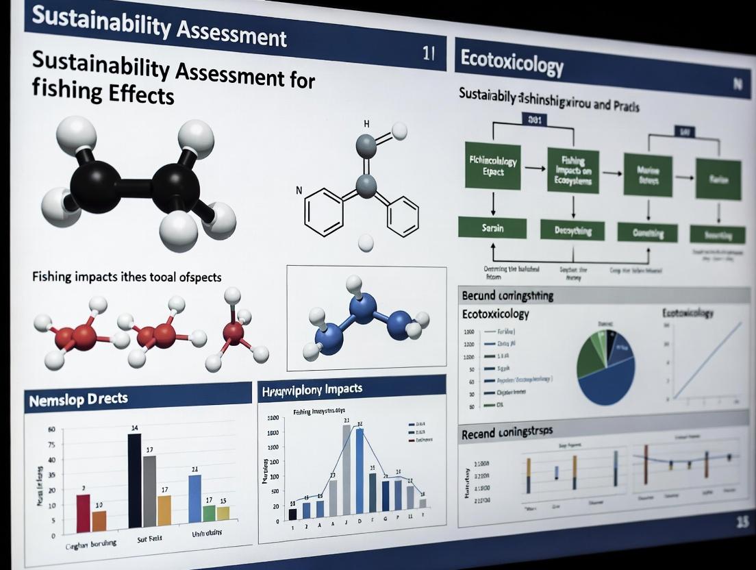
Advancing Sustainability Assessments in Global Fisheries: A 2025 Framework for Researchers and Scientists
This article provides a comprehensive examination of contemporary sustainability assessments for fisheries, tailored for researchers, scientists, and professionals engaged in evidence-based analysis and method development.
Advancing Sustainability Assessments in Global Fisheries: A 2025 Framework for Researchers and Scientists
Abstract
This article provides a comprehensive examination of contemporary sustainability assessments for fisheries, tailored for researchers, scientists, and professionals engaged in evidence-based analysis and method development. It explores the foundational state of global fish stocks and key trends, details innovative and updated methodological frameworks for assessment, addresses prevalent challenges and optimization strategies in practice, and concludes with rigorous approaches for validating and comparing assessment outcomes. The synthesis aims to bridge ecological science with robust analytical practices, offering insights applicable to complex system evaluations in fields including biomedical research.
The Current State of Global Fisheries: Exploring Sustainability Trends and Regional Disparities
The following tables synthesize quantitative data on U.S. fisheries stock assessments, which serve as a critical proxy for understanding global efforts in determining the proportion of stocks fished within biologically sustainable levels. This data is foundational to the Sustainability Assessment for Fishing Effect (SAFE) research framework.
Table 1: Annual Stock Assessment Performance (Fiscal Year 2024) [1] This table summarizes the volume and regional distribution of Fish Stock Sustainability Index (FSSI) and non-FSSI stock assessments completed by NOAA Fisheries, providing insight into monitoring intensity.
| Region | FSSI Stocks (Planned / Completed) | Non-FSSI Stocks (Planned / Completed) | Total Assessments Completed (FY24 Q4) |
|---|---|---|---|
| Alaska | 37 / 44 | Not Specified | Part of National Total |
| West Coast | 3 / 3 | Not Specified | Part of National Total |
| Pacific Islands | 2 / 3 | Not Specified | Part of National Total |
| Greater Atlantic | 13 / 15 | Not Specified | Part of National Total |
| Southeast | 14 / 10 | Not Specified | Part of National Total |
| National Total (FY24) | 69 / 75 | 393 Tracked | 38 (Q4 only) |
Table 2: Stock Status Classification and Enterprise Performance Metrics [2] [1] This table defines key status classifications and presents the composite performance index used to evaluate the assessment enterprise.
| Metric | Definition / Quantitative Value | Relevance to SAFE Research |
|---|---|---|
| Overfishing | The annual catch rate is too high [2]. | Indicates immediate unsustainable fishing pressure. |
| Overfished | The population size is too small [2]. | Indicates a depleted stock biomass requiring recovery. |
| Rebuilt | A previously overfished stock that has increased to a target population size [2]. | Measures success of management interventions. |
| Fish Stock Assessment Target Index (FSATI) | Composite index score: 49.5% (Q4 FY24) [1]. | Measures performance of the assessment system in meeting frequency and data quality goals for all 462 tracked stocks (69 FSSI + 393 non-FSSI) [1]. |
| Stocks with Adequate Assessments (Legacy Metric) | Percentage of high-priority (FSSI) stocks with an assessment <5 years old [1]. | Provides a baseline for tracking improvement in temporal coverage of robust assessments. |
Experimental and Assessment Protocols
Protocol: Integrated Stock Assessment for Status Determination
This protocol outlines the core methodology for determining if a stock is being fished within biologically sustainable levels [1].
1. Objective: To estimate stock abundance, fishing mortality rate, and sustainable harvest levels by integrating multiple data streams into a quantitative model.
2. Materials & Data Inputs:
- Fishery-Dependent Data: Commercial and recreational catch (landings and discards) in weight and numbers.
- Fishery-Independent Data: Scientific survey indices of abundance, biomass, and population demographic structure (age, length, sex).
- Biological Data: Growth rates, natural mortality, maturity at age, fecundity, and recruitment indices.
- Historical Data: Time series of all above data, preferably spanning multiple decades.
3. Procedure: 1. Data Compilation and Conditioning: Assemble, quality-check, and standardize all input data series. Conduct exploratory analyses (e.g., catch-per-unit-effort standardization). 2. Model Selection: Choose an assessment model class based on data quality and quantity: * Data-Limited/Index-Based: For stocks with only catch or relative abundance index data [1]. * Statistical Catch-at-Age (SCAA) or Integrated Models: For data-rich stocks; these integrate all data types in a statistical framework to estimate historical population trajectories [1]. 3. Model Configuration & Estimation: * Define core population dynamics equations (e.g., stock recruitment, growth, mortality). * Specify likelihood functions for each data component (catch, survey indices, composition data). * Estimate model parameters (e.g., initial biomass, recruitment deviations, selectivity, fishing mortality) using maximum likelihood or Bayesian methods. 4. Reference Point Calculation: Derive biological reference points from estimated parameters: * FMSY: Fishing mortality rate that produces Maximum Sustainable Yield. * BMSY: Biomass level that supports MSY. 5. Status Determination: Compare current (e.g., last year's) estimates to reference points [2]: * Subject to Overfishing: If F > FMSY. * Overfished: If B < BMSY (or a related threshold like ½ BMSY). * Biologically Sustainable: If F ≤ FMSY and B ≥ BMSY. 6. Projection & Harvest Recommendation: Project the population forward under different catch scenarios to estimate outcomes and recommend an Annual Catch Limit (ACL). 7. Review & Certification: Submit assessment for independent peer review. Upon approval, it is certified as "best scientific information available" for management [1].
4. Analysis & Validation:
- Conduct retrospective analysis to check for systematic estimation biases.
- Perform sensitivity runs to test model assumptions (e.g., on natural mortality).
- Quantify uncertainty using confidence intervals or Bayesian credible intervals derived from a Markov Chain Monte Carlo (MCMC) or bootstrap procedure.
Protocol: Sustainability Risk Assessment (Adapted for SAFE Research)
This protocol adapts quantitative risk assessment (QRA) methodology for evaluating the risk to sustainability posed by fishing and other stressors [3] [4].
1. Objective: To quantify the cumulative risk of a fish stock becoming overfished or subject to overfishing, considering multiple biological, ecological, and anthropogenic factors.
2. Materials & Data Inputs:
- Stock assessment output (biomass, F, reference points).
- Environmental covariate data (e.g., sea surface temperature, primary productivity).
- Spatial data on habitat quality and overlap with fishing effort.
- Projections of future climate change or economic scenarios.
3. Procedure: 1. Problem Formulation & Scenario Definition: Define the risk question (e.g., "Risk of stock biomass falling below BMSY by 2040 under climate scenario X"). Establish counterfactual scenarios (e.g., with vs. without a proposed management measure) [3]. 2. Hazard Identification & Exposure Assessment: Identify factors affecting stock status (fishing, climate, habitat loss). Characterize the magnitude, spatial extent, and frequency of exposure to each hazard for the stock [3]. 3. Dose-Response Modeling: Establish quantitative relationships between exposure levels of each hazard and a stock performance metric (e.g., recruitment success, population growth rate). This can use stock assessment model output or meta-analysis. 4. Risk Characterization: Integrate exposure and dose-response to estimate the probability and severity of adverse sustainability outcomes (e.g., 40% probability of biomass declining below BMSY). For multiple stressors, consider interactions (additive, synergistic) [3]. 5. Uncertainty Analysis: Propagate uncertainty from all inputs through the risk model using Monte Carlo simulation. Document key uncertainties and assumptions [3].
4. Analysis:
- Calculate Population Attributable Fractions for different hazards to rank their relative contribution to risk [3].
- Perform sensitivity analysis to identify which model inputs most influence the risk estimate [4].
- Economic Assessment (optional): Translate biological risk into expected economic loss (e.g., Annual Loss Expectancy in fishery revenue) [4].
Visual Workflows and Logical Diagrams
Workflow for Determining Sustainable Fishing Status [1]
Quantitative Sustainability Risk Assessment Protocol [3] [4]
The Researcher's Toolkit: Essential Reagents & Materials
Table 3: Key Research Reagent Solutions for Stock Sustainability Assessment This table details essential computational tools, reference materials, and data resources required for implementing the described protocols.
| Tool / Resource Name | Category | Function & Application in SAFE Research |
|---|---|---|
| Stock Synthesis (SS3) | Statistical Modeling Software | Industry-standard, open-source integrated stock assessment platform for implementing SCAA models (Protocol 2.1, Step 3) [1]. |
| R Programming Environment | Statistical Computing Platform | Core environment for data conditioning, running assessment models (via packages like r4ss), conducting risk analyses, and generating reproducible reports. |
| NOAA Fisheries Toolbox (NFT) | Software Suite | Collection of validated algorithms and applications for data-limited assessment methods, catch-only analyses, and ecosystem modeling [1]. |
| Monte Carlo Simulation Engine | Risk Analysis Tool | Used in Protocol 2.2 (Steps 4 & 5) to propagate uncertainty through risk models and generate probability distributions of outcomes (e.g., via R packages mvtnorm, ggplot2 for visualization). |
| Fisheries & Environmental Time-Series Databases | Reference Data | Curated datasets (e.g., RAM Legacy Stock Assessment Database, NOAA’s Environmental Research Division Data Access Program) provide essential inputs for model estimation and covariate analysis. |
| Spatial Habitat & Effort Layers | Geospatial Data | GIS layers detailing essential fish habitat, seabed composition, and historical fishing effort intensity are critical for spatially explicit risk assessments. |
| Peer-Reviewed Stock Assessment Reports | Reference Material | Certified assessments provide the validated estimates of biomass, F, and reference points that are the foundational inputs for any sustainability risk analysis (Protocol 2.2) [1]. |
The Sustainability Assessment for Fishing Effect (SAFE) research framework necessitates a detailed, comparative analysis of global fisheries performance. A core tenet of SAFE is that sustainability outcomes are not uniform but are dictated by the interplay of governance efficacy, scientific application, and technological adoption. Recent global assessments reveal a landscape of stark contrasts: while certain regions exemplify successful, science-based management leading to stock recovery and economic benefit, others remain under intense pressure characterized by overfishing, data deficiencies, and governance challenges [5] [6]. Decoding this regional variation is critical for diagnosing systemic failures, scaling proven solutions, and ultimately steering global fisheries toward the Sustainable Development Goals. This document provides detailed application notes and protocols for researchers to quantify, analyze, and understand these disparities, offering a toolkit for replicating assessments and designing interventions.
Quantitative Analysis of Regional Performance
The foundation of regional analysis is robust, comparable data. The following tables synthesize the latest global and regional findings, providing a snapshot of performance gradients essential for SAFE research prioritization.
Table 1: Global and Regional Stock Sustainability Metrics (2025 FAO Data) [5] [6]
| Region (FAO Area) | Percentage of Stocks Fished Sustainably | Key Characteristics & Contributing Factors | Status Relative to Global Average |
|---|---|---|---|
| Global Average | 64.5% | Overfishing increasing ~1% per year; 77.2% of landings by volume are sustainable. | Baseline |
| Antarctica | 100.0% | Small-volume fisheries; demonstrates power of ecosystem-based management and binding international cooperation (CCAMLR). | High-Performing |
| Northeast Pacific | 92.7% | Strong, science-based management (e.g., U.S., Canada); effective enforcement and adaptive policies. | High-Performing |
| Southwest Pacific | 85.0% | Robust management frameworks (e.g., New Zealand, Australia); long-term investment in monitoring. | High-Performing |
| Southeast Pacific | 46.0% | Central to food security; challenges include limited institutional capacity and data gaps. | Under Pressure |
| Eastern Central Atlantic | 47.4% | Relies on small-scale artisanal fisheries; fragmented governance and assessment challenges. | Under Pressure |
| Mediterranean & Black Sea | 35.1% | Early signs of recovery (fishing pressure down 30% since 2013); complex multi-jurisdictional management. | Under Pressure |
Table 2: Species-Specific Sustainability and Vulnerability [5] [6]
| Species Group | Percentage of Stocks Fished Sustainably | Notes on Management and Pressure |
|---|---|---|
| Tuna & Tuna-like Species | 87% (99% of landings) | Effective management by Regional Fisheries Management Organizations (RFMOs) using harvest strategies. Key example of recovery through international cooperation. |
| Deep-Sea Species | 29% | Vulnerable due to slow growth, late maturity; often managed with high uncertainty due to data limitations. |
| Highly Migratory Sharks | Data Limited | Significant bycatch in tuna fisheries; populations like oceanic whitetip have declined >90%. Lack of consistent international catch limits hinders recovery. |
Experimental Protocols for Regional Assessment
Protocol 1: Three-Dimensional Spatial Analysis of Fishing Footprint and Conservation Gaps
This protocol, derived from recent pioneering research, moves beyond 2D mapping to assess the vertical (depth) distribution of fishing pressure and conservation measures [7].
Objective: To quantify the overlap and mismatch between the three-dimensional footprint of fishing activities and the placement of Marine Protected Areas (MPAs) and Other Effective area-based Conservation Measures (OECMs).
Methodology:
- Define Depth Realms: Overlay benthic and pelagic depth realms (e.g., Euphotic: 0-30m; Mesophotic: 30-150m; Bathyal: 150-3000m; Abyssal: >3000m) onto 2D marine ecoregions to create a 3D assessment framework.
- Map Fishing Footprint:
- Data Source: Integrate vessel activity data from Global Fishing Watch (GFW), which uses AIS/VMS and machine learning to identify apparent fishing activity [8] [7].
- Gear Classification: Disaggregate data by gear type (e.g., bottom trawl, pelagic longline). For benthic gears, assume fishing depth equals seafloor bathymetry. For pelagic gears, assign target depth ranges based on known gear specifications (e.g., deep-setting longlines target 100-400m) [7].
- Calculate Effort: Compute fishing pressure (hours/km²/year) and total fishing effort (hours/year) for each 3D spatial-depth cell.
- Map Conservation Coverage: Overlay spatial layers of MPAs and OECMs, categorizing them by IUCN management category (Ia-VI). Calculate the percentage area of each depth realm within each ecoregion that is under protection, noting the level of protection (e.g., no-take vs. multi-use).
- Analyze Mismatch: Statistically compare the spatial and depth distribution of high fishing pressure areas with the location and protection level of conservation areas. Identify "conservation gaps"—high-pressure depth realms with low protection coverage.
Key Outputs: 3D maps of fishing effort by gear type; maps of conservation coverage by depth and protection level; quantitative tables of effort and coverage mismatch; identification of priority depth realms for conservation intervention.
Protocol 2: Evaluating Selective Fishing Gear via Controlled Field Experiment
This protocol outlines a method for field-testing alternative fishing gears designed to reduce bycatch and mortality, based on a recent experiment with fish traps in the Columbia River [9].
Objective: To compare the sustainability performance (bycatch rates, post-release survival, target catch quality) of an experimental selective gear against conventional gear (e.g., gillnet).
Methodology:
- Site & Gear Selection: Establish a study site in a region with mixed-stock fisheries. The experimental gear in this case is a purpose-built fish trap, consisting of a leader net guiding fish into a holding pot (livewell). The control is a conventional monofilament gillnet [9].
- Experimental Fishing:
- Conduct simultaneous, paired fishing sets with trap and gillnet in proximity during the same tidal and diurnal cycles.
- Standardize soak times for both gear types.
- Data Collection Per Set:
- Catch Enumeration: Count and identify all species and, where possible, stock origin (e.g., wild vs. hatchery salmon via marks or tags).
- Bycatch Handling: For non-target species in the trap, record species, size, and release condition. For gillnet bycatch, carefully document entanglement and injury status upon retrieval.
- Biological Sampling: For target species, collect length, weight, and scale samples for age/growth analysis. Document external condition (scale loss, bruising, injuries) using a standardized scoring system.
- Post-Release Survival (if applicable): For key bycatch species, tag a subset of live-released individuals from both gear types with acoustic or PIT tags to monitor short-term (48-hour) and long-term survival.
- Economic & Social Data: Record processing time per unit catch, dock-side price per pound for target species, and qualitative feedback from participating fishers on gear operability and safety.
Key Outputs: Comparative metrics of bycatch ratio, release survival rate, target fish quality index, and economic efficiency. Statistical analysis (e.g., ANOVA) to determine significant differences between gears.
Protocol 3: Geospatial Modeling of Recreational Fishing Pressure
This protocol details a method for predicting and validating spatial patterns of recreational fishing effort to identify areas under disproportionate pressure [10].
Objective: To develop a predictive model identifying "hotspots" of recreational fishing for specific species to inform targeted management and angler outreach.
Methodology:
- Data Compilation: Assemble long-term fisheries-independent survey data (e.g., from state agencies). For each sample point, include species, size, catch-per-unit-effort (CPUE), location (coordinates), date, and environmental parameters (depth, temperature, habitat type) [10].
- Spatial Analysis:
- Hot Spot Analysis: Use tools like the Getis-Ord Gi* statistic in ArcGIS to identify statistically significant spatial clusters of high values (e.g., areas with consistently larger fish or higher CPUE) [10].
- Interpolation: Apply Kriging to create continuous raster surfaces predicting species size or abundance across the study area.
- Proximity Analysis: Establish buffers (e.g., 0.5-4 nautical miles) around identified hotspots and intersect with layers of fishing access points (boat ramps, marinas).
- Model Validation via Angler Surveys: Deploy field teams to high-probability and control access points. Conduct structured interviews with returning anglers to record species caught, size, fishing location (general area), and trip motivation [10].
- Data Synthesis: Compare model predictions (e.g., "Boat Ramp A is optimal for large sheepshead") with angler survey results to calculate model accuracy. Overlay results with habitat maps and existing regulatory zones.
Key Outputs: Predictive maps of fishing hotspots for key species; validated list of access points leading to high-pressure zones; data supporting spatial management measures like seasonal closures or artificial reef deployments.
Protocol 4: Utilizing Large-Scale Vessel Tracking Data for Effort Analysis
This protocol provides a framework for using public satellite-AIS data platforms to analyze commercial fishing effort dynamics [8].
Objective: To characterize patterns of apparent fishing effort (AFE) by fleet, gear type, and region over time.
Methodology:
- Platform Access: Register for and utilize the Global Fishing Watch (GFW) public map or data API. GFW applies machine learning algorithms to vessel AIS data to classify "apparent fishing activity" [8].
- Define Area of Interest (AOI): Create a custom polygon for your study region (e.g., an exclusive economic zone, a marine protected area, or a regional sea).
- Data Extraction & Filtering:
- Select a time range (data available from 2012 to near-present).
- Filter layers for "Apparent Fishing Effort." Further filter by vessel flag state, gear type (e.g., purse seine, trawl, longline), and vessel length if needed [8].
- Analysis:
- Effort Metrics: Download data reports to calculate total fishing hours, fishing vessel presence, or effort density (hours/km²) within the AOI over time.
- Spatiotemporal Patterns: Use the animation tool to visualize seasonal shifts in fishing grounds. Analyze trends in effort before and after management events (e.g., MPA establishment, seasonal closures).
- Co-occurrence Analysis: Overlay layers for different fleets or gear types to identify areas of potential interaction or conflict.
Key Outputs: Time series of fishing effort by gear/flag; spatial heat maps of fishing density; evidence of compliance/non-compliance with spatial regulations; data for calculating fishing pressure indices in stock assessments.
The Scientist's Toolkit: Research Reagent Solutions
Table 3: Essential Research Tools and Platforms for SAFE Assessments
| Tool/Platform Name | Primary Function in SAFE Research | Key Application & Data Output | Source/Access |
|---|---|---|---|
| Global Fishing Watch (GFW) Map & API | Visualization and analysis of global vessel-based human activity using satellite AIS/VMS and machine learning. | Mapping apparent fishing effort by gear, flag, and time; analyzing effort near MPAs; detecting potential illegal activity. | Public online platform [8]. |
| NOAA Marine Recreational Information Program (MRIP) Data | Provides standardized, designed survey data on U.S. recreational catch and effort. | Time-series analysis of recreational pressure on stocks; calibrating other assessment models. | Public-use datasets and query tools [11] [12]. |
| ArcGIS Pro with Spatial Analyst | Geospatial modeling and statistical analysis of ecological and fisheries data. | Hot spot analysis (Getis-Ord Gi*), Kriging interpolation, habitat suitability modeling, and map production. | Commercial software (Esri) [10]. |
R Statistical Environment with survey, sf, ggplot2 packages |
Statistical computing and graphics for complex survey data analysis and spatial data manipulation. | Custom domain analysis of MRIP data; modeling population trends; creating publication-quality graphs and maps. | Open-source software. |
| FAO Fishery Resources Monitoring System (FIRMS) | Access to global and regional stock status reports and metadata. | Benchmarking regional performance; obtaining background data for less-assessed regions. | FAO online portal [5] [6]. |
| Satellite Telemetry Tags (Acoustic, PIT, Satellite) | Tracking individual fish movement and post-release survival. | Quantifying survival rates after capture and release; studying migration pathways and habitat use. | Various commercial suppliers. |
| Selective Fishing Gear (e.g., Fish Traps, Modified Longlines) | Experimental apparatus for reducing bycatch and mortality. | Field testing alternative gear; generating comparative catch data for sustainability metrics. | Specialized manufacturers or custom-built [9]. |
Tuna fisheries represent a critical model system for developing and validating Sustainability Assessment for Fishing Effect (SAFE) research frameworks. The management of these highly migratory, high-value species operates at the intersection of complex population dynamics, international governance, and ecosystem-based science. Recent global assessments indicate that 87% of the global tuna catch originates from stocks at healthy abundance levels, and 87% of tuna and tuna-like stocks are classified as sustainably exploited [13] [14]. This positive trend, reversing historical declines, is a direct result of the implementation of science-based management policies through Regional Fisheries Management Organizations (RFMOs) [15]. The success achieved in tuna management provides a replicable template for other fisheries and serves as a live laboratory for testing SAFE methodologies, particularly in quantifying the cause-and-effect relationships between management interventions and stock recovery [6].
Benchmark Cases in Sustainable Tuna Management
The recovery of specific tuna stocks from overfished status to sustainability offers validated benchmark cases for SAFE research. These cases provide critical data points for modeling the efficacy of management interventions.
Table 1: Benchmark Case: Pacific Bluefin Tuna Recovery
| Metric | Status (c. 2009-2012) | Status (2022) | Key Management Interventions | SAFE Research Implication |
|---|---|---|---|---|
| Spawning Stock Biomass | ~2% of unfished level [16] | 23.2% of unfished level [16] | Coordinated catch reductions on juveniles/large fish (WCPFC/IATTC, 2011+) [16] | Validates model: Reduced fishing mortality (F) directly leads to biomass (B) increase. |
| Exploitation Status | Subject to overfishing [16] | Rebuilding target met a decade ahead of schedule [16] | Science-based recovery plan targeting 20% biomass by 2034 [16] | Demonstrates time-bound recovery trajectories under enforced catch limits. |
| Governance Mechanism | Fragmented international effort [15] | Coordinated management via ISC, WCPFC, IATTC [16] | Establishment of a Joint IATTC-WCPFC Working Group [16] | Highlights governance integration as a critical variable in SAFE assessments. |
The Pacific bluefin tuna case demonstrates that coordinated international action based on robust science can drive rapid stock recovery. The stock surpassed its biomass target a decade early, proving the resilience of tuna populations when fishing pressure is effectively controlled [16]. Another key benchmark is the performance of stocks relative to the Marine Stewardship Council (MSC) standard. An ISSF evaluation found that 12 of 23 major global tuna stocks meet the MSC Principle 1 benchmark for healthy stock status, with all five tuna RFMOs receiving passing scores on Principle 3 for management effectiveness [17]. However, the same report notes that only seven stocks have fully implemented harvest control rules, identifying a critical gap between policy and precautionary practice [17].
Data Presentation: Global and Regional Stock Status
Quantitative assessment of stock status is the foundation of SAFE research. The following tables synthesize the latest global and regional data, providing a baseline for comparative analysis.
Table 2: Global Tuna Stock Status Summary (ISSF, March 2025) [13] [14]
| Abundance Category | Percentage of Stocks | Percentage of Global Catch | Key Trend |
|---|---|---|---|
| Healthy | 65% | 87% | Steady increase from 80% (2022) to 87% (2025) [13]. |
| Intermediate | 22% | 10% | Eight-point increase from Nov. 2024 report [14]. |
| Overfished | 13% | 2% | Eight-point decrease from Nov. 2024 report [14]. |
| Exploitation Rate (Fishing Mortality) | Percentage of Stocks | ||
| Not Overfishing | 87% | Indicates management controls are generally effective [13]. | |
| Overfishing Occurring | 9% | Includes Indian Ocean bigeye & Mediterranean albacore [5]. |
Table 3: Regional Sustainability of Marine Stocks (FAO, 2025) [5] [6]
| FAO Fishing Area | Region | % of Stocks Fished Sustainably | SAFE Context / Key Driver | |
|---|---|---|---|---|
| Areas 48, 58, 88 | Antarctic | 100% | Ecosystem-based management & strong international cooperation [6]. | |
| Area 67 | Northeast Pacific | 92.7% | Robust, long-term management frameworks and investment [6]. | |
| Area 81 | Southwest Pacific | 85% | Effective regional governance (WCPFC) [6]. | |
| Area 37 | Mediterranean & Black Sea | 35.1% | Early recovery signs: 30% drop in fishing pressure since 2013 [6]. | |
| Area 34 | Eastern Central Atlantic | 47.4% | Fragmented governance, limited capacity, major data gaps [6]. | |
| Area 87 | Southeast Pacific | 46% | Global Average | 64.5% [6] |
Application Notes for SAFE Research
4.1 Implementing Harvest Control Rules (HCRs) as a Management Tool HCRs are pre-agreed, science-based formulas that automatically adjust catch limits based on stock status indicators. Their implementation is a cornerstone of modern SAFE frameworks. In tuna RFMOs, HCRs move management from reactive, negotiation-driven decisions to proactive, predictable strategies [15]. The protocol involves: (1) Selecting indicator stocks (e.g., South Pacific albacore, which recently achieved a passing MSC score [17]), (2) Establishing reference points (e.g., target and limit biomass levels), and (3) Simulating HCR performance using Management Strategy Evaluation (MSE) before adoption [16]. A major research note is that while all tuna RFMOs passed MSC Principle 3, the scarcity of fully implemented HCRs (7 of 23 stocks) remains the largest barrier to broader certification [17].
4.2 Electronic Monitoring (EM) and Catch Documentation Schemes EM (onboard cameras and sensors) and electronic catch documentation are critical for independent verification, a key component of SAFE's "E" (Effect) assessment. These tools close data gaps on bycatch and fishing location, directly tackling Illegal, Unreported, and Unregulated (IUU) fishing [15]. For researchers, EM data provides high-resolution, verifiable datasets on fishing effort and ecosystem interaction, enabling more accurate calculation of mortality coefficients. The Atlantic bluefin tuna electronic documentation scheme is a benchmark, enhancing traceability from vessel to market and reducing fraud [15]. A key application note is that wider implementation is still needed, and SAFE protocols must account for varying levels of monitoring coverage across fleets [15].
Detailed Experimental Protocols
5.1 Protocol for Integrated Stock Assessment and MSE Objective: To generate a scientifically rigorous stock assessment and test the robustness of proposed Harvest Control Rules. Materials: Fishery-dependent data (catch, size composition), fishery-independent data (acoustic surveys, tagging data), biological data (growth, maturity, natural mortality), and assessment software (e.g., Stock Synthesis, MULTIFAN-CL). Procedure:
- Data Compilation and Standardization: Assemble all available data for the stock across its range. Standardize catch time series and calibrate different abundance indices.
- Model Configuration: Configure an integrated, age-structured population model. Define key parameters and priors based on biological studies.
- Base Model Fitting: Fit the model to the data, estimating historical population trajectory, fishing mortality, and current biomass. A benchmark case is the ISC assessment for Pacific bluefin, which combined decades of data to estimate biomass had recovered to 23.2% of unfished levels [16].
- Management Strategy Evaluation (MSE): Using the fitted model as an "Operating Model,"
- Step 4.1: Simulate the stock's future under a range of plausible biological and climatic scenarios.
- Step 4.2: Test candidate HCRs by having a simulated "Management Procedure" calculate catch advice based on simulated, imperfect data.
- Step 4.3: Evaluate HCR performance against pre-set objectives (e.g., probability of stock being above target biomass, average catch stability) [16].
- Peer Review and Provision of Advice: Present assessment and MSE results to an independent scientific body (e.g., the ISC). Provide a range of science-based management options to RFMO commissions [16].
5.2 Protocol for MSC-Based Sustainability Benchmarking Objective: To evaluate a tuna stock or fishery against the MSC Fisheries Standard v3.1, providing a standardized sustainability score. Materials: MSC Fisheries Standard v3.1 [18], RFMO management reports, scientific committee reports (e.g., from IATTC, WCPFC), stock assessment outputs, and observer/EM data. Procedure:
- Principle 1 (Stock Status) Scoring:
- PI 1.1.1 (Stock Status): Determine if the stock's spawning biomass (SSB) is above the point where maximum sustainable yield (MSY) can be generated. Use the most recent stock assessment (e.g., ISSF reports 65% of stocks are at healthy abundance [13]).
- PI 1.2.1 (Harvest Strategy): Evaluate if a well-defined HCR is in place. Note: As of 2025, this is a critical failing point for many stocks, with only 7 of 23 having such rules [17].
- PI 1.2.2 (Information & Monitoring): Assess the adequacy of data collection and monitoring to support the HCR.
- Principle 3 (Management System) Scoring:
- PI 3.1.1 (Governance & Policy): Evaluate the RFMO's legal and policy framework (all five major tuna RFMOs received passing scores in 2025 [17]).
- PI 3.2.1 (Consultation Process): Assess stakeholder involvement.
- PI 3.2.3 (Compliance & Enforcement): Review mechanisms to ensure member state compliance—an area of ongoing concern [17].
- Scoring and Gap Analysis: Score each Performance Indicator (80+ = pass). Aggregate scores to Principle and overall levels. The output is a diagnostic report, such as the ISSF evaluation showing 12 stocks passing P1 [17], which identifies specific gaps (e.g., lack of HCRs) requiring management action.
The Scientist's Toolkit: Key Reagents & Materials
Table 4: Essential Research Tools for Tuna Sustainability Assessment
| Tool / Material | Function in SAFE Research | Example from Benchmark Cases |
|---|---|---|
| Integrated Population Models | To synthesize disparate data (catch, size, tagging) into a coherent estimate of historical and current stock status. | Used by the ISC to assess Pacific bluefin biomass, estimating recovery to 23.2% of unfished levels [16]. |
| Management Strategy Evaluation (MSE) Framework | To test the robustness of Harvest Control Rules (HCRs) against environmental, biological, and data uncertainty. | Critical next step for Pacific bluefin to develop a long-term harvest strategy [16]. |
| Electronic Monitoring (EM) Systems | To independently verify fishing location, effort, and bycatch, providing data for compliance and ecological impact assessment. | Identified as a key tool for improving compliance and enforcement within RFMOs [15]. |
| Genetic Markers & Otolith Microchemistry | To determine stock structure, origin, and mixing rates, which is essential for defining management units. | Fundamental for managing transboundary stocks like Pacific bluefin across RFMO boundaries [16]. |
| Standardized RFMO Scientific Reports | To provide the official, peer-reviewed data on stock status and trends required for MSC assessments and policy. | Source data for ISSF's annual evaluation of stocks against MSC criteria [18] [17]. |
| Harvest Control Rule (HCR) Simulation Software | To model the long-term performance of candidate HCRs in achieving biomass and catch objectives. | Necessary for the 16 stocks lacking HCRs to progress towards MSC certification [17]. |
The persistent challenge of overfishing remains a critical pressure point on global marine ecosystems and food security. Defined as catching fish faster than stocks can replenish, overfishing has led to a situation where fully one-third of the world's assessed fisheries are currently pushed beyond their biological limits [19]. This large-scale extraction, driven by a global fishing fleet estimated to be up to two-and-a-half times the capacity needed [19], directly undermines ocean biodiversity and the resilience of marine food webs.
The Sustainability Assessment for Fishing Effects (SAFE) framework emerges as a pivotal scientific response within this context. Developed as a quantitative ecological risk assessment method, SAFE provides fishery scientists and managers with a tool to estimate the impact of fishing on large numbers of non-target, data-poor species and to establish clear sustainability reference points for management [20]. This application note details contemporary overfishing trends, the status of vulnerable species, and provides detailed experimental protocols for implementing the SAFE methodology, placing it within the broader thesis of developing robust, actionable sustainability assessments.
Analysis of Current Overfishing Trends and Global Stock Status
Global assessments reveal a mixed picture of fishery stock health, characterized by significant regional disparities strongly linked to the quality of fisheries management.
Table 1: Global Status of Marine Fish Stocks (FAO 2025 Assessment) [6]
| Stock Status Category | Percentage of Assessed Stocks | Percentage of Global Landings (Production-Weighted) | Key Regional Examples |
|---|---|---|---|
| Fished at Biologically Sustainable Levels | 64.5% | 77.2% | Northeast Pacific (92.7% sustainable), Antarctic (100%) [6] |
| Overfished | 35.5% | 22.8% | Mediterranean & Black Sea (35.1% sustainable), Southeast Pacific (46%) [6] |
The data underscores that while nearly two-thirds of assessed stocks are within sustainable limits, overfishing continues to increase globally at an average rate of about 1% per year [6]. The distribution of unsustainable fishing is not uniform. Regions with long-term investment in robust, science-based management demonstrate that recovery is achievable. The Northeast Pacific, for example, has a 92.7% sustainability rate for stocks, responsible for 99% of the region's landings [6]. Conversely, areas like the Southeast Pacific and Eastern Central Atlantic, where fisheries are central to food security but face limited institutional capacity and major data gaps, have less than half of their stocks fished sustainably [6].
The primary drivers of overfishing are multifaceted:
- Overcapacity: The global fleet is vastly oversized, encouraged by government subsidies that distort production costs [19].
- Illegal, Unreported and Unregulated (IUU) Fishing: Estimated to account for up to 30% of the catch for high-value species, this undermines legal management and nets criminals billions annually [19].
- Rising Demand and Climate Change: A growing global population reliant on seafood for protein, coupled with climate-driven shifts in fish stock distributions, exacerbates pressure on fisheries [21].
The SAFE Framework: Protocol for Quantitative Sustainability Assessment
The Sustainability Assessment for Fishing Effects (SAFE) is designed to assess the sustainability of fishing impacts on diverse, data-poor bycatch assemblages [20]. The following protocol is based on its application to elasmobranch bycatch in Australia's Northern Prawn Fishery (NPF).
Core SAFE Experimental Protocol
Objective: To estimate fishing mortality for non-target species and compare it to sustainability reference points based on life-history parameters.
Materials & Data Requirements:
- Fishery-Independent Survey Data: Presence-absence or abundance data from scientific surveys across the fishery management area (e.g., from 70+ voyages in the NPF case) [20].
- Fishery Effort Data: High-resolution spatial data on fishing effort (e.g., boat-days per management grid cell).
- Life-History Parameters: Species-specific estimates of natural mortality (M) and von Bertalanffy growth parameters (K, L∞) for all assessed bycatch species.
- Catch and Escapement Data: Observed catch rates and estimated probabilities of escape (e.g., via Bycatch Reduction Devices).
Methodology:
Estimate Spatial Overlap (
pᵢ):- Model the probability of a species being present in a given area using detection-nondetection survey data.
- Calculate
pᵢ, the proportion of the population for species i that is distributed within the trawled area, using a binomial model: the probability of capture in a trawl is a function of gear efficiency andpᵢ[20].
Calculate Fishing Mortality (
Fᵢ):- Estimate the instantaneous fishing mortality rate for each species i using the formula:
Fᵢ = -ln(1 - (Cᵢ * pᵢ * (1 - θᵢ)) / Nᵢ)whereCᵢis the observed catch rate,θᵢis the escapement probability, andNᵢis the estimated abundance from surveys [20].
- Estimate the instantaneous fishing mortality rate for each species i using the formula:
Establish Sustainability Reference Points:
- Maximum Sustainable Fishing Mortality (
Fmsf): Set at the natural mortality rate (M). Fishing mortality above this level is deemed unsustainable [20]. - Minimum Unsustainable Fishing Mortality (
Fmu): Set atF = 0.75*M + 0.25*K, where K is the von Bertalanffy growth coefficient. Fishing mortality above this level indicates a higher risk of unsustainability [20].
- Maximum Sustainable Fishing Mortality (
Risk Classification:
- Compare estimated
Fᵢfor each species againstFmsfandFmu. - Classify species as:
- Potentially Sustainable:
Fᵢ < Fmsf - At Potential Risk:
Fmsf ≤ Fᵢ < Fmu - Likely Unsustainable:
Fᵢ ≥ Fmu
- Potentially Sustainable:
- Compare estimated
Table 2: Key Parameters and Reference Points in the SAFE Assessment [20]
| Parameter | Symbol | Description | Source / Calculation |
|---|---|---|---|
| Population in Fished Area | pᵢ |
Proportion of population distributed within trawl footprint. | Derived from fishery-independent survey models. |
| Fishing Mortality Rate | Fᵢ |
Instantaneous rate of mortality due to fishing. | Calculated from catch, escapement, and spatial overlap data. |
| Natural Mortality Rate | M | Instantaneous rate of mortality from natural causes. | Published life-history studies or empirical estimates. |
| Von Bertalanffy K | K | Growth rate coefficient. | Published life-history studies. |
| Maximum Sustainable F | Fmsf |
Sustainability threshold 1. | Fmsf = M |
| Minimum Unsustainable F | Fmu |
Sustainability threshold 2. | Fmu = 0.75M + 0.25K |
Diagram 1: The SAFE Assessment Workflow (87 characters)
Status and Pressures on Vulnerable Species
Vulnerable species, particularly elasmobranchs (sharks and rays), deep-sea fish, and marine mammals, suffer disproportionately from overfishing and bycatch due to life-history traits characterized by slow growth, late maturity, and low reproductive rates [19] [20]. In the Northern Prawn Fishery SAFE assessment, results indicated that fishing impacts exceeded the maximum sustainable fishing mortality for 19 out of 51 elasmobranch species, with 9 exceeding the higher, minimum unsustainable threshold [20]. Globally, hundreds of thousands of marine mammals, seabirds, and sea turtles are captured as bycatch each year [19].
Climate change acts as a threat multiplier for these vulnerable populations. A Climate Vulnerability Assessment (CVA) for the Western Baltic Sea fish community revealed a dichotomy: traditional, commercially important species like cod and herring face high vulnerability due to complex life histories and specific environmental requirements, while more adaptable or invasive species may thrive under changing conditions [22]. Vulnerability is a combination of a species' sensitivity (biological traits) and its exposure to projected environmental changes [22].
Diagram 2: Climate Vulnerability Assessment Framework (68 characters)
Supplementary Experimental Protocols for Sustainability Research
Protocol for Behavioral Studies to Reduce Bycatch
Objective: To determine species-specific behavioral preferences (e.g., for light color) to inform the development of selective fishing gear that deters vulnerable species.
Adapted from research on Yellow Catfish (Pelteobagrus fulvidraco) [23]:
Materials:
- Hexagonal Maze Apparatus: A central chamber connected to six choice chambers.
- LED Light Panels: Providing distinct light spectra (e.g., Violet: 410-420nm, Green: 550-560nm, Yellow: 580-590nm, Red: 620-630nm, Blue: 470-480nm, White).
- High-Speed Camera: For tracking movement (e.g., 30 frames/second).
- Behavioral Tracking Software.
Methodology:
- Acclimate test species in holding tanks under controlled conditions.
- Place a single specimen in the central, dark chamber of the maze.
- Simultaneously illuminate the six choice chambers with different colored lights.
- Remove the central barriers and record fish movement for a standardized period (e.g., 10-15 minutes).
- Quantify preference using: Cumulative Dwell Time (% time in each chamber), Visit Frequency, and Total Moved Distance in each zone.
- Analyze data to identify aversive or attractive light colors for potential use in gear modification.
Protocol for Assessing Phenotypic Plasticity in Response to Habitat
Objective: To quantify heritable versus plastic components of morphological traits (e.g., cryptic coloration) relevant to survival and vulnerability.
Adapted from research on Brown Trout (Salmo trutta) [24]:
Materials:
- Controlled Rearing Tanks: With interchangeable substrate backgrounds (e.g., light vs. dark gravel).
- Digital Photography Setup: Standardized lighting and camera settings.
- Image Analysis Software: (e.g., ImageJ) to quantify color values (e.g., melanin-based skin darkness, carotenoid-based fin coloration).
Methodology:
- Create full-sib families (F1 generation) from wild-caught parents from distinct populations.
- Employ a split-brood design: rear siblings from each family in two contrasting substrate environments (Light vs. Dark).
- After a sufficient period for morphological color change (e.g., 30-60 days), anesthetize and photograph specimens under standardization.
- Use image analysis to quantify average skin/fin coloration for each individual.
- Perform reaction norm analysis to separate effects: a significant effect of rearing environment indicates plasticity; a significant effect of population/family within an environment indicates heritable genetic variation; a significant population-by-environment interaction indicates genetic variation for plasticity.
The Scientist's Toolkit: Research Reagent Solutions
Table 3: Key Research Reagents and Materials for Sustainability Assessment Experiments
| Item / Reagent | Primary Function in Research | Example Application |
|---|---|---|
| LED Light Panels (Specific Spectra) | To provide controlled, narrow-wavelength light stimuli for behavioral choice experiments. | Testing aversive/attractive light colors to develop bycatch reduction devices [23]. |
| Standardized Substrate Tiles | To create controlled visual rearing environments for plasticity studies. | Assessing cryptic coloration plasticity in fish reared on light vs. dark gravel [24]. |
| MS-222 (Tricaine Methanesulfonate) | Anesthetic for safe handling of fish during measurement (length, weight, tagging, photography). | Standard protocol for immobilization in SAFE field sampling and controlled experiments [23] [24]. |
| High-Resolution GPS & VMS Loggers | To record precise, high-resolution spatial data on fishing effort. | Essential for calculating the spatial footprint (pᵢ) in SAFE assessments [20]. |
| Bycatch Reduction Device (BRD) Test Rigs | Experimental gear modifications to estimate species-specific escapement probability (θᵢ). |
Quantifying the escape rate of vulnerable elasmobranchs or turtles from trawls for SAFE Fᵢ calculation [20]. |
| Environmental DNA (eDNA) Sampling Kits | For non-invasive detection of species presence/absence in survey areas. | Potentially supplementing trawl survey data to estimate pᵢ for rare or elusive bycatch species. |
| Digital Image Analysis Software | To quantitatively measure morphological traits (color, pattern, shape) from standardized photographs. | Objectively scoring skin darkness or fin coloration in plasticity and population studies [24]. |
Innovative Assessment Frameworks: Applying FAO's Updated Methodology and Data Strategies
The Food and Agriculture Organization of the United Nations (FAO) has instituted a major update to the methodology of the State of Stocks Index (SoSI), moving to a three-tiered assessment approach to evaluate the biological sustainability of global fish stocks [25]. This evolution, detailed in the 2025 "Review of the state of world marine fishery resources," marks a significant advancement from previous assessments by dramatically increasing resolution and adaptability [5] [6]. The number of assessed stocks has expanded approximately five-fold, from about 500 to 2,570 individual stocks, enabling high-resolution insights at both regional and global levels [25] [6].
This new framework is designed to be more precise and comprehensive, ensuring greater adaptability based on data availability and quality across different fisheries [25]. It was developed and validated through a collaborative scientific process involving 19 workshops and consultations that engaged over 650 scientists and policy analysts from 200 institutions across 92 countries [25]. The methodology is explicitly framed within the broader context of ecosystem-based fisheries management, aligning with and advancing the objectives of Sustainability Assessment for Fishing Effects (SAFE) research, which seeks to quantify fishing impacts on both target and non-target species [20].
The Three-Tiered Assessment Protocol
The core of the updated FAO methodology is a tiered framework that matches assessment complexity to data quality and availability. This structure ensures robust evaluations across diverse fisheries, from data-rich to data-poor contexts.
Table 1: FAO Three-Tiered Assessment Protocol for Stock Sustainability
| Tier | Data Requirements | Assessment Methodology | Output & Purpose |
|---|---|---|---|
| Tier 1: Standard Stock Assessment | Sufficient data for formal assessment (time series of catch, abundance, age/size structure). | Integrated analytical models (e.g., Stock Synthesis), statistical catch-at-age models. | Estimates of fishing mortality (F) and stock biomass (B) relative to reference points (FMSY, BMSY). Provides most reliable classification [5]. |
| Tier 2: Intermediate-Complexity Methods | Limited catch and effort data, basic life-history parameters. | Models of intermediate complexity for stock assessment (MICA), depletion-corrected average catch methods. | Indicators of stock trend and exploitation status. Used when Tier 1 assessments are not feasible [5]. |
| Tier 3: Data-Limited Techniques | Very limited data (e.g., catch trends only, expert knowledge). | Data-limited reference points (e.g., based on catch-MSY), productivity-susceptibility analysis, expert surveys. | Preliminary risk screening and ranking. Identifies stocks requiring priority for improved monitoring and data collection [5]. |
This protocol represents a structured yet flexible approach, combining qualitative and quantitative data to quickly scan a broad range of information sources [26]. The participatory nature of the process, which formally incorporates input from national and regional experts, is intended to strengthen local capacity and build trust in the assessments [25] [5].
Diagram 1: Decision Logic for FAO Three-Tiered Assessment
Integration within the SAFE Research Framework
The FAO's three-tiered approach directly operationalizes key principles of Sustainability Assessment for Fishing Effects (SAFE), a quantitative ecological risk assessment method designed for data-poor bycatch assemblages [20]. SAFE estimates fishing mortality and compares it to sustainability reference points derived from life-history parameters, a logic that permeates the new FAO tiers.
Core Conceptual Integration:
- Risk-Based Foundation: Both frameworks are fundamentally risk-based. SAFE establishes maximum sustainable fishing mortality (Fms) and minimum unsustainable fishing mortality (Fcrash) reference points based on natural mortality (M) and growth [20]. The FAO tiers classify stocks relative to FMSY and BMSY, applying the same precautionary logic across data-quality spectrums.
- Focus on Data-Limited Contexts: SAFE was developed specifically to assess diverse and data-poor bycatch species [20]. The FAO's Tier 2 and Tier 3 protocols formalize this need for the global assessment of target stocks, providing scalable methods where traditional assessments are impossible.
- Management Guidance: The output of both frameworks is designed to guide monitoring and management. SAFE identifies at-risk species to focus monitoring programs [20]. Similarly, the FAO's tiered outcomes help policymakers prioritize management interventions and data-collection investments.
Diagram 2: Integration of FAO Framework within SAFE Research
Application and Global Findings
The application of the updated methodology has yielded a more accurate and nuanced picture of global fishery sustainability, revealing significant regional variations driven by management effectiveness [25] [6].
Table 2: Regional Sustainability Findings from the Updated FAO Assessment (2025)
| FAO Fishing Area & Region | % of Stocks Fished Sustainably | Key Findings and Context | |
|---|---|---|---|
| Antarctica (Areas 48, 58, 88) | 100% [6] | Demonstrates potential of strict ecosystem-based management & international cooperation [5] [6]. | |
| Northeast Pacific (Area 67) | 92.7% [6] | High sustainability linked to strong, long-term science-based management frameworks [6]. | |
| Southwest Pacific (Area 81) | 85.5% [25] | Comprehensive data reveals strong sustainability; variability exists (e.g., thriving blue grenadier vs. overfished orange roughy) [25]. | |
| Western Central Pacific (Area 71) | 52.5% [25] | More accurate assessment shows greater challenges; sustainability declined from prior estimates due to expanded stock coverage, not necessarily worsening conditions [25]. | |
| Mediterranean & Black Sea (Area 37) | 35.1% [6] | Early signs of recovery: fishing pressure down 30%, biomass up 15% since 2013, showing impact of regional cooperation [6]. | |
| Southeast Pacific (Area 87) | 46% [6] | Global Average | 64.5% of stocks are within biologically sustainable levels [6]. |
A critical insight from the new assessment is that the global proportion of sustainably fished stocks (64.5%) is stable, but this aggregate masks stark regional disparities [6] [27]. The reported decline in sustainability for some areas, such as the Western Central Pacific, is attributed to the increased resolution and accuracy of the new method—assessing 265 stocks versus 43 previously—rather than a sudden stock collapse [25].
Species-Specific Insights:
- Tuna and Tuna-like Species: Stand out as a success, with 87% of assessed stocks sustainable, and 99% of global landings coming from sustainable sources, credited to science-based management by Regional Fisheries Management Organizations (RFMOs) [5] [6].
- Deep-Sea Species and Highly Migratory Sharks: Remain vulnerable. Only 29% of deep-sea stocks are fished sustainably, often due to complex life histories and data gaps [5]. For sharks, often caught as bycatch, inconsistent international management hinders recovery despite conservation measures [5] [6].
Experimental Protocols for Tier Implementation
Protocol 5.1: Conducting a Tier 1 (Standard) Stock Assessment
- Objective: To estimate current fishing mortality (F) and stock biomass (B) relative to maximum sustainable yield (MSY) reference points (FMSY, BMSY).
- Data Curation: Compile time-series datasets of annual catch (landings + discards), fishery-independent abundance indices (from scientific surveys), and age- or size-composition data from catches.
- Model Implementation:
- Select and configure an integrated stock assessment model (e.g., Stock Synthesis, MULTIFAN-CL, or a state-space statistical catch-at-age model).
- Fit the model to the data, estimating parameters for population dynamics, selectivity, and recruitment.
- Conduct a retrospective analysis to check for systematic trends in estimates and a model diagnostic (e.g., Markov Chain Monte Carlo sampling) to quantify uncertainty.
- Reference Point Calculation: Derive FMSY and BMSY from the model's yield-per-recruit and spawner-per-recruit relationships or production curve. Classify stock status based on the ratios F/FMSY and B/BMSY [5].
Protocol 5.2: Applying a Tier 2 (Intermediate) Assessment
- Objective: To derive indicators of exploitation status and stock trend when data are insufficient for a full Tier 1 assessment.
- Data Requirements: Reliable time series of catch and a standardized index of abundance (e.g., catch-per-unit-effort, CPUE). Basic life-history parameters (growth rate k, asymptotic length Linf, natural mortality M) are essential.
- Method Application:
- Apply a catch-MSY method or a depletion-corrected average catch model to estimate sustainable yield and stock depletion from catch history and resilience.
- Use length-based indicators (e.g., mean length in catch, length at first capture relative to maturity) from representative samples to indicate exploitation pressure.
- Fit a surplus production model (e.g., Schaefer or Fox model) to catch and abundance index data to estimate biomass trend and productivity.
Protocol 5.3: Executing a Tier 3 (Data-Limited) Risk Screening
- Objective: To conduct a preliminary sustainability risk ranking for stocks with very limited quantitative data.
- Input Data: Best available information, which may include qualitative catch trends, known life-history traits from related species, geographic range, and expert knowledge from fishers and scientists.
- Assessment Steps:
- Conduct a Productivity-Susceptibility Analysis (PSA): Score the stock on productivity attributes (e.g., fecundity, age at maturity) and susceptibility attributes (e.g., spatial overlap with fishery, encounterability). Calculate an overall risk score [20].
- Expert Elicitation Workshop: Convene regional experts in a structured workshop to collectively classify stock status based on the precautionary principle. This participatory approach is a cornerstone of the updated FAO methodology [25] [5].
- Result: A classification of "sustainably fished," "overfished," or "unknown," with an explicit flag for high-priority data gaps requiring future monitoring investment.
The Researcher's Toolkit
Table 3: Essential Research Reagent Solutions for Stock Assessment
| Tool / Resource | Function | Application Context |
|---|---|---|
| Integrated Stock Assessment Platforms (e.g., Stock Synthesis, MULTIFAN-CL, SPiCT) | Statistical software for fitting population dynamics models to catch, survey, and composition data. | Core to Tier 1 protocols for estimating F, B, and MSY reference points. |
| Data-Limited Assessment Packages (e.g., DLMtool R package, StockAssessment.org tools) | Provides standardized methods (e.g., catch-MSY, length-based indicators) for stocks with limited data. | Essential for Tier 2 & 3 analyses and risk screening [5]. |
| Life-History Invariant Databases (e.g., FishBase, SeaLifeBase) | Repositories of species-specific parameters (growth, mortality, maturity) for priors and proxies. | Critical for all Tiers, especially when local data are absent (used in SAFE methods) [20]. |
| Structured Expert Elicitation Protocols | Formal frameworks (e.g., IDEA protocol) to gather, weight, and aggregate qualitative expert judgments. | Key for Tier 3 and for validating assessments in all tiers, as used in FAO's collaborative process [25] [26]. |
| Geospatial Analysis Software (e.g., R, GIS) | To map species distribution, fishing effort overlap, and habitat (fraction of population in fished area). | Fundamental for spatial risk analysis, a core component of SAFE and ecosystem-based management [20]. |
Methodological Framework for Expanded Sustainability Assessment
The Sustainability Assessment for Fishing Effect (SAFE) research framework transitions from a limited, stock-centric model to an ecosystem-level, high-resolution analytical platform. This expansion from approximately 500 to over 2,600 assessed stocks is predicated on the integration of heterogeneous data sources, advanced analytical protocols, and a structured, tiered assessment methodology.
The cornerstone of this expansion is the systematic incorporation of pre-assessment data from global certification bodies, such as the Marine Stewardship Council (MSC) [28]. Publicly available pre-assessment reports provide a foundational layer of validated sustainability scores across a wide array of fisheries, covering diverse geographies, species, and gear types [28]. This data is synergized with national fisheries monitoring programs, like the NOAA Fisheries Fishing Effort Survey (FES), which is undergoing methodological refinements to reduce reporting bias and improve the accuracy of recreational fishing effort estimates [29].
The integration workflow follows a sequential protocol: Data Acquisition & Curation → Multi-Dimensional Meta-Analysis → High-Resolution Modeling → Interactive Visualization & Decision Support. This pipeline ensures raw data from disparate sources are standardized, analyzed for cross-cutting trends, and modeled to fill spatial and temporal gaps, ultimately yielding actionable insights for researchers and policymakers.
Experimental Protocols for Data Integration and Analysis
Protocol A: Curation and Standardization of Pre-Assessment Data
- Objective: To create a unified, query-ready database from global fishery pre-assessment reports.
- Materials: Public MSC pre-assessment report repository; structured database (SQL/NoSQL); data validation software.
- Procedure:
- Automated Extraction: Deploy web-scraping tools with natural language processing (NLP) capabilities to extract key fields from reports: fishery name, location (FAO area), target species, gear type, assessment date, and scores for each MSC Performance Indicator (PI) [28].
- Manual Sampling & Validation: Randomly select 10% of extracted reports. A trained analyst manually verifies the accuracy of extracted data against the original PDFs. Acceptable error threshold is <2% per key field [28].
- Taxonomic & Spatial Harmonization: Cross-reference extracted species names with the World Register of Marine Species (WoRMS) database to ensure taxonomic consistency. Geocode fishery locations to standard geographic identifiers (e.g., FAO Major Fishing Area, EEZ).
- Database Population: Load cleansed and harmonized data into a central relational database. Establish linked fields to external datasets, such as FAO catch statistics and Fishery Improvement Project (FIP) databases [28].
Protocol B: Temporal Calibration of Fishing Effort Time-Series
- Objective: To calibrate historical fishing effort estimates using revised survey methodologies, minimizing measurement error.
- Materials: Parallel time-series data from legacy and revised survey designs (e.g., NOAA FES); statistical calibration software (R, Python with pandas/statsmodels).
- Procedure:
- Data Pairing: For a defined geographic region (e.g., U.S. Gulf Coast), obtain effort estimates for the same time period (e.g., 2024) calculated from both the current FES design and the revised design. The revised design tests changes like monthly sampling and a reversed question order to mitigate recall bias [29].
- Model Development: Construct a generalized linear model (GLM) where the revised design estimate is the response variable and the legacy design estimate is the predictor. Incorporate covariates such as fishing mode (shore/private boat) and state [29].
- Model Application & Back-Calibration: Apply the validated calibration model to historical effort time-series (pre-2024) to rescale them to the new metric. This generates a consistent, bias-reduced historical record [29].
- Uncertainty Quantification: Calculate confidence intervals for all back-calculated estimates using bootstrap resampling methods. Document the propagated uncertainty in all downstream analyses.
Protocol C. Meta-Analysis of Global Sustainability Performance Trends
- Objective: To identify factors most strongly correlated with high (or low) sustainability scores across the global dataset.
- Materials: Curated global pre-assessment database; statistical computing environment.
- Procedure:
- Variable Selection: Define independent variables: fishery characteristics (gear type, target species taxon), operational scale (vessel size), management context (flag state, presence of a FIP), and ecological context (habitat type).
- Model Fitting: Implement a multivariate regression analysis, with the MSC composite score (or individual PI scores) as the dependent variable. Use mixed-effects models to account for non-independence of fisheries within the same region or flag state.
- Sensitivity & Robustness Testing: Conduct leave-one-out cross-validation to assess model robustness. Test for interaction effects between management context and gear type.
- Output: Generate a ranked list of factors (with effect sizes and p-values) associated with sustainability performance. Visualize results using partial dependence plots.
Data Presentation and Comparative Analysis
Table 1: Comparative Analysis of Stock Assessment Data Sources
| Data Source | Key Characteristics | Number of Stocks/Coverage | Primary Strengths | Inherent Limitations | Role in SAFE Expansion |
|---|---|---|---|---|---|
| Traditional Single-Stock Assessments | Detailed population models (e.g., stock synthesis); high data requirements. | ~500 major commercial stocks. | High-fidelity, stock-specific reference points (FMSY, BMSY). | Resource-intensive; limited to well-studied stocks. | Provides gold-standard validation data for core stocks. |
| MSC Pre-Assessment Database [28] | Standardized scoring against 28 performance indicators; pre-certification snapshot. | 276 pre-assessments, 257 species, 70 countries [28]. | Global coverage; common metric; includes emerging & data-poor fisheries. | Snapshot in time; not a full assessment; potential selection bias. | Primary driver of scale, adding ~2,100 new fisheries to the analysis framework. |
| NOAA FES & Calibrated Effort Data [29] | Survey-based estimates of recreational fishing effort (trips). | Coastal U.S. from Maine to Mississippi and Hawaii [29]. | Critical for estimating total mortality (commercial + recreational). | Requires calibration to correct for recall/design bias [29]. | Enhances resolution of mortality estimates for U.S. coastal stocks. |
Table 2: Summary Characteristics of Expanded SAFE Research Database
| Dimension | Metric | Pre-Expansion (Legacy) | Post-Expansion (SAFE v2.0) | Data Source for Expansion |
|---|---|---|---|---|
| Spatial Scale | Number of Flag Countries/Regions | ~30 | 70 [28] | MSC Pre-Assessment Database [28] |
| Taxonomic Breadth | Number of Unique Species | ~350 | 257+ (from MSC) + existing = >500 [28] | MSC Pre-Assessment Database [28] |
| Gear Diversity | Number of Gear Types | ~15 | 53 [28] | MSC Pre-Assessment Database [28] |
| Temporal Resolution | Effort Survey Frequency | Bimonthly | Monthly [29] | NOAA FES Revised Design [29] |
| Management Insight | Link to Improvement Actions | Limited | Linked to Fishery Improvement Project (FIP) IDs [28] | MSC Pre-Assessment Database [28] |
Visualizing the SAFE Research Framework and Workflow
SAFE Research Framework: Four-Tier Data Pipeline
Protocol A Workflow: Data Curation and Validation
The Scientist's Toolkit: Essential Research Reagent Solutions
Table 3: Key Reagents and Materials for SAFE Research Protocols
| Item | Function in Protocol | Specifications & Notes |
|---|---|---|
| Curated MSC Pre-Assessment Database [28] | Primary source for expanding stock coverage. Provides standardized sustainability scores, species, gear, and location data for meta-analysis. | Requires linkage to FAO and FIP databases for enhanced analysis [28]. |
| Calibrated Fishing Effort Time-Series [29] | Corrects historical bias in recreational effort data. Essential for accurate total mortality calculations in stock assessments. | Output of Protocol B. Use calibrated data available from Spring 2026 for management [29]. |
| Statistical Computing Environment (e.g., R, Python) | Platform for executing Protocols B and C (calibration modeling, multivariate meta-analysis). | Must support mixed-effects modeling (e.g., lme4 in R, statsmodels in Python) and geospatial analysis. |
| Web-Scraping & NLP Toolkit | Automates initial data extraction from text-based reports in Protocol A. | Tools should handle PDFs and structured web data. NLP component identifies key score and metadata fields. |
| Accessible Visualization Library (e.g., ggplot2, Plotly, D3.js) | Creates interactive, WCAG-compliant charts and dashboards for communicating complex results. | Critical: All visualizations must meet a minimum contrast ratio of 4.5:1 for normal text and 3:1 for large text or UI components [30] [31] [32]. |
| Color Contrast Validator | Ensures all diagrams, charts, and interface elements are perceivable by users with low vision or color deficiencies. | Use tools like WebAIM's Contrast Checker to verify compliance with WCAG AA standards [31] [32]. |
The Sustainability Assessment for Fishing Effects (SAFE) provides a quantitative ecological risk assessment method designed to evaluate the impact of fisheries on diverse, data-poor bycatch species [20]. Operationalizing this scientific framework relies on three interdependent pillars: rigorous at-sea and dockside catch monitoring, standardized reporting and data validation protocols, and adaptive sector-based management strategies. Effective integration of these components transforms theoretical assessments into actionable management, ensuring that fishing mortality for target and non-target species remains within sustainable limits derived from life-history parameters [20]. This document details the application notes and protocols necessary to implement these pillars within a cohesive management system, drawing from regulatory standards, scientific methodology, and technological innovation.
Catch Monitoring Protocols: Standards and Deployments
Catch monitoring is the foundational activity for generating reliable data on fishing effort, catch composition, and bycatch rates. Protocols must address personnel certification, deployment strategies, and onboard procedures.
Catch Monitor Certification and Training Standards
Catch monitors (CMs) are independent, certified professionals responsible for verifying and recording catch data. Regulatory standards, such as those defined in U.S. fishery regulations, specify comprehensive certification requirements [33].
Certification Requirements:
- Basic Qualifications: Candidates must be U.S. citizens or authorized to work, be at least 18 years old, and possess a valid driver's license [33].
- Education/Experience: A high school diploma plus either two years of relevant college study or one year of specialized experience in natural resource management, law enforcement, or a related field [33].
- Physical and Background Checks: Candidates must pass a physical examination and a background investigation with no criminal convictions affecting job credibility [33].
- Training: Successful completion of a mandatory training course covering species identification, sampling protocols, data recording, and conduct standards is required [33].
Ongoing Validity: To maintain certification, a CM must perform sampling duties within a 12-month period, attend annual briefings, and meet all debriefing and data submission standards [33].
Deployment and Onboard Protocols
The deployment of CMs follows a risk-based strategy to ensure representative coverage of fishing operations.
Deployment Planning Workflow:
- Pre-Trip Briefing: The CM receives trip details, target species, observer forms, and safety equipment.
- Vessel Integration: Upon boarding, the CM informs the captain of their role, confirms fishing plans, and identifies a safe, accessible workspace for sampling.
- Sample Collection: Protocols require monitoring entire hauls or systematic random sub-sampling. For each sampled haul, the CM records:
- Total haul weight.
- Species composition (sorted into target, retained bycatch, and discarded bycatch).
- Weight of each category.
- Biological data (e.g., length, sex) for key species.
- Data Security: All collected data is treated as confidential and may only be disclosed to the vessel operator, authorized officers, or the managing agency [33].
Table 1: Key Quantitative Metrics from a Representative SAFE Assessment [20]
| Assessment Metric | Value for Northern Prawn Fishery Elasmobranchs | Management Implication |
|---|---|---|
| Mean Proportion of Population in Fished Area | 0.36 (± 0.31 SD) | Indicates spatial overlap between species and fishery. |
| Species Exceeding Max. Sustainable Fishing Mortality | 19 of 51 species | Highlights species requiring priority management action. |
| Species Exceeding Min. Unsustainable Fishing Mortality | 9 of 51 species | Identifies species at highest risk of depletion. |
| Annual Trawled Area (Effort >5 boat-days) | ~6% of managed area | Contextualizes fishing pressure spatially. |
Reporting Protocols and Data Lifecycle Management
Accurate, timely, and standardized reporting transforms raw monitoring data into information usable for the SAFE assessment and management decisions.
Catch Documentation Schemes (CDS) and Electronic Reporting
A robust reporting protocol is based on Catch Documentation Schemes (CDS), which track catch from point of harvest through to final sale [34]. The core principle is chain-of-custody verification.
Electronic Fish Ticket Protocol:
- Data Generation: At the point of landing, the first receiver (e.g., processor) and the CM jointly complete an electronic fish ticket.
- Mandatory Fields: The ticket must include vessel identification, landing date/time, species, product type (e.g., round, filleted), weight per species, and area of capture.
- CM Validation: The CM verifies the accuracy of species identification and weights, signing the ticket to confirm its validity [33].
- Submission: The validated ticket is submitted electronically to the fisheries management authority within a mandated timeframe (e.g., within 24 hours of landing).
Data Analysis Workflow for SAFE Assessment
The data collected through monitoring and reporting feeds into the quantitative SAFE assessment. The workflow involves specific analytical steps to estimate fishing mortality and assess sustainability [20].
Diagram 1: SAFE Method Quantitative Data Analysis Workflow.
Detailed Protocol for Key SAFE Analysis Steps [20]:
Step 1: Spatial Overlap Analysis
- Objective: Estimate (P), the proportion of a bycatch species' population vulnerable to the fishery.
- Method: Use scientific survey detection/non-detection data. Model species distribution relative to trawl effort grids.
- Calculation:
P = Σ (Species Density_i * Trawl Effort_i) / Σ (Species Density_i)across all spatial cells i.
Step 2: Fishing Mortality Estimation
- Objective: Estimate the annual fishing mortality rate (F) for each bycatch species.
- Method: Use the formula
F = (Catch Rate * Effort * P) / (Abundance * Area), where abundance is derived from survey data and catch rate from observer records.
Step 3: Sustainability Assessment
- Objective: Compare estimated F against sustainability reference points.
- Reference Points:
- Fmsy (Maximum Sustainable): Proxy set at
M(natural mortality rate). - Fcrash (Minimum Unsustainable): Proxy set at
1.5Mor based on population growth ratePmax.
- Fmsy (Maximum Sustainable): Proxy set at
- Output: Species are categorized as Sustainable (F < M), Potentially Overfished (M < F < 1.5M), or At High Risk (F > 1.5M).
Sector Management and Adaptive Operationalization
Management measures must be actionable at the level of fishery sectors (e.g., gear groups, fleet segments). Operationalization involves a tiered, iterative process.
Framework for Operationalizing Management Strategies
Translating SAFE assessment results into sector-specific rules requires a structured process that integrates monitoring data, assessment outputs, and stakeholder input. This mirrors operationalization frameworks used in other fields [35].
Diagram 2: Tiered Adaptive Management Cycle for Bycatch.
Development of Sector-Specific Management Measures
Management responses are tailored based on the SAFE risk categorization and sector operational characteristics.
Table 2: Example Management Measures by SAFE Risk Category
| SAFE Risk Category | Potential Sector Management Measures |
|---|---|
| High Risk (F > Fcrash) | 1. Spatial/Temporal Closures in core habitat. 2. Mandatory Use of Bycatch Reduction Devices (BRDs) with specified efficacy. 3. Hard Caps on encounter limits, triggering fishery closure. |
| Potential Risk (Fmsy < F < Fcrash) | 1. Enhanced Monitoring (100% observer coverage). 2. Development of Mitigation Plans requiring best practice BRDs. 3. Incentive-based catch quotas or fleet communication programs. |
| Sustainable (F < Fmsy) | 1. Routine Monitoring at baseline levels. 2. Mandatory Reporting for continued data collection. |
Protocol for Implementing a Time-Area Closure:
- Trigger: A SAFE assessment identifies a high-risk species with concentrated vulnerability in a specific area and season.
- Design: Define closure boundaries and duration using spatial overlap maps and fisher input to maximize conservation while minimizing economic impact.
- Rulemaking: Develop regulatory text; complete impact analyses.
- Communication: Notify sector participants via direct outreach, notices, and chart updates at least 30 days pre-implementation.
- Enforcement & Compliance: Use vessel monitoring systems (VMS) and patrols. The catch monitoring program verifies compliance during landings [33].
- Review: Re-assess the species' status and closure efficacy in the next SAFE assessment cycle.
The Scientist's Toolkit: Research Reagent Solutions
Table 3: Essential Research Reagents and Materials for Field and Laboratory Protocols
| Item Category | Specific Item | Function & Application Notes |
|---|---|---|
| Field Sampling & Data Collection | Digital Calipers & Scales | Standardized measurement of fish length and weight for biological data inputs into stock assessments. |
| Waterproof Data Loggers/Tablets | For electronic recording of catch, effort, and biological data at sea, reducing transcription errors. | |
| Species Identification Guides | Field manuals or digital apps for accurate identification of target and bycatch species, crucial for composition data. | |
| Biological Sample Analysis | Tissue Preservation Kits (RNA/DNA later, ethanol, freezers) | For preserving genetic, isotopic, or contaminant samples to study population structure, diet, and health. |
| Otolith and Spine Extraction Tools | For collecting age-structures to estimate individual age, a key parameter for growth models and mortality estimates. | |
| Data Management & Analysis | Statistical Software (R, Python with pandas/NumPy) [36] | For executing SAFE quantitative analyses, statistical modeling, and data visualization. |
| GIS Software (QGIS, ArcGIS) | For spatial analysis, including calculating distribution overlaps and mapping fishing effort and closures. | |
| Relational Database (SQL-based) | For storing, managing, and querying large, complex datasets from monitoring programs and surveys. |
Application Notes: Context and Comparative Analysis
This case study applies the Sustainability Assessment for Fishing Effect (SAFE) research framework to analyze the divergent ecological and management outcomes in two adjacent Pacific regions: the broader Western and Central Pacific (WCPO) and the Southwest Pacific (SWP). The analysis is framed within a thesis examining how governance efficacy, scientific investment, and climate vulnerability interact to determine fishery sustainability.
1.1 Regional Context and Economic Importance The Western and Central Pacific Ocean (WCPO) is the world's most productive tuna fishing ground. In 2024, a record catch of 3.02 million metric tonnes was recorded in the WCPFC Convention Area, representing 54% of the global tuna catch [37]. Over 80% of this catch was taken within the Exclusive Economic Zones (EEZs) of Pacific coastal states, underscoring the critical role of national waters [37]. In contrast, the Southwest Pacific, as a sub-region, is distinguished by its particularly high sustainability scores, with 85% of its fish stocks being fished within biologically sustainable levels—a rate significantly above the global average of 64.5% [5] [6].
1.2 Contrasting Stock Status Outcomes The core contrast lies in stock health. The WCPO's major tuna stocks (skipjack, yellowfin, bigeye, South Pacific albacore) are currently not overfished and not subject to overfishing [37]. This success is attributed to science-based management by the Western and Central Pacific Fisheries Commission (WCPFC). Conversely, specific billfish stocks within these waters, such as the Southwest Pacific striped marlin, are assessed as overfished, highlighting challenges with non-target species [38] [37]. The SWP's high overall sustainability rate (85%) demonstrates the outcome of effective regional management [6].
1.3 Climate Change as a Differentiating Stressor Climate change is recasting fisheries across both regions but poses an acute threat to the archipelagic nations of the WCPO. Waters have warmed by approximately 1°C since pre-industrial times [39]. Projections indicate that by 2050, climate change could drive more than half of the world's commercially important "straddling stocks" (which move between EEZs and high seas) across maritime borders [40]. For the central Indo-Pacific, this may result in 58% of straddling stocks shifting into the high seas, potentially moving away from the EEZs of Small Island Developing States (SIDS) and complicating management [40]. This elevates the risk of future overexploitation and revenue loss for climate-vulnerable nations, even for currently healthy stocks [39].
Table 1: Comparative Fishery Status and Pressures in the Western/Central Pacific and Southwest Pacific
| Metric | Western & Central Pacific (WCPO) | Southwest Pacific (SWP) Region | Data Source/Year |
|---|---|---|---|
| Tuna Catch (2024) | 3.02 million metric tonnes (WCPFC CA) | Part of WCPO total; Specific regional catch not disaggregated. | [37] |
| % Global Tuna Catch | 54% | Not Applicable (subset of WCPO) | [37] |
| Sustainable Stock Rate | Major tuna stocks: Not overfished, no overfishing. | 85% of assessed stocks fished sustainably. | [6] [37] |
| Key Stock of Concern | Southwest Pacific Striped Marlin (Overfished) | Southwest Pacific Striped Marlin (Overfished, but recovering) | [38] [37] |
| Primary Climate Threat | Redistribution of stocks out of EEZs; Coastal fishery declines (~21-29% by 2050). | Ocean warming, stratification affecting productivity. | [39] [40] |
| Governance Body | Western & Central Pacific Fisheries Commission (WCPFC) | WCPFC & national management (e.g., New Zealand, Australia). | [38] [37] |
Experimental Protocols for SAFE Assessments
2.1 Protocol A: Integrated Stock Assessment Modeling (Bayesian Surplus Production Model)
- Objective: To estimate stock depletion (D/DMSY) and fishing mortality (F/FMSY) for data-moderate species (e.g., striped marlin) to determine if a stock is overfished or undergoing overfishing [38].
- Materials & Reagents:
- Catch Time-Series Data: Historical total removals (1952-present) [38].
- Standardized CPUE Indices: Multiple indices of relative abundance from commercial and recreational fleets [38].
- Software: R or AD Model Builder with specialized stock assessment packages (e.g.,
aspic,jabba). - Prior Distributions: Informed priors for intrinsic growth rate (r) and carrying capacity (K) derived from life-history invariants or simulation testing [38].
- Procedure:
- Data Compilation & Standardization: Assemble and harmonize all catch and effort data. Standardize CPUE using Generalized Linear Models (GLMs) to account for factors like gear, area, and season.
- Model Configuration: Implement a state-space Bayesian Surplus Production Model (BSPM). The observation equation links predicted biomass to CPUE indices. The process equation describes biomass dynamics as a function of catch and population growth [38].
- Incorporation of Priors: Elicit and apply informative priors for productivity parameters to stabilize estimation given data limitations [38].
- Parameter Estimation: Use Markov Chain Monte Carlo (MCMC) sampling to estimate the posterior distributions for
r,K, and annual biomass. - Derivation of Reference Points: Calculate MSY-based reference points (BMSY, FMSY) from posterior distributions of
randK. - Status Estimation: Estimate terminal-year depletion (
Bcurrent/BMSY) and fishing mortality (Fcurrent/FMSY). Calculate probabilities (e.g., P(Bcurrent < BMSY)) to inform risk assessments [38].
- Analysis & Interpretation: A stock is considered "overfished" if the median posterior for
D/DMSYis less than 1. "Overfishing" is occurring if the median posterior forF/FMSYis greater than 1. Projections under status-quo catch inform recovery timelines [38].
2.2 Protocol B: Management Strategy Evaluation (MSE) for Harvest Strategies
- Objective: To test and compare the performance of different harvest control rules (HCRs) against management objectives (e.g., maximizing catch, minimizing collapse risk) in the face of climate-driven stock redistribution [38] [40].
- Materials & Reagents:
- Operating Models (OMs): A suite of complex simulation models representing the "true" population dynamics, including hypotheses about climate-driven habitat shifts, productivity changes, and stock structure [40].
- Observation Models: Simulates the process of scientific assessment (e.g., error in catch reporting, bias in CPUE indices) to generate "assessed" data from the OM.
- Harvest Control Rules (HCRs): Candidate management procedures (e.g.,
TAC = f(CPUE trend), spatial effort controls). - Software: Specialized MSE platforms (e.g.,
MSEtoolin R,FLRframework).
- Procedure:
- OM Construction: Develop a range of OMs that encapsulate key uncertainties (e.g., stock-recruitment relationship, magnitude of climate-driven distribution shift) [40].
- Define HCR Candidates: Specify alternative HCRs, including current fixed-TAC approaches and climate-adaptive rules responsive to distribution indicators.
- Simulation Loop: For each OM-HCR pair:
- Project the OM forward one management cycle.
- Sample the OM via the Observation Model to create simulated assessment data.
- Apply the HCR to the simulated data to generate a management recommendation (e.g., TAC).
- Apply the recommendation back to the OM.
- Repeat for a 30-50 year projection period.
- Performance Metrics Calculation: For each simulation, calculate metrics like average catch, probability of stock falling below
BMSY, interannual catch stability, and equity in catch between nations.
- Analysis & Interpretation: The preferred HCR is the one that delivers robust performance across the full range of OMs, meeting pre-agreed performance standards for trade-offs between yield, conservation, and stability [38].
2.3 Protocol C: Climate-Informed Habitat Suitability and Redistribution Modeling
- Objective: To project changes in the distribution and relative abundance of straddling fish stocks (e.g., tunas) between EEZs and the high seas under future climate scenarios [40].
- Materials & Reagents:
- Species Occurrence Data: Longline and purse seine catch-per-unit-effort (CPUE) data.
- Environmental Data: Historical and projected fields for sea surface temperature, oxygen concentration, salinity, and primary productivity from CMIP6 Earth System Models [40].
- Maritime Boundaries: GIS layers for global EEZs and high seas areas.
- Software: R with
sdmtune,biomod2, or similar ecological niche modeling packages.
- Procedure:
- Model Fitting: Correlate contemporary species distribution data (CPUE) with concurrent environmental data to establish a habitat suitability model (e.g., Generalized Additive Model) [40].
- Model Validation: Evaluate model predictive skill using historical data splits or independent survey data.
- Future Projection: Project the fitted model onto future environmental layers (e.g., for 2050 under SSP2-4.5 and SSP5-8.5 scenarios) to generate maps of future habitat suitability [40].
- Biomass Disaggregation: Overlay future suitability maps with a dynamic biomass cohort model or use a biomass-envelope approach to estimate the proportion of total stock biomass located within EEZs vs. the high seas over time.
- Shift Analysis: Calculate the percentage of studied straddling stocks projected to experience a statistically significant shift in biomass share from EEZs to the high seas, or vice versa, by mid-century [40].
- Analysis & Interpretation: Results quantify the exposure of coastal states (particularly Pacific SIDS) to potential loss of fishery resources. A finding that >50% of stocks shift toward the high seas indicates a high risk for weakened governance and increased overfishing, informing advocacy for adaptive international management [40].
Mandatory Visualizations
Diagram 1: SAFE Assessment Framework for Pacific Fisheries
Diagram 2: Contrasting Regional Management & Outcomes
Diagram 3: Climate Impact Pathways on Pacific Fisheries
The Scientist's Toolkit: Research Reagent Solutions
Table 2: Key Reagents and Tools for Fishery Sustainability Assessment
| Tool/Reagent | Primary Function in SAFE Research | Application Example from Case Study |
|---|---|---|
| Bayesian Surplus Production Model (BSPM) | Estimates stock status and sustainable reference points for data-moderate species. | Used to assess Southwest Pacific striped marlin, determining it is overfished but recovering under current catches [38]. |
| Close-Kin Mark-Recapture (CKMR) | Estimates absolute adult population size and informs stock structure by genetically identifying parent-offspring pairs in catches. | Cited as a priority research need to resolve critical uncertainty in the absolute scale of striped marlin populations [38]. |
| Management Strategy Evaluation (MSE) | Simulation framework to test the robustness of harvest control rules against ecological, assessment, and climate uncertainties. | Recommended as the next step for developing a climate-resilient management procedure for striped marlin and other stocks [38]. |
| Regional Fisheries Management Organization (RFMO) Data | Consolidated catch, effort, size, and observer data from member nations, forming the core input for stock assessments. | The WCPFC's comprehensive data collection (logbooks, observers, VMS) enables the assessment of major tuna stocks and informs management measures [37]. |
| Satellite Telemetry & Environmental Data | Provides oceanographic variables (SST, O2, salinity) for habitat modeling and projects future species distributions. | Used in models projecting the shift of straddling tuna stocks from Pacific Island EEZs to the high seas by 2050 [40]. |
| Standardized Catch-Per-Unit-Effort (CPUE) Analysis | Generates relative abundance indices from commercial fishery data, correcting for confounding factors. | Multiple CPUE indices from longline fleets serve as key inputs for the striped marlin stock assessment [38]. |
| Fishery Observer Programs | Collects at-sea data on catch composition, bycatch, fishing operations, and biological samples. | Critical for validating logbook data, estimating bycatch of sharks and other species, and collecting biological samples for age and growth studies [5] [37]. |
| Electronic Monitoring (EM) Systems | Automates collection of video and sensor data on vessel activity and catch handling, complementing human observers. | An emerging tool to increase monitoring coverage and cost-efficiency, particularly for bycatch accounting. |
Navigating Assessment Complexities: Troubleshooting Data Gaps and Optimizing Management
The assessment of fishing effects within an Ecosystem-Based Fisheries Management (EBFM) framework is fundamentally constrained by profound data deficiencies, particularly for deep-sea ecosystems and data-limited species. It is estimated that over 90% of marine species are still unknown, with the deep sea representing the most underexplored biome [41]. Quantitative assessments of fishing sustainability, such as the Sustainability Assessment for Fishing Effects (SAFE) framework, are designed to work with data-poor conditions but still require baseline biological and distributional data that is often absent [20]. This data gap directly undermines the implementation of global sustainability targets, including those within the Kunming-Montreal Global Biodiversity Framework, which aims to halt human-driven extinctions and increase species abundance [42].
The deficiency is multi-dimensional. For deep-sea species, challenges include the immense cost and technological difficulty of sampling, the fragility of specimens, and a critical shortage of taxonomic expertise, leading to delays of 20 to 40 years between specimen collection and formal scientific description [43]. For data-limited fish stocks and bycatch species, the lack of time-series data on abundance, life-history parameters, and spatial distribution prevents the application of conventional stock assessment models [20] [44]. Consequently, these species are dramatically underrepresented in conservation planning; for example, only 0.077% of IUCN Red List assessments are for deep-sea species [43]. Closing these data gaps is not merely an academic exercise but an urgent prerequisite for credible sustainability assessments, effective marine spatial planning, and the mitigation of emerging threats like deep-sea mining [45] [46].
Quantitative Analysis of Current Data Gaps
The following tables synthesize the current state of data availability across key ocean sectors and the specific parameters limiting assessments for data-poor species.
Table 1: Status of Ocean Data Availability by Sector (2025) [42]
| Sector | Key Components | Current Data Status | Primary Gaps |
|---|---|---|---|
| Marine Life | Fish, Mammals, Reptiles, Birds | Partial Data Gap to Data Gap | Species locations & population trends; sparse pre-2010 data for extinction risk analysis [42]. |
| Protected Spaces | MPAs, OECMs | Partial Data Gap | Locally managed & unofficial protected areas are often unrecorded [42]. |
| Ecosystems | Coral reefs, seagrass, mangroves, etc. | Data Gap to Sufficient Data | Strong data only for mangroves; missing historical data for seagrass, coral reefs, algal forests [42]. |
| Harvesting | Fish, seabed mining, seaweed | Data Gap to Sufficient Data | Comprehensive data for fish (RAM Legacy Database); major gaps for seaweed, algae, and deep-sea mining scale/impact [42]. |
| Pollution | Plastic, nutrients, noise, thermal | Partial Data Gap to Data Gap | Major gaps in noise, wastewater, and thermal pollution data [42]. |
Table 2: Core Data Deficiencies for SAFE and Related Assessments of Data-Limited Species [20]
| Assessment Parameter | Ideal Data Requirement | Typical Data-Limited Scenario | Impact on Sustainability Reference Points |
|---|---|---|---|
| Spatial Distribution | High-resolution species distribution models. | Presence/absence or detection/non-detection data from sporadic surveys [20]. | High uncertainty in estimating the proportion of population (P_i) within fished areas. |
| Life-History Parameters | Species-specific growth (k), maturity, natural mortality (M). |
Estimated from phylogenetic scaling or life-history invariants [20]. | Reference points (F_msy, F_crash) are derived from M and k, propagating uncertainty. |
| Fishing Mortality (F) | Direct estimates from tag-recapture or detailed catch-at-age. | Estimated indirectly from catch rate, spatial overlap, and assumed escapement mortality [20]. | Highly uncertain, often requiring precautionary management buffers. |
| Abundance/Biomass Index | Time-series from standardized surveys. | Single snapshots or no direct abundance data [20]. | Prevents trend analysis and measurement of biomass depletion. |
Application Notes: Integrating Novel Technologies into Assessment Frameworks
Environmental DNA (eDNA) Metabarcoding for Biodiversity Inventories
Application Context: Rapid biodiversity assessment in deep-sea and remote environments where traditional surveys are infeasible [47].
- Protocol Workflow: 1) Collection: Filter large volumes of seawater (deep-sea: via Niskin bottles on CTD rosettes; shallow: in-situ pumping) or collect sediment cores. Preserve filters/cores in Longmire's buffer or ethanol. 2) Extraction & Amplification: Use standardized commercial kits for DNA extraction. Amplify with universal metabarcode primers (e.g., COI for animals, 18S rRNA for eukaryotes, 12S rRNA for fish) in a PCR blocking primer to limit host DNA amplification. 3) Sequencing: Perform high-throughput sequencing (Illumina MiSeq). 4) Bioinformatics: Process sequences through pipeline (e.g., DADA2, QIIME2) for ASV/OTU clustering. Filter against contaminants. 5) Taxonomic Assignment: Compare sequences to reference databases (e.g., BOLD, GenBank). Critical Note: Assignments are limited by database completeness; unassigned sequences indicate unknown diversity [47] [48].
- Integration with SAFE: eDNA presence/absence data can inform the spatial distribution parameter (
P_i). Quantitative eDNA models (in development) may future-estimate relative biomass. eDNA is pivotal for establishing baseline species lists in areas like the Clarion-Clipperton Zone (CCZ), where 88–92% of species are undescribed [48].
AI-Enhanced Image and Acoustic Analysis for Abundance Indices
Application Context: Generating catch-per-unit-effort (CPUE) and distribution data from non-extractive surveys [47] [49].
- Protocol for Autonomous Image Analysis: 1) Data Acquisition: Deploy benthic sleds or ROVs with synchronized still/video cameras and lasers for scale. 2) AI Model Training: Curate training image sets with expert-annotated species identifications. Train convolutional neural networks (CNNs) like Mask R-CNN for object detection and classification. 3) Analysis & Validation: Process survey imagery through the trained model. Implement a human-in-the-loop system to verify uncertain identifications and add new morphospecies to the training library [47].
- Protocol for Passive Acoustic Monitoring (PAM): 1) Deployment: Moore hydrophones at strategic locations. 2) Detection: Use AI algorithms (e.g., neural networks) to isolate target signals (e.g., whale calls, fish choruses) from ambient noise. 3) Limitation: Performance varies by taxon; models for many deep-sea and invertebrate sounds are lacking [47].
Collaborative Deep-Sea Habitat and Species Distribution Mapping
Application Context: Creating the foundational spatial data layer required for calculating the P_i parameter in SAFE assessments for deep-sea bycatch and VMEs [20] [45].
- Protocol for Atlantic Deep-Sea "Digital Twin" Initiative: 1) Data Mobilization: Collate and harmonize historical datasets from research voyages, industry surveys, and museum collections via nodes like OBIS (which hosts 165M+ species observations [48]). 2) Modeling: Use machine learning (e.g., Random Forest, MaxEnt) to model species distribution. Employ predictor variables (bathymetry, slope, backscatter, water mass properties) derived from ship-based mapping and remote sensing. 3) Validation & Iteration: Ground-truth model predictions with targeted ROV/dredge surveys. The initiative, led by the Challenger 150 programme, aims to move beyond protecting only known Vulnerable Marine Ecosystems (VMEs) to predicting where they are likely to occur [45].
Detailed Experimental Protocols
Protocol: Sustainability Assessment for Fishing Effects (SAFE) for Data-Limited Elasmobranch Bycatch
This protocol adapts the SAFE methodology [20] for deep-sea or data-limited chondrichthyans.
I. Data Requirements and Preparation
- Spatial Effort Data: Obtain fishery logbook data specifying fishing locations (coordinates) and effort (e.g., hours trawled) per trip over a minimum 5-year period. Grid the fishing area.
- Species Occurrence Data: Compile detection/non-detection records from scientific surveys, even if sporadic. Sources include museum collections, literature, and platforms like OBIS [48]. Code as
1(presence) or0(absence) for each grid cell. - Life-History Parameters: For each species, compile known values or estimate:
- Natural Mortality (
M): Use Hoenig’s estimator:ln(M) = 1.46 − 1.01 * ln(t_max), wheret_maxis maximum age. - Von Bertalanffy growth coefficient (
k): Obtain from literature or phylogenetic comparative methods. - Critical Note: For unknown
t_max, use a congeneric value and apply an uncertainty multiplier (e.g., CV = 0.6).
- Natural Mortality (
II. Core Modeling Steps
- Estimate Spatial Distribution (
P_i):- For each species
i, fit a Bayesian hierarchical occupancy model (e.g., usingRpackageunmarkedorJAGS). - Model:
y_{j} ~ Bernoulli(ψ_{j} * p), wherey_{j}is detection in cellj,ψ_{j}is probability of occupancy, andpis detection probability. Use environmental covariates (depth, temp) if available. P_i= Σ (ψ{j} * A{j} for cells where fishing effort > threshold) / Σ (ψ{j} * A{j} for all cells), whereA_{j}is cell area.
- For each species
Estimate Fishing Mortality (
F_i):F_i = (C_i * o_i) / (B_i * P_i).C_i: Estimated total catch of speciesi(from observer data or genus-level ratios).o_i: Oceanic mortality rate for escaped individuals (assume 0.5 for elasmobranchs if unknown).B_i: Total population biomass. For data-limited: Derive index from survey CPUE normalized by area of occupancy.
Calculate Sustainability Reference Points:
III. Risk Categorization
- Sustainable:
F_i<F_msy. - Potential Risk:
F_msy≤F_i<F_crash. - Likely Unsustainable:
F_i≥F_crash. - Report the 95% credible intervals for each
F_iestimate.
Protocol: Standardized Deep-Sea Specimen Collection for Taxonomy and eDNA
This protocol ensures samples are suitable for both morphological description and genomic analysis [43].
I. Pre-Cruise Planning
- Target Area: Identify area using best-available habitat maps.
- Equipment: Prepare ROV or epibenthic sled, Niskin bottles, sterilized sediment corers, -80°C freezer, liquid nitrogen, RNAlater, ethanol, and buffered formalin.
II. At-Sea Collection & Processing
- Imaging: Before collection, capture high-resolution in-situ images/video for color and posture.
- Gentle Collection: Use ROV manipulator or sled designed to minimize damage.
- Immediate Triaging:
- Morphology (Primary Type Specimen): Place specimen in 10% buffered seawater formalin for 24-48 hours, then transfer to 70% ethanol. Label with unique ID.
- Tissue for Genetics: Before formalin fixation, subsample muscle or gonad tissue. For large specimens, take multiple ~1 cm³ pieces. Flash-freeze in liquid nitrogen or preserve in >95% ethanol (changed after 24 hrs). For RNA, preserve in RNAlater.
- eDNA Water Sample: From near the specimen, collect 2-5L of seawater via Niskin bottle. Filter onto 0.22μm Sterivex filters using a peristaltic pump. Preserve filter in Longmire's buffer or CTAB.
- Metadata Recording: Record GPS, depth, temperature, habitat type, and unique ID for all samples.
III. Post-Cruise Curation
- Deposit voucher specimens in a recognized museum with a public collection database.
- Extract DNA/RNA from tissue samples within 6 months.
- Sequence COI, 18S, and other marker genes as part of the description process. Submit sequences to BOLD/GenBank.
- Publish description in a timely manner using accelerated platforms like Senckenberg Ocean Species Alliance (SOSA) Discovery service [43].
Protocol: Assessing Long-Term Recovery from Deep-Sea Disturbance
This protocol, based on the SMARTEX project [46], measures recovery from events like mining trials.
I. Site Selection & Baseline
- Select a historical disturbance site (e.g., 1970s mining track [46]) and paired, undisturbed control sites with similar depth, sediment, and nodule density.
- Define Baseline: Use pre-disturbance data if available. Otherwise, use control sites as spatial baselines.
II. Sampling Design
- Transects: Deploy ROV to run video transects longitudinally and perpendicularly across disturbance features (e.g., tracks).
- Quantitative Sampling: Use paired box cores (e.g., 25x25cm) from within track, track edge, and control areas (n=5 per stratum). Process for:
- Megafauna: Sort, identify, count, and weigh all individuals >2 cm from whole core.
- Macrofauna: Sieve sediment on 300μm mesh. Preserve in rose Bengal-stained formalin for later sorting and identification.
- Xenophyophores & Nodules: Count and measure in situ from imagery or in core.
III. Recovery Metrics & Analysis
- Key Metrics:
- Density: Individuals per m² for each taxon/group.
- Biomass: Wet weight per m².
- Biodiversity: Species richness, Shannon index, Pielou's evenness.
- Community Structure: NMDS ordination based on Bray-Curtis dissimilarity.
- Nodule Regrowth: Measure cover and size distribution.
- Statistical Comparison: Use PERMANOVA to test for significant differences in community structure between disturbance and control strata. Use indicator species analysis to find taxa associated with recovery states.
- The SMARTEX finding: After 44 years, mobile fauna and xenophyophores showed recovery signs, but large, sessile fauna attached to nodules did not [46].
The Scientist's Toolkit: Essential Research Reagents & Solutions
Table 3: Key Reagents and Technologies for Field and Lab Research
| Tool / Reagent | Primary Function | Application Notes |
|---|---|---|
| Longmire's Lysis / Preservation Buffer | Stabilizes DNA on filters at room temperature for months. | Critical for eDNA fieldwork; allows long cruises without freezing [47]. |
| RNAlater Stabilization Solution | Presves cellular RNA by inhibiting RNases. | For transcriptomic studies on stress responses in bycatch or mining impacts. |
| Universal Metabarcode PCR Primers (e.g., mlCOIintF, 18S V4/V9) | Amplifies a standard gene region across broad taxa for sequencing. | Choice depends on target group; poor reference databases limit assignment [47]. |
| Sterivex 0.22μm Filter Units | Filters water for eDNA capture. Compatible with in-line pumping. | Standardized unit allows direct extraction, reducing contamination. |
| CTD-Rosette with Niskin Bottles | Collects water column samples at precise depths with associated physico-chemical data. | Essential for pelagic eDNA studies and understanding habitat drivers. |
| High-Resolution Still/Video Camera with Lasers | Provides scalable imagery for photogrammetry and AI training. | Lasers provide scale; synchronized strobes reduce blur. Key for non-extractive monitoring [49]. |
| Miniature Biologging Tags (Archival, Satellite) | Records animal movement, depth, and physiology. | For tracking migration routes and habitat use of data-limited species (e.g., storm petrels [47]). Limited by recovery rates. |
| AI Model Training Platforms (e.g., TensorFlow, FAIR) | Enables creation of custom image or sound recognition models. | Requires extensive, curated training data. Performance is taxon-specific [47]. |
The Sustainability Assessment for Fishing Effects (SAFE) framework represents a critical advancement in quantitative ecological risk assessment for data-poor bycatch species [20]. Developed to meet stringent ecosystem-based fishery management objectives, SAFE provides a methodology to estimate fishing mortality and compare it against sustainability reference points derived from life-history parameters [20]. Sharks and rays (elasmobranchs), characterized by slow growth, late maturity, and low reproductive output, are disproportionately vulnerable to fishing mortality, making them a prime case study for applying and refining the SAFE approach [20] [50]. This document outlines the application notes, experimental protocols, and mitigation strategies for assessing and protecting shark populations within the broader context of sustainability science, aligning with international conservation mandates and regulatory frameworks like the U.S. Magnuson-Stevens Act [51].
The SAFE Framework: Quantitative Methodology for Bycatch Risk Assessment
The SAFE methodology provides a standardized, quantitative approach to assess the sustainability of bycatch species assemblages [20].
- Core Objective: To estimate species-specific fishing mortality (F) and evaluate it against two sustainability reference points:
- FMSY: The maximum sustainable fishing mortality rate.
- FCRASH: The minimum unsustainable fishing mortality rate that leads to population collapse [20].
- Data Requirements and Model Inputs: The framework is designed to function with data-limited scenarios common in bycatch assessments [20].
- Key Output: A quantitative estimate of risk, classifying species as sustainable, potentially overfished, or unsustainable based on the comparison of estimated F to the reference points [20].
Table 1: Key Quantitative Outputs from a SAFE Assessment of Elasmobranch Bycatch (Case Study: N. Prawn Fishery) [20]
| Assessment Metric | Result | Management Implication |
|---|---|---|
| Number of Species Assessed | 51 elasmobranch species | Highlights the multispecies challenge of bycatch. |
| Mean Proportion of Population in Fished Area | 0.36 (± 0.31 SD) | Significant overlap between species distribution and trawl effort. |
| Species Exceeding FMSY (Potentially Overfished) | 19 species | Identifies species requiring priority monitoring and potential intervention. |
| Species Exceeding FCRASH (Unsustainable) | 9 species | Flags species at high risk of collapse, necessitating immediate mitigation. |
Application Notes & Experimental Protocols for Shark Bycatch Research
Protocol 3.1: Field Testing of Gear Modifications
- Objective: To empirically quantify the bycatch reduction performance and target species selectivity of modified fishing gear.
- Methodology: Conduct paired controlled fishing trials (treatment vs. control gear) on commercial or research vessels. Treatment gear should incorporate one mitigation measure (e.g., nylon monofilament leaders, modified hook design, acoustic deterrents) [52] [53].
- Data Collection: For each set, record total effort (hooks, soak time), catch in numbers and biomass for target and all non-target species (including condition at capture), and environmental variables (depth, location) [20].
- Analysis: Compare catch per unit effort (CPUE) ratios between treatment and control for target and bycatch species. Statistical tests (e.g., ANOVA, GAMs) should account for spatial and temporal variability. Assess any changes in size selectivity.
Protocol 3.2: Assessing Post-Release Survival (PRS)
- Objective: To estimate mortality rates of sharks following capture and release, a critical parameter for accurate fishing mortality estimates in SAFE and other assessments [54].
- Methodology:
- Capture & Handling Simulation: Capture sharks using standard commercial or recreational gear (longline, rod-and-reel). Apply standardized handling treatments (e.g., air exposure duration, hook removal vs. line cutting) [52] [54].
- Tagging & Monitoring: Attach electronic tags (PSATs, acoustic transmitters) to released animals. Pop-off satellite archival tags (PSATs) are ideal for pelagic species, providing data on post-release movement, depth profiles, and confirming survivorship via transmitted data [54].
- Control Groups: Where ethical and feasible, establish control groups (minimally handled animals) for baseline comparison.
- Analysis: Calculate PRS rates using known-fate models from tag data. Correlate mortality with handling variables (fight time, injury score, air exposure) to identify key mortality drivers.
Protocol 3.3: Biological Sampling for Life-History Parameter Estimation
- Objective: To collect species-specific biological data essential for populating SAFE reference points (natural mortality M, growth rate k) and for CITES Non-Detriment Findings [20] [55].
- Methodology:
- Sample Collection: Obtain samples from fishery observers, designated research catches, or stranding networks. Measure precaudal length, total length, weight, and sex.
- Age and Growth: Extract vertebral centra or spines for age determination via sectioning and staining. Conduct marginal increment analysis for validation.
- Reproduction: Determine maturity stage, fecundity, and reproductive mode via necropsy.
- Data Integration: Use collected parameters in demographic models (e.g., Leslie matrices) to estimate population growth rates (r) and resilience.
Mitigation Protocols and Regulatory Compliance
Effective bycatch mitigation operates at the intersection of gear technology, handling practice, and regulatory enforcement.
4.1. Gear-Based Mitigation Measures
- Leader Material: Mandate the use of nylon monofilament leaders instead of wire. Sharks can bite through monofilament, increasing escape and survival rates [52].
- Hook Technology: Promote the use of non-offset, large circle hooks which are more likely to be engaged in the jaw, reducing deep-hooking and associated mortality in both target and non-target species [53].
- Bycatch Reduction Devices (BRDs): Install and enforce the use of physical exclusion devices (e.g., Turtle Excluder Devices, radial escape sections) in trawl nets to allow non-target species to escape [20] [53].
- Electromagnetic Deterrents: Investigate the efficacy of electropositive metal (e.g., rare earth magnets) or battery-powered deterrents to exploit sharks' sensitivity to electromagnetic fields, creating an aversive barrier around baits [53].
4.2. Operational and Handling Best Practices
- Safe Release Protocols: Implement mandatory training for vessel crews in safe handling. Key steps include: minimizing air exposure, using tools (de-hookers, line cutters) to release animals in the water, and avoiding gaffing animals intended for release [52].
- "Fins-Naturally-Attached" Policy: Enforce regulations requiring all landed sharks to have fins attached to the carcass. This is the most effective measure to prevent finning, improves data collection, and aids in species-specific monitoring [52] [50].
- No-Retention Species Lists: Establish and enforce species-specific prohibitions on retention. For critically endangered species like the oceanic whitetip shark (Carcharhinus longimanus), a strict no-retention rule is essential for recovery [52] [55].
Table 2: Efficacy of Select Bycatch Mitigation Measures for Sharks
| Mitigation Measure | Target Gear | Mechanism of Action | Reported Efficacy/Outcome |
|---|---|---|---|
| Monofilament Leaders [52] | Pelagic Longline | Allows bite-off escape | Reduces shark catch rates; increases post-hooking survival. |
| Non-Offset Circle Hooks [53] | Longline, Rod & Reel | Reduces deep-hooking | Can reduce bycatch mortality by >70% for some teleost species; beneficial for sharks. |
| Safe Handling & Release [52] [54] | All Gears | Minimizes injury & stress | Critical for improving survival in no-retention species; efficacy highly training-dependent. |
| Acoustic & Magnetic Deterrents [53] | Longline | Creates sensory barrier | Experimental; shows variable species-specific promise. |
Regulatory Frameworks and Funding Mechanisms
Research and implementation of bycatch mitigation are supported by a multi-layered governance structure.
- National Legislation (U.S. Example): The Magnuson-Stevens Fishery Conservation and Management Act (MSA) is the foundational law requiring prevention of overfishing, rebuilding of stocks, and minimization of bycatch [51]. The Shark Conservation Act (2011) amended the MSA to close finning loopholes, requiring a "fins-naturally-attached" policy for all sharks landed in U.S. waters [51] [50]. The Endangered Species Act (ESA) provides protection for listed shark species (e.g., scalloped hammerhead, oceanic whitetip) and mandates conservation of their critical habitat [51] [50].
- International Agreements: The Convention on International Trade in Endangered Species (CITES) regulates international trade for over 70 shark and ray species listed on its appendices. A 2024 decision added gulper sharks (family Centrophoridae) to Appendix II and uplisted oceanic whitetip sharks to Appendix I, banning all commercial trade [55] [50]. Regional Fisheries Management Organizations (RFMOs) like the Western and Central Pacific Fisheries Commission (WCPFC) implement binding conservation measures, including gear restrictions and no-retention rules for vulnerable sharks [52].
- Research Funding: Programs like NOAA's Bycatch Reduction Engineering Program (BREP) provide critical funding (approximately $2.3M in 2025) for the development and testing of innovative gear technologies and fishing practices to reduce bycatch [53].
The Scientist's Toolkit: Essential Reagents & Materials
Table 3: Key Research Reagent Solutions for Shark Bycatch Studies
| Item | Function & Application | Specification Notes |
|---|---|---|
| Pop-off Satellite Archival Tags (PSATs) | Track post-release survival, depth, and geo-position of pelagic sharks. Essential for PRS studies [54]. | Should include mortality detection algorithms (e.g., constant depth sensor). |
| Acoustic Telemetry Array & Transmitters | Monitor fine-scale movement and survival of coastal sharks within a receiver network. | Range varies with frequency; systems must be matched to study species and site. |
| Biological Sampling Kit | Collect life-history samples: vertebrae for ageing, tissue for genetics, reproductive tracts. | Includes calipers, scales, scalpels, forceps, sample vials, and preservatives (ethanol, formalin). |
| Hook & Gear Testing Rigs | Standardized setups for comparative fishing trials of mitigation gear (hook types, leaders, deterrents) [53]. | Must replicate commercial configurations. |
| Environmental DNA (eDNA) Sampling Kit | For non-invasive detection of rare or protected shark species to assess distribution/occupancy [20]. | Includes sterile filtration equipment and nucleic acid preservation buffers. |
Synthesis and Research Priorities
The SAFE framework provides a robust, quantitative foundation for assessing shark bycatch, but its application reveals critical data gaps. Future research must prioritize:
- Filling Life-History Gaps: Systematic biological sampling for data-poor species, especially deepwater sharks (e.g., gulper sharks) targeted for squalene, is essential for accurate risk assessment and CITES implementation [55].
- Quantifying Cumulative Mortality: Research must integrate mortality from all sources, including recreational fishing (which can exceed commercial landings in some regions) and cryptic mortality from ghost gear and sub-lethal effects [54].
- Understanding Trait-Based Vulnerability: Studies indicate sharks with specialized traits (e.g., unique tooth morphology, deep-sea adaptation) face higher extinction risk, leading to phenotypic homogenization [56]. Mitigation strategies must account for this non-random vulnerability.
- Promoting Technological Innovation: Continued support for engineering solutions—such as smart longlines, artificial intelligence-assisted gear, and effective non-physical deterrents—is needed through programs like BREP [53].
- Strengthening Compliance & Monitoring: Enhancing electronic monitoring (EM) and observer coverage, especially on high-seas fleets, is paramount for enforcing no-retention rules, "fins-attached" policies, and collecting reliable data for SAFE assessments [52] [51].
Integrating precise scientific assessment via the SAFE framework with proven mitigation technologies and robust international regulation forms the cornerstone of a sustainable strategy for shark conservation and ecosystem-based fisheries management.
This document provides Application Notes and Experimental Protocols for the design and assessment of adaptive management systems in fisheries, specifically focusing on Sector Exemptions and Annual Catch Entitlement (ACE) systems. Framed within the broader Sustainability Assessment for Fishing Effects (SAFE) research thesis, these notes translate policy and management instruments into structured, testable scientific protocols. The goal is to standardize the evaluation of how regulatory flexibility (exemptions) and quantitative rights-based management (ACE) interact to achieve biological sustainability, economic efficiency, and ecosystem resilience.
Adaptive management is codified in U.S. fisheries law under the Magnuson-Stevens Act (MSA), which mandates preventing overfishing, rebuilding stocks, and optimizing long-term benefits through science-based management [51]. Sector Exemptions and ACE programs are key tools within this framework. In the Northeast U.S., sectors—groups of fishermen operating under a shared quota—can be exempted from certain gear and effort controls to improve efficiency, provided they adhere to a strict ACE [57]. Concurrently, the global shift towards "Safe and Sustainable by Design" (SSbD) frameworks emphasizes the need for proactive, iterative assessment of environmental and socio-economic impacts throughout a system's lifecycle [58]. These protocols integrate fisheries management tools with this SSbD philosophy, creating a standardized methodology for SAFE research.
Quantitative Data Synthesis: Sector Exemptions and ACE Parameters
Table 1: Classification and Prevalence of Sector Exemption Types (Fishing Year 2025) This table synthesizes regulatory flexibility mechanisms as documented for the Northeast Multispecies fishery [57].
| Exemption Category | Description | Key Examples | Prevalence / Constraints |
|---|---|---|---|
| Universal Exemptions | Automatically granted to all approved sectors, exempting vessels from specific common-pool regulations. | Trip limits on allocated stocks; Specific seasonal closures (e.g., Gulf of Maine Cod Closures IV & V); Days-at-sea restrictions for groundfish. | Granted to all 15 operating sectors for FY2025-2026 [57]. |
| Sector-Specific Exemptions | Requested by individual sectors in operations plans to test novel gear, access areas, or practices. | Exemptions from minimum mesh size when using a haddock separator trawl or fishing under the Redfish Exemption Program [57]. | Granted via a Letter of Authorization (LOA); must be kept on board. |
| Prohibited Exemptions | Management measures from which sectors may not be exempted, protecting core conservation goals. | Closed areas protecting Essential Fish Habitat (EFH); Gear restrictions to minimize habitat impact; Permitting and reporting requirements [57]. | Universal prohibition across all sectors. |
| Experimental Exemptions (EFPs) | Permits for testing new gear or regulations, serving as a pathway for innovation and adaptive management [59]. | Limited testing, data collection, conservation engineering, and exploratory fishing [60]. | Issued on a case-by-case basis; successful projects often feature multi-partner, bottom-up design [59]. |
Table 2: Key Parameters of Annual Catch Entitlement (ACE) Systems This table defines the core quantitative and governance parameters of ACE systems, synthesizing definitions from fisheries management glossaries and regulations [57] [61] [60].
| Parameter | Definition | Calculation & Operational Notes |
|---|---|---|
| Annual Catch Limit (ACL) | The total allowable catch for a stock or complex for a given year. It is a hard cap intended to prevent overfishing [60]. | Set by Fishery Management Councils based on the Acceptable Biological Catch (ABC), which accounts for scientific uncertainty [60]. |
| Annual Catch Entitlement (ACE) | A sector's or individual's share of the ACL for a specific stock [57] [60]. | For NE groundfish: ACE = Σ (Potential Sector Contributions of member permits) × (Commercial ACL for that stock) [60]. |
| Carryover | The allowance to transfer unused quota from one fishing year to the next. | Limited to a maximum of 10% of unused ACE for most stocks [57]. |
| ACE Transfer | The mechanism allowing sectors to buy, sell, or trade quota shares. | Transfers can occur anytime; sectors with an overage have a two-week post-reconciliation window to acquire ACE to cover it [57]. |
| In-Season Discard Rate | The estimated rate of discarded catch applied to unobserved trips to debit quota. | Initially based on prior-year observer data; updated in-season once sufficient at-sea monitor data is available [57]. |
| At-Sea Monitoring (ASM) Coverage | The level of independent observation required to verify catch and discards. | Coverage levels are set annually by NOAA Fisheries. ASM data validates area fished and catch by species/gear [57]. |
Experimental Protocols for Adaptive Management Assessment
The following protocols provide a detailed methodology for assessing the performance and sustainability outcomes of Sector Exemption and ACE systems. They are structured according to guidelines for reporting experimental protocols in life sciences [62] and best practices for protocol writing [63].
Protocol: Five-Phase Experimental Framework for Exemption Testing
This protocol outlines a structured, iterative process for requesting, implementing, and evaluating sector-specific or Exempted Fishing Permit (EFP) exemptions, aligning with adaptive management principles [59].
1. Scoping & Proposal Design Phase
- Objective: Define the exemption's testable hypothesis (e.g., "Using gear X in area Y reduces bycatch of species Z by 30% without increasing mortality of stock A").
- Activities:
- Form a collaborative team including fishermen, scientists, and managers [59].
- Conduct a risk assessment against prohibited exemption categories (e.g., habitat impact) [57].
- Draft an Exemption Request or EFP application detailing: experimental design, target and non-target species, data collection methods, and success criteria.
2. Pre-Approval Baseline Assessment Phase
- Objective: Establish baseline data for key performance indicators (KPIs).
- Activities:
- Collect at least 2-3 years of historical data for the proposed study area/fleet segment: catch per unit effort (CPUE), discard rates, revenue, and habitat status.
- Characterize the control group (common pool or non-exempted vessels) for comparative analysis.
3. Authorized Experiment & Monitoring Phase
- Objective: Implement the exemption under strict monitoring to collect treatment data.
- Activities:
- All participating vessels operate under a detailed Letter of Authorization (LOA) [57].
- Implement enhanced monitoring, exceeding standard ASM coverage. This includes:
- Electronic Monitoring (EM): Use onboard cameras to record 100% of fishing activity [60].
- Scientific Observers: Deploy trained biologists on a subset of trips for detailed biological sampling.
- Logbook data must be submitted within 24 hours of trip completion.
4. Data Analysis & Impact Assessment Phase
- Objective: Analyze data to test the hypothesis and assess socio-economic and ecological impacts.
- Activities:
- Quantitative Analysis: Compare treatment vs. control/baseline data for KPIs using appropriate statistical tests (e.g., t-tests, ANOVA). Calculate effect sizes.
- SAFE Assessment: Evaluate impacts across four pillars:
- Biological: Changes in fishing mortality (
F), discard mortality, and impacts on non-target species [60]. - Economic: Changes in ex-vessel revenue, fuel efficiency, and profitability.
- Social: Effects on crew safety, job satisfaction, and community resilience.
- Ecosystem: Indicators of habitat interaction and food web effects.
- Biological: Changes in fishing mortality (
5. Review, Iteration & Knowledge Integration Phase
- Objective: Decide on exemption permanence, modification, or termination and integrate findings into management.
- Activities:
- Convene a review panel with independent experts.
- Prepare a final report following SSbD documentation standards, ensuring transparency for potential meta-analysis [58] [64].
- Based on findings, recommend: (a) adoption as a universal exemption, (b) continuation as a sector-specific exemption with modifications, (c) termination, or (d) further testing.
Protocol: Data Management Plan (DMP) for Catch Accounting and SAFE Research
Robust data stewardship is critical for ACE accountability and reproducible research [64]. This DMP complies with 21 CFR Part 11, HIPAA (for any crew health data), and FISMA standards.
Data Collection & Capture
- Primary Tools: Utilize electronic data capture (EDC) systems (e.g., REDCap, Fisheries-specific software) to minimize transcription errors [64]. Paper forms are discouraged but, if used, must be transcribed within 24 hours.
- Core Data Elements: For every trip, collect: vessel ID, permit number, sector, gear, location (start/end), catch (landings and discards) by species and size, effort (tow duration, soak time), and observer/EM verification ID.
- Metadata: Document all data collection protocols, instrument calibrations, and software versions.
Data Storage, Security & De-identification
- Storage: All data must reside on secure, access-controlled servers. Use of personal devices or unencrypted drives is prohibited [64].
- Security: Implement role-based access control (RBAC). Only the Principal Investigator (PI) and designated data manager have full access. Data entrants have write-only access to specific forms.
- De-identification: For public datasets or research publications, replace vessel identification numbers with unique study codes. Maintain a secure, password-protected master linking key [64].
Data Validation & Quality Control (QC)
- Automated QC: Build range and logic checks into the EDC (e.g., discard weight cannot exceed total catch).
- Manual QC: Perform weekly cross-checks between vessel logbooks, dealer reports, and observer/EM records. Resolve discrepancies within 5 business days.
- Audit Trail: The EDC system must maintain an immutable log of all data entries, changes, and the users who made them [64].
Data Analysis & Archiving
- Analysis Environment: Use reproducible scripting languages (R, Python) for all analyses. Version-control all scripts using Git.
- Archiving: Per NSF/NMFS guidelines, de-identified datasets and associated analysis code must be deposited in a public repository (e.g., Dryad, Zenodo) upon project completion or publication, with a permanent DOI assigned [64] [62].
Protocol: Integrated Sustainability Assessment Framework (SAFE Assessment)
This protocol operationalizes the "Safe and Sustainable by Design" concept [58] for fisheries management systems.
Step 1: Define System Boundaries & Scenarios
- Define the assessment's temporal (e.g., fishing year) and spatial boundaries (e.g., fishery management area).
- Define scenarios to compare (e.g., "Status Quo" common pool vs. "Sector Management with Exemption X").
Step 2: Select Indicators & Metrics
- For each pillar of sustainability, select 3-5 key indicators derived from the data collected in Protocols 3.1 & 3.2.
- Biological: Fishing mortality rate (
F) vs.FMSY[60]; Discard mortality rate; Ratio of catch to ACE. - Economic: Ex-vessel revenue per unit effort; Quota utilization rate; Price volatility.
- Social: Safety incident rate; Crew retention rate; Indicators of community well-being.
- Ecosystem: Bycatch ratio of ETP species; Habitat interaction footprint score.
- Biological: Fishing mortality rate (
- For each pillar of sustainability, select 3-5 key indicators derived from the data collected in Protocols 3.1 & 3.2.
Step 3: Data Collection & Normalization
- Gather data for each indicator under each defined scenario.
- Normalize indicator scores to a common scale (e.g., 0-1, where 1 represents the optimal target or benchmark).
Step 4: Multi-Criteria Assessment & Visualization
- Use a multi-criteria decision analysis (MCDA) framework to weigh and aggregate indicators (weights should be determined via stakeholder engagement).
- Visualize results using radar charts (see Figure 2) to display the performance profile of each management scenario across all sustainability pillars.
Step 5: Iterative Review & Management Response
- Present assessment results to managers, stakeholders, and scientists.
- Use the outcome to inform the Review phase of Protocol 3.1, closing the adaptive management loop.
Visualization of the Adaptive Management Framework
Figure 1: Adaptive Management Cycle for Sector Exemptions & ACE Systems. This workflow illustrates the iterative, science-driven process linking regulatory design, implementation, assessment, and adaptation, all under the overarching legal mandate of the MSA [59] [51].
Figure 2: Hypothetical SAFE Assessment Radar Chart for Management Scenario Comparison.
- Description: A multi-axis radar chart visualizing the performance of two scenarios (e.g., "Common Pool" vs. "Sector with Gear Exemption") across the four sustainability pillars (Biological, Economic, Social, Ecosystem). Each axis represents a normalized indicator score (0-1). This visual tool facilitates clear, multi-criteria comparison for decision-makers in the Review phase [58].
The Scientist's Toolkit: Essential Research Reagent Solutions
Table 3: Key Reagents, Materials, and Software for Fisheries SAFE Research This table details essential tools for executing the experimental and assessment protocols.
| Item Name | Category | Function in Protocol | Specification / Notes |
|---|---|---|---|
| Electronic Monitoring (EM) System | Hardware | Provides independent, high-resolution video and sensor data for catch accounting and compliance monitoring in Protocol 3.1, Phase 3 [60]. | Must include GPS, sealed cameras covering hauling and sorting areas, hydraulic sensors, and tamper-proof data storage. |
| REDCap (Research Electronic Data Capture) | Software | A secure, 21 CFR Part 11-compliant web application for building and managing online surveys and databases. Used for logbook data, observer forms, and socio-economic surveys in Protocols 3.1 & 3.2 [64]. | Enforces data quality checks, provides audit trails, and manages user roles. Essential for reproducible data management. |
R Statistical Environment with tidysafe package |
Software | Open-source platform for statistical computing and graphics. A hypothetical tidysafe package would streamline data analysis for SAFE assessments (Protocol 3.3) [65]. |
Used for data cleaning, hypothesis testing, modeling fishing mortality, and generating standardized sustainability indicator plots. |
| At-Sea Observer Biological Sampling Kit | Consumable/Hardware | Enables detailed biological data collection on observed trips, crucial for calibrating EM and calculating discard mortality rates. | Includes calipers, scales, otolith removal tools, tissue sample vials, preservatives, and species identification guides. |
| Secure, Encrypted Field Tablet | Hardware | Ruggedized tablet for electronic data entry at sea or on the dock, interfacing with the REDCap database. | Must be waterproof, drop-resistant, and have whole-disk encryption to protect sensitive data prior to transmission [64]. |
| "Safe and Sustainable by Design (SSbD) Framework" | Reference / Protocol | The European Commission's decision-support tool for steering innovation towards safer, more sustainable products [58]. | Serves as the conceptual foundation for the integrated, multi-criteria SAFE Assessment Protocol (3.3), ensuring a holistic evaluation. |
The central challenge in managing small-scale and complex fisheries is reconciling ecological conservation with the socio-economic viability of fishing communities. This balance is critical for the Sustainability Assessment for Fishing Effect (SAFE) research framework, which requires integrated metrics that go beyond biological stock assessments. Small-scale fisheries (SSFs) are paramount for global food security and livelihoods, yet they operate under intense pressure from overfishing, climate change, and competing ocean uses [66] [67].
Current global data reveals a fragmented picture. According to the 2025 FAO review, while 64.5% of global marine fish stocks are fished within biologically sustainable levels, significant regional disparities exist [5]. The Mediterranean and Black Sea region, dominated by small-scale, multi-species fisheries, has one of the lowest sustainability rates at 35.1% [5]. Conversely, regions with strong governance structures like the Northeast Pacific show sustainability rates exceeding 92% [5]. This underscores that effective management is a decisive factor. However, management approaches have historically prioritized biological productivity, often at the expense of social and cultural dimensions, leading to policy resistance and non-compliance from fishing communities [68].
An OECD analysis further complicates the economic landscape, noting that 41% of assessed fish stocks are below levels that would maximize their volume and value, indicating lost economic potential [69]. Critically, a significant portion of government support to fisheries—65% across 41 studied countries—presents a risk of encouraging overfishing or illegal fishing in the absence of effective management controls [69]. This creates a perverse incentive structure that SAFE research must account for, measuring not just fishing's effect on stocks, but also the effect of policy and economic incentives on fishing behavior.
Table 1: Global and Regional Status of Marine Fish Stocks (FAO 2025 Data)
| Region | Percentage of Stocks Fished Sustainably | Key Context & Challenges |
|---|---|---|
| Global Average | 64.5% | Overfishing has stabilized but remains a critical issue; significant unknowns for deep-sea species (29% sustainable) [5]. |
| Mediterranean & Black Sea | 35.1% | Complex multi-jurisdictional area with long-established fishing cultures; early signs of recovery from regional cooperation [5]. |
| Northeast Pacific | 92.7% | Fewer managing entities; demonstrates outcome of effective, science-based management [5]. |
| Southeast Pacific | 46.0% | Stocks under intense pressure; highlights management challenges in key fishing areas [5]. |
| Tuna Stocks (Global) | 87.0% | Success linked to Regional Fisheries Management Organizations (RFMOs) using harvest strategies; 95% of catch is from non-overfished stocks [5]. |
Methodological Frameworks for Integrated Assessment
SAFE research requires methodologies that embed social-ecological systems thinking. Two frameworks are essential: Participatory Action Research (PAR) and Co-management Institutional Design.
Participatory Action Research (PAR) is a collaborative, iterative process where researchers, fishers, and managers jointly diagnose problems, enact interventions, and reflect on outcomes [68]. A PAR study on the Western Mediterranean demersal fisheries plan revealed a critical perception gap: fishers viewed EU Common Fisheries Policy measures as another layer of biologically-driven restriction threatening profitability, while scientists largely agreed with the conservation measures [68]. This framework is vital for SAFE as it generates socially robust data, builds trust, and identifies shared solutions, such as integrating cultural heritage and alternative marketing systems into policy to improve social viability and prestige [68].
Co-management Institutional Design operationalizes participation into governance. WWF’s Mediterranean initiative, active across 30 sites in 10 countries, demonstrates this approach [66]. It places small-scale fishers at the center of designing locally-tailored rules (e.g., no-take zones, gear modifications). The goal is a participatory system where adaptive decisions are shared, enhancing both compliance and ecological knowledge [66]. For SAFE, assessing the strength and equity of co-management institutions is a key indicator of long-term sustainability potential.
Table 2: Core Components of Integrated Methodological Frameworks
| Framework | Primary Function in SAFE Research | Key Outputs & Metrics |
|---|---|---|
| Participatory Action Research (PAR) | Elicit stakeholder knowledge, values, and perceptions; co-produce management scenarios. | Stakeholder perception maps; identified conflicts/alignments; list of co-designed alternative measures (e.g., cultural heritage branding) [68]. |
| Co-management Institutional Design | Establish legitimate and effective governance structures for rule-making and enforcement. | Analysis of representation (gender, youth); maps of decision-making authority; compliance rates under co-management vs. top-down [66]. |
| Ecosystem-Based Management (EBM) | Assess fishing effects beyond target species to include bycatch, habitat, and food webs. | Bycatch ratios; habitat impact scores; ecological risk assessments [70]. |
| Resilience Assessment | Evaluate system capacity to absorb shocks (e.g., climate change, market collapse). | Livelihood diversification indices; climate vulnerability indexes; social network strength [67]. |
Application Notes & Experimental Protocols
Protocol for Stakeholder Perception Analysis (PAR Workshop)
This protocol is adapted from participatory research on Mediterranean fisheries policy [68].
Objective: To systematically gather and analyze stakeholder perceptions (fishers, scientists, managers, NGOs) on proposed or existing management measures, identifying points of conflict and alignment.
Materials:
- Structured questionnaire (Likert-scale and open-ended questions).
- Venue for workshop with breakout rooms.
- Recording and transcription equipment (with consent).
- Facilitator guide with neutral framing questions.
Procedure:
- Stakeholder Recruitment & Stratification: Identify and invite key representatives from all major stakeholder groups. Aim for 30-50 participants to ensure diversity while allowing meaningful dialogue [68].
- Structured Elicitation: Administer the questionnaire individually at the workshop start. Questions should probe: (i) Agreement with proposed regulations, (ii) Perceived impact on livelihood/ecology, (iii) Trust in management bodies, (iv) Alternative solutions.
- Facilitated Dialogue: Conduct moderated small-group and plenary discussions based on initial questionnaire results. The facilitator prompts exploration of divergent views, especially between fishers and scientists [68].
- Co-Design Session: Guide groups to brainstorm alternative or supplemental measures (e.g., territorial use rights, eco-certification, cultural heritage marketing) [68].
- Data Analysis: Quantitatively analyze questionnaire data (ANOVA, non-parametric tests for group differences). Qualitatively code discussion transcripts for themes (e.g., "distrust," "cultural value," "economic anxiety").
Protocol for Behavioral Assessment in Impact Studies
This protocol adapts high-throughput behavioral toxicology methods [71] for assessing sub-lethal impacts of fishing-related stressors (e.g., catch-and-release, habitat degradation) on fish.
Objective: To quantify changes in locomotor and photomotor responses in larval/juvenile fish as sensitive, sub-lethal indicators of population-level fitness impacts.
Materials:
- Larval fish (e.g., locally relevant species or model like zebrafish).
- Automated video-tracking system (e.g., EthoVision, Noldus).
- 24- or 48-well plates.
- Reconstituted water and chemical/dissolved gas exposure system.
- Controlled light/temperature chamber.
Procedure:
- Exposure Setup: Prepare exposure chambers (e.g., 500 mL beakers with 200 mL solution) for control and treatment groups. Treatment can simulate stressor (e.g., defined CO₂ for ocean acidification, cortisol for capture stress). Use 3-4 replicates per treatment, with 10 fish per replicate [71].
- Fish Loading: After exposure period (e.g., 96h), individually load fish into wells of a tracking plate using a wide-bore pipette. Ensure equal water volume in all wells.
- Tracking Calibration: Calibrate tracking software. Define well locations, set a spatial scale (mm/pixel), and adjust detection threshold to reliably identify fish against background [71].
- Behavioral Assay: Program a light-dark transition protocol (e.g., 10 min light, 10 min dark). Record locomotor endpoints: total distance moved, velocity, time active, and thigmotaxis (wall-hugging). The photomotor response (PMR)—the burst of activity immediately following the light-to-dark transition—is a key neurobehavioral endpoint [71].
- Data Processing: Use tracking software to compute endpoint variables. Statistically compare treatment and control groups (e.g., MANOVA, linear mixed models). A significant alteration in PMR or baseline locomotion indicates sub-lethal physiological stress.
Protocol for Co-Management Institution Mapping
Objective: To visually map and assess the structure, flow of authority, and stakeholder representation within a co-management arrangement.
Materials:
- Key informant interview guides.
- Institutional charter documents.
- Visualization software.
Procedure:
- Document Analysis: Review formal documents (management plans, committee charters) to identify named entities (e.g., "Fishers' Council," "Scientific Committee," "Government Agency").
- Stakeholder Interviews: Conduct semi-structured interviews with representatives from each entity. Ask about: (i) Who makes proposal X? (ii) Who must approve it? (iii) Who is informed? (iv) Who is typically not involved but should be?
- Network Mapping: Create a directed graph where nodes are entities/stakeholder groups. Draw arrows to represent flows of proposals, advice, or authority. Use node color to represent sector (e.g., fishers, government, science, NGO). Use node size to represent perceived influence.
- Gap Analysis: Identify missing links (e.g., no direct communication between fishers and scientists), bottlenecks (single points of authority), and underrepresented groups (e.g., women, youth) [66].
- Validation Workshop: Present the map to a mixed stakeholder group for correction and interpretation.
The Scientist's Toolkit: Research Reagent Solutions
Table 3: Essential Research Materials for SAFE Studies
| Tool/Reagent | Function in SAFE Research | Application Note |
|---|---|---|
| Structured & Semi-Structured Interview Guides | Elicit qualitative data on perceptions, traditional knowledge, and institutional relationships. | Must be translated and culturally adapted; use open-ended questions to avoid bias [68]. |
| Automated Video-Tracking System (e.g., EthoVision) | Quantifies sub-lethal behavioral endpoints in fish (locomotion, photomotor response). | Critical for assessing non-lethal stress from fishing practices or environmental change; use larval/juvenile stages for high-throughput [71]. |
| Social Network Analysis (SNA) Software (e.g., Gephi) | Maps and quantifies relationships and influence flows within co-management institutions. | Identifies key actors, communication bottlenecks, and marginalized groups in governance networks [66]. |
| Environmental DNA (eDNA) Sampling Kits | Non-invasive biodiversity monitoring to assess ecosystem effects of fishing and MPAs. | Useful in data-poor contexts; can monitor bycatch species and stock recovery without direct capture. |
| Catch Monitoring Kits (Logbooks, Scales, DNA Barcoding) | Generates reliable landings and bycatch data at the source. | Foundation for stock assessment; participatory data collection by fishers increases buy-in and accuracy. |
| Economic Valuation Tools (Livelihood Surveys) | Quantifies dependence, costs, revenues, and vulnerability of fishing households. | Essential for modeling trade-offs and impacts of management measures on livelihood viability [69]. |
Ensuring Robustness: Validating Assessment Results and Conducting Comparative Analyses
1. Introduction: Framing Comparative Analysis within Sustainability Assessment for Fishing Effects (SAFE) Research
Comparative analysis provides a structured framework for evaluating the relative effectiveness, impact, or sustainability of different interventions, strategies, or states. Within ecological and resource management contexts, such as fisheries science, these principles translate into robust methodologies for assessing human impacts on complex natural systems [72]. The Sustainability Assessment for Fishing Effects (SAFE) framework serves as a critical exemplar, applying comparative analytical principles to evaluate the ecological risk of fisheries on non-target, data-poor bycatch species [20]. This document outlines the core principles for designing such analyses, detailed application protocols grounded in SAFE research, and essential tools for researchers and scientists, particularly those bridging ecological and biomedical fields where comparative effectiveness research (CER) is also paramount [73].
2. Foundational Principles for Comparative Analysis in Resource Assessment
Effective comparative analysis in resource assessment is governed by a set of core methodological principles designed to ensure scientific rigor, transparency, and actionable outcomes. Derived from best practices in comparative effectiveness research and ecological risk assessment, these principles guide the design and execution of studies like SAFE [72] [20].
Table 1: Core Principles for Comparative Analysis in Resource Assessment
| Principle | Definition & Intent | Application in SAFE Context |
|---|---|---|
| Clarity of Objectives | Precisely define the comparison, including the populations, interventions, and outcomes of interest. | To compare estimated fishing mortality (F) for bycatch species against sustainability reference points (Fmsm, Fcrash) [20]. |
| Relevant Comparators | Select appropriate counterfactuals or benchmarks for comparison. | Using sustainability reference points derived from life-history invariants (natural mortality M, growth rate K) as biological benchmarks [20]. |
| Evaluation of Relevant Outcomes | Measure outcomes that are meaningful to the system's sustainability or health. | The primary outcome is whether fishing mortality exceeds species-specific sustainable thresholds, leading to a classification of risk [20]. |
| Consideration of Heterogeneity | Assess if effects vary across different subgroups or species. | Acknowledges that impact varies by species based on susceptibility, distribution, and life-history traits [20]. |
| Stakeholder Engagement | Involve relevant end-users in the research process to ensure applicability. | Designed for use by fishery scientists and managers to prioritize monitoring and management actions for at-risk bycatch species [20]. |
| Transparency & Reproducibility | Fully document data sources, assumptions, models, and uncertainties. | Publishes detailed methodology for estimating distribution, catchability, and mortality, including treatment of uncertainty [20]. |
3. Application Notes: Implementing SAFE as a Comparative Analysis Framework
The SAFE framework operationalizes the principles in Table 1 through a quantitative, multi-step process. Its primary comparative question is: Does the estimated fishing mortality for a given bycatch species exceed its theoretically sustainable limit? [20]
Table 2: Key Quantitative Outputs from a SAFE Case Study (Elasmobranch Bycatch) [20]
| Metric | Value / Range | Interpretation |
|---|---|---|
| Number of Species Assessed | 51 | Elasmobranch bycatch species in the Northern Prawn Fishery. |
| Mean Proportion of Population in Fished Area | 0.36 ± 0.31 S.D. | High variability in spatial overlap between species and trawl effort. |
| Species Exceeding Maximum Sustainable Fishing Mortality (F_msm) | 19 | Fishing impact is likely unsustainable for these species. |
| Species Exceeding Minimum Unsustainable Fishing Mortality (F_crash) | 9 | Fishing impact poses a high risk of population depletion for these species. |
| Species with Highly Uncertain Estimates | Several (Not quantified) | Highlights need for targeted monitoring to reduce data gaps. |
4. Detailed Experimental Protocols for SAFE Methodology
Protocol 1: Estimating Species-Specific Fishing Mortality (F) Objective: To calculate the annual fishing mortality rate (F) for a bycatch species.
- Data Acquisition: Gather three primary data streams:
- Scientific Survey Data: Presence-absence or abundance data from research voyages across the management area [20].
- Fishery Operational Data: Fine-scale, logbook-derived records of trawl effort (e.g., boat-days per grid cell) [20].
- Fishery-Independent Data: Estimates of catch rate (catch per unit effort, CPUE) and escapement probability (proportion of captured individuals that die) [20].
- Model Species Distribution: Using survey data, model the probability of a species' presence/absence across grids. Convert this to an estimate of the proportion (P_i) of the total population occurring in each grid cell (i) [20].
- Calculate Cell-Specific Mortality: For each grid cell, calculate fishing mortality as: Fi = Ei * Q * S * P_i, where:
E_i= Fishing effort in cell i.Q= Catchability coefficient.S= Mortality rate after capture (1 - escapement probability).P_i= Proportion of population in cell i [20].
- Integrate to Total Mortality: Sum the cell-specific mortality (F_i) across all fished grids to obtain the total estimated annual fishing mortality rate (F) for the species [20].
Protocol 2: Deriving and Applying Sustainability Reference Points Objective: To establish biological benchmarks for comparing estimated F.
- Compile Life-History Parameters: For each species, obtain estimates of:
- Calculate Reference Points:
- Maximum Sustainable Mortality (Fmsm): Typically set at Fmsm = M. Mortality exceeding natural mortality is unlikely to be sustainable [20].
- Minimum Unsustainable Mortality (Fcrash): A more conservative point indicating high depletion risk, often derived from population models (e.g., Fcrash = 1.5M or based on spawning potential ratio models) [20].
- Perform Comparative Assessment: Compare the estimated F (from Protocol 1) to Fmsm and Fcrash. Classify species into risk categories:
- Sustainable: F < Fmsm
- Potentially Unsustainable: Fmsm ≤ F < Fcrash
- High Risk: F ≥ Fcrash [20].
5. The Scientist's Toolkit: Essential Research Reagent Solutions
Table 3: Essential Materials for SAFE and Comparative Resource Assessment
| Item / "Reagent" | Function in the Analysis |
|---|---|
| Long-Term Scientific Survey Data | Provides the foundational data for modeling species distribution and relative abundance in the absence of fishing [20]. |
| High-Resolution Fishery Logbook Data | Quantifies the spatial and temporal distribution of the "treatment" (fishing effort) for impact attribution [20]. |
| Life-History Parameter Database | Supplies the species-specific biological traits (M, K) required to establish sustainability reference points, acting as the "comparator" [20]. |
| Catchability (Q) & Survivorship (S) Estimates | These parameters, often from independent studies, calibrate the model to translate effort into mortality, akin to a dose-response coefficient [20]. |
| Hierarchical Bayesian Statistical Model | The analytical engine that integrates disparate, often uncertain data streams to produce probabilistic estimates of F and associated uncertainty [20]. |
6. Visualization of Methodological Workflows
SAFE Workflow: From Data to Comparative Assessment
Comparative Analysis Design Logic & Principles
Within the framework of Sustainability Assessment for Fishing Effect (SAFE) research, the validation of assessment outcomes is paramount. Monitoring, Control, and Surveillance (MCS) systems serve as the foundational mechanism for this validation, transforming theoretical management into verifiable, sustainable practice. MCS is fundamentally about ensuring compliance with fishery management measures, which is essential for the credibility and success of any sustainability assessment [74]. The core objective of MCS is to contribute to good fishery management by ensuring that appropriate controls—informed by scientific assessment—are set, monitored, and adhered to [74].
Historically viewed as a separate enforcement activity, modern fisheries management now integrates MCS strategy and planning at its core [74]. This shift recognizes that even the most scientifically robust management plan will fail without effective implementation and compliance. For SAFE research, MCS provides the critical empirical data stream against which stock assessments, ecosystem impact models, and social-economic indicators are calibrated and validated. It closes the loop between management advice and real-world fishing activity, ensuring that sustainability assessments reflect what is actually happening at sea.
Core Components and Data Streams of an MCS System
An effective MCS system generates and integrates multiple data streams, each serving a specific function in the management and validation cycle. The Food and Agriculture Organization (FAO) defines the three pillars as:
- Monitoring: The continuous measurement of fishing effort characteristics and resource yields [74].
- Control: The establishment of regulatory conditions for exploitation [74].
- Surveillance: The observations required to maintain compliance with regulatory controls [74].
These components are operationalized through a combination of human and electronic means, providing both independent validation and comprehensive coverage.
Table 1: Core MCS Components and Data Applications in SAFE Research
| Component | Primary Methods | Key Data Collected | Application in SAFE Validation |
|---|---|---|---|
| Monitoring | Human observers, Electronic Monitoring (EM), Logbooks, Dockside sampling [75]. | Species-specific catch, Bycatch/discards, Fishing effort (location, duration), Biological samples [75]. | Validates catch per unit effort (CPUE) indices, Provides discard mortality estimates, Ground-truths fisher-reported data. |
| Control | Fishing licenses, Catch quotas (TACs), Gear restrictions, Spatial/temporal closures [74]. | Regulations in force, Quota allocations, Vessel/gear characteristics. | Defines the baseline "rules" against which compliance is measured; essential for evaluating management scenario outcomes. |
| Surveillance | Vessel Monitoring Systems (VMS), Automatic Identification System (AIS), Patrol vessels/aircraft, Port inspections [75] [74]. | Vessel position and speed, Entry/exit from closed areas, Transshipment events, Landing declarations. | Detects Illegal, Unreported, and Unregulated (IUU) fishing, Validates fishing location data, Enables risk-based inspection targeting. |
Human Observers and Electronic Monitoring
Human observers are independent specialists deployed on commercial vessels to collect essential data for scientific and compliance purposes [75]. They record total catch, measure samples, and document interactions with protected species, providing a high-resolution, validated dataset that is irreplaceable for stock assessment [75]. Electronic Monitoring (EM), involving onboard video cameras and sensors, offers a complementary or alternative method to achieve monitoring objectives, particularly where observer coverage is logistically challenging or unsafe [75]. The Marine Stewardship Council (MSC) certification process requires that the quality and range of data from such programs are sufficient to support effective management, with the method (observer or EM) assessed on a case-by-case basis [75].
Experimental Protocols for MCS Data Integration and Analysis
Protocol: Integrated Risk Assessment for Unreported Landings
Objective: To proactively identify vessels and time periods with a higher probability of non-compliance (specifically, unreported landings) to optimize the cost-effectiveness of surveillance and enforcement resources [76].
Background: This protocol leverages the synergistic power of combining vessel tracking data (e.g., VMS/AIS) with official fishery-dependent data (landing records). The core hypothesis is that a discernible mismatch between fishing effort and subsequent reported landings can serve as a powerful proxy indicator of potential non-compliance [76].
Materials & Data Sources:
- Vessel Tracking Data: Time-stamped geographic position (longitude, latitude), speed, and course data from VMS or AIS for the target fleet.
- Fishing Trip Database: Official records of all declared landings, including vessel ID, date, port, and species-wise weight/volume.
- Analytical Software: Geospatial analysis software (e.g., GIS) and statistical programming environment (R/Python) for data merging, cleaning, and analysis.
Methodology:
- Data Preprocessing & Fusion:
- Clean and filter vessel tracking data. Use speed and movement patterns to algorithmically identify fishing events (e.g., applying a state-space model to classify VMS pings as "fishing" or "steaming") [76].
- Aggregate fishing events into discrete fishing trips. A trip is defined as the period from departure from port to return to any port.
- Merge the trip database with the official landing database using a unique vessel identifier and date.
Flagging Anomalies:
- For each identified fishing trip, check for a corresponding landing record within a defined temporal window (e.g., 24-48 hours of trip end).
- Flag trips that have no associated landing record as "Potential Unreported Landing Events" [76].
Risk Analysis:
- Vessel-Level Risk Profile: Calculate the historical proportion of unreported trips per vessel. Identify vessels that are consistently responsible for a disproportionate share of unreported events [76].
- Temporal Risk Analysis: Analyze the seasonal or monthly distribution of unreported events to identify high-risk periods [76].
- Economic Driver Analysis: Investigate correlation between the market price of key target species and the frequency of unreported events [76].
Output & Intelligence Product:
- Generate a ranked list of high-risk vessels.
- Produce a seasonal calendar highlighting high-risk periods for unreported landings.
- This intelligence directly informs the planning of dockside inspections, at-sea patrols, and audit schedules, making MCS efforts more targeted and effective [76].
Diagram 1: Risk assessment workflow for MCS targeting.
Protocol: Validating Fishery-Dependent Data Through Cross-Platform Monitoring
Objective: To quantify the accuracy and bias in fisher-reported data (logbooks) by comparing it with data from independent monitoring sources (human observers or EM).
Background: Fisher logbooks are a primary data source for many stock assessments but are subject to intentional and unintentional misreporting. Independent at-sea monitoring is considered the "gold standard" for validation [75].
Methodology:
- Stratified Sampling Design: Select fishing trips for observer/EM coverage using a stratified random sampling plan based on vessel size, gear type, area, and season to ensure representativeness.
- Paired Data Collection: For each selected trip, collect two parallel datasets:
- The fisher-reported logbook (catch by species, location, effort).
- The observer/EM audit report (independently recorded catch, discards, effort).
- Statistical Comparison:
- For key species, calculate the ratio (Observer Logbook) for retained catch and discards.
- Use linear mixed models or generalized estimating equations to analyze differences, treating vessel and trip as random effects to account for repeated measures.
- Estimate systematic biases (e.g., consistent under-reporting of bycatch species) and their confidence intervals.
- Data Correction and Integration: Develop correction factors or Bayesian integration models to adjust the larger, unobserved logbook dataset based on the validated observer data, producing a more accurate input for stock assessment models.
Table 2: Advantages and Limitations of Primary MCS Methods
| Method | Key Advantages | Key Limitations / Biases | Primary Role in Validation |
|---|---|---|---|
| Human Observers | High-quality, detailed data; Can record complex interactions; Provides biological sampling [75]. | Coverage often <100%; Potential safety/ intimidation risks; High cost [75]. | Gold standard for validating catch composition, discards, and fishing operations. |
| Electronic Monitoring (EM) | Continuous coverage potential; Permanent video record; Can be cost-effective at scale [75]. | Limited without human review; May miss details (e.g., species ID); Privacy/ data storage concerns. | Scalable validation of logbook data and compliance with spatial/ gear rules. |
| Vessel Monitoring System (VMS) | Mandatory, near real-time positional data; Excellent for spatial effort analysis [76]. | Does not record catch; Data ownership and sharing restrictions. | Validates fishing location and effort; Detects incursions into closed areas. |
| Fisher Logbooks | High-frequency, fleet-wide data; Low direct cost to management. | Susceptible to misreporting (bias); Requires validation. | Primary data source to be validated by independent methods. |
Table 3: Research Reagent Solutions for MCS and SAFE Studies
| Tool / Resource | Function | Application Example | Notes |
|---|---|---|---|
| VMS/AIS Data Analytics Platform | Processes raw vessel positioning data into fishing effort metrics (e.g., fishing hours, swept area). | Mapping fishing pressure on vulnerable habitats; Calculating spatial overlap coefficients for ecosystem assessments. | Requires algorithms (e.g., Hidden Markov Models) to infer fishing activity from movement data. |
| Electronic Monitoring Review Software | Manages video and sensor data from EM systems, facilitating review, annotation, and data extraction. | Auditing logbook accuracy for bycatch species; Verifying compliance with gear regulations. | Machine learning models are emerging for automated detection of haul events or species. |
| Geographic Information System (GIS) | Integrates, visualizes, and analyzes spatial data layers (fishing effort, bathymetry, habitat maps, closures). | Assessing the effectiveness of Marine Protected Areas (MPAs); Modeling bycatch hotspots. | Essential for spatial management and temporal-spatial validation of fishing impacts. |
| Statistical Programming Environment (R/Python) | Provides libraries for data wrangling, statistical analysis, and modeling of complex MCS datasets. | Conducting the risk assessment in Protocol 3.1; Developing integrated stock assessment models that incorporate multiple data sources. | R excels in statistical modeling and visualization; Python is strong in data engineering and machine learning [77]. |
| Data Visualization Libraries (ggplot2, Matplotlib, Seaborn) | Creates clear, publication-quality graphs and charts to communicate MCS findings [77]. | Producing time-series plots of compliance rates; Creating spatial maps of fishing effort for stakeholder reports. | Adherence to colorblind-friendly and sequential/diverging palettes is critical for clarity [78] [79]. |
Data Integration and Decision Framework for SAFE
The ultimate value of MCS for SAFE research lies in the integration of its disparate data streams into a coherent information system that supports adaptive management. This integrated data environment allows researchers to move from simple compliance checking to evaluating the causal chain between management measures, fisher behavior, and resource outcomes.
Diagram 2: Integrated MCS data framework for SAFE validation and adaptive management.
Framework Logic: Management policies establish the control rules. The MCS system, comprising multiple components, generates the empirical data on system state (the fishery) and compliance. Integrated analysis of this data, including risk profiling, tests the hypotheses underlying the SAFE assessment (e.g., "Is fishing mortality within sustainable limits?"). The validation of these outcomes directly informs adaptive management decisions, which then feed back to adjust policy—a true science-based management cycle where MCS provides the critical feedback mechanism [74].
MCS is not merely a policing activity but an indispensable scientific and governance infrastructure for sustainable fisheries. Within SAFE research, it provides the essential link between assessed states and actual practices, enabling the validation of sustainability claims. The future of effective MCS lies in intelligent integration—leveraging electronic and human resources synergistically, applying risk-based strategies to maximize deterrence and data quality, and firmly embedding MCS data streams into the core of iterative stock assessment and ecosystem modeling. By doing so, MCS moves from costing a fishery to truly valuing it, ensuring that sustainability assessments are grounded in verifiable reality.
The sustainable management of transboundary fish stocks presents a critical global challenge. Regional Fisheries Management Organizations (RFMOs) are the primary intergovernmental bodies tasked with this responsibility, yet their effectiveness in preventing stock depletion varies significantly [80]. Evaluating and comparing their management regimes is essential for improving ocean governance. This analysis is framed within the research paradigm of Sustainability Assessment for Fishing Effects (SAFE), a quantitative ecological risk assessment method designed to evaluate fishing impacts on data-poor species and establish science-based sustainability reference points [20].
The core challenge for RFMOs lies in reconciling national interests with the collective action required for sustainability. Their collaborative performance is influenced by organizational structure, including the roles of Secretariats, the size of decision-making Commissions, and the meaningful involvement of stakeholders [80]. Furthermore, the efficacy of management depends on robust scientific advisory processes, the consistent application of the precautionary approach, and enforceable compliance mechanisms [81] [82]. Recent trends show a promising expansion of science-based tools like harvest strategies (management procedures) and electronic monitoring, particularly among tuna RFMOs [83]. By systematically comparing these elements across regimes, researchers can identify best practices and structural conditions that contribute to high collaborative performance and sustainable outcomes, thereby directly informing and advancing the application of SAFE principles in regional and global fisheries management [81] [80].
Data Presentation: Comparative Performance Metrics
The performance of RFMOs and the status of the stocks they manage show marked regional and organizational differences. The following tables summarize key quantitative and qualitative metrics for comparison.
Table 1: Regional Sustainability Status of Marine Fish Stocks (FAO 2025 Data) [5]
| Region | Stocks Fished at Biologically Sustainable Levels (%) | Key Characteristics & Notes |
|---|---|---|
| Antarctica | 100.0% | Small-volume fisheries; demonstrates potential of ecosystem-based management and international cooperation. |
| Northeast Pacific | 92.7% | Belongs to fewer entities, simplifying management coordination. |
| Southwest Pacific | 85.0% | Comfortably above global average. |
| Global Tuna Stocks | 87.0% (by number) | 99% of landings by volume are from sustainable stocks; driven by healthy skipjack tuna stocks and RFMO management. |
| Global Average | ~64.5%* | 35.5% of assessed stocks are classified as overfished. |
| Eastern Central Atlantic | 47.4% | Less than half of stocks fished sustainably; indicates serious pressure. |
| Southeast Pacific | 46.0% | Less than half of stocks fished sustainably; indicates serious pressure. |
| Mediterranean & Black Seas | 35.1% | Some of the lowest proportions; early signs of recovery from regional cooperation noted. |
| Deep-Sea Species | 29.0% | Characterized by unknown status for many stocks and limited data availability. |
Note: Calculated as the complement of the reported 35.5% of stocks classified as overfished [5].
Table 2: Comparative Analysis of RFMO Structural & Management Attributes [81] [80] [82]
| RFMO Category / Example | Key Structural Features | Management Progress & Tools | Identified Challenges |
|---|---|---|---|
| High-Performing Tuna RFMOs (e.g., WCPFC, ICCAT) | Smaller Commission size [80]; Distinct roles for Secretariat and committees [80]. | Advanced: Adoption of Harvest Strategies/MPs [83]. Progressing: EM standards, FAD management rules (biodegradable, non-entangling) [83]. | Managing stock mixing complexities [83]; Full implementation of tools across all stocks. |
| Other RFMOs (e.g., NEAFC, GFCM) | Varying structures; some with larger memberships or diffuse roles. | Variable: Implementation of Precautionary Approach and Ecosystem-Based Fisheries Management (EBFM) is inconsistent [81] [82]. | Transparency gaps in advisory processes [81]; Lack of stakeholder involvement leading to lower performance [80]. |
| Cross-Cutting Condition for Success | Meaningful stakeholder representation [80]. | Strong, transparent compliance assessment processes with clear responses to non-compliance [84] [83]. | Political gridlock from consensus-based decisions and competing short-term national interests [82]. |
Experimental Protocols for Regime Comparison and Impact Assessment
3.1. Protocol for a Comparative Qualitative Analysis of RFMO Governance Structures
This protocol outlines a systematic method for comparing the governance and advisory processes of different RFMOs, based on methodologies used in recent comparative studies [81] [80].
- RFMO Selection and Framing: Define the scope of the comparison. Selection can be based on regional focus (e.g., Atlantic bodies), target species (e.g., tuna RFMOs), or relevance to specific interests (e.g., EU fleets) [81].
- Data Collection and Document Review: Gather primary documents from selected RFMOs, including:
- Coding and Thematic Analysis: Use a qualitative coding framework to analyze documents. Key analytical themes include:
- Scientific Advice Process: Transparency, timeliness, and independence of stock assessments and advice [81].
- Decision-Making: Commission size, voting rules (consensus vs. majority), and role of subsidiary bodies [80].
- Management Framework: Adoption of the precautionary approach, harvest strategies (HCRs, reference points), and EBFM measures [81] [82].
- Compliance & Enforcement: Structure of compliance assessment, transparency of findings, and range of responses to non-compliance [84].
- Fuzzy-Set Qualitative Comparative Analysis (fsQCA): For a structured cross-case analysis, employ fsQCA [80]. This involves:
- Defining Conditions and Outcome: Calibrate conditions (e.g., "small Commission size," "high stakeholder involvement," "distinct Secretariat roles") and an outcome (e.g., "high collaborative performance").
- Truth Table Construction: Build a truth table listing all RFMOs and their scores (0 to 1) for each condition and the outcome.
- Analysis of Sufficiency/Necessity: Use fsQCA software to identify which combinations of conditions are consistently associated with the presence (or absence) of the high-performance outcome [80].
- Synthesis and Recommendation Formulation: Synthesize findings from the thematic and fsQCA analyses to identify best practices, common barriers, and specific, actionable recommendations for improving inter-RFMO cooperation and advisory efficiency [81].
3.2. Protocol for a Quantitative Sustainability Assessment for Fishing Effects (SAFE)
This protocol details the application of the SAFE framework to assess the impact of a fishery on data-poor bycatch species, as demonstrated in the Northern Prawn Fishery [20].
- Problem Definition and Species Selection: Define the fishery (gear, effort, spatial extent) and identify the bycatch species assemblage of concern (e.g., elasmobranchs, seasnakes).
- Data Compilation: Gather all available data:
- Fishery Data: Fine-scale logbook data on trawl effort (location, duration), target species catch.
- Bycatch Data: Scientific observer records of bycatch composition and catch rates.
- Independent Survey Data: Historical scientific survey data (presence/absence or abundance) across the fishery region [20].
- Life-History Parameters: For each bycatch species, compile estimates of natural mortality (M), growth rate (k), and maturity (Lm) from literature or related species.
- Model Estimation of Fishing Mortality (F):
- Spatial Overlap: For each species i, model the proportion (pᵢ) of its population distributed within the trawled area using detection-nondetection data from surveys [20].
- Capture Probability: Estimate the conditional probability of capture given exposure, using catch rate and gear selectivity data.
- Mortality Rate: Calculate an estimate of fishing mortality Fᵢ = pᵢ * (Capture Probability) * (Discard Mortality Rate) [20].
- Establish Sustainability Reference Points: Derive two precautionary reference points from life-history invariants for each species [20]:
- Maximum Sustainable Fishing Mortality (FMSY): Set at 0.5M, or using established M/k relationships.
- Minimum Unsustainable Fishing Mortality (Fcrash): Set at 1.0M or higher.
- Risk Classification: Compare the estimated Fᵢ for each species against its reference points:
- Sustainable: Fᵢ < FMSY
- Potentially Unsustainable: FMSY ≤ Fᵢ < Fcrash
- Unsustainable: Fᵢ ≥ Fcrash
- Uncertainty and Prioritization: Acknowledge uncertainty in estimates, particularly for rare species. Prioritize species classified as potentially or clearly unsustainable for enhanced monitoring, further research, or targeted management intervention.
Visualizing Management Frameworks and Assessment Workflows
Diagram 1: SAFE Methodology for Bycatch Impact Assessment
Diagram 2: RFMO Compliance Assessment & Response Process
The Scientist's Toolkit: Essential Reagents & Research Solutions
Table 3: Key Research and Monitoring Tools for RFMO Science and Compliance
| Tool / Solution | Primary Function | Application in RFMO Context |
|---|---|---|
| Electronic Monitoring (EM) Systems | Automated collection of video, sensor, and GPS data on fishing activity. | Critical for increasing observer coverage, especially on longline vessels, to verify catch, bycatch, and compliance with measures [83]. |
| Non-Entangling & Biodegradable FADs | Fish Aggregating Devices designed to minimize bycatch of non-target species (e.g., sharks, turtles) and marine pollution. | A key innovation promoted through RFMO measures to reduce ecosystem impacts of purse-seine tuna fisheries [83]. |
| Harvest Strategy (Management Procedure) Simulation Software | Software (e.g., MSE, SS3) for testing harvest control rules against simulated stock and fishery scenarios. | Used by RFMO scientific groups to develop robust, pre-agreed management procedures that stabilize decision-making against short-term pressures [82] [83]. |
| Standardized Compliance Assessment Table | A framework for consistently evaluating member compliance against agreed CMMs and assigning tailored responses. | A best-practice tool to improve transparency, fairness, and effectiveness of RFMO compliance processes [84] [83]. |
| Presence/Absence (P/A) Survey Data | Historical data from scientific trawl surveys recording species detection. | Foundational data for SAFE and other data-limited methods to estimate species distribution and vulnerability to fishing [20]. |
| Vessel Monitoring Systems (VMS) & E-Logbooks | Near real-time satellite tracking of vessel position and automated catch reporting. | Core components of Monitoring, Control, and Surveillance (MCS) for monitoring closed areas, effort, and catch limits [84]. |
The transition from single-species stock assessments to comprehensive ecosystem resilience indicators represents a fundamental evolution in sustainable fisheries science. This shift is central to the Sustainability Assessment for Fishing Effect (SAFE) research framework, which demands integrated metrics to evaluate the complex interplay between extraction, ecosystem health, and socio-economic systems [85]. Traditional stock status metrics, while foundational, are insufficient to predict systemic risks or promote long-term ecological resilience. Contemporary research now leverages large-scale benchmarking datasets—covering thousands of fisheries and species—and adopts ecosystem-based fisheries management (EBFM) principles to develop multi-dimensional performance indicators [86] [85] [28]. This document provides detailed application notes and experimental protocols for researchers implementing this holistic assessment paradigm, focusing on reproducible methodologies for generating comparable, actionable sustainability intelligence.
A robust SAFE assessment integrates quantitative data from multiple, complementary global sources. The following tables summarize core datasets and key performance benchmarks essential for comprehensive analysis.
Table 1: Core Global Datasets for Fisheries Sustainability Benchmarking
| Dataset / Tool Name | Primary Custodian | Scope & Scale | Key Metrics Provided | Primary Application in SAFE Research |
|---|---|---|---|---|
| FishSource / Seafood Metrics [86] | Sustainable Fisheries Partnership (SFP) | 5,000+ fishery IDs, 1,400+ stocks, 600+ species [86] | Sustainability risk ratings, stock status, management effectiveness | Sourcing risk assessment, supplier benchmarking, gap analysis against commitments |
| MSC Pre-Assessment Dataset [28] | Marine Stewardship Council (MSC) | 276 pre-assessments (2003-2023), 257 species, 70 countries [28] | Performance scores against 28 MSC Fishery Standard indicators | Baseline performance scoring, tracking improvement in Fishery Improvement Projects (FIPs) |
| FishStat (Global Production) [87] | UN Food and Agriculture Organization (FAO) | Global capture & aquaculture data from 1950 to present [87] | Landings volume, production value by species, country, region | Trend analysis of production, integrating sustainability scores with global catch data |
| Integrated Ecosystem Assessment (IEA) [85] | NOAA Fisheries & Partners | Region-specific (e.g., 8 U.S. regional ecosystems) [85] | Indicators of ecosystem status, pressure, and resilience (e.g., trophic structure, habitat health) | Ecosystem-level impact assessment, evaluating trade-offs in management scenarios |
Table 2: Key Benchmarking Findings from the 2023 Seafood Stewardship Index [88] The index assesses 30 of the world’s most influential seafood companies, representing ~25% of global industry revenue.
| Assessment Area | Key Finding | Metric (Performance among 30 companies) | Implication for SAFE Research |
|---|---|---|---|
| Illegal, Unreported, Unregulated (IUU) Fishing Risk | Majority lack transparent risk assessment. | Only 3/30 assess IUU risks in operations/supply chain; 0/30 disclose results [88]. | Highlights critical data gap; protocols must include opaque supply chain mapping. |
| Traceability | Commitments are high, but implementation transparency is low. | 24/30 have a traceability commitment; only 9/30 disclose system details [88]. | Demonstrates need for verified chain-of-custody metrics beyond policy statements. |
| Human Rights Due Diligence (HRDD) | Implementation is incipient. | 9/30 demonstrate steps to implement HRDD [88]. | Confirms social metrics are integral to holistic sustainability assessment. |
| Sustainable Sourcing Targets | Lack of ambitious, time-bound targets. | Only 7/30 have a target for 100% sustainable seafood with reported progress [88]. | Underscores necessity of time-bound, measurable indicators for tracking corporate performance. |
Application Notes: From Data to Decision-Making
Integrating Single-Species and Ecosystem Metrics
Effective SAFE research requires a dual lens. Stock-level metrics (e.g., spawning biomass, fishing mortality) provide the foundational understanding of direct fishing effects on target species [28]. These must be integrated with ecosystem resilience indicators that reflect broader health, such as trophodynamic structure, habitat condition (e.g., wetland loss rates [85]), and biodiversity. Researchers should design assessments where single-species metrics act as leading indicators of fishing pressure, while ecosystem indicators serve as lagging measures of cumulative impact and systemic resilience [85].
Conducting a Tiered Risk Assessment
A practical application is a tiered risk screening of a seafood portfolio using the Seafood Metrics framework [86]:
- Inventory & Classification: Compile a complete list of sourced fisheries/aquaculture items, annotated with species, geographic origin, and gear type.
- Data Integration: For each item, collate corresponding performance data from FishSource (stock status, management score) and the FAO production database (volume trends) [86] [87].
- Risk Scoring: Apply a consistent risk-rating algorithm (e.g., based on MSC scoring bands or SFP’s risk categories) to each item [86] [28].
- Scenario Analysis: Model the portfolio-wide risk reduction achievable by switching specific items to higher-scoring alternative sources [86]. This provides actionable intelligence for sustainable sourcing strategies.
Accounting for Social and Economic Dimensions
The Seafood Stewardship Index reveals that social performance lags behind environmental metrics [88]. A complete SAFE assessment must therefore incorporate social resilience indicators. Protocols should include metrics for labor rights (aligned with HRDD processes), community livelihood dependence, and equitable benefit distribution. These can be benchmarked against emerging standards from the Seafood Stewardship Index and international human rights frameworks.
Detailed Experimental Protocols
Protocol: MSC-Based Fishery Pre-Assessment for Benchmarking
This protocol outlines the steps for using the MSC pre-assessment framework to generate a standardized sustainability score for a fishery, as derived from the global dataset [28].
Objective: To conduct a reproducible, third-party benchmark of a fishery’s performance against the MSC Fisheries Standard, identifying strengths and gaps.
Materials:
- MSC Fisheries Standard v3.0 document.
- Pre-assessment dataset structure (for comparison) [28].
- Fishery-specific data: stock assessments, management plans, catch/effort data, environmental impact analyses.
Procedure:
- Defining the Unit of Assessment (UoA):
- Clearly delineate the specific fishery to be assessed, including target species, gear type, and geographic area [28].
- Desktop Review and Data Collection:
- Gather all relevant public and client-provided documentation on the fishery’s management system, stock status, and ecosystem impacts.
- Scoring Against Performance Indicators (PIs):
- For each of the 28 PIs within the three MSC Principles (Sustainable Stock, Environmental Impact, Effective Management), evaluate evidence.
- Assign a score from 0-100 based on predefined scoring guidelines. A score of 80+ indicates the fishery meets the MSC requirement for that PI [28].
- Gap Analysis and Report Generation:
- Identify all PIs scoring below 80. For each, document the specific evidence gap or deficiency preventing a higher score.
- Produce a report detailing scores per PI, an overall risk profile, and prioritized recommendations for improvement (forming the basis for a potential FIP).
- Data Archiving and Linking:
- Annotate the assessment with universal identifiers (e.g., FAO area, ISSCAAP species code). Where applicable, link the report to a Fishery Improvement Project (FIP) ID on platforms like Fishery Progress [28].
Validation: Cross-check a random sample (≥10%) of scored PIs against the original evidence documents to ensure scoring accuracy and consistency [28].
Protocol: Developing an Integrated Ecosystem Assessment (IEA) Framework
This protocol is adapted from NOAA’s EBFM guidelines for establishing a science-based, decision-support process [85].
Objective: To synthesize physical, ecological, and human-dimension data into a periodic assessment that evaluates ecosystem status, forecasts outcomes of management choices, and identifies trade-offs.
Materials:
- Long-term monitoring data (physical, chemical, biological).
- Stock assessment outputs for key species.
- Human use data (fishing effort, economic metrics, community surveys).
- Ecosystem model templates (e.g., Ecopath with Ecosim, Atlantis).
Procedure:
- Scoping and Stakeholder Engagement:
- Define the geographic ecosystem boundary using criteria like bathymetry, hydrography, and trophic structure [85].
- Engage managers, scientists, and stakeholders to identify key management goals and ecosystem attributes to monitor.
- Indicator Selection and Development:
- Select a concise suite of indicators (≈5-10 per goal) for Ecosystem Status (e.g., phytoplankton diversity [85]), Pressure (e.g., fishing mortality rate), and Resilience.
- Establish reference points (e.g., targets, limits) for each indicator.
- Risk Analysis:
- Use quantitative or semi-quantitative methods to evaluate the level of risk that current ecosystem conditions pose to achieving management goals.
- Scenario Evaluation and Trade-off Analysis:
- Use conceptual or quantitative models to evaluate how different management actions (e.g., changing catch limits, area closures) are projected to affect the suite of indicators.
- Explicitly calculate and present trade-offs between competing objectives (e.g., maximizing yield vs. conserving predator biomass) [85].
- Iterative Monitoring and Review:
- Establish a 3-5 year reassessment cycle. Update indicators, refine models with new data, and repeat the risk and trade-off analysis to support adaptive management [85].
Visualization of Methodologies
Diagram 1: The SAFE Holistic Assessment Framework Workflow (Max Width: 760px)
Diagram 2: MSC Fishery Pre-Assessment Scoring Protocol (Max Width: 760px)
Table 3: Key Research Reagent Solutions for SAFE Studies
| Item / Resource | Primary Function in SAFE Research | Example & Notes |
|---|---|---|
| FishSource Database [86] | Core reference dataset for stock status and management performance. Provides standardized risk ratings for thousands of global fisheries. | Accessed via Seafood Metrics tool; essential for baseline risk profiling and benchmarking [86]. |
| FAO FishStatJ [87] | Global production data context. Provides time-series catch and aquaculture production data to scale findings and analyze trends. | Critical for converting sustainability scores into volume-weighted portfolio analyses [87]. |
| MSC Fisheries Standard & Scoring Guidelines [28] | Definitive scoring rubric. Provides the internationally recognized benchmark and detailed criteria for scoring environmental sustainability of fisheries. | The basis for the pre-assessment protocol; ensures consistency and comparability with global dataset [28]. |
| Integrated Ecosystem Assessment (IEA) Toolkit [85] | Methodological guide for ecosystem-level assessment. Provides frameworks for indicator selection, risk analysis, and trade-off evaluation. | NOAA’s guidelines are a key resource for moving beyond single-species analysis [85]. |
| Seafood Stewardship Index Methodology [88] | Benchmark for corporate performance. Provides metrics and indicators for assessing social responsibility and governance in seafood supply chains. | Used to incorporate social metrics (HRDD, traceability) into holistic SAFE assessments [88]. |
Conclusion
The sustainability assessment of fisheries is a dynamic field underpinned by evolving methodologies, persistent regional challenges, and a critical need for robust, validated data. Key takeaways include the demonstrable success of science-based, cooperative management in restoring stocks, the imperative to address data gaps for vulnerable species and regions, and the value of comparative analysis to drive best practices. For biomedical and clinical research, these assessment frameworks offer analogies for managing complex, data-driven systems—emphasizing adaptive monitoring, transparent validation, and the integration of diverse data streams to inform high-stakes decisions. Future directions point toward greater integration of ecosystem and climate variables into assessments, leveraging technology for real-time data collection, and fostering interdisciplinary collaboration to enhance the precision and impact of sustainability science across domains.
References
- 1. Fish Stock Assessment Report [https://www.fisheries.noaa.gov/national/population-assessments/fish-stock-assessment-report]
- 2. Fishery Stock Status Updates [https://www.fisheries.noaa.gov/national/population-assessments/fishery-stock-status-updates]
- 3. The methodology of quantitative risk assessment studies [https://pmc.ncbi.nlm.nih.gov/articles/PMC10821313/]
- 4. 2021 Volume 2 Risk Assessment and Analysis Methods [https://www.isaca.org/resources/isaca-journal/issues/2021/volume-2/risk-assessment-and-analysis-methods]
- 5. What the FAO's latest report tells us about sustainable fishing [https://www.msc.org/media-centre/news-opinion/news/2025/07/04/fao-fishery-resources-report-six-takeaways]
- 6. FAO releases the most detailed global assessment of ... [https://www.fao.org/newsroom/detail/fao-releases-the-most-detailed-global-assessment-of-marine-fish-stocks-to-date/en]
- 7. 3D ocean assessments reveal that fisheries reach deep but ... [https://pmc.ncbi.nlm.nih.gov/articles/PMC11109251/]
- 8. Global Fishing Watch Map User Guide [https://globalfishingwatch.org/user-guide/]
- 9. Working Against the Current—A New Experiment Brings ... [https://wildfishconservancy.org/working-against-the-current-a-new-experiment-brings-hope-for-sustainable-fishing/]
- 10. A Model of Popular Fishing Locations Aims to Reduce ... [https://www.esri.com/about/newsroom/arcnews/a-model-of-popular-fishing-locations-aims-to-reduce-pressure-on-certain-species]
- 11. Recreational Fishing Data [https://www.fisheries.noaa.gov/topic/recreational-fishing-data]
- 12. Recreational Fishing Data Downloads [https://www.fisheries.noaa.gov/recreational-fishing-data/recreational-fishing-data-downloads]
- 13. An Overview of Tuna and its Sustainability in 2025 [https://sustainablefisheries-uw.org/tuna-sustainability-2025/]
- 14. 87% of Global Tuna Catch from Healthy Stocks | PLUS [https://www.iss-foundation.org/about-issf/what-we-publish/2025/08/28/87-of-global-tuna-catch-from-healthy-stocks-plus-priorities-for-epo-tuna-interactive-resources/]
- 15. Science-Based Fisheries Management Works, U.N. Report ... [https://www.pew.org/en/research-and-analysis/articles/2025/07/25/science-based-fisheries-management-works-un-report-shows]
- 16. From Overfished to Sustainable Harvests: Pacific Bluefin ... [https://www.fisheries.noaa.gov/feature-story/overfished-sustainable-harvests-pacific-bluefin-tuna-rebound-new-highs]
- 17. Updated ISSF Report Assesses Tuna Stock Sustainability ... [https://www.iss-foundation.org/about-issf/what-we-publish/2025/07/28/updated-issf-report-assesses-tuna-stock-sustainability-against-msc-criteria/]
- 18. ISSF 2025-08: An Evaluation of the Sustainability of Global ... [https://www.iss-foundation.org/about-issf/what-we-publish/issf-documents/issf-2025-08-an-evaluation-of-the-sustainability-of-global-tuna-stocks-relative-to-marine-stewardship-council-criteria/]
- 19. What Is Overfishing? [https://www.worldwildlife.org/our-work/oceans/sustainable-seafood/wild-caught-seafood/overfishing/]
- 20. Sustainability Assessment for Fishing Effects (SAFE) [https://www.sciencedirect.com/science/article/abs/pii/S0165783607003141]
- 21. What Is Overfishing [https://www.msc.org/what-we-are-doing/oceans-at-risk/overfishing]
- 22. A climate vulnerability assessment of the fish ... [https://www.nature.com/articles/s41598-024-67029-2]
- 23. Shy and Bold Fish Have the Same Preference for Light ... [https://www.mdpi.com/2076-2615/14/11/1583]
- 24. Experimental Tests for Heritable Morphological Color ... [https://journals.plos.org/plosone/article?id=10.1371/journal.pone.0080401]
- 25. FAO unveils updated methodology for tracking ... [https://www.fao.org/newsroom/detail/fao-unveils-updated-methodology-for-tracking-the-sustainability-of-fisheries/en]
- 26. New FAO report explores how human expertise and ... [https://www.fao.org/fao-who-codexalimentarius/news-and-events/news-details/hu/c/1743005/]
- 27. Over A Third of Fish Stocks Are Being Overexploited… [https://webtv.un.org/en/asset/k1o/k1oap4btjw]
- 28. Global fisheries sustainability performance data collected ... [https://www.sciencedirect.com/science/article/pii/S2352340925004263]
- 29. Fishing Effort Survey Research and Improvements [https://www.fisheries.noaa.gov/recreational-fishing-data/fishing-effort-survey-research-and-improvements]
- 30. Understanding Success Criterion 1.4.3: Contrast (Minimum) [https://www.w3.org/WAI/WCAG21/Understanding/contrast-minimum.html]
- 31. Color contrast - Accessibility - MDN Web Docs - Mozilla [https://developer.mozilla.org/en-US/docs/Web/Accessibility/Guides/Understanding_WCAG/Perceivable/Color_contrast]
- 32. Understanding WCAG 2 Contrast and Color Requirements [https://webaim.org/articles/contrast/]
- 33. 50 CFR 660.17 -- Catch monitor program. [https://www.ecfr.gov/current/title-50/chapter-VI/part-660/subpart-C/section-660.17]
- 34. Voluntary Guidelines for Catch Documentation Schemes [https://fishwise.org/resource/voluntary-guidelines-for-catch-documentation-schemes/]
- 35. Operationalizing implementation science frameworks to plan a ... [https://pmc.ncbi.nlm.nih.gov/articles/PMC11601874/]
- 36. Quantitative Data Analysis. A Complete Guide [2025] [https://www.6sigma.us/six-sigma-in-focus/quantitative-data-analysis/]
- 37. Fish Stock and Ecosystem Sustainability [https://www.wcpfc.int/sustainability/fish-stock-and-ecosystem-sustainability]
- 38. Southwest Pacific striped marlin (extended summary) [https://www.wcpfc.int/southwest-pacific-striped-marlin-extended-summary]
- 39. Pacific Assessment Reveals How Climate Change Is ... [https://www.spc.int/updates/blog/2025/11/pacific-assessment-reveals-how-climate-change-is-recasting-fisheries-and]
- 40. Climate change is driving fish stocks from countries' waters ... [https://news.mongabay.com/2025/08/climate-change-is-driving-fish-stocks-from-countries-waters-to-the-high-seas-study/]
- 41. How Many Ocean Species Remain Undiscovered? [https://oceancensus.org/how-many-ocean-species-remain-undiscovered/]
- 42. The 2025 Ocean Data Gaps Report [https://oceancentral.org/stories/articles/the-2025-ocean-data-gaps-report]
- 43. Overcoming the Challenges of Describing Deep-Sea Species [https://deep-sea-conservation.org/overcoming-the-challenges-of-describing-deep-sea-species/]
- 44. Integrating assessments of secure tenure rights and co ... [https://www.frontiersin.org/journals/sustainable-food-systems/articles/10.3389/fsufs.2024.1343473/full]
- 45. Scientists plan to chart all life in the Atlantic's deep sea [https://oceanographicmagazine.com/news/scientists-plan-to-chart-all-life-in-the-atlantics-deep-sea/]
- 46. New study reveals long-term impacts of deep-sea mining ... [https://noc.ac.uk/news/new-study-reveals-long-term-impacts-deep-sea-mining-first-signs-biological-recovery]
- 47. Highlights from the Biodiversity Monitoring Science Fair [https://www.biodiversa.eu/2025/06/19/event-connecting-people-technology-and-data-for-biodiversity-monitoring/]
- 48. Ocean Biodiversity Information System (OBIS) [https://obis.org/]
- 49. Advancing biodiversity monitoring with technology [https://www.foresight.group/news-insights/news/2025/advancing-biodiversity-monitoring-with-technology/]
- 50. Shark Conservation [https://www.fisheries.noaa.gov/international-affairs/shark-conservation]
- 51. Laws & Policies: Magnuson-Stevens Act [https://www.fisheries.noaa.gov/topic/laws-policies]
- 52. Sharks [https://www.wcpfc.int/sustainability/bycatch-mitigation/sharks]
- 53. Bycatch Reduction Engineering Program [https://www.fisheries.noaa.gov/national/bycatch/bycatch-reduction-engineering-program]
- 54. Shark recreational fisheries: Status, challenges, and ... [https://pmc.ncbi.nlm.nih.gov/articles/PMC5385669/]
- 55. Deepwater sharks, killed to make cosmetics, are granted ... [https://www.cnn.com/science/deepwater-sharks-extinction-protection-laws-c2e-spc]
- 56. Survival of the blandest: Unusual sharks face highest ... [https://sustainability.stanford.edu/news/survival-blandest-unusual-sharks-face-highest-extinction-risk]
- 57. Fishing Year 2025 Sectors [https://www.fisheries.noaa.gov/new-england-mid-atlantic/commercial-fishing/fishing-year-2025-sectors]
- 58. Survey opens on a revised Framework for safe and ... [https://research-and-innovation.ec.europa.eu/news/all-research-and-innovation-news/survey-opens-revised-framework-safe-and-sustainable-design-chemicals-and-materials-2025-07-28_en]
- 59. U.S. exempted fishing permits: Role, value, and lessons ... [https://www.scienceforconservation.org/products/US-exempted-fishing-permits]
- 60. Glossary [https://catchshareindicators.org/glossary/]
- 61. Commercial fishing annual catch entitlement (ACE) [https://www.mpi.govt.nz/fishing-aquaculture/commercial-fishing/operating-as-a-commercial-fisher/commercial-fishing-annual-catch-entitlement]
- 62. A guideline for reporting experimental protocols in life sciences [https://pmc.ncbi.nlm.nih.gov/articles/PMC5978404/]
- 63. Chapter 15 Experimental protocols | Lab Handbook [https://ccmorey.github.io/labHandbook/experimental-protocols.html]
- 64. An Overview of Data Management in Human Subjects Research [https://pmc.ncbi.nlm.nih.gov/articles/PMC10898467/]
- 65. A Deep Dive into Quantitative Data Research [https://www.philomathresearch.com/blog/2024/01/03/the-power-of-precision-a-deep-dive-into-quantitative-data-research/]
- 66. Transforming small-scale fisheries [https://www.wwfmmi.org/what_we_do/fisheries/transforming_small_scale_fisheries/]
- 67. Moving Together with Small-scale Fisheries for Conservation [https://afsannualmeeting2024.fisheries.org/2024/03/22/moving-together-with-small-scale-fisheries-for-conservation/]
- 68. Balancing ecology, economy and culture in fisheries policy [https://www.sciencedirect.com/science/article/pii/S0301479721007908]
- 69. OECD Review of Fisheries 2025 [https://www.oecd.org/en/publications/2025/02/oecd-review-of-fisheries-2025_d308ff48.html]
- 70. Sustainable Fishing [https://ocean.si.edu/conservation/fishing/sustainable-fishing]
- 71. Experimental Protocol for Examining Behavioral Response ... [https://pmc.ncbi.nlm.nih.gov/articles/PMC6126542/]
- 72. Principles for planning and conducting comparative ... [https://pubmed.ncbi.nlm.nih.gov/24236420/]
- 73. Methods Guide for Effectiveness and Comparative ... - NCBI [https://www.ncbi.nlm.nih.gov/books/NBK47095/]
- 74. FISHERY MONITORING, CONTROL AND SURVEILLANCE [https://www.fao.org/4/y3427e/y3427e0a.htm]
- 75. At-sea monitoring and surveillance [https://www.msc.org/what-we-are-doing/our-approach/at-sea-monitoring-and-surveillance]
- 76. Improving monitoring, control and surveillance efforts ... [https://www.sciencedirect.com/science/article/pii/S0964569125002510]
- 77. Python vs. R: What's the Difference? [https://www.ibm.com/think/topics/python-vs-r]
- 78. Your Data Visualization Color Guide: 7 Best Practices | Sigma [https://www.sigmacomputing.com/blog/7-best-practices-for-using-color-in-data-visualizations]
- 79. How to choose colors for data visualizations [https://www.atlassian.com/data/charts/how-to-choose-colors-data-visualization]
- 80. The impact of Regional Fishery Management Organization ... [https://www.sciencedirect.com/science/article/pii/S0964569125004247]
- 81. Identifying future steps to allow an efficient fisheries ... [https://www.sciencedirect.com/science/article/pii/S0308597X25002477]
- 82. Assessment of Regional Fisheries Management ... [https://www.mdpi.com/2071-1050/13/15/8128]
- 83. Recognizing Progress in Tuna Fisheries Management [https://www.iss-foundation.org/about-issf/what-we-publish/2025/05/20/recognizing-progress-in-tuna-fisheries-management/]
- 84. ISSF 2023-05: Tuna RFMO Compliance Assessment ... [https://www.iss-foundation.org/about-issf/what-we-publish/issf-documents/issf-2023-05-tuna-rfmo-compliance-assessment-processes-a-comparative-analysis-to-identify-best-practices/]
- 85. Tools and Methods for Ecosystem Science [https://www.fisheries.noaa.gov/topic/ecosystems/tools-and-methods]
- 86. Seafood Metrics [https://sustainablefish.org/industry-leadership/tools-for-sustainability/advisory-services/seafood-metrics/]
- 87. Global Production. March 2025 update [https://www.fao.org/statistics/events/events-detail/global-production.-march-2025-update/en]
- 88. 2023 Seafood Stewardship Index [https://www.worldbenchmarkingalliance.org/publication/seafood-stewardship-index/]