A Modern Methodology: Landscape Ecological Risk Assessment for Informed Decision-Making
This article provides a comprehensive guide to Landscape Ecological Risk Assessment (LERA) methodology, tailored for researchers and professionals in environmental science and planning.
A Modern Methodology: Landscape Ecological Risk Assessment for Informed Decision-Making
Abstract
This article provides a comprehensive guide to Landscape Ecological Risk Assessment (LERA) methodology, tailored for researchers and professionals in environmental science and planning. It begins by exploring the foundational principles and core concepts that define the field, from risk frameworks to spatial heterogeneity. The piece then details the methodological workflow, including index construction, geospatial techniques, and practical applications through major case studies. It addresses common challenges, such as subjectivity and scale dependency, and offers solutions for optimization. Finally, the article examines methods for validating assessment results and comparing different methodological approaches, concluding with a synthesis of key insights and future directions for research and application in spatial planning and ecosystem management.
Understanding the Basics: Core Concepts and Principles of Landscape Ecological Risk
Landscape Ecological Risk (LER) assessment is a methodological approach that evaluates the potential adverse effects on ecosystem structure, function, and services resulting from the interaction between landscape patterns and ecological processes under natural or anthropogenic disturbances [1]. This field has evolved from human health and contaminant-based risk assessment models to a landscape-centric framework that emphasizes spatial heterogeneity, scale effects, and the cumulative impacts of multiple stressors [2]. Within a broader thesis on LER methodology, this article delineates the transition from conceptual models to standardized application protocols, providing researchers with actionable frameworks for ecological risk characterization.
Traditional ecological risk assessment often followed a "risk source–risk receptor–risk impact" model, primarily focusing on specific environmental hazards like pollutants [3]. In contrast, LER assessment breaks from this limitation by utilizing landscape pattern indices to construct a composite risk index [3]. This approach allows for a holistic evaluation of various potential ecological threats and their cumulative, spatially explicit outcomes [3]. The core conceptual advancement lies in linking spatial patterns—such as fragmentation, connectivity, and diversity—to ecological processes and vulnerabilities [2]. A contemporary refinement integrates the supply-demand balance of ecosystem services, arguing that risk arises not only from the loss of ecological supply but also from the escalating demand from socio-economic systems [4]. Furthermore, integrating ecosystem resilience—the capacity of a system to absorb disturbance and maintain function—into the LER framework is recognized as crucial for informing effective ecological management and restoration zoning [2].
Methodological Framework and Assessment Protocols
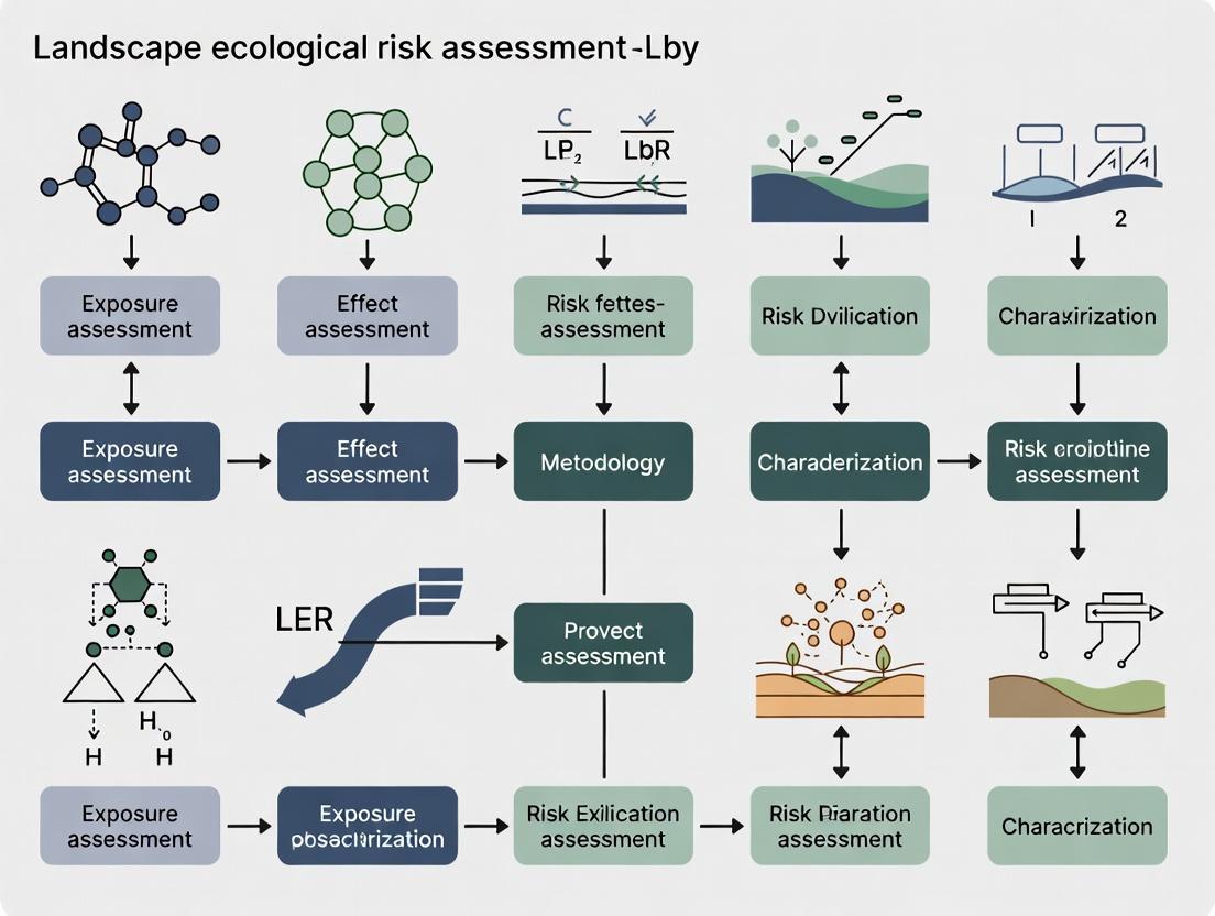
A robust LER assessment protocol involves sequential stages: landscape pattern analysis, risk index construction, spatial characterization, and driver identification. The following workflow and detailed protocols standardize this process.
Landscape Ecological Risk Assessment Core Workflow
Protocol 1: Landscape Classification and Assessment Unit Delineation
- Objective: To establish a spatially explicit foundation for risk calculation based on land use/cover or functional space.
- Procedure:
- Source Land Use Data: Utilize multi-temporal land use/cover (LULC) data with a resolution appropriate to the study scale (e.g., 30m) [5]. Classify land types (e.g., forest, cropland, urban, water).
- Alternative Functional Classification: For a socio-ecological perspective, reclassify LULC into Production-Living-Ecological Spaces (PLES) [1] [5]. For instance, assign cropland and industrial land to Production Space; rural and urban settlements to Living Space; and forests, grasslands, and water bodies to Ecological Space [5].
- Delineate Assessment Units: Overlay a regular grid (e.g., 3 km × 3 km) over the study area. The grid size should be 2–5 times the average landscape patch area to capture pattern heterogeneity [3]. For watershed studies, sub-catchments can serve as natural assessment units [2].
Protocol 2: Composite LER Index Calculation
- Objective: To compute a dimensionless LER index that integrates landscape disturbance and vulnerability.
- Procedure [3]:
- Calculate Landscape Metrics per Unit: For each assessment unit k, use software like Fragstats to calculate:
- Landscape Disturbance Index (LDIi): A weighted sum of indices for the i-th landscape type:
LDI_i = aC_i + bF_i + cD_i. WhereC_iis the fragmentation index,F_iis the fractal dimension index (measuring shape complexity), andD_iis the dominance index. Weights a, b, and c sum to 1. - Landscape Vulnerability Index (LVIi): Determine the relative susceptibility of each landscape type to external stresses. This can be assigned empirically (e.g., 1-6 for construction land to unused land) [2] or derived from ecosystem service valuation (e.g., normalized composite of water retention, soil conservation, carbon sequestration) [2]. Values are normalized to 0–1.
- Landscape Disturbance Index (LDIi): A weighted sum of indices for the i-th landscape type:
- Compute Landscape Loss Index (LLIi):
LLI_i = LDI_i × LVI_i. - Compute Final LER for Unit k:
LER_k = Σ ( (A_{ki} / A_k) × LLI_i ). WhereA_{ki}is the area of landscape i in unit k, andA_kis the total area of unit k. HigherLER_kindicates greater risk.
- Calculate Landscape Metrics per Unit: For each assessment unit k, use software like Fragstats to calculate:
Protocol 3: Spatiotemporal Analysis and Driving Force Detection
- Objective: To identify risk patterns, temporal trends, and primary causative factors.
- Procedure:
- Spatial Statistics: Perform spatial autocorrelation analysis (Global & Local Moran's I) to identify significant risk clusters (high-high, low-low) [1] [5].
- Driver Detection with GeoDetector:
- Factor Selection: Prepare raster layers of potential natural (elevation, slope, NDVI, precipitation) and anthropogenic (GDP, population density, distance to roads) drivers [3] [5].
- Discretization: Classify each continuous factor layer into appropriate intervals or strata.
- Run Factor Detector: The q-statistic quantifies the power of determinant of a factor on LER spatial heterogeneity (
q ∈ [0,1], higher value = greater explanatory power) [3]. - Run Interaction Detector: Assess whether two factors, when combined, weaken or enhance their explanatory power on LER (e.g., non-linear enhancement) [5].
Data Presentation and Quantitative Analysis
Table 1: Key LER Quantitative Findings from Regional Case Studies (2000-2020)
| Study Region | LER Trend & Magnitude | Dominant Risk Level | Key Driving Factors (q-statistic or priority) | Primary Spatial Pattern |
|---|---|---|---|---|
| Southwest China [4] [5] | Mean LER fluctuated ~0.20-0.21 [5]; Increased in northeast parts [4] | Medium risk zones predominant [5] | Anthropogenic disturbance & land use [5]; Shannon Diversity Index (increasing negative effect) [4] | High in northeast, low in southwest [4]; Significant clustering [5] |
| Luo River Watershed [2] | Overall LER increased (0.43 to 0.44) [2] | -- | Land use type > Elevation > Climate [2] | Lower in west, higher in east; Negative correlation with ecosystem resilience [2] |
| Lower Yangtze River [1] | Mean LER increased (0.2508 to 0.2573) [1] | Medium risk (consistently >30% area) [1] | -- | Significant positive spatial autocorrelation (Moran's I: 0.4773 to 0.4779) [1] |
| Jianghan Plain [3] | LER initially increased then decreased [3] | Medium and higher risk [3] | NDVI (primary), human activity intensity [3] | High in southeast, low in central/north [3] |
Table 2: Multi-Scenario LER Simulation for the Jianghan Plain (2030 Projection) [3]
| Scenario | Core Policy Focus | Simulated Land Use Change Trend | Projected LER Outcome |
|---|---|---|---|
| Natural Development | Follows historical trend | Continued cropland conversion to built-up land | Highest LER |
| Economic Development | Maximize GDP growth | Accelerated urban/industrial expansion | Higher LER |
| Cropland Protection | Protect prime farmland | Strict control of cropland loss | Lower LER |
| Ecological Protection | Prioritize ecosystem services | Expansion of woodland/grassland/water | Lowest LER |
Experimental Protocols for Key Analyses
Protocol 4: Multi-Scenario Simulation of Future LER
- Objective: To project future LER under different land use policy scenarios.
- Procedure (Markov-PLUS Model) [3]:
- Land Use Demand Projection (Markov Chain): Analyze historical transition matrices between land types. Use these probabilities to forecast the total area demand for each land type at a future date (e.g., 2030).
- Spatial Allocation (PLUS Model): Use the Land Expansion Analysis Strategy (LEAS) to mine the drivers of land type expansion. Then, apply a Cellular Automata (CA) model based on multi-class random patch seeds to allocate the projected land demands from Step 1 spatially onto the map, constrained by scenario-specific rules.
- Cropland Protection Scenario: Add conversion restrictions for prime farmland.
- Ecological Protection Scenario: Increase transition costs for developing ecological lands.
- Future LER Assessment: Calculate the LER index (Protocol 2) for the simulated future land use maps.
Multi-Scenario LER Simulation Protocol
Protocol 5: Ecological Management Zoning Based on LER and Resilience
- Objective: To delineate spatially targeted zones for adaptive ecological management.
- Procedure [2]:
- Quantify Ecosystem Resilience (ER): Construct an index from factors like vegetation net primary productivity (NPP), landscape connectivity, and soil organic matter.
- Bivariate Local Moran's I Analysis: Perform a bivariate spatial autocorrelation analysis between LER and ER values across assessment units. This identifies four types of spatial agglomeration:
- High-LER, Low-ER: Priority Ecological Restoration Region.
- Low-LER, High-ER: Core Ecological Conservation Region.
- High-LER, High-ER & Low-LER, Low-ER: Ecological Adaptation Region (requiring monitoring and adaptive management).
- Zone-Specific Strategy Formulation: Develop targeted measures for each zone (e.g., restorative projects in Restoration regions, strict protection in Conservation regions).
The Scientist's Toolkit
Table 3: Essential Research Reagent Solutions for LER Assessment
| Tool/Reagent | Primary Function | Application in LER Protocol |
|---|---|---|
| Fragstats | Landscape pattern metric computation | Calculates core indices for the Landscape Disturbance Index (LDI) within each assessment unit [3] [5]. |
| ArcGIS / QGIS | Geospatial data processing & visualization | Used for assessment unit delineation, spatial overlay, interpolation, zoning, and map production [3] [5]. |
| GeoDetector | Spatial heterogeneity & driving force analysis | Quantifies the explanatory power (q-statistic) of individual factors and their interactions on LER spatial patterns [3] [5]. |
| Markov-PLUS Model | Land use change simulation | Projects future land use under different scenarios, forming the basis for future LER projection [3]. |
| R / Python (GDAL, scikit-learn) | Statistical analysis & machine learning | Supports advanced spatial statistics (Moran's I), regression modeling (GTWR), and Random Forest analysis for driver detection [4] [5]. |
| InVEST / RUSLE | Ecosystem service modeling | Generates quantitative maps of services (water yield, soil conservation) used to derive objective Landscape Vulnerability Indices [2]. |
| Thalidomide-5-(PEG2-amine) | Thalidomide-5-(PEG2-amine), MF:C20H24N4O7, MW:432.4 g/mol | Chemical Reagent |
| Monoisodecyl Phthalate-d4 | Monoisodecyl Phthalate-d4, MF:C18H26O4, MW:310.4 g/mol | Chemical Reagent |
The discipline of ecological risk assessment (ERA) has undergone a profound transformation, evolving from a focus on human health and chemical toxicology to a comprehensive, spatially explicit analysis of landscape-scale systems [2] [6]. This evolution reflects a growing recognition that environmental management requires an understanding of complex interactions across entire ecosystems. The foundational framework, established by agencies like the United States Environmental Protection Agency (USEPA), initially emphasized a stressors-receptor model to evaluate the likelihood of adverse effects from specific hazards [7] [6]. This approach excelled at site-specific contamination issues but struggled to characterize cumulative risks from multiple, diffuse pressures across heterogeneous landscapes [2].
The shift towards Landscape Ecological Risk Assessment (LER) represents a paradigm change. LER is defined as the potential damage to an ecosystem’s structure, function, and stability within a landscape resulting from natural or anthropogenic activities [2] [7]. Unlike its predecessor, LER explicitly incorporates spatial heterogeneity, scale dependency, and the mutual feedback between landscape patterns and ecological processes [2]. It moves beyond evaluating single stressors to assess the integrated risk arising from land use change, habitat fragmentation, and climate variation, treating the landscape pattern itself as both an indicator and a mediator of risk [7] [5]. This methodological progression provides the critical tools needed to support territorial spatial ecological restoration, sustainable land management, and the achievement of global biodiversity and development goals [2] [7].
Methodological Evolution and Optimization in LER
The optimization of LER methodologies centers on overcoming the subjectivity of traditional models and enhancing their functional relevance for ecosystem management [2]. Early LER models often relied on static landscape pattern indices and expert-based assignment of vulnerability scores to different land use types, which introduced uncertainty and failed to capture dynamic ecological functions [2].
Integrating Ecosystem Services and Resilience
A significant advancement is the incorporation of ecosystem services (ES) directly into the risk assessment framework. Instead of using arbitrary vulnerability indices, modern approaches quantify landscape vulnerability based on the capacity of ecosystems to provide key services such as water conservation, soil retention, and carbon sequestration [2]. The underlying principle is that a decline in ecosystem services indicates increased landscape vulnerability and, consequently, higher ecological risk. This method provides a more scientific and ecologically meaningful assessment [2].
Concurrently, the concept of ecosystem resilience (ER) has been integrated to inform risk management. Resilience refers to an ecosystem's ability to withstand disturbance and recover its structure and function [2]. Research shows an inverse, non-linear relationship between LER and ER; improving ecosystem resilience is a proven strategy for mitigating landscape ecological risk [2]. The coupling of LER and ER assessments enables more nuanced ecological management zoning, identifying regions for priority conservation, targeted restoration, or adaptive management [2].
Analytical Workflow for Integrated LER Assessment
The following diagram illustrates the integrated workflow for a contemporary LER assessment that incorporates ecosystem services and resilience, moving from data preparation to management guidance.
Diagram: Integrated LER Assessment Workflow Incorporating ES and Resilience [2].
Quantitative LER Findings from Case Studies
The application of these optimized methods across diverse regions reveals clear spatiotemporal patterns and driving forces of ecological risk.
Table 1: Comparative LER Assessment Findings from Regional Case Studies
| Study Region | Time Period | Overall LER Trend | Spatial Pattern | Key Driving Factors Identified | Source |
|---|---|---|---|---|---|
| Luo River Watershed (Qinling Mountains) | 2001-2021 | Increased (0.43 to 0.44) | Lower in west, higher in east. Inverse correlation with Ecosystem Resilience. | Land use type, elevation, climate. | [2] |
| Harbin City (Northeast China) | 2000-2020 | Decreased | "High in west & north, low in east & south". High-risk areas concentrated near water bodies. | DEM (topography), interaction of DEM & precipitation. | [7] |
| Southwest China (Karst Region) | 2000-2020 | Stable (Avg. ERI 0.20-0.21) | Transition from high/low risk to medium-risk zones. Poor connectivity in northeast. | Anthropogenic disturbance, land use level, economic factors. | [5] |
Detailed Experimental Protocols for LER Research
Protocol 1: Ecosystem Services-Based Vulnerability Assessment
This protocol details the method for replacing subjective vulnerability indices with a quantitative assessment based on ecosystem services [2].
- Objective: To calculate a spatially explicit Landscape Vulnerability Index (LVI) derived from the capacity of key ecosystem services.
- Materials: Land use/cover maps, digital elevation model (DEM), climate data (precipitation, temperature), soil type maps, and geospatial software (e.g., ArcGIS, QGIS with InVEST model).
- Procedure:
- Service Selection & Modeling: Identify 3-4 dominant regional ecosystem services (e.g., water yield, soil retention, carbon storage, habitat quality). Utilize biophysical models (e.g., the InVEST suite) to quantify the provision of each service for every landscape parcel or grid cell.
- Normalization & Integration: Normalize the values of each ecosystem service layer to a 0-1 scale. Use an analytic hierarchy process (AHP) or equal weighting to combine the normalized layers into a composite Ecosystem Service Capacity (ESC) index.
- Vulnerability Calculation: Invert the ESC index to derive the LVI:
LVI = 1 - ESC. This operationalizes the principle that lower service capacity equates to higher vulnerability. - Validation: Cross-validate the LVI spatial pattern with independent indicators of ecological degradation, such as soil erosion rates or habitat fragmentation indices.
Protocol 2: Multi-Scenario Future LER Simulation Using the PLUS Model
This protocol outlines steps for projecting future LER under different land-use scenarios to inform proactive management [7].
- Objective: To simulate land use change and assess consequent LER patterns for 2030 under Natural Development, Economic Priority, and Ecological Priority scenarios.
- Materials: Historical land use maps (e.g., 2000, 2010, 2020), spatial driver data (DEM, slope, distance to roads/rivers, population, GDP), the PLUS model software, and Fragstats.
- Procedure:
- Driver Analysis & Model Calibration: Use the land expansion analysis strategy (LEAS) module in PLUS to analyze the contributions of various drivers to historical land use changes. Train the multi-type random patch seed (CARS) module with historical data to calibrate simulation parameters.
- Scenario Definition:
- Natural Development: Project trends using Markov chains based on historical transition probabilities.
- Economic Priority: Increase transition probabilities to construction land, relaxing constraints near urban centers.
- Ecological Priority: Impose strict conversion restrictions on ecological lands (forest, grassland, water) and incentivize restoration.
- Land Use Simulation: Run the PLUS model for each 2030 scenario to generate projected land use maps.
- Future LER Assessment: Calculate landscape pattern indices and the LER index for each simulated map. Compare the area and spatial distribution of high-risk zones across scenarios to evaluate policy outcomes.
Protocol 3: Ecological Network Construction for Risk Mitigation
This protocol describes constructing an ecological network to enhance landscape connectivity and reduce risk by facilitating ecological flows [5].
- Objective: To identify ecological sources, corridors, and nodes to form a functional network that mitigates landscape fragmentation and ecological risk.
- Materials: LER assessment results, land use map, NDVI data, resistance surface template.
- Procedure:
- Identify Ecological Sources: Extract areas with low ecological risk (e.g., lowest 20% of ERI values) and high ecosystem service value as primary ecological source patches.
- Create Resistance Surface: Assign a cost value (1-100) to each land use type based on its permeability to species movement and ecological processes. Higher LER values should correspond to higher resistance.
- Extract Corridors and Nodes: Use the Minimum Cumulative Resistance (MCR) model to calculate the least-cost paths between source patches. These paths form potential ecological corridors. Identify strategic locations where multiple corridors intersect as key ecological nodes.
- Network Analysis & Optimization: Evaluate network connectivity using metrics like corridor pinch points and node importance. Propose specific measures for protecting identified corridors (e.g., greenways) and strengthening nodes (e.g., targeted restoration).
The Scientist's Toolkit: Essential Reagents and Materials for LER Research
Table 2: Key Research Reagent Solutions for Landscape Ecological Risk Assessment
| Item Category | Specific Item / Tool | Function in LER Research | Key Consideration |
|---|---|---|---|
| Core Geospatial Data | Multi-temporal Land Use/Land Cover (LULC) Data | Serves as the fundamental input for calculating landscape pattern indices and tracking change. | Resolution (e.g., 30m), classification accuracy, and temporal consistency are critical [2] [5]. |
| Environmental Drivers | Digital Elevation Model (DEM), Climate Datasets, Soil Maps | Used to model ecosystem services, create resistance surfaces, and analyze risk drivers via Geodetector. | Spatial resolution and accuracy directly influence model outputs like soil erosion and water yield [2] [7]. |
| Socio-economic Data | Population Density, GDP, Road Networks, Point of Interest (POI) | Quantifies anthropogenic pressure, a primary driver of land use change and ecological risk. | Temporal alignment with LULC data is necessary for robust causal analysis [7] [5]. |
| Primary Software Tools | Fragstats | The standard software for computing a wide array of landscape pattern metrics (patch, class, landscape level). | Choice of metrics must be hypothesis-driven to avoid redundancy [5]. |
| Geodetector (q-statistic) | Statistically quantifies spatial stratified heterogeneity and identifies the power of determinant factors (q) and their interactions. | Handles both numerical and categorical data well, with no linear assumption required [7] [5]. | |
| InVEST Model Suite | Integrates biophysical data to map and value ecosystem services, enabling vulnerability assessment. | Model selection and parameterization must be tailored to the study region [2]. | |
| Modeling & Simulation | PLUS Model | Simulates future land use change under multiple scenarios by coupling LEAS and CARS modules. | Superior to earlier models (CA-Markov, FLUS) in simulating patch-level changes and driver interactions [7]. |
| Validation & Analysis | Random Forest (RF) Model | A machine learning algorithm used to rank the importance of driving factors and predict risk patterns. | Provides robust, non-parametric analysis of complex variable relationships [5]. |
| TAT-HA2 Fusion Peptide | TAT-HA2 Fusion Peptide|Cell-Penetrating Reagent | TAT-HA2 Fusion Peptide enhances macromolecular delivery via endosomal escape. For Research Use Only. Not for human, veterinary, or household use. | Bench Chemicals |
| Glucocorticoids receptor agonist 2 | Glucocorticoids receptor agonist 2, MF:C25H25FN2O, MW:388.5 g/mol | Chemical Reagent | Bench Chemicals |
The evolution from human health-focused risk assessment to landscape-scale analysis represents a critical advancement in our ability to manage complex environmental challenges. Contemporary LER methodologies, which integrate ecosystem services, resilience theory, and spatial simulation, provide a powerful, scientifically-grounded framework for diagnosing ecological health and guiding sustainable land-use planning [2] [7]. The protocols outlined herein offer a standardized yet flexible approach applicable to diverse regions, from urbanizing cities to ecologically fragile watersheds.
Future methodological research should focus on several frontiers:
- Dynamic Process Integration: Moving beyond static pattern indices to incorporate dynamic ecological process models that better reflect feedback loops between pattern, process, and risk [2].
- Multi-Scale Synthesis: Developing frameworks to seamlessly integrate LER assessments across local, regional, and global scales to inform coordinated policy action.
- Big Data and AI Enhancement: Leveraging high-resolution remote sensing, citizen science data, and artificial intelligence (e.g., deep learning for pattern recognition) to improve the accuracy and real-time capability of risk monitoring and prediction [8].
- Enhanced Decision-Support Tools: Translating LER maps and scenarios into interactive platforms for stakeholders and policymakers, directly linking assessment outcomes to land-use zoning and conservation investment decisions [2] [6].
By continuing to refine these tools and protocols, the scientific community can strengthen the foundation for evidence-based ecological governance, ensuring that landscape ecological risk assessment remains a vital instrument in the pursuit of ecosystem sustainability and human well-being.
Introduction Within the interdisciplinary field of landscape ecological risk assessment (LER), methodological rigor is paramount. This article synthesizes two distinct yet conceptually analogous frameworks: the regulatory guidelines of the U.S. Environmental Protection Agency (EPA) and the physiological Pressure-Receptor-Response (PRR) model. The EPA's framework provides a structured, policy-driven approach to managing anthropogenic environmental stress, while the PRR model offers a mechanistic, systems-level understanding of biological responses to physical forces. Together, they form a complementary foundation for LER methodology, enabling researchers to quantify stressors, characterize receptor sensitivity, and predict systemic responses across spatial and biological scales [9] [10] [11].
1. The EPA Regulatory Framework: Application in Risk Assessment The EPA's guidelines establish a formal process for identifying, evaluating, and controlling environmental risks. A contemporary application is found in the agency's management of methane emissions from the oil and natural gas sector under rules OOOOb and OOOOc [9] [12].
1.1 Core Principles and Recent Regulatory Actions The framework operates on the principles of source identification, technological feasibility, and cost-benefit analysis. In March 2024, the EPA announced New Source Performance Standards (NSPS) and Emissions Guidelines for this sector [9]. A subsequent Interim Final Rule (IFR) in July 2025 extended multiple compliance deadlines, a move finalized in November 2025 [9] [12]. Key extensions include an 18-month delay for requirements on control devices, equipment leaks, and storage vessels, and an additional 180-day extension for continuous monitoring of flares and enclosed combustion devices [9] [12]. The stated rationale is to provide "more realistic timelines" and address industry-identified challenges related to supply chain and personnel limitations [9]. The EPA estimates these extensions will save an estimated $750 million in compliance costs over 11 years [9].
1.2 Quantitative Summary of Key EPA Rule Deadlines Table: Key Compliance Deadlines from EPA's 2025 Final Rule on Oil and Gas Sources (OOOOb/c) [9] [12]
| Requirement Category | Original 2024 Rule Deadline | 2025 Final Rule Extension | New Final Deadline (from IFR publication) |
|---|---|---|---|
| Control Devices, Equipment Leaks, Storage Vessels | Specified in 2024 rule | Extended by 18 months | 18 months post-Federal Register publication |
| State Implementation Plans (for existing sources) | Specified in 2024 rule | Extended by 18 months | 18 months post-Federal Register publication |
| "Super Emitter" Program Implementation | Specified in 2024 rule | Extended by 18 months | 18 months post-Federal Register publication |
| Flare/Combustor Continuous Monitoring | November 28, 2025 | Extended by 180 days (from IFR's 120-day extension) | 300 days post-Federal Register publication |
| Annual NSPS OOOOb Reports (initially due before rule) | Prior to effective date | Grace period of 360 days | 360 days from effective date of final action |
2. The Pressure-Receptor-Response (PRR) Model: A Biomechanistic Framework The PRR model describes how mechanical forces (pressure) are transduced by specialized receptors to elicit calibrated physiological responses. This is exemplified by the arterial baroreceptor system, a canonical negative feedback loop for blood pressure homeostasis [11].
2.1 Anatomical and Functional Basis Arterial baroreceptors are mechanosensitive nerve endings located in the carotid sinuses and aortic arch. They are stimulated by stretch of the vessel wall caused by increased arterial pressure [11]. This sensory information is relayed via the glossopharyngeal (carotid) and vagus (aortic) nerves to the nucleus tractus solitarius (NTS) in the medulla oblongata [11]. The NTS integrates this input and modulates autonomic outflow: increased baroreceptor firing inhibits sympathetic tone and enhances parasympathetic activity, leading to vasodilation, reduced heart rate, and a consequent decrease in blood pressure [11]. The system demonstrates sophisticated features like dual-fiber signaling (rapid A-fibers for dynamic control and slower C-fibers for tonic control) and receptor "resetting" in chronic hypertension [11].
2.2 Experimental Elucidation of PRR Interactions Research has expanded the model to examine interactions between different pressor pathways. A key 2019 study investigated the interplay between Central Command (CC, from higher brain centers) and the Exercise Pressor Reflex (EPR, from muscle afferents) in normotensive (WKY) and spontaneously hypertensive (SHR) rats [13]. The protocol involved decerebrated, paralyzed animals. CC was mimicked by electrically stimulating the Mesencephalic Locomotor Region (MLR; 20–50 μA), while the EPR was simulated by stimulating the sciatic nerve (SN; 3, 5, and 10 × motor threshold) [13]. The pressor (blood pressure) responses were measured individually and concurrently. Findings revealed an inhibitory interaction: the summed individual responses were greater than the simultaneous response. This neural "occlusion" was attenuated in SHR rats, suggesting dysfunctional integration of pressor pathways in hypertension [13].
3. Integrated LER Methodology: Synthesizing the Frameworks Landscape ecological risk assessment leverages the logical structures of both frameworks. The EPA model provides the regulatory and source-stress-receptor paradigm, while the PRR model offers a template for quantifying landscape sensitivity and nonlinear responses.
3.1 Conceptual Integration In LER, anthropogenic activities (EPA "sources") exert "pressure" on landscape patches (the "receptors"). The receptor's vulnerability is a function of its structural and functional characteristics, analogous to the density and sensitivity of baroreceptors. The landscape-level "response" is a change in ecosystem services, stability, or pattern, mirroring the integrated cardiovascular outcome [10]. This synthesis allows for modeling complex, cascading effects across spatial scales.
3.2 Application in Landscape Analysis: A Case Study A 2023 study of the Fuchunjiang River Basin, China, demonstrates this integrated approach [10]. Using land use data (1990-2020), researchers calculated a Landscape Ecological Risk Index (LERI) based on landscape pattern indices like fragmentation, loss, and dominance. Their spatiotemporal analysis found risk was "high in the northwest and low in the southeast," with an overall decreasing trend from 1990 to 2020 [10]. Statistical geodetector analysis identified GDP, human interference, and changes in arable/ residential land areas as dominant influencing factors. Crucially, the coupling between LERI and GDP exhibited an inverted "U" shaped Environmental Kuznets Curve relationship, illustrating a complex systemic response to economic pressure [10].
Table: Key Metrics and Findings from the Fuchunjiang River Basin LER Case Study (1990-2020) [10]
| Metric Category | Specific Indicator/Findings | Interpretation in PRR Analogy |
|---|---|---|
| Landscape Pattern Change | Increased agglomeration; decreased loss index. | Altered "receptor" structural configuration. |
| Spatial Risk Distribution | "High in northwest, low in southeast." | Spatial heterogeneity in receptor sensitivity. |
| Temporal Risk Trend | Overall decreasing trend at basin scale. | Systemic adaptation or successful mitigation. |
| Dominant Influencing Factors | GDP, human interference, land use change areas. | Key sources of landscape "pressure." |
| Economy-Risk Relationship | Inverted "U" shaped curve (EKC) with GDP. | Nonlinear, threshold-dependent systemic response. |
4. Detailed Application Notes & Protocols
4.1 Protocol: Simulating Pressor Pathway Interactions (In Vivo) This protocol is adapted from studies investigating central and peripheral pressor mechanism interactions [13].
- Objective: To quantify the interactive pressor response between central command (CC) and the exercise pressor reflex (EPR) in an animal model.
- Subjects: Age-matched male normotensive (e.g., WKY) and hypertensive (e.g., SHR) rats (13-16 weeks) [13].
- Surgical Preparation:
- Anesthetize with isoflurane (4% induction, 1.5-2% maintenance) [13].
- Cannulate carotid artery (for blood pressure monitoring) and jugular vein (for fluid/drug infusion) [13].
- Perform pre-collicular decerebration, discontinue anesthesia, and wait >1.25 hours for stabilization [13].
- Place concentric bipolar electrode in the Mesencephalic Locomotor Region (MLR) for CC simulation [13].
- Isolate and mount the sciatic nerve (SN) on a bipolar electrode for EPR simulation [13].
- Administer neuromuscular blocker (e.g., pancuronium) and initiate artificial ventilation post motor threshold determination [13].
- Stimulation & Data Acquisition:
- Individual Stimulation: Record baseline and pressor response to MLR stimulation (e.g., 20, 30, 40, 50 μA) and SN stimulation (e.g., 3, 5, 10 × MT) separately [13].
- Concurrent Stimulation: Apply a constant intensity SN stimulus while varying MLR intensity, and vice versa [13].
- Continuously record mean arterial pressure (MAP), heart rate (HR), and renal sympathetic nerve activity (RSNA) if measured [13].
- Data Analysis: Calculate the algebraic sum of individual stimulus responses. Compare this sum to the response during concurrent stimulation to identify interactive effects (e.g., occlusion). Compare patterns between animal groups [13].
4.2 Protocol: Landscape Ecological Risk Assessment via Remote Sensing This protocol is based on the landscape pattern-based evaluation method [10].
- Objective: To assess spatiotemporal changes in landscape ecological risk for a defined basin or region.
- Data Acquisition: Acquire multi-temporal land use/land cover (LULC) classification data (e.g., for 1990, 2000, 2010, 2020) from satellite remote sensing (e.g., Landsat, Sentinel) for the study area [10].
- Landscape Pattern Analysis:
- Divide the study area into assessment units (e.g., townships, watershed grids) [10].
- Calculate landscape pattern indices for each unit and time period:
- Fragmentation Index (Ci): Ci = ni / Ai, where ni is patch number and Ai is total area of landscape type i [10].
- Loss Index (Si): Represents the vulnerability of landscape type i (often based on expert judgment or ecological value) [10].
- Dominance Index (Di): Measures the relative importance of landscape type i in the overall pattern [10].
- Risk Index Calculation: Compute the Landscape Ecological Risk Index (LERI) for each spatial unit k: LERI_k = ∑ (Ei * Ai) / A_k, where Ei is the ecological risk degree of landscape type i (Ei = Ci * Si * Di), Ai is the area of type i in unit k, and A_k is the total area of unit k [10].
- Spatiotemporal & Statistical Analysis:
5. Visualization of Frameworks and Pathways
Diagram 1: EPA Regulatory Framework as a Cyclic Process (Width: 760px)
Diagram 2: Core Baroreceptor Pressure-Receptor-Response Pathway (Width: 760px)
6. The Scientist's Toolkit: Essential Reagents & Materials
Table: Key Research Reagent Solutions and Materials for Featured Experiments
| Item Name | Category | Primary Function in Protocol | Key Reference/Example |
|---|---|---|---|
| Isoflurane | Anesthetic | Induction and maintenance of surgical anesthesia in rodent models. | [13] |
| Concentric Bipolar Electrode | Surgical Tool | Precise electrical stimulation of discrete brain regions (e.g., MLR). | [13] |
| Pancuronium Bromide | Neuromuscular Blocker | Induces paralysis to isolate cardiovascular effects from muscle movement during nerve stimulation. | [13] |
| NaHCO3/Dextrose Ringer Solution | Physiological Fluid | Maintains fluid balance, electrolyte homeostasis, and baseline blood pressure during experiments. | [13] |
| Land Use/Land Cover (LULC) Data | Geospatial Data | The foundational dataset for calculating landscape pattern indices and ecological risk. | [10] |
| GIS Software (e.g., ArcGIS, QGIS) | Analysis Tool | Platform for spatial analysis, grid creation, index calculation, and map generation in LER studies. | [10] |
| Geodetector Software | Statistical Tool | Quantifies the driving forces and interactions behind spatial patterns of landscape ecological risk. | [10] |
The Central Role of Landscape Pattern and Process in Risk Assessment
Application Notes: Integrating Pattern and Process in LER Assessment
Landscape Ecological Risk (LER) assessment has evolved from static, pattern-based analyses to dynamic frameworks that integrate ecological processes and resilience. The core advancement lies in coupling traditional landscape pattern indices with functional metrics of ecosystem services and stability, moving beyond mere spatial heterogeneity to assess the systemic vulnerability and response capacity of socio-ecological systems [2].
Recent methodological optimizations address key limitations of traditional models, notably the strong subjectivity in assigning landscape vulnerability and the disconnect between pattern indices and ecological processes [2]. The contemporary approach reframes vulnerability not by arbitrary land-use rankings but by quantifying the loss of key ecosystem services—such as water retention, soil conservation, and carbon sequestration—which directly reflect functional degradation [2]. Concurrently, the integration of Ecosystem Resilience (ER) into the assessment framework introduces a critical temporal dimension. Resilience characterizes a system's capacity to absorb disturbance and recover its structure and function, thereby modulating the final risk outcome [2]. Spatially, LER and ER exhibit a non-linear, often quadratic relationship, where increasing resilience generally corresponds with decreasing risk, enabling sophisticated zoning for management [2].
Empirical applications across diverse Chinese watersheds and plains demonstrate the scalability of this integrated approach. Studies in the Luo River Watershed, Xin'an River Basin, Jianghan Plain, and Bosten Lake Basin consistently utilize a grid-based sampling framework (e.g., 3 km x 3 km or watershed-based units) to calculate a composite LER index [2] [14] [3]. The spatial correlation of LER is persistently high (Global Moran's I > 0.7), confirming that risk is a clustered, spatially auto-correlated phenomenon rather than a random distribution [15]. Driving force analyses, increasingly conducted via the GeoDetector model, consistently identify land use type and natural factors (elevation, NDVI, temperature) as primary determinants, while socioeconomic factors play a secondary, though significant, role [2] [14] [3].
The ultimate application is risk-informed zoning for ecological management. By coupling LER and ER via bivariate spatial autocorrelation, landscapes can be partitioned into Adaptation, Conservation, and Restoration regions, guiding targeted interventions [2]. Furthermore, coupling LER assessment with multi-scenario simulation models (e.g., Markov-PLUS) allows for the predictive evaluation of future risk under different development pathways, transforming the methodology from a diagnostic to a strategic planning tool [3].
Key Quantitative Findings in LER Research
Table 1: Summary of Key LER Assessment Studies and Quantitative Findings (2000-2025)
| Study Area & Period | Dominant Landscape Change | LER Trend | Primary Driving Factors (Identified via GeoDetector) | Spatial Autocorrelation (Global Moran's I) | Management Zoning Outcome |
|---|---|---|---|---|---|
| Luo River Watershed (2001-2021) [2] | Urban expansion, cropland change. | Overall increase (0.43 to 0.44); 67.61% of area saw increased risk. | Land use type, Elevation, Climate factors. | Not explicitly stated; used bivariate Moran's I for LER-ER coupling. | Three zones delineated: Ecological Adaptation, Conservation, and Restoration. |
| Xin'an River Basin (1990-2020) [14] | Forest expansion, cropland/tea plantation decline, urban growth. | Overall decline, especially post ecological compensation policy. | Natural factors (Elevation, Temperature). | Distinct clustering patterns reported. | Policy assessment shows ecological compensation reduces LER. |
| Jianghan Plain (2000-2020) [3] | Significant conversion of cropland to built-up land; cropland-water body interchange. | Increased then decreased; dominated by medium-high risk. | NDVI (primary), other natural environmental factors. | Analysis performed; pattern "high in southeast, low in central/north". | Multi-scenario simulation for 2030 predicts lower risk under ecological/cropland protection vs. natural/economic development. |
| Bosten Lake Basin (2000-2020) [15] | Dominated by grassland and bare area dynamics. | Area of high-risk zones increased; lower/lowest risk zones shrank (62.02% to 58.44%). | Not analyzed in detail. | Exceeded 0.7 for all three periods, indicating strong positive spatial autocorrelation. | Foundation for multi-scale risk studies in fragile ecoregions. |
Table 2: Core Components of an Optimized LER Assessment Model [2] [3]
| Component | Description | Calculation/Metric | Rationale & Advancement |
|---|---|---|---|
| Landscape Disturbance Index (LDI) | Measures intensity of external stress on a landscape. | Composite of fragmentation (C), isolation (S), and dominance (D) indices: a*C + b*S + c*D (a, b, c are weights). |
Quantifies structural pressure from human activity and natural change. |
| Landscape Vulnerability Index (LVI) | Assesses a landscape type's inherent sensitivity to disturbance. | Traditional: Expert-assigned ordinal ranks (1-6) by land use type. Optimized: Quantified via inverse of composite ecosystem service value (e.g., water retention, soil conservation) [2]. | Replaces subjective ranking with objective, process-based functional metrics. |
| Landscape Loss Index (LLI) | Integrated measure of potential ecological loss. | LLI = LDI * LVI. |
Combines external pressure with internal susceptibility. |
| Landscape Ecological Risk Index (LERI) | Final risk value for an assessment unit (grid). | LER_k = ∑ (A_ki / A_k) * LLI_ki where A_ki is area of landscape i in unit k [3]. |
Weighted average of loss, representing cumulative risk per spatial unit. |
| Ecosystem Resilience (ER) | Capacity to resist disturbance and recover function. | Composite index of vegetation vigor, soil moisture, landscape connectivity, etc. [2]. | Introduces adaptive capacity, modulating final risk and enabling dynamic management zoning. |
Detailed Experimental Protocols
Protocol A: Grid-Based LER Assessment with Integrated Vulnerability
Objective: To quantitatively assess spatiotemporal LER by integrating ecosystem service-based vulnerability and landscape pattern disturbance. Workflow: See Diagram 1: LER Assessment Workflow. Materials: Land use/cover (LULC) raster data (e.g., 30m resolution), Digital Elevation Model (DEM), soil type data, precipitation data, NDVI time series, GIS software (e.g., ArcGIS, QGIS), Fragstats software, statistical software (R, Python). Procedure:
- Data Preparation & Scale Determination: Preprocess all spatial data to a unified coordinate system and resolution. Determine the optimal assessment grain and extent using semi-variance analysis or by setting the grid size to 2-5 times the average patch area of the landscape [15]. Create a vector grid (e.g., 3km x 3km) over the study area [3].
- Landscape Metrics Calculation: Use Fragstats to calculate landscape pattern indices (Patch Density, Edge Density, Splitting Index, Aggregation Index) for each LULC class within each grid cell for each time period.
- Compute Landscape Disturbance Index (LDI): For each LULC class i, standardize the selected fragmentation, isolation, and dominance indices and combine them using a weighted sum (e.g., 0.5, 0.3, 0.2) to generate a class-specific LDI [3].
- Quantify Landscape Vulnerability Index (LVI):
- Ecosystem Service Assessment: Model key services (e.g., water yield, sediment retention, carbon storage) using tools like InVEST or the RUSLE equation. Generate a composite ecosystem service (ES) value map.
- Assign LVI: For each LULC class, calculate the mean composite ES value. Normalize these mean values (0-1). Define LVI for each class as
LVI_i = 1 - Normalized_ES_i. This ensures low-service (highly vulnerable) landscapes receive higher LVI scores [2].
- Calculate Landscape Loss & Risk Index: Compute
LLI_i = LDI_i * LVI_ifor each LULC class. For each grid cell k, calculate the area-weighted LER:LER_k = ∑ (Area_ki / Area_k) * LLI_i. Map the results and classify risk levels (e.g., Low, Medium-Low, Medium, Medium-High, High) using natural breaks. - Spatio-temporal Analysis: Analyze change between periods. Perform spatial autocorrelation analysis (Global & Local Moran's I) to identify risk clusters and outliers [15].
Protocol B: Coupled LER-ER Analysis for Ecological Management Zoning
Objective: To integrate Ecosystem Resilience (ER) with LER for identifying spatially targeted management zones. Workflow: See Diagram 2: LER-ER Coupling for Management Zoning. Materials: LER results from Protocol A, remote sensing indices (NDVI, LSWI for soil moisture, etc.), landscape connectivity metrics, GIS software with spatial statistics toolbox. Procedure:
- Ecosystem Resilience (ER) Quantification: Construct a multi-factor ER index. Common indicators include:
- Vegetation Vigor: Mean annual NDVI.
- Soil/Moisture Status: Land Surface Water Index (LSWI) or soil organic carbon.
- Landscape Connectivity: Probability of connectivity index based on core habitat patches.
- Diversity: Shannon's Diversity Index of LULC. Standardize and weight these factors (e.g., using Principal Component Analysis) to create a composite ER raster, resampled to the LER grid.
- Bivariate Spatial Coupling: Perform a bivariate Local Moran's I analysis between LER and ER grids. This identifies five types of spatial relationships: High-LER & Low-ER (High-High), Low-LER & High-ER (Low-Low), High-LER & High-ER (High-Low), Low-LER & Low-ER (Low-High), and non-significant.
- Management Zoning: Interpret the bivariate clusters as management zones [2]:
- Ecological Restoration Zone (High-LER, Low-ER): Highest priority for active intervention to reduce pressure and restore functionality.
- Ecological Adaptation Zone (High-LER, High-ER): Manage stress while monitoring resilient systems' natural adjustment.
- Ecological Conservation Zone (Low-LER, High-ER): Protect and maintain current healthy, resilient state.
- Monitoring Zone (Low-LER, Low-ER): Areas with low risk but low capacity; prevent degradation.
- Driving Force Analysis: Use the Geodetector model (
gdpackage in R) to quantify the determinant power (q-statistic) of natural and socioeconomic factors (e.g., elevation, slope, GDP, population density) on both LER and ER spatial patterns. The interaction detector can reveal synergistic driving forces [3].
Protocol C: Multi-Scenario LER Simulation and Prediction
Objective: To project future LER under different land use and policy scenarios. Materials: Historical LULC maps (multiple periods), spatial driver variables (distance to roads, cities, slope, etc.), future scenario storylines, simulation software (e.g., PLUS model, FLUS model). Procedure:
- Land Use Change Simulation:
- Scenario Definition: Develop 3-4 scenario storylines (e.g., Natural Development, Economic Priority, Ecological Protection, Cropland Protection) [3].
- Model Calibration: Use the Markov-PLUS model. A Markov chain predicts total demand per LULC class. The PLUS model uses a Land Expansion Analysis Strategy (LEAS) to mine the drivers of past transitions and a Cellular Automata (CA) based on Multi-class Random Patch Seeds to allocate future changes spatially under different scenario constraints.
- Simulation & Validation: Simulate land use for a target year (e.g., 2030). Validate the model by simulating a known year and comparing with actual data using Kappa coefficient and FoM.
- Future LER Assessment: Apply the LER assessment model (Protocol A) to the simulated future LULC maps.
- Comparative Risk Analysis: Compare the area, distribution, and spatial statistics of risk levels across different future scenarios to inform policy planning and land use optimization [3].
Visualizations
The Scientist's Toolkit: Essential Research Reagents & Materials
Table 3: Key Reagents, Datasets, and Software for LER Research
| Item Name | Type | Specification/Example Source | Primary Function in LER Assessment |
|---|---|---|---|
| Multi-temporal Land Use/Land Cover (LULC) Data | Core Dataset | 30m Global Land Cover datasets (e.g., FROM-GLC, GlobeLand30), or national land use surveys. | Serves as the fundamental spatial data layer for calculating landscape pattern indices and tracking change. |
| Google Earth Engine (GEE) | Cloud Platform | Platform with petabytes of satellite imagery (Landsat, Sentinel) and geospatial datasets [14]. | Enables efficient large-scale LULC classification, time-series analysis (NDVI), and ecosystem service modeling without local computational burdens. |
| Fragstats Software | Analytical Tool | Latest version (e.g., Fragstats 4.2). | The standard software for calculating a comprehensive suite of landscape pattern metrics (patch, class, and landscape level) from LULC rasters. |
| InVEST Model Suite | Ecosystem Service Model | Integrated Valuation of Ecosystem Services and Tradeoffs by Natural Capital Project. | Provides spatially explicit models for quantifying key ecosystem services (water yield, sediment retention, carbon storage) used to derive objective Landscape Vulnerability Indices [2]. |
| Geodetector Software/Package | Statistical Tool | gd package in R, or standalone GeoDetector software. |
Quantifies the driving forces behind LER spatial heterogeneity, assessing factor contributions (q-statistic) and interaction effects [14] [3]. |
| PLUS (Patch-generating Land Use Simulation) Model | Simulation Software | Coupled with Markov chain for demand projection. | Simulates future land use changes under different scenarios with high spatial accuracy, enabling predictive LER assessment [3]. |
| Sentinel-2/Landsat 8-9 Imagery | Remote Sensing Data | Multispectral satellite data (10-30m resolution). | Source for calculating vegetation indices (NDVI for resilience), classifying LULC, and monitoring environmental variables. |
| SRTM or ASTER GDEM | Topographic Data | 30m resolution Digital Elevation Model (DEM). | Provides essential terrain variables (elevation, slope) as drivers for both ecosystem services and LER patterns. |
| Iroxanadine hydrochloride | Iroxanadine hydrochloride, CAS:276690-59-6, MF:C14H21ClN4O, MW:296.79 g/mol | Chemical Reagent | Bench Chemicals |
| Quercetin 3,5,3'-trimethyl ether | Quercetin 3,5,3'-trimethyl ether, MF:C18H16O7, MW:344.3 g/mol | Chemical Reagent | Bench Chemicals |
Landscape ecological risk (LER) assessment represents a critical advancement in ecological risk evaluation by shifting focus from single-element receptors to the ecosystem as a whole, with particular emphasis on spatiotemporal differentiation and scale effects [16]. Traditional ecological risk assessment often overlooks the spatial heterogeneity inherent in landscapes—the uneven distribution of ecosystems, land uses, and human disturbances across geographical space. This heterogeneity fundamentally influences how ecological processes operate and how risks propagate through systems.
The unique perspective of LER methodology lies in its capacity to translate complex landscape patterns into measurable risk indicators. Unlike conventional approaches that might assess chemical contaminants or single-species impacts, LER evaluates how landscape pattern changes—particularly fragmentation, connectivity loss, and land use conversion—affect ecosystem stability, function, and resilience [7]. This approach is especially relevant in regions experiencing rapid urbanization, where human activities drastically reconfigure land resources and create new ecological pressures [16].
This application note details protocols for assessing LER with explicit consideration of spatial heterogeneity, providing researchers with methodological frameworks for quantifying and interpreting risk patterns across varied landscapes.
Core Conceptual Framework: From Landscape Pattern to Ecological Risk
The foundational principle of LER assessment is that landscape structure influences ecological function and process. The "patch-corridor-matrix" model provides the basic language for describing this structure [7]. Risk emerges from the interaction between the spatial configuration of landscape elements (patches of different land use types) and the ecological vulnerabilities associated with those elements.
Spatial heterogeneity matters in this framework for several key reasons:
- Risk Propagation: Heterogeneous landscapes can either impede or facilitate the spread of disturbances (e.g., pollution, fires, invasive species).
- Habitat Quality: The size, shape, and connectivity of habitat patches directly determine species viability and biodiversity.
- Ecosystem Services: The spatial arrangement of forests, wetlands, agricultural land, and urban areas affects water regulation, soil retention, and climate moderation services.
- Cumulative Impacts: Multiple, spatially dispersed stressors can have synergistic effects that are only apparent when viewed at a landscape scale.
The following conceptual diagram illustrates the analytical workflow for assessing LER, highlighting how spatial heterogeneity is quantified and integrated into risk indices.
Figure 1: LER Assessment Workflow Integrating Spatial Analysis. This workflow demonstrates the sequential steps from data acquisition to risk visualization, with an explicit feedback loop for analyzing spatiotemporal dynamics [16] [7].
Quantitative LER Assessment: Models, Indices, and Spatial Metrics
A robust LER assessment quantifies both the intensity of ecological disturbance and its spatial distribution. The following tables summarize core quantitative models, indices, and representative findings from recent studies.
Table 1: Core Landscape Pattern Indices for LER Assessment [16] [7]
| Index Category | Specific Index | Formula / Description | Ecological Interpretation |
|---|---|---|---|
| Fragmentation | Patch Density (PD) | PD = N / A (N=number of patches, A=total area) |
Higher PD indicates greater fragmentation, often linked to habitat degradation and disrupted flows. |
| Diversity | Shannon's Diversity Index (SHDI) | SHDI = -∑(Pᵢ * lnPᵢ) (Pᵢ=proportion of class i) |
Higher SHDI suggests greater landscape diversity and potential stability, but can indicate anthropogenic disturbance in certain contexts. |
| Aggregation | Aggregation Index (AI) | Percentage of like adjacencies among a patch type. | Lower AI suggests a more dispersed or fragmented pattern of a given land use type, potentially increasing edge effects. |
| Shape Complexity | Landscape Shape Index (LSI) | LSI = E / (2 * sqrt(Ï€ * A)) (E=total edge length) |
LSI ≥ 1. Higher values indicate more complex, irregular patch shapes, influencing species interactions and microclimates. |
| Connectivity | Connectance Index (CONNECT) | CONNECT = (∑Cᵢⱼ) / N (C=connectivity of patches) |
Measures functional connectivity between patches; critical for assessing habitat network resilience. |
Table 2: Representative LER Values and Trends from Case Studies
| Study Area & Period | Key Land Use Change Trend | Overall LER Trend & Value Range | Identified Spatial Pattern | Primary Driving Forces (via Geodetector) |
|---|---|---|---|---|
| Cities along Lower Yellow River (2000-2020) [16] | Decrease in cropland; increase in impervious surface. | Fluctuating, slight downward trend (0.1761 to 0.1751). | Center of gravity moving towards river mouth; increasing dispersion. | Natural factors > Social factors. Interaction of any two factors > single factor effect. |
| Harbin, China (2000-2020) [7] | Cultivated land and woodland dominant; development land increased; unused area decreased. | Overall downward trend, primarily medium-risk. | "High in west and north, low in east and south"; high-risk clusters around water bodies. | DEM had greatest explanatory power; interaction of DEM & annual precipitation was dominant. |
| General LER Risk Levels | N/A | Low Risk: < 0.15Medium Risk: 0.15–0.20High Risk: > 0.20 [16] | High spatial autocorrelation is common (Moran's I > 0.7) [7]. | Topography (DEM), climate (precipitation), and human activity (GDP, road density) are ubiquitous drivers. |
Detailed Experimental Protocols
Protocol 1: LER Index Calculation Based on Landscape Units
This protocol outlines the standard method for calculating a comprehensive LER index by integrating landscape disturbance and ecosystem vulnerability.
1. Objective: To compute a spatially explicit Landscape Ecological Risk Index that captures the combined effect of landscape pattern disturbance and the intrinsic sensitivity of different ecosystem types.
2. Materials & Input Data:
- Land Use/Land Cover (LULC) Data: Multi-temporal raster datasets (e.g., 30m resolution) classified into types such as forest, grassland, cropland, water, barren land, and impervious surface [16].
- GIS Software: ArcGIS, QGIS, or FRAGSTATS for spatial analysis and index calculation.
- Sampling Grid: A vector grid (e.g., 2km x 2km or 5km x 5km) overlaid on the study area to serve as the basic assessment unit.
3. Procedure:
- Step 1 - Landscape Classification and Grid Division: Reclassify LULC data into consensus categories. Overlay a uniform sampling grid over the study area.
- Step 2 - Calculate Landscape Pattern Indices per Grid Cell: For each grid cell, calculate a suite of indices (see Table 1). A critical composite metric is the Landscape Disturbance Index (LDI).
LDI = a*Ci + b*Si + c*Di- Where
Ciis the fragmentation index,Siis the separation index, andDiis the dominance index for gridi. Weightsa, b, csum to 1 and are often determined via expert judgment or principal component analysis.
- Step 3 - Assign Ecosystem Vulnerability Weights: Assign a relative vulnerability weight (
Fk) to each LULC typek(e.g., Water: 0.8; Forest: 0.6; Cropland: 0.4; Impervious: 0.2) based on its sensitivity to disturbance and ecological function. - Step 4 - Compute LER Index per Grid Cell:
LERi = LDIi * ∑(Aki * Fk) / Ai- Where
LERiis the risk index for gridi,Akiis the area of landscape typekin gridi, andAiis the total area of gridi. This formula integrates spatial disturbance with the vulnerability of the landscape composition.
- Step 5 - Spatial Interpolation and Classification: Use Kriging or Inverse Distance Weighting (IDW) interpolation on all grid cell
LERivalues to create a continuous risk surface. Reclassify the surface into distinct risk levels (e.g., Low, Medium-Low, Medium, Medium-High, High).
4. Output: A geospatial map of Landscape Ecological Risk and an attribute table containing the LER value for each spatial unit.
Protocol 2: Analyzing Driving Forces of Spatial Heterogeneity with Geodetector
This protocol uses the Geodetector method to quantitatively assess the drivers behind the observed spatial patterns of LER.
1. Objective: To identify and quantify the influence of natural and socioeconomic factors on the spatial heterogeneity of LER, including single-factor effects and interaction effects.
2. Materials & Input Data:
- Dependent Variable: Raster map of computed LER values.
- Explanatory Variables: Raster layers of candidate driving factors (e.g., DEM, slope, precipitation, temperature, population density, GDP density, distance to roads/waterways, land use degree) [16] [7].
- Software: R with
GDpackage, or dedicated Geodetector software.
3. Procedure:
- Step 1 - Data Layer Preparation and Discretization: Ensure all factor layers are aligned (same extent, resolution). Discretize continuous factor data (e.g., DEM, GDP) into strata using appropriate classification methods (natural breaks, quantiles, etc.). The Optimal Parameters-based Geographical Detector (OPGD) model can optimize this step [16].
- Step 2 - Factor Detector Analysis: Run the Factor Detector to measure the explanatory power (
qstatistic) of each single factor on the spatial distribution of LER.q = 1 - (∑ Nh * σh²) / (N * σ²)- Where
h=1..Lis the stratum of the factor;NhandNare stratum and population sample sizes;σh²andσ²are variances. Theqvalue ranges [0,1]; a largerqindicates a stronger determining power of the factor.
- Step 3 - Interaction Detector Analysis: Run the Interaction Detector to assess how the combined influence of two factors affects LER. Evaluate whether the interaction is: Non-linear Weakened, Single-factor Weakened, Bi-enhanced, Independent, or Non-linear Enhanced.
- Step 4 - Risk Detector Analysis: Use the Risk Detector (e.g., t-test) to determine if there is a significant difference in the mean LER value between two strata of a factor.
- Step 5 - Ecological Detector Analysis: Use the Ecological Detector (e.g., F-test) to determine if there is a significant difference in the influence of two different factors on LER.
4. Output: Quantitative q values for all factors, interaction q values for factor pairs, and statistical significance tests identifying the dominant drivers and their interactions shaping LER spatial heterogeneity.
The interplay between landscape patterns, ecological processes, and external drivers is visualized in the following conceptual diagram, which underpins the analytic protocols.
Figure 2: Conceptual Framework of Spatial Heterogeneity in LER. This diagram shows how natural and human driving forces shape landscape structure, which in turn governs ecological processes to jointly determine LER. The system features constant feedback loops [16] [7].
The Scientist's Toolkit: Research Reagent Solutions
Table 3: Essential Analytical Tools and Platforms for LER Research
| Tool Category | Specific Tool/Platform | Primary Function in LER Research | Key Application Notes |
|---|---|---|---|
| Landscape Pattern Analysis | FRAGSTATS | The industry-standard software for calculating a comprehensive suite of landscape pattern metrics from raster maps. | Essential for Protocol 1 (Step 2). Input requires a classified LULC raster. Batch processing enables multi-temporal analysis. |
| Geospatial Analysis & Modeling | ArcGIS Pro / QGIS | Core platform for data management, LULC reclassification, grid creation, spatial interpolation, and map visualization. | Used throughout all protocols. The Raster Calculator and Zonal Statistics tools are particularly important for index computation. |
| Spatial Statistical Analysis | R (with spdep, GD packages) |
Statistical computing for spatial autocorrelation (Global/Local Moran's I) and Geodetector analysis. | GD package implements the Geodetector model for Protocol 2. Critical for quantifying driving forces and spatial clustering. |
| Land Use Change Simulation | PLUS (Patch-generating Land Use Simulation) Model | A CA-based model that simulates future land use scenarios by leveraging a land expansion analysis strategy and random forest algorithm [7]. | Used for forecasting future LER under different development scenarios (e.g., natural growth, ecological protection). |
| Automated Accessibility Checking | Color Contrast Analysers (e.g., CCA, WAVE) | Tools to verify that graphical outputs (charts, maps) meet minimum color contrast ratios (≥ 3:1 for large graphics) for accessibility [17] [18]. | Critical for ensuring research findings are communicated inclusively. Should be applied to all final presentation maps and figures. |
| NMDA receptor antagonist-3 | NMDA receptor antagonist-3, MF:C13H19N3O6, MW:313.31 g/mol | Chemical Reagent | Bench Chemicals |
| tert-Butyl 2-((5-bromopentyl)oxy)acetate | tert-Butyl 2-((5-bromopentyl)oxy)acetate, MF:C11H21BrO3, MW:281.19 g/mol | Chemical Reagent | Bench Chemicals |
The explicit incorporation of spatial heterogeneity elevates LER assessment from a descriptive exercise to an analytical framework capable of diagnosing the structural causes of ecological risk. Methodologies that integrate landscape pattern indices with spatial statistical tools like Geodetector allow researchers to move beyond mapping risk to explaining its drivers [16] [7].
Future methodological advancements are likely to focus on:
- Higher Resolution Temporal Analysis: Leveraging annual or seasonal LULC data to understand shorter-term risk dynamics and tipping points.
- Integration with Ecosystem Service Models: Directly linking LER indices to the provision and flow of key ecosystem services (e.g., carbon sequestration, water purification).
- Machine Learning Enhanced Forecasting: Using AI to improve the accuracy of land use change and risk simulation models under complex, non-linear future scenarios.
- Standardization of Vulnerability Weights: Developing region- and ecosystem-specific vulnerability weight (
Fk) databases to improve the comparability of LER studies across different geographies.
By adopting the detailed protocols and tools outlined in this application note, researchers can systematically assess landscape ecological risk, providing a scientifically robust basis for land use planning, ecological conservation, and sustainable development policy.
The LER Assessment Toolkit: Methods, Models, and Practical Applications
Landscape Ecological Risk (LER) assessment is a critical subfield of regional ecological risk analysis that emphasizes spatiotemporal heterogeneity and the effects of scale [7]. It evaluates the potential damage to ecosystem structure, function, and stability resulting from natural or human-induced disturbances within a landscape [7]. The Landscape Ecological Risk Index (LERI) serves as a synthesized, core metric within this assessment framework. It diverges from traditional pollutant-focused ecological risk models by adopting a landscape pattern-centric approach [16]. This methodology treats the landscape mosaic itself as the risk receptor, integrating the cumulative ecological impacts arising from multiple stress sources through changes in landscape pattern [7].
The construction of LERI is grounded in the "pattern-process-risk" paradigm. It operates on the premise that external disturbances (e.g., urbanization, climate change) alter the composition and configuration of land use/cover. These alterations in landscape pattern, measurable through indices, subsequently affect the flow of ecological processes and the stability of ecosystems, manifesting as ecological risk [19]. Within the context of a broader thesis on LER methodology, the LERI provides a quantifiable, spatially explicit foundation for diagnosing risk hotspots, deciphering driving mechanisms, and simulating future risk scenarios under different land-use policies [7].
Core Methodology: Constructing the LERI
The standard LERI construction protocol involves a multi-step process that transforms land use/cover data into a normalized risk surface. The following workflow details this procedure.
Figure 1: LERI Construction and Analysis Workflow [7] [16].
Mathematical Formulation
The LERI for a given spatial unit i (typically a grid cell) is calculated as a composite of key landscape pattern indices [7] [16]:
LERi = Ci × Di × Si
Where:
- Ci (Landscape Fragmentation Index) represents the degree of fragmentation within the cell. It is often derived from the Landscape Division Index or a function of patch density and edge density. Higher fragmentation implies greater disruption to ecological flows.
- Di (Landscape Dominance Index) quantifies the extent to which the landscape is dominated by one or a few patch types. It is calculated from the Landscape Dominance metric based on relative patch area. High dominance can indicate reduced biodiversity and resilience.
- Si (Landscape Isolation Index) measures the degree of isolation of similar patch types. It can be derived from the Euclidean Nearest-Neighbor Distance metric. Greater isolation hinders species movement and gene flow.
Each component index (Ci, Di, Si) is normalized to a 0-1 scale before multiplication to ensure comparability. The resulting LERi value is a unitless, relative measure where a higher value indicates higher ecological risk within that spatial unit [16].
Key Calculation Steps
- Data Preparation: Acquire multi-temporal land use/cover (LULC) raster data (e.g., 30m resolution) for the study area [16].
- Grid Creation: Overlay a vector grid (e.g., 3km x 3km) onto the study region. The grid cell size should be 2-5 times the average landscape patch size to capture pattern dynamics effectively.
- Metric Calculation: For each grid cell and time period, calculate the three core landscape metrics (Ci, Di, Si) using spatial analysis software (e.g., FRAGSTATS).
- LERI Computation: Apply the formula LERi = Ci × Di × Si for each cell.
- Classification: Reclassify the continuous LERI values into distinct risk levels (e.g., Low, Medium-Low, Medium, Medium-High, High) using a classification scheme like Natural Breaks (Jenks).
- Spatial & Temporal Analysis: Analyze the resulting LERI surface for spatial autocorrelation (e.g., using Global and Local Moran's I) and track changes over time [7].
Application Notes: Insights from Contemporary Research
Recent advancements in LERI application emphasize multi-scale analysis and future scenario simulation. The integration of spatial statistical tools like GeoDetector has refined the understanding of driving forces [19] [16].
Table 1: LERI Trends and Drivers from Recent Case Studies (2020-2025)
| Study Area & Reference | Key LERI Trend (Temporal) | Spatial Pattern | Primary Driving Forces Identified | Key Analytical Method |
|---|---|---|---|---|
| Cities along Lower Yellow River, China [16] | Fluctuating, slight downward trend (0.1761 to 0.1751 from 2000-2020). | Center of gravity moved towards river mouth; increasing dispersion. | Natural factors > Social factors. Interaction of any two factors > single factor effect. | OPGD (Optimal Parameters-based Geodetector) |
| Harbin, China [7] | Overall downward trend (2000-2020), primarily medium risk. | "High in west/north, low in east/south"; highest risk around water bodies. | DEM was strongest natural driver. Interaction of DEM & Annual Precipitation was dominant. | GeoDetector; PLUS model for future scenarios. |
| Three Plateau Lakes Basin, Yunnan, China [19] | Risk reduced overall from global perspective. | Deteriorated areas progressed SW to NE (2000-2020). | Global: Anthropogenic disturbances. Local: Varies by area type (deteriorated vs. improved). | Multi-scale Geodetector analysis. |
| 10-oxo-12(Z),15(Z)-Octadecadienoic Acid | 10-oxo-12(Z),15(Z)-Octadecadienoic Acid, MF:C18H30O3, MW:294.4 g/mol | Chemical Reagent | Bench Chemicals | |
| Amino-PEG4-bis-PEG3-methyltetrazine | Amino-PEG4-bis-PEG3-methyltetrazine, MF:C58H90N14O17, MW:1255.4 g/mol | Chemical Reagent | Bench Chemicals |
Multi-Scale Driver Analysis
A seminal 2025 study in the Three Plateau Lakes Basin demonstrated that driving factors operate differently across scales [19]. While a global analysis found anthropogenic disturbances to be most influential, a local-scale analysis of "deteriorated," "improved," and "stable" risk areas revealed nuanced drivers:
- Deteriorated Areas: Intense anthropogenic pressure was the primary driver.
- Improved/Stable Areas: Natural disturbances held greater explanatory power [19]. This underscores the necessity of a multi-scale perspective in LER driver identification to formulate comprehensive and feasible ecological protection strategies [19].
Future Risk Projection
Research in Harbin utilized the PLUS model to simulate land use in 2030 under three scenarios: Business-As-Usual (BAU), Economic Priority (EP), and Ecological Priority (ECP) [7]. The LERI was projected under each scenario:
- The Ecological Priority (ECP) scenario resulted in a slower decrease of ecological land and was identified as the most effective approach for improving landscape ecological conditions [7].
- This application provides a critical decision-support tool, allowing policymakers to visualize the potential long-term ecological consequences of different development pathways.
Experimental Protocols for LERI Research
Protocol A: Comprehensive LERI Assessment and Driver Analysis
Objective: To assess the spatiotemporal evolution of landscape ecological risk and quantify the influence of natural and anthropogenic driving factors.
Materials & Data:
- LULC Data: Multi-temporal (e.g., 2000, 2010, 2020) raster datasets.
- Driving Factor Data: Raster layers for natural (DEM, slope, precipitation, temperature) and anthropogenic (population density, GDP, distance to roads/waterways) variables.
- Software: ArcGIS/QGIS, FRAGSTATS, R/Python with GeoDetector package.
Procedure:
- Data Preprocessing: Reclassify LULC data into consistent categories. Project all raster data to a unified coordinate system and resolution.
- LERI Calculation: Follow steps outlined in Section 2.2 to generate LERI raster layers for each time point.
- Spatial Autocorrelation Analysis: Calculate Global Moran's I to determine if LERI exhibits clustering. Perform Local Moran's I analysis to identify specific "High-High" and "Low-Low" clusters [7].
- Driver Detection with GeoDetector:
a. Discretization: Convert continuous driving factor rasters into categorical layers using an optimal method (e.g., natural breaks).
b. Factor Detector: Execute the
factor_detectorfunction to calculate the q-statistic for each factor. The q-value (0-1) indicates the factor's explanatory power on LERI spatial heterogeneity [16]. c. Interaction Detector: Execute theinteraction_detectorfunction to assess whether two factors, when combined, weaken or enhance each other's influence on LERI. Results typically show non-linear or bi-factor enhancement [16]. d. Optimal Parameters: For enhanced accuracy, employ the OPGD model to automatically determine the optimal discretization method and break number for each factor [16].
Protocol B: LERI Projection Using Multi-Scenario Land Use Simulation
Objective: To project future LERI under different socio-economic and policy scenarios.
Materials & Data: Same as Protocol A, plus historical socio-economic data for scenario parameterization.
Procedure:
- Land Use Change Simulation with PLUS Model: a. Use LULC data from two historical periods to extract land expansion and generate development probability maps for each land type via a Random Forest algorithm. b. Define scenario-specific parameters for 2030 (e.g., restricting urban expansion in ECP scenario, promoting cropland protection in EP scenario). c. Run the multi-type random patch seeding mechanism in the PLUS model to generate simulated LULC maps for 2030 under BAU, EP, and ECP scenarios [7].
- Future LERI Assessment: Calculate the LERI for each simulated 2030 LULC map using the standard method.
- Comparative Analysis: Quantify and map the differences in LERI magnitude and spatial distribution among the three future scenarios. Identify areas of greatest risk change under each development pathway.
Visualizing Pathways and Drivers
Understanding the interaction between drivers and LERI requires visualizing complex, non-linear relationships. The following diagram synthesizes the key pathways identified through GeoDetector analysis.
Figure 2: Pathways and Key Drivers in LERI Formation [19] [7] [16].
The Scientist's Toolkit: Essential Research Reagent Solutions
Table 2: Key Software and Analytical Tools for LERI Research
| Tool / "Reagent" | Primary Function in LERI Research | Example Use Case / Note |
|---|---|---|
| FRAGSTATS | Calculates a comprehensive suite of landscape pattern metrics from raster data. | Generating the core components (Ci, Di, Si) for the LERI formula [7]. |
| GeoDetector | Statistically quantifies spatial heterogeneity and detects the driving forces behind it. | Identifying that DEM explains 40% of LERI spatial variance, and its interaction with precipitation is stronger [7] [16]. |
| PLUS Model | Simulates land use change at the patch level under multiple scenarios. | Projecting 2030 LULC and corresponding LERI under ecological protection policies [7]. |
| ArcGIS Pro / QGIS | Provides integrated platform for spatial data management, processing, grid creation, and cartography. | Conducting spatial overlay, zonal statistics, and producing final risk maps. |
| R / Python (scikit-learn, pandas, GDAL) | Enables data cleaning, advanced statistical analysis, and custom automation of workflows. | Running OPGD models, calculating spatial autocorrelation indices, and batch-processing temporal data [16]. |
| Global Moran's I | Measures global spatial autocorrelation of LERI values. | Confirming that LERI in Harbin exhibits significant clustering (I > 0.79) [7]. |
| Aminooxy-PEG2-bis-PEG3-BCN | Aminooxy-PEG2-bis-PEG3-BCN, MF:C54H90N6O18, MW:1111.3 g/mol | Chemical Reagent |
| 1-Dehydroxy-23-deoxojessic acid | 1-Dehydroxy-23-deoxojessic acid, MF:C31H50O4, MW:486.7 g/mol | Chemical Reagent |
This document provides detailed application notes and experimental protocols for quantifying and applying three essential landscape pattern indices—fragmentation, disturbance, and loss—within the context of Landscape Ecological Risk (LER) assessment methodology research. Framed as a technical guide for researchers and scientists, it synthesizes contemporary findings from basin-scale carbon studies [20], optimized LER models [2], global forest disturbance analyses [21], and multi-scenario simulations [7]. The synthesis demonstrates that these indices are critical for diagnosing ecosystem vulnerability, projecting future risk under anthropogenic pressure, and informing targeted ecological management zones. Protocols detail the integration of ecosystem service valuations to objectively quantify landscape vulnerability [2], the use of global remote sensing data to classify disturbance patterns [21], and the application of spatial regression models to unravel the complex drivers of soil loss [22]. A curated toolkit of models, software, and datasets enables the standardized implementation of these advanced LER assessments.
Core Indices in Landscape Ecological Risk Assessment
Within LER assessment, landscape pattern indices serve as quantitative proxies for ecological processes and vulnerabilities. Three indices are fundamental:
- Fragmentation: The splitting of a habitat or land cover type into smaller, more isolated patches. It is a critical mediator of ecosystem functions, negatively impacting carbon sequestration [20] and biodiversity [23], though it may unexpectedly reduce soil loss in managed agricultural plains by disrupting runoff pathways [22].
- Disturbance: The spatial imprint and temporal dynamics of events that alter ecosystem structure. The form of disturbance (e.g., patch size, shape, clustering) is as important as its rate, with human activities introducing novel structural patterns that can lead to global forest homogenization [21].
- Loss: The outright reduction in the area of a specific land cover class, primarily due to land-use change. It is the most direct component of LER, driving immediate declines in associated ecosystem services and species habitats [24] [25].
These indices are interlinked within the "pattern-process-risk" framework central to contemporary LER methodology [2]. Their accurate measurement is essential for moving from descriptive landscape analysis to predictive risk assessment and management zoning.
Quantitative Synthesis of Index Dynamics and Impacts
Table 1: Key Landscape Pattern Indices and Their Ecological Implications
| Index Category | Specific Metric | Typical Calculation / Definition | Ecological Process & Risk Implication | Key Finding from Literature |
|---|---|---|---|---|
| Fragmentation | Patch Density (PD) | Number of patches per unit area. | Increased isolation, edge effects, reduced core habitat. Impedes species movement, alters microclimate. | In the Dongting Lake basin, PD increased by 82% over 300 years, correlating with an 11.4% loss in carbon stocks [20]. |
| Fragmentation | Perimeter-Area Fractal Dimension (PAFRAC) | Measures shape complexity independent of scale. | Complex shapes increase edge-to-core ratio, affecting species interactions and resource flows. | A 1% increase in PAFRAC led to a 20% increase in soil loss in the Jianghan Plain, demonstrating its dominant role in erosion processes [22]. |
| Disturbance | Disturbance Patch Structure | Classification based on size, shape, and spatiotemporal clustering [21]. | Determines forest recovery trajectory, habitat connectivity, and carbon cycling. | Four global patterns identified: Small-isolated (most frequent), Clustered, Complex, and Large-multiyear. Human activities increase the prevalence of non-natural structures [21]. |
| Loss | Mean Species Abundance (MSA) | Average abundance of original species relative to undisturbed state [23]. | Direct measure of biodiversity intactness loss due to cumulative pressures. | The Intactness-based Biodiversity Impact Factors (IBIF) dataset provides country-level impact factors linking land use, emissions, and roads to MSA loss [23]. |
| LER Composite | Landscape Ecological Risk Index | Often a function of landscape disturbance and vulnerability indices. | Integrates pattern dynamics to map spatial risk heterogeneity for management. | An optimized model using ecosystem services to weight vulnerability found LER increased from 0.43 to 0.44 (2001-2021) in the Luo River watershed, showing a quadratic relationship with ecosystem resilience [2]. |
Table 2: Documented Impacts of Landscape Pattern Change
| Study Context | Temporal Scale | Key Pattern Change | Quantified Ecosystem Impact |
|---|---|---|---|
| Dongting Lake Basin, China [20] | 1661-2020 (Century-scale) | Fragmentation (+82%), Regularity (+56%), Diversity (+37%). | Carbon stock loss of 11.4% (4.13 Gt to 3.66 Gt). Soil carbon accounted for 51% (0.24 Gt) of total loss. |
| Global Forests [21] | 2002-2014 | Human activities increase prevalence of complex and large-multiyear disturbance patches outside intact forests. | Suggests a trajectory of structural homogenization of global forests, with consequences for biodiversity and function. |
| Jianghan Plain, China [22] | 2005-2019 | Farmland fragmentation (increased PD) and shape complexity (increased PAFRAC). | PD negatively correlated with soil loss (-2% change per 1% PD increase). PAFRAC positively correlated (+20% change per 1% increase). |
| Luo River Watershed, China [2] | 2001-2021 | Increased LER correlated with decreased Ecosystem Resilience (ER). | Spatial analysis led to zoning: Ecological Adaptation (21.47%), Conservation (32.70%), Restoration (45.83%) regions [2]. |
| Harbin, China [7] | 2000-2020 | Urban expansion, decrease in unused land. | Overall LER trended downward, with strong spatial autocorrelation (Moran's I > 0.79). DEM was the strongest natural driver. |
Application Notes & Experimental Protocols
Protocol 1: Enhanced LER Assessment Integrating Ecosystem Services
Objective: To optimize the traditional LER assessment by replacing subjective landscape vulnerability coefficients with objective, spatially explicit ecosystem service valuations [2]. Workflow:
- Landscape Unit Delineation: At the watershed scale, establish assessment units (e.g., regular grid or sub-basins). A 2km grid is often effective for balancing detail and computational load [2].
- Landscape Disturbance Index (LDI) Calculation: For each unit i, calculate LDI using class-level landscape metrics: LDIᵢ = ∑ (Aᵢⱼ/Aᵢ) × Nᵢⱼ where Aᵢⱼ is the area of landscape class j in unit i, Aᵢ is the total area of unit i, and Nᵢⱼ is the fragmentation index (e.g., Patch Density) for class j in unit i [2].
- Ecosystem Service-based Vulnerability Index (ESVI) Modeling: a. Select Key Services: Model spatially distributed outputs for water yield, soil retention, and carbon storage using tools like InVEST or RUSLE [2]. b. Normalize & Integrate: Normalize each service layer (0-1) and compute a composite ESVI via weighted summation or principal component analysis. c. Invert for Vulnerability: Since high service value implies low vulnerability, compute Landscape Vulnerability Index (LVIáµ¢) = 1 - ESVIáµ¢.
- LER Index Integration: Compute the final risk index as LERᵢ = LDIᵢ × LVIᵢ. Standardize the result to a 0-1 scale for interpretation.
- Spatial Correlation & Zoning: Calculate the bivariate Moran's I between LER and an independent Ecosystem Resilience (ER) index. Use the resulting cluster map (High-High, Low-Low, etc.) to delineate Ecological Restoration, Conservation, and Adaptation zones [2] [26].
Protocol 2: Characterizing Global Forest Disturbance Patterns
Objective: To classify stand-replacing forest disturbance patches into distinct structural patterns using remote sensing and analyze their global distribution and anthropogenic drivers [21]. Workflow:
- Data Acquisition: Obtain annual 30m resolution tree cover loss data (2002-2014) from the Global Forest Change (GFC) dataset. Use ancillary land cover data (e.g., ESA CCI) to mask permanent land-use changes (>9ha pixels).
- Patch Delineation & Metric Calculation: For each detected loss pixel cluster (≥2 contiguous pixels), calculate a suite of metrics describing:
- Magnitude: Patch area, duration (years).
- Complexity: Shape Index, Elongation Index.
- Context: Spatio-temporal clustering (e.g., number of concomitant patches within a 5km buffer).
- Pattern Classification: Perform k-means clustering on the standardized metric vectors for all patches globally. The optimal number of clusters (e.g., k=4) is determined via silhouette analysis [21].
- Biome & Driver Analysis: Overlay the classified patch map with global biome maps and human modification indices. Quantify the relative prevalence of each disturbance pattern (e.g., Small-isolated, Clustered, Complex, Large-multiyear) within intact forests versus human-modified lands to isolate anthropogenic signatures [21].
Protocol 3: Multi-Scenario LER Projection Using Land Use Simulation
Objective: To project future LER under different land-use policy scenarios (e.g., Natural Growth, Ecological Priority) to inform preemptive risk management [7]. Workflow:
- Historical Change Analysis: Analyze land-use transitions (e.g., 2000, 2010, 2020) to establish a transition matrix and identify dominant conversion processes (e.g., forest to cropland).
- Driver Identification & Suitability Modeling: Use GeoDetector to identify key natural (DEM, slope, precipitation) and socio-economic (GDP, population, road network) drivers of land-use change. Model the suitability for each land-use type via algorithms like Random Forest within the PLUS model framework [7].
- Scenario Definition & Simulation:
- Natural Growth Scenario: Extrapolates historical trends.
- Ecological Priority Scenario: Incorporates spatial constraints (e.g., protected areas, steep slope afforestation) and incentivizes ecological land expansion.
- Economic Development Scenario: Prioritizes urban and cropland expansion. Simulate land-use maps for a target year (e.g., 2030) under each scenario using the PLUS model.
- Future LER Assessment & Comparison: Calculate the LER index for each simulated landscape using the protocol in 3.1. Compare the spatial distribution and total risk area between scenarios to evaluate policy efficacy.
The Scientist's Toolkit: Research Reagent Solutions
Table 3: Essential Tools for Advanced LER Research
| Tool Name | Type | Primary Function in LER Research | Key Application / Note |
|---|---|---|---|
| Google Earth Engine (GEE) | Cloud Computing Platform | Enables large-scale, multi-temporal analysis of remote sensing data (e.g., Landsat, Sentinel) for calculating landscape metrics and detecting change. | Used for efficient land-use change analysis over decadal scales at watershed level [14]. |
| InVEST Model | Software Suite (Natural Capital Project) | Maps and values ecosystem services (carbon storage, water yield, habitat quality) to objectively quantify landscape vulnerability. | Critical for replacing subjective vulnerability weights in LER models [2]. |
| PLUS Model | Land Use Change Simulation Model | Patched-based CA model that simulates future land-use patterns under multiple scenarios by analyzing expansion probabilities and drivers. | Used for projecting future LER under Ecological Priority, Economic Development, etc. scenarios [7]. |
| GeoDetector | Statistical Software | Quantifies the explanatory power of driving factors on LER spatial heterogeneity and detects factor interactions. | Identified DEM and its interaction with precipitation as dominant drivers of LER in Harbin [7]. |
| GLOBIO Model | Global Biodiversity Model | Quantifies mean species abundance (MSA) as a metric of biodiversity intactness loss due to pressures like land use, fragmentation, and climate change. | Source for the Intactness-based Biodiversity Impact Factors (IBIF) dataset, linking pressures to biodiversity footprints [23]. |
| RUSLE Model | Empirical Erosion Model | Estimates annual soil loss based on rainfall erosivity, soil erodibility, topography, cover management, and support practices. | Used to quantify soil loss as an ecosystem degradation metric and correlate it with landscape pattern indices [22]. |
| HILDA+ Global LULC Data | Dataset | Provides harmonized global land use/cover data at 1km resolution annually from 1960-2020. | Supports multi-scale, global analysis of landscape pattern change trajectories [25]. |
| Global Forest Change Data | Dataset (UMD) | Annual 30m maps of tree cover loss since 2000, essential for global and regional forest disturbance analysis. | Foundational data for global classification of forest disturbance patch patterns [21]. |
| Beclin1-Bcl-2 interaction inhibitor 1 | Beclin1-Bcl-2 interaction inhibitor 1, MF:C27H26BrN3O3, MW:520.4 g/mol | Chemical Reagent | Bench Chemicals |
| Condurango glycoside E | Condurango glycoside E, MF:C53H76O18, MW:1001.2 g/mol | Chemical Reagent | Bench Chemicals |
Abstract This application note details protocols for the integrated application of Geographic Information Systems (GIS), remote sensing, and spatial statistics within landscape ecological risk assessment (LER) methodology research. The synergistic use of these tools enables the quantification of spatiotemporal risk patterns, the modeling of ecosystem service interactions, and the projection of future risk under various scenarios. Framed within a thesis on advancing LER frameworks, this document provides actionable methodologies for data processing, analysis, and visualization, supporting researchers in developing robust, predictive models for sustainable landscape management and decision-support.
1. Foundational Concepts and Integrative Framework The transition from descriptive geography to an adaptive, predictive discipline—termed Intelligent Geography—provides the overarching framework for modern LER assessment [27]. This paradigm integrates continuous data streams from sensing platforms with analytical models to generate knowledge through feedback loops of prediction, comparison, and learning [27]. Within this context, GIS provides the foundational platform for data synthesis and spatial modeling; remote sensing delivers multi-scale, temporal data on landscape attributes; and spatial statistics offers the methods to detect patterns, quantify relationships, and validate models. Their integration is critical for moving beyond static risk snapshots to dynamic assessments that account for spatial heterogeneity, temporal trends, and complex driver interactions [5] [28].
1.1 Core Principles of GIS in LER GIS serves as the central nervous system for LER studies, enabling the hierarchical integration of vector, raster, and tabular data. Core functions critical to LER include:
- Spatial Data Management: Organizing disparate data layers (land use, topography, infrastructure) into a coherent geodatabase with consistent coordinate systems and scales.
- Landscape Pattern Analysis: Calculating metrics of fragmentation, connectivity, and diversity using tools like Fragstats, which are fundamental for constructing landscape disturbance and vulnerability indices [7] [5].
- Spatial Modeling and Zoning: Implementing suitability analysis, constructing ecological networks via Minimum Cumulative Resistance (MCR) models, and delineating ecological risk zones or management areas [29] [5].
1.2 Core Principles of Remote Sensing in LER Remote sensing provides the empirical data on land surface characteristics. Key considerations include:
- Multi-Source Data Integration: Leveraging satellite imagery (e.g., Landsat, Sentinel), UAV-derived high-resolution data, and IoT sensor networks to capture data across spatial, temporal, and spectral dimensions [30]. The fusion of optical, radar (SAR), and hyper-spectral data is crucial for comprehensive monitoring.
- Land Use/Land Cover (LULC) Mapping: Utilizing machine learning classifiers, particularly convolutional neural networks (CNNs), to generate accurate, time-series LULC maps from imagery, which form the base data for landscape pattern analysis [30].
- Ecosystem Service Proxy Variable Extraction: Deriving indices (e.g., NDVI for vegetation health, leaf area index) and biophysical parameters that serve as inputs for ecosystem service models like InVEST [29].
1.3 Core Principles of Spatial Statistics in LER Spatial statistics provides the methods to rigorously analyze the structured, non-independent nature of geospatial data.
- Spatial Autocorrelation Analysis: Using global (Moran’s I) and local indicators (LISA) to quantify and map the clustering of high or low ecological risk values, confirming that risk is not randomly distributed [7].
- Spatially Explicit Regression: Applying techniques like Geographically and Temporally Weighted Regression (GTWR) to model non-stationary, location-specific relationships between LER and driving factors over time [29].
- Driver Detection and Interaction: Employing geographical detectors (GeoDetector) and Random Forest algorithms to identify key anthropogenic and natural drivers and quantify their interactive effects on LER spatial heterogeneity [7] [5].
2. Quantitative Integration: Data Synthesis and Metrics Effective integration is demonstrated through quantifiable outputs and synthesized data products. The following tables summarize key quantitative findings and model performances from recent LER studies.
Table 1: Summary of Key Quantitative Findings from Integrated LER Assessments
| Study Region | Temporal Trend (LER) | Key Spatial Pattern | Primary Driver (Analysis Method) | Correlation with Ecosystem Service |
|---|---|---|---|---|
| Wuling Mountain Area [29] | Generally declined (2000-2020) | High risk in peri-urban zones; reduction in karst areas | Land use change / Urban expansion (GTWR) | Strong negative correlation with Habitat Quality & Soil Conservation |
| Harbin, China [7] | Trended downward (2000-2020) | "High in west/north, low in east/south"; clustered around water | DEM & its interaction with precipitation (GeoDetector) | N/A (Study focused on landscape pattern risk) |
| Southwest China [5] | Stable (Avg. ERI 0.20-0.21) | Transition from high/low to medium-risk zones | Anthropogenic disturbance & land use level (RF & GeoDetector) | Inferred from PLEs framework; not directly quantified |
Table 2: Performance Metrics of Featured Analytical Models and Protocols
| Model/Protocol Name | Primary Function in LER | Key Performance Metric | Critical Consideration |
|---|---|---|---|
| Geographically & Temporally Weighted Regression (GTWR) [29] | Modeling spatiotemporal non-stationary effects of LER on ES. | R² values indicating explanatory power of local models. | Bandwidth selection critically impacts results; requires optimization. |
| GeoDetector (q-statistic) [7] [5] | Detecting spatial stratified heterogeneity & factor interaction. | q-value: proportion of LER variance explained by a factor (0-1). | Factor discretization method can influence results. |
| Random Forest (RF) for Driver Analysis [5] | Ranking importance of driving factors for LER. | Mean Decrease in Accuracy/Gini impurity. | Risk of overfitting; requires careful validation. |
| PLUS Land Use Simulation Model [7] | Projecting future LER under multiple scenarios. | Figure of Merit (FoM) comparing simulated vs. actual change. | Accuracy depends on correct calibration of transition probabilities and driver weights. |
3. Experimental Protocols for Integrated LER Assessment
Protocol 3.1: Spatiotemporal LER Assessment and Ecosystem Service Coupling Objective: To quantify the dynamic evolution of LER and its relationship with key ecosystem services over a multi-decadal period.
- Data Acquisition & Preprocessing: Acquire time-series LULC data (e.g., 2000, 2010, 2020) for the study area. Preprocess concurrent remote sensing imagery for atmospheric correction and mosaicking. Collect ancillary data on topography, climate, and soil.
- LER Index Calculation: Divide the study area into assessment grids (e.g., 2-5x average patch size). For each period, calculate landscape indices (patch density, fragmentation, loss index) within each grid using Fragstats software. Compute the Landscape Ecological Risk Index (LERI) using a weighted sum model integrating disturbance and vulnerability indices [5].
- Ecosystem Service (ES) Assessment: Employ the InVEST model suite. Run the Habitat Quality, Sediment Delivery Ratio (soil conservation), and Annual Water Yield modules using the corresponding LULC maps and biophysical parameters [29].
- Spatiotemporal Relationship Modeling: Perform Geographically and Temporally Weighted Regression (GTWR) using LERI as the dependent variable and ES metrics as independent variables. Optimize the spatiotemporal bandwidth. Analyze the local R² and parameter estimates to map how the LER-ES relationship varies in space and time [29].
- Ecological Zoning: Conduct a quadrant analysis based on the standardized values of LERI and a composite ES index (e.g., MESLI). Delineate zones as Ecological Conservation, Ecological Reshaping, Ecological Restoration, and Sustainable Utilization, and propose tailored management strategies [29].
Protocol 3.2: Driving Force Analysis Using Spatial Statistics Objective: To identify and quantify the natural and anthropogenic factors driving the spatial heterogeneity of LER.
- Driver Variable Selection & Preparation: Select candidate drivers from categories: natural (elevation, slope, precipitation), landscape (LULC configuration metrics), and anthropogenic (population density, GDP, distance to roads/urban centers). Rasterize all variables to a common resolution and extent.
- Spatial Autocorrelation Test: Calculate Global Moran’s I for the LERI raster to confirm significant spatial clustering. Perform Local Moran’s I analysis to identify specific clusters of High-High and Low-Low risk [7].
- Factor Detection with GeoDetector: Discretize continuous driver variables using appropriate classification methods (natural breaks, quantiles). Use the GeoDetector’s factor detector to calculate the q-statistic for each driver, representing its explanatory power over LER spatial variance [7].
- Interaction Detection: Use GeoDetector’s interaction detector to assess the combined influence of any two drivers. Determine if the interaction is linear or nonlinear, and if it weakens or enhances the individual explanatory power [5].
- Validation with Machine Learning: Implement a Random Forest (RF) regression model with LERI as the target and all drivers as features. Rank driver importance using mean decrease in accuracy. Compare the rankings with GeoDetector results for robust conclusion triangulation [5].
Protocol 3.3: Future LER Projection Under Multi-Scenario Land Use Simulation Objective: To simulate future land use patterns and project consequent LER under different development scenarios (e.g., Natural Growth, Ecological Priority).
- Historical Land Use Change Analysis: Analyze land use transitions from two historical periods (e.g., 2000-2010, 2010-2020). Calculate transition matrices and areas to understand change trajectories.
- Driving Factor Analysis for Simulation: Select socioeconomic, proximity, and environmental drivers of land use change. Use the Land Expansion Analysis Strategy (LEAS) within the PLUS model to extract the contributions of each driver to each land use type’s expansion [7].
- Model Calibration & Validation: Calibrate the PLUS model using data from the first period to simulate the second period’s land use. Validate the simulation using the real LULC map from the second period, calculating a Figure of Merit (FoM). Adjust the sampling rate and neighborhood weights to optimize accuracy.
- Multi-Scenario Simulation: Define scenario parameters (e.g., transition probability matrices, development area constraints). For an Ecological Priority scenario, restrict the conversion of ecological lands (forest, grassland) to built-up areas. Simulate future land use for the target year (e.g., 2030) under each scenario.
- Future LER Assessment & Comparison: Calculate the LERI for the simulated future land use maps under each scenario. Compare the area and spatial distribution of different risk levels. Statistically analyze the changes in overall and zonal mean LERI to recommend the most sustainable development pathway [7].
4. Visualization of Integrated Workflows and Analytical Relationships
5. The Scientist's Toolkit: Essential Research Reagents
Table 3: Key Research Reagent Solutions for Integrated LER Studies
| Reagent/Tool Name | Category | Primary Function in LER Research |
|---|---|---|
| Fragstats | Landscape Pattern Analysis Software | Computes a wide array of landscape metrics from categorical maps (e.g., LULC) which are fundamental for constructing landscape disturbance and vulnerability indices [7] [5]. |
| InVEST Model Suite | Ecosystem Service Modeling | Spatially explicit models that map and value ecosystem services (e.g., habitat quality, water yield) to quantify trade-offs and synergies with LER [29]. |
| GeoDa / GWR4 | Spatial Statistics Software | Provides tools for exploratory spatial data analysis (ESDA), spatial autocorrelation tests (Moran’s I), and Geographically Weighted Regression (GWR/GTWR) modeling [29]. |
| PLUS Model | Land Use Change Simulation | A patch-level land use simulation model that integrates a land expansion analysis strategy and a multi-type random seed cellular automata to project future LULC under various scenarios for forward-looking LER assessment [7]. |
| Google Earth Engine | Cloud Computing Platform | A planetary-scale platform for remote sensing data analysis that enables rapid processing of large geospatial datasets, crucial for long-term, large-area LER trend analysis [30]. |
R spatial/sf/terra Packages |
Programming Libraries | Open-source libraries providing comprehensive functions for spatial data handling, visualization, and advanced statistical analysis (e.g., spatial regression, kriging) within a reproducible scripting environment [5]. |
The assessment of risk in major water diversion projects requires an integrated methodology that addresses both engineering safety and landscape ecological impacts. Within the broader thesis on Landscape Ecological Risk (LER) assessment methodology, this analysis synthesizes two complementary approaches: a fuzzy Bayesian network for engineering risk quantification [31] and a landscape ecological risk index (ERI) for evaluating ecosystem responses [32]. These projects, characterized by long distances and traversal through diverse climatic and ecological regions, face multidimensional risks including sudden pollution, flood overflow, channel instability, and unintended ecological consequences [31]. Traditional single-factor analyses are insufficient to capture the complex interactions within these systems [31]. This document provides detailed application notes and standardized protocols for implementing an integrated LER assessment framework, supporting researchers and engineers in generating reproducible, evidence-based risk evaluations for water resource infrastructure.
Quantitative Data Synthesis: Case Study Findings
Table 1: Comparative Risk Assessment of Major Water Diversion Project Components
| Project/Segment | Assessment Method | Primary Risk Factors Identified | Risk Probability/Level | Key Quantitative Findings | Source |
|---|---|---|---|---|---|
| General Water Diversion Projects | Fuzzy Bayesian Network | Sudden pollution, flood overflow, channel instability | Quantified into four risk levels (e.g., Low, Moderate) | Model validated via three scenarios; chi-square tests confirmed factor significance. | [31] |
| Yangtze-to-Huaihe (Henan Reach) | Consequence Reverse Diffusion Method (CRDM) & Risk Loss Index | Hydrological, channel morphology, engineering structures, operational management | Risk probability range: 1 to 3 (Low to Moderate) | Channel morphology showed greatest spatial variability. Qingshui River segments had higher risk loss. | [33] |
| Heihe River Basin (Ecological Water Diversion) | Hydrological & Ecological Analysis | Water allocation imbalance, groundwater decline, vegetation degradation | N/A (Qualitative assessment of risk) | >57.8% of upstream water diverted downstream. Middle reach groundwater declined by 5.8m total. | [34] |
| Tarim River Basin (Taitema Lake) | Landscape Ecological Risk Index (ERI) | Desertification, loss of ecological barrier function | ERI reduced post-intervention | ERI calculation based on landscape disturbance and vulnerability indices. EWC effectively reduced risk. | [32] |
Table 2: Ecological Impact Metrics from Water Diversion Case Studies
| Location & Project | Hydrological Change | Ecological Response | Socio-Economic Impact | Time Frame |
|---|---|---|---|---|
| Heihe River Basin [34] | >57.82% of upstream water discharged to lower reaches. Terminal lake area >50 km². | Lower Reaches: Groundwater rise, vegetation recovery in riparian zone & core oases. Middle Reaches: Vegetation degradation along river course. | Downstream (Ejin) economy grew at 28.06% annual rate. Discrepancy in water allocation intensified. | Post-2000 |
| Tarim River Basin (Taitema Lake) [32] | Downstream flow decreased historically; restored via Ecological Water Conveyance (EWC) since 2000. | Lake dried up pre-2000, causing desertification. Post-EWC: water body recovered, ecological environment improved. Evaporation losses remain high. | Implied threat to oasis stability and human health from prior degradation. | 1986-2020 (Study Period) |
| South-to-North (Middle Route Simulation) [31] | Modeled scenarios include sudden pollution events. | Focus on water quality risk as a subsystem. | Model incorporates impacts on water supply security. | N/A (Model Application) |
Table 3: Methodological Comparison for Risk Assessment
| Methodology | Core Principle | Application in Case Studies | Strengths | Limitations |
|---|---|---|---|---|
| Fuzzy Bayesian Network [31] | Combines fuzzy set theory (for uncertainty) with Bayesian networks (for causal relationships). | Simulated risk scenarios (e.g., sudden pollution) for the South-to-North Water Diversion Project. | Handles ambiguous data; allows dynamic updating; models factor interactions. | Requires expert input for structure; computational complexity. |
| Consequence Reverse Diffusion Method (CRDM) [33] | Deductive approach tracing risk factors back from failure modes (e.g., dike overtopping). | Identified risk factors across four domains for Yangtze-to-Huaihe conveyance channels. | Systematic; avoids omission/redundancy; suitable for engineered systems. | Primarily focused on engineering failure, less on ecological risk. |
| Landscape Ecological Risk Index (ERI) [32] | Based on Landscape Disturbance Index and Landscape Vulnerability Index from remote sensing. | Assessed spatiotemporal changes in risk before/after ecological water conveyance in Taitema Lake. | Holistic ecosystem view; uses readily available satellite data; visualizes spatial patterns. | Depends on classification accuracy; may oversimplify complex ecological processes. |
Detailed Experimental Protocols
Protocol 1: Integrated Engineering-Ecological Risk Assessment Workflow
This protocol outlines a mixed-methods approach [35] for a comprehensive risk assessment, combining the quantitative rigor of engineering models with a landscape-scale ecological evaluation.
1. System Scoping and Data Acquisition
- Objective: Define the spatial boundaries of the water diversion project and its zone of ecological influence. Collect foundational datasets.
- Procedure: a. Delineate the study area to include the engineering infrastructure (channels, sluices, reservoirs) and the affected ecological region (riparian zones, groundwater basins, terminal lakes). b. Engineering Data Collection: Gather design specifications, historical incident reports, hydrological records (flow, water level), structural monitoring data, and operational management logs [33]. c. Ecological Data Collection: Acquire time-series remote sensing imagery (e.g., Landsat TM/OLI [32]) for land cover classification. Collect field data on vegetation plots, groundwater table levels, and water quality parameters at stratified sampling points [34]. d. Socio-Economic Data: Compile data on population density, land use, and economic output for areas downstream and within the water supply region [33].
2. Parallel Risk Pathway Analysis
- Objective: Conduct simultaneous but linked assessments of engineering failure risk and landscape ecological risk.
- Pathway A - Engineering Subsystem: a. Risk Identification: Use the Consequence Reverse Diffusion Method (CRDM) [33]. Start with primary failure modes (e.g., dike overtopping, seepage). Deduce triggering causes and categorize risk factors into domains: Hydrology, Channel Morphology, Engineering Structures, Operational Management. b. Model Construction & Quantification: Build a Fuzzy Bayesian Network (FBN) [31]. i. Define network nodes: terminal nodes (risk accidents), intermediate nodes (disaster-causing factors), and parent nodes (risk levels). ii. For each factor node, define states (e.g., High, Medium, Low) and construct piecewise linear membership functions to quantify linguistic expert judgments into fuzzy probabilities [31]. iii. Establish Conditional Probability Tables (CPTs) for each node based on historical data, simulation models, and expert elicitation. c. Scenario Simulation: Run the FBN model under defined scenarios (e.g., extreme flood, pollutant spill) to obtain probabilistic risk levels. Use the centroid method for defuzzification of final outputs [31].
- Pathway B - Ecological Subsystem:
a. Landscape Classification: Process remote sensing imagery using a supervised classification algorithm (e.g., Random Forest [32]) to generate land use/cover (LULC) maps for multiple time points (pre- and post-project).
b. Index Calculation: For each ecological risk assessment unit (grid cell), calculate:
i. Landscape Disturbance Index (Ei): Integrates metrics like fragmentation, dominance, and loss [32].
ii. Landscape Vulnerability Index (Vi): Assigns a relative vulnerability weight to each LULC class (e.g., water body > forest > grassland > desert) [32].
iii. Landscape Ecological Risk Index (ERI): Compute as
ERI = Ei * Vifor each unit [32]. c. Spatiotemporal Analysis: Perform spatial statistics (e.g., Moran's I) to analyze clustering of high-risk areas. Track ERI changes over time to correlate with project operations [32].
3. Integration and Synthesis
- Objective: Identify feedback loops and cross-system interactions.
- Procedure: a. Cross-Walk Analysis: Map the outputs of the engineering model (e.g., a simulated channel breach location) to potential ecological consequences (e.g., flooding of a specific wetland type) using spatial overlay in a GIS. b. Validation: Compare temporal trends. For example, validate improvements in ecological ERI in a downstream oasis with modeled increases in guaranteed water supply from the engineering assessment. c. Comprehensive Reporting: Integrate findings into a unified risk profile, highlighting areas where engineering and ecological risks converge or conflict (e.g., a geotechnically stable channel segment that traverses a high-value, vulnerable ecosystem).
This protocol details the core computational methodology for engineering risk assessment.
1. Network Structure Definition (The "Bayesian" Component)
- Input: List of risk factors identified via CRDM or similar method.
- Procedure: a. Define hierarchical node structure: Target Node (Overall System Risk Level), Intermediate Nodes (e.g., Water Quality Risk, Structural Stability Risk), Parent Nodes (specific measurable or observable factors like "Pollutant Concentration" or "Seepage Flow Rate"). b. Establish directed arcs from parent to intermediate to target nodes representing causal or influential relationships. This structure forms the qualitative part of the Bayesian Network.
2. Parameterization with Fuzzy Logic (The "Fuzzy" Component)
- Objective: To handle the uncertainty and ambiguity in data and expert judgment.
- Procedure: a. For each parent node with continuous or vague inputs, define 3-5 fuzzy sets (e.g., "Low," "Medium," "High"). b. Construct a piecewise linear membership function for each fuzzy set. For example, for the factor "Wind Speed," define ranges where its membership to the "High" set gradually increases from 0 to 1. c. For each row in a node's Conditional Probability Table (CPT), expert judgment is used to assign a linguistic probability (e.g., "Very Likely"). This is converted to a numerical probability using a corresponding fuzzy membership function for probabilities.
3. Inference and Defuzzification
- Objective: To compute the probability of the target risk level given evidence.
- Procedure: a. Enter Evidence: Input observed or simulated states for parent nodes (e.g., "Pollutant Concentration = High"). b. Probabilistic Propagation: Use Bayesian inference algorithms (e.g., junction tree algorithm) to update the probabilities of all unknown nodes in the network. c. Defuzzify Output: The target node's output will be a fuzzy distribution over risk levels (e.g., 30% Low, 65% Moderate, 5% High). Apply the centroid method to calculate the weighted center of this distribution, resulting in a crisp, actionable risk value [31].
Visual Workflows and Methodological Diagrams
Diagram 1: Integrated LER Assessment Workflow for Water Diversion Projects
The Scientist's Toolkit: Essential Research Reagents and Materials
Table 4: Key Research Reagent Solutions and Essential Materials
| Item Category | Specific Item/Software | Function in Assessment | Application Notes |
|---|---|---|---|
| Data Acquisition & Preprocessing | Landsat TM/OLI, Sentinel-2 Imagery | Provides multispectral data for land cover classification and change detection over large spatiotemporal scales. | Primary source for calculating landscape indices [32]. Requires atmospheric and radiometric correction. |
| Gaofen (GF) Series Imagery | Offers higher spatial resolution for detailed feature extraction of engineering structures and riparian vegetation. | Useful for validating coarser classifications and identifying small-scale risk features. | |
| Hydrological Gauging Data (Flow, Level) | Essential for calibrating hydraulic models and defining extreme event scenarios (e.g., 100-year flood). | Input for the hydrological risk factor nodes in the FBN model [31] [33]. | |
| Modeling & Analysis Software | Geospatial Software (ArcGIS, QGIS) | Platform for spatial data management, overlay analysis, map creation, and calculating spatial metrics (e.g., fragmentation). | Core environment for integrating engineering and ecological data layers and performing ERI spatial analysis [32]. |
| Bayesian Network Software (Netica, GeNIe, OpenBUGS) | Provides graphical interface and algorithms for constructing, parameterizing, and running inference on Bayesian networks. | Facilitates the development and computation of the Fuzzy Bayesian Network model [31]. | |
| Statistical Software (R, Python with scikit-learn, pandas) | Used for data cleaning, statistical analysis (e.g., chi-square tests [31]), running classification algorithms (Random Forest [32]), and custom script development. | Essential for automating the calculation of landscape indices and performing advanced statistical validation. | |
| Field & Validation Equipment | Portable Water Quality Multiprobe | Measures in-situ parameters (pH, DO, conductivity, turbidity, nitrates) to validate remote sensing-based water quality risk and calibrate models. | Critical for ground-truthing during sudden pollution scenario simulations [31]. |
| Differential GPS (DGPS) & UAVs (Drones) | Provides high-precision location data and centimeter-resolution imagery for mapping channel morphology, structural cracks, and vegetation plots. | Used to collect validation data for remote sensing products and detailed site-specific risk factors [33]. | |
| Reference & Documentation | Project Design Documents & As-Built Drawings | Define the original engineering specifications, intended operational parameters, and structural details. | Baseline for identifying deviations and assessing "as-built" versus "as-designed" risks [33]. |
| Historical Incident and Maintenance Logs | Provides data on past failures, near-misses, and routine repair cycles for probabilistic model calibration. | Key input for estimating prior probabilities and conditional dependencies in the FBN [31]. | |
| E3 Ligase Ligand-linker Conjugate 17 | E3 Ligase Ligand-linker Conjugate 17, MF:C27H37N5O6, MW:527.6 g/mol | Chemical Reagent | Bench Chemicals |
| KRAS G12C inhibitor 59 | KRAS G12C inhibitor 59, MF:C32H39F6N7O5, MW:715.7 g/mol | Chemical Reagent | Bench Chemicals |
Landscape Ecological Risk (LER) assessment represents a critical methodological bridge between ecological science and spatial management policy. Framed within broader thesis research on LER methodology, this assessment quantifies the potential adverse effects of landscape pattern changes on ecosystem structure, function, and services, characterized by inherent uncertainty and potential harm [2]. In the context of accelerated global urbanization, these assessments transition from academic exercises to essential tools for territorial spatial ecological restoration and sustainable development planning [2]. The core challenge, and the focus of this protocol, is the systematic translation of spatially explicit LER results into actionable and differentiated management zones—a process moving from descriptive "assessment" to prescriptive "policy."
Recent methodological advances have optimized LER models by integrating dynamic functional indicators, such as ecosystem services (ES) and ecosystem resilience (ER), moving beyond static landscape pattern indices [2]. This integration enriches the ecological connotation of risk assessment and provides a dual-axis framework (risk vs. resilience) for management zoning. Watersheds, as relatively independent socio-ecological systems, serve as ideal units for this applied research, offering completeness and representativeness for evaluating LER and testing zoning frameworks [2]. The resultant zoning, which delineates regions for ecological adaptation, conservation, and restoration, provides a direct scientific basis for prioritizing interventions and allocating resources [2].
Core Application Note: An Optimized LER Assessment Model Integrating Ecosystem Services and Resilience
This application note details an advanced LER assessment protocol that addresses the subjectivity of traditional models by quantifying landscape vulnerability through ecosystem services and couples the result with ecosystem resilience for comprehensive management zoning [2].
Quantitative Data Synthesis from the Luo River Watershed Case Study
The following tables summarize key quantitative findings from a 20-year study (2001-2021) in the Luo River Watershed, illustrating the model's outputs and drivers [2].
Table 1: Key Ecosystem Service Indicators Used for Landscape Vulnerability Assessment
| Ecosystem Service | Proxy Metric | Role in Vulnerability Assessment |
|---|---|---|
| Water Yield | Water yield depth (mm) | High yield indicates low vulnerability. Inversely weighted [2]. |
| Soil Conservation | Soil retention amount (t/ha) | High retention indicates low vulnerability. Inversely weighted [2]. |
| Carbon Sequestration | Net Primary Productivity (NPP) (gC/m²) | High NPP indicates low vulnerability. Inversely weighted [2]. |
| Composite Landscape Vulnerability Index | Weighted sum of normalized ES metrics | Final Output: Lower values indicate higher ecosystem service provision and lower landscape vulnerability [2]. |
Table 2: LER Assessment Results and Spatial-Temporal Trends (2001-2021)
| Metric | 2001 Value | 2021 Value | Change Trend | Spatial Pattern |
|---|---|---|---|---|
| Mean LER Index | 0.43 | 0.44 | Overall increase (+2.3%) | Lower in west, higher in east [2]. |
| Area with Increasing LER | - | - | 67.61% of total area | Concentrated in eastern region [2]. |
| Ecosystem Resilience (ER) | Analyzed relative to LER | Analyzed relative to LER | Inverse correlation with LER | High resilience associated with lower risk [2]. |
| LER-ER Relationship | Spatial correlation approximating a quadratic function [2]. |
Table 3: Driving Factors of LER and Ecosystem Resilience Identified via Geographical Detector
| Driving Factor | Impact on LER & ER | Relative Influence |
|---|---|---|
| Land Use Type | Key determining factor for spatial distribution of both LER and ER [2]. | Primary Factor |
| Elevation | Significant influence on ecological processes and risk exposure [2]. | Secondary Factor |
| Climate Factors (e.g., precipitation) | Influences ecosystem productivity and stability [2]. | Secondary Factor |
Detailed Experimental Protocols
Protocol 1: Optimized LER Assessment with Ecosystem Service-Based Vulnerability
- Objective: To calculate a landscape ecological risk index that reflects functional vulnerability.
- Methodology:
- Landscape Disturbance Index (Ldi): Calculate for each assessment unit (e.g., watershed grid) using traditional landscape pattern indices: Fragmentation (Ci), Isolation (Ni), and Dominance (Di), combined as Ldi = aCi + bNi + cDi (where a, b, c are weights) [2].
- Landscape Vulnerability Index (Lvi): Derive functionally, not from land use class alone.
- Quantify key ecosystem services (e.g., water yield, soil conservation, carbon sequestration) using models like InVEST or RUSLE [2].
- Normalize and weight ES metrics to create a composite ES value per unit.
- Calculate Lvi as the inverse of the composite ES value, where lower ES indicates higher vulnerability [2].
- Landscape Ecological Risk Index (LERI): Compute for each spatial unit with the formula: LERIi = Ldii * Lvii [2].
- Spatial Interpolation: Use Kriging or other geostatistical methods to create a continuous LER surface from unit-based results [2].
Protocol 2: Ecological Management Zoning Using Bivariate Spatial Autocorrelation
- Objective: To delineate management zones by coupling the LER and Ecosystem Resilience (ER) surfaces.
- Methodology:
- Quantify Ecosystem Resilience (ER): Develop an index integrating factors like vegetation vigor, landscape connectivity, and soil stability. Normalize the result [2].
- Bivariate Local Indicator of Spatial Association (LISA) Analysis: Perform bivariate Moran's I analysis with LER as the primary variable and ER as the secondary variable. This identifies statistically significant spatial clusters [2].
- Zone Delineation Based on Cluster Types:
- High-LER, Low-ER Clusters: Designate as Ecological Restoration Regions. Priority for active intervention to reduce risk and build resilience [2].
- Low-LER, High-ER Clusters: Designate as Ecological Conservation Regions. Focus on protection and maintenance of current healthy state [2].
- Other Clusters (e.g., High-High, Low-Low, Not Significant): Designate as Ecological Adaptation Regions. Require monitoring and adaptive management [2].
Visualization of Methodological Pathways
Figure 1: LER Assessment to Management Zoning Workflow. This diagram outlines the sequential and integrative steps for translating landscape data into policy-ready management zones. [2]
Figure 2: Quantitative Analysis Protocol for LER. This diagram details the statistical and modeling workflow for analyzing LER patterns, drivers, and future scenarios. [2] [36] [37]
Table 4: Research Reagent Solutions for LER Assessment and Management Zoning
| Tool Category | Specific Solution / Software | Function in Protocol | Key Consideration |
|---|---|---|---|
| Geospatial Data & Processing | Multi-temporal Land Use/Land Cover (LULC) Remote Sensing Imagery (e.g., Landsat, Sentinel) | Primary input for calculating landscape pattern indices and change detection [2] [36]. | Resolution (e.g., 30m), classification accuracy, and temporal consistency are critical. |
| Ecosystem Service Modeling | InVEST (Integrated Valuation of Ecosystem Services & Tradeoffs) Suite | Models key ES (water yield, sediment retention, carbon, habitat quality) for vulnerability assessment [2]. | Requires biophysical input data (DEM, soil, precipitation, LULC). |
| Statistical & Spatial Analysis | R with spdep, GD, or Python with PySAL, scikit-learn libraries |
Performs spatial autocorrelation (Moran's I), Geodetector analysis, and general statistical testing [2] [36] [37]. | Essential for implementing bivariate LISA and quantifying driving forces. |
| Land Use Change Simulation | PLUS (Patch-generating Land Use Simulation) Model or CLUE-S | Simulates future LULC under different scenarios (Natural Development, Ecological Priority) [36]. | Used for forward-looking LER projections and policy testing. |
| GIS & Visualization | ArcGIS Pro, QGIS, GRASS GIS | Platform for data integration, spatial overlay, map algebra, and final cartographic presentation of zones [2]. | Necessary for managing spatial databases and creating policy communication maps. |
| Risk Zoning & Diagramming | Diagramming Techniques (e.g., Influence Diagrams) | Aids in conceptualizing and communicating causal relationships between drivers, risks, and management decisions [38]. | Useful in the planning stage to structure the zoning logic and stakeholder discussions. |
Translation Protocol: From Zoning Maps to Management Policy
The final and most critical phase is translating the classified zoning map into a hierarchy of specific, actionable management policies.
Protocol 3: Policy Formulation Based on Zoning Classifications
- For Ecological Restoration Regions (High-LER, Low-ER):
- Immediate Actions: Implement structural restoration projects (e.g., afforestation of degraded slopes, engineered erosion control). Enforce strict limitations on land use conversions [2].
- Planning Instrument: Develop and fund Priority Restoration Action Plans with measurable targets for risk reduction and resilience enhancement.
- For Ecological Conservation Regions (Low-LER, High-ER):
- Primary Policy: Establish protective regulations to minimize anthropogenic disturbance. This includes creating or expanding protected areas, enforcing ecological redlines, and promoting conservation easements [2].
- Management Focus: Monitor ecosystem health indicators to provide early warning of any degradation.
- For Ecological Adaptation Regions (e.g., Moderate LER & ER):
- Policy Approach: Adaptive Management. Land use should be guided by sustainability principles, allowing for economic activity under strict ecological carrying capacity assessments [2].
- Tools: Implement payment for ecosystem services (PES) schemes and promote sustainable agricultural or forestry practices.
Conclusion: The pathway from LER assessment to management zoning is a structured, quantitative, and spatially explicit process. By integrating dynamic ecosystem properties like services and resilience, and employing robust spatial statistical methods like bivariate LISA, researchers can provide land-use planners and policymakers with a scientifically defensible map for differentiated intervention. This translation of ecological risk science into spatial policy is fundamental for achieving sustainable landscape governance and effective ecological restoration [2].
Overcoming Challenges: Optimizing LER Assessment for Accuracy and Relevance
Within the broader methodological research on Landscape Ecological Risk (LER) assessment, a persistent challenge is the strong subjectivity inherent in traditional evaluation systems [2]. This subjectivity is particularly pronounced in the quantification of landscape vulnerability, a core component of LER models. Conventionally, vulnerability is assigned via expert scoring based on land use types, an approach that relies heavily on intuition and introduces significant uncertainty [2] [39]. This application note posits that the integration of quantifiable ecosystem services (ES) and ecosystem resilience (ER) provides a robust, objective framework for characterizing landscape vulnerability. This shift from a pattern-based to a process-and-function-based assessment enhances the scientific rationality of LER evaluations, offering a more reliable foundation for ecological management zoning and decision-support within landscape ecology [2] [39].
Application Notes: Core Methodological Shifts
The following notes detail the principal advancements in moving from subjective to objective LER assessment.
2.1. From Land Use Classification to Ecosystem Service Valuation The traditional method assigns fixed vulnerability indices (e.g., 1-6) to static land use classes (e.g., woodland, cropland) [2]. The improved method replaces this with a dynamic, spatially explicit assessment of key ecosystem services. Vulnerability is inversely related to the ecosystem service supply capacity: areas with higher service provision (e.g., carbon sequestration, water retention, soil conservation) are considered less vulnerable [2] [39]. This directly links vulnerability to ecological function and human well-being.
2.2. Incorporating Ecosystem Resilience as a Moderating Factor Landscape vulnerability is not static but is mediated by the ecosystem's inherent capacity to resist and recover from disturbance—its resilience. Integrating ER allows for a more nuanced assessment where high LER may be offset by high ER [2]. Spatially coupling LER and ER (e.g., using bivariate spatial autocorrelation) enables the identification of areas that are high-risk but low-resilience (critical restoration zones) versus high-risk but high-resilience (potential adaptation zones) [2].
2.3. Rigorous Multi-Scale Analysis LER assessments are scale-dependent. A critical preliminary step is determining the optimal spatial grain and extent for analysis to avoid information loss or obscuration [39]. This involves analyzing the stability of landscape pattern indices across a range of scales (e.g., 30m to 300m grain size) and using models like area information loss or semi-variograms to identify the characteristic scale of the landscape [39].
Experimental Protocols
Protocol 1: Objective Landscape Vulnerability Index (LVI) Calculation via Ecosystem Services
Objective: To quantitatively calculate a Landscape Vulnerability Index (LVI) by aggregating key ecosystem service indicators, thereby eliminating expert scoring subjectivity.
Materials & Software: GIS software (e.g., ArcGIS, QGIS), land use/cover data, remote sensing data (e.g., MODIS NPP), soil and DEM datasets, statistical software.
Procedure:
- Indicator Selection: Select 3-4 core ecosystem services relevant to the study region's dominant ecological functions (e.g., Water Yield, Soil Retention, Carbon Sequestration, Habitat Quality) [2].
- Quantification: Use established biophysical models (e.g., InVEST, RUSLE) to quantify the supply of each selected service for each spatial unit (e.g., raster pixel or watershed) for the time period of interest.
- Normalization: Normalize the values of each ecosystem service indicator to a range of 0-1 using the min-max method to ensure comparability.
- Aggregation: Calculate the composite Ecosystem Service Supply (ESS) index using a weighted linear combination: ESS_i = ∑(w_j * NS_ij) where ESS_i is the supply index for spatial unit i, w_j is the weight for service j (determined via AHP or entropy method), and NS_ij is the normalized value of service j in unit i.
- Vulnerability Derivation: Calculate the Landscape Vulnerability Index (LVI) as the inverse of the ESS index. Further normalize LVI to a 0-1 scale: LVI_i = 1 - NS(ESS_i) where NS() denotes the min-max normalization. A higher LVI value indicates greater vulnerability [2] [39].
Protocol 2: Integrated LER Assessment Incorporating Vulnerability and Disturbance
Objective: To compute a final Landscape Ecological Risk Index by integrating the objective LVI with a landscape disturbance index.
Procedure:
- Landscape Disturbance Index (LDI): Calculate the LDI for each landscape type or spatial unit. This typically incorporates:
- Landscape Loss Index (LLI): Compute the potential ecological loss, which is the product of the disturbance degree and vulnerability: LLI_i = LDI_i * LVI_i [39].
- Landscape Ecological Risk Index (LERI): Aggregate the LLI across all landscape types within a defined risk assessment unit (e.g., a watershed grid): LERI = ∑(A_k / A) * LLI_k where A_k is the area of landscape type k within the assessment unit, A is the total area of the unit, and LLI_k is the loss index for that landscape type [2] [39].
- Spatial Interpolation: Use Kriging or other geostatistical methods to interpolate LERI values from assessment units to a continuous surface for regional analysis [7].
Protocol 3: Ecological Management Zoning Based on LER-ER Coupling
Objective: To delineate spatially explicit ecological management zones by analyzing the coupling relationship between LER and Ecosystem Resilience (ER).
Materials & Software: GIS software, LERI results, ER assessment results (e.g., derived from biomass, vegetation cover, landscape connectivity metrics) [2].
Procedure:
- Quantify Ecosystem Resilience (ER): Develop an ER index from indicators such as vegetation regrowth capacity, landscape diversity, and connectivity. Normalize to a 0-1 scale.
- Bivariate Spatial Autocorrelation: Perform a bivariate Local Indicators of Spatial Association (LISA) analysis using the LERI and ER index layers. This identifies statistically significant spatial clustering of their relationship [2].
- Zone Delineation: Based on the bivariate LISA results, classify the territory into four primary management zones (see Table 3 for typical classes):
- High-High Cluster (High LER, High ER): Ecological Adaptation Region. Focus on monitoring and adaptive management.
- High-Low Cluster (High LER, Low ER): Ecological Restoration Region. Priority for active restoration interventions.
- Low-High Cluster (Low LER, High ER): Ecological Conservation Region. Focus on protection and maintenance of resilience.
- Low-Low Cluster (Low LER, Low ER): Stable Management Region [2].
- Driving Force Analysis: Use Geographical Detectors (Geodetector) within each zone to identify the dominant natural (e.g., elevation, slope) and anthropogenic (e.g., land use change intensity, population density) factors influencing LER and ER, guiding targeted policy formulation [2] [7].
Data Presentation
Table 1: Comparative Analysis of Traditional vs. Improved LER Assessment Methods
| Aspect | Traditional Method | Improved Method | Advantage of Improvement |
|---|---|---|---|
| Vulnerability Basis | Expert scoring on land use type [2] [39]. | Quantitative aggregation of ecosystem service indicators [2] [39]. | Reduces subjectivity, integrates ecological function. |
| Spatial Explicit | Often uniform within a land use class. | Spatially heterogeneous, varies with service supply. | Reflects intra-class variability and actual ecological state. |
| Scale Consideration | Often uses arbitrary or data-defined scales. | Includes pre-analysis to determine optimal grain and extent [39]. | Increases methodological robustness and accuracy. |
| Management Linkage | LER result alone. | LER coupled with Ecosystem Resilience (ER) for zoning [2]. | Provides direct, nuanced guidance for differentiated management. |
Table 2: Typical Ecosystem Service Indicators for Vulnerability Assessment
| Ecosystem Service | Representative Indicator | Measurement Method / Model | Data Source |
|---|---|---|---|
| Carbon Sequestration | Net Primary Productivity (NPP) | CASA model, MODIS NPP product [39] | Remote Sensing (MODIS, Landsat) |
| Water Retention | Water Yield | InVEST Water Yield model [2] | Precipitation, DEM, soil depth, LULC |
| Soil Conservation | Soil Retention Capacity | InVEST SDR model or RUSLE [2] | DEM, soil type, rainfall erosivity, LULC |
| Habitat Quality | Habitat Suitability / Degradation | InVEST Habitat Quality model | LULC, threat sources & sensitivity |
Table 3: Ecological Management Zoning Scheme Based on LER-ER Coupling [2]
| Zone Type | LER Level | ER Level | Spatial Relationship | Recommended Management Strategy |
|---|---|---|---|---|
| Ecological Restoration Region | High | Low | Negative Coupling | Highest priority. Implement active restoration (afforestation, soil remediation), strictly limit human disturbance. |
| Ecological Adaptation Region | High | High | Positive Coupling | Focus on monitoring and adaptive management. Enhance resilience maintenance, prepare for potential risk escalation. |
| Ecological Conservation Region | Low | High | Positive Coupling | Priority for protection. Maintain existing ecological integrity, control development activities. |
| Stable Management Region | Low | Low | Negative Coupling | Sustainable utilization. Encourage eco-friendly practices, general landscape planning. |
Visualization of Methodological Frameworks
Fig. 1: Integrated workflow for an improved, objective LER assessment, from data preprocessing through to management zoning.
Fig. 2: Conceptual matrix for zoning based on LER and Ecosystem Resilience levels [2].
The Scientist's Toolkit: Research Reagent Solutions
Table 4: Essential Tools and Data for Objective LER Assessment
| Category | Item / Software | Primary Function in Protocol | Key Considerations |
|---|---|---|---|
| Geospatial Analysis | ArcGIS Pro / QGIS | Core platform for data management, spatial analysis, cartography, and executing toolkits. | QGIS is open-source with strong plugin support (e.g., InVEST). |
| Ecosystem Service Modeling | InVEST Suite (Natural Capital Project) | Models key ES (habitat, water, carbon, nutrients) for vulnerability derivation [2]. | Requires specific biophysical input data. Model selection must match regional characteristics. |
| Landscape Metrics | FRAGSTATS / LecoS Plugin (QGIS) | Calculates landscape pattern indices (patch density, proximity, etc.) for the Disturbance Index. | Choice of metrics must be scale-aware and ecologically meaningful. |
| Statistical & Spatial Analysis | R (with spdep, gd) / GeoDa |
Performs bivariate spatial autocorrelation (LISA), Geodetector analysis, and general statistical testing [2] [7]. | Essential for validating spatial patterns and identifying driving forces. |
| Remote Sensing Data | Landsat, MODIS, Sentinel-2 | Provides land cover data and derivatives (NDVI, NPP) for ES and ER modeling [7] [39]. | Temporal and spatial resolution must align with study objectives. Cloud-free image composites are critical. |
| Scenario Simulation | PLUS Model / CA-Markov | Projects future land use change under different scenarios (e.g., natural growth, ecological priority) for forward-looking LER assessment [7]. | Calibration with historical data is required for reliable simulation. |
| Tau Peptide (1-16) (human) | Tau Peptide (1-16) (human), MF:C77H120N20O28S3, MW:1870.1 g/mol | Chemical Reagent | Bench Chemicals |
| Thalidomide-4-NH-PEG1-NH2 TFA | Thalidomide-4-NH-PEG1-NH2 TFA, MF:C19H21F3N4O7, MW:474.4 g/mol | Chemical Reagent | Bench Chemicals |
1. Introduction: The Centrality of Scale in Landscape Ecological Risk Assessment In landscape ecological risk assessment (LERA), scale encompasses two fundamental components: granularity (the spatial resolution or pixel size of data) and extent (the overall size of the assessment unit or study area) [40]. The selection of these parameters is not merely a technical pre-processing step but a critical analytical decision that directly determines the validity, reliability, and ecological meaning of assessment outcomes [41]. Inappropriate scale choices can lead to the Modifiable Areal Unit Problem (MAUP), where results become artifacts of the spatial framework rather than true representations of ecological reality [40]. This article, framed within broader LER methodology research, provides detailed application notes and experimental protocols for systematically determining optimal granularity and analysis extent, thereby ensuring that risk assessments accurately reflect landscape pattern-process relationships and support robust ecological management zoning [2].
2. Foundational Protocols for Determining Optimal Granularity and Extent This section details sequential and complementary protocols for scale optimization.
2.1. Protocol A: Granularity Effect Analysis via Landscape Pattern Indices Objective: To identify the optimal raster resolution (granularity) that accurately represents landscape structure without losing essential pattern information [40].
Materials & Software:
- Land use/cover raster data at the finest available resolution (e.g., 30m).
- Landscape pattern analysis software (e.g., Fragstats).
- Scripting environment (e.g., Python with
arcpy,numpy) for automated batch processing.
Procedure:
- Resample Base Data: Using the nearest-neighbor method [41], resample the original high-resolution land use dataset to a series of coarser granularities (e.g., 30m, 60m, 90m, 120m, 150m, 200m, 300m, 500m).
- Calculate Landscape Indices: For each resampled map, compute a suite of key landscape pattern indices. Recommended indices include:
- Number of Patches (NP)
- Patch Density (PD)
- Largest Patch Index (LPI)
- Landscape Division Index (DIVISION)
- Splitting Index (SPLIT)
- Shannon's Diversity Index (SHDI)
- Patch Cohesion Index (COHESION) [40].
- Generate Response Curves: Plot the value of each landscape index against granularity [41].
- Identify Optimal Granularity: The optimal granularity is typically located within the stable range of the response curves, where index values show minimal sensitivity to further increases in pixel size. This range can be quantitatively identified using an Area Accuracy Loss Model [40] [41]. The granularity at which the rate of information loss (measured by the change in index values) begins to accelerate significantly is selected as optimal.
2.2. Protocol B: Semivariogram Analysis for Optimal Assessment Extent Objective: To determine the optimal size of the assessment unit (extent) that maintains spatial integrity and minimizes within-unit variance.
Materials & Software:
- Land use data (at the optimal granularity from Protocol A).
- Geostatistical software (e.g., ArcGIS Geostatistical Analyst, R
gstatpackage).
Procedure:
- Define Extent Candidates: Based on the average patch size in the study area, define a logical range for assessment unit size (e.g., 2-5 times the mean patch area) [40]. Generate assessment grids at multiple extents within this range (e.g., 2km, 3km, 4km, 5km).
- Calculate LER Index per Unit: Using a standard or improved LER model [2] [41], calculate a Landscape Ecological Risk Index value for every grid cell at each candidate extent.
- Perform Semivariogram Analysis: For each grid of LER values, construct an experimental semivariogram. Model the semivariogram to obtain key parameters: Range, Sill, and Nugget [40].
- Select Optimal Extent: The optimal extent is often indicated by the analysis where the semivariogram model achieves a stable sill and a clearly definable range. An extent that corresponds to approximately half the semivariogram range is frequently effective, as it ensures grid cells are smaller than the dominant scale of spatial autocorrelation in the LER pattern [40].
Table 1: Empirically Determined Optimal Scales in Recent LER Studies
| Study Area | Optimal Granularity | Optimal Extent | Key Determinant Method | Source |
|---|---|---|---|---|
| Shiyang River Basin | 60 m | 4.5 km | Granularity effect curve & Semivariogram | [40] |
| Luan River Basin | 30 m | 3.2 km | Response curve, Accuracy loss, Semivariogram | [41] |
| Luo River Watershed | Watershed as unit | N/A | Watershed as a holistic socio-ecological system | [2] |
| Cities-Lower Yellow River | 30 m (data resolution) | 5 km grid | Standard deviation ellipse analysis | [42] |
3. Application Workflow: Integrating Scale Optimization into LER Assessment The following diagram illustrates the integrated workflow from scale determination to final ecological management zoning, synthesizing the protocols above.
Integrated Workflow for Scale-Optimized LER Assessment and Zoning
4. Advanced Framework: The Improved LER Assessment Model Building on the optimal scale, an advanced LER assessment model incorporates ecosystem services and resilience to move beyond static pattern analysis [2]. The following diagram outlines this improved conceptual and computational framework.
Improved LER Index Framework Integrating Ecosystem Services
5. The Scientist's Toolkit: Essential Research Reagents & Materials Table 2: Key Research Reagents and Computational Tools for Scale-Optimized LER Assessment
| Category | Item/Software | Primary Function in Scale & LER Analysis | Example/Note |
|---|---|---|---|
| Core Data | Multi-temporal Land Use/Land Cover (LULC) Raster Data | The fundamental spatial dataset for calculating landscape patterns and tracking change. Optimal granularity is determined from this data. | CLCD, FROM-GLC, or regional datasets; Resolution typically 30m [40] [42]. |
| Analysis Software | Fragstats | Computes a wide array of landscape pattern metrics essential for granularity effect analysis and disturbance index formulation [40]. | Industry standard for quantitative landscape pattern analysis. |
| ArcGIS / QGIS with Geostatistical Plugins | Used for spatial resampling, grid creation, semivariogram analysis, and spatial autocorrelation (Global/Local Moran's I) [40] [41]. | Essential for all geospatial processing and visualization. | |
R (with raster, spdep, gstat, GD packages) |
Provides a programmable environment for batch scale analysis, custom metric calculation, and advanced statistical modeling (e.g., Geodetector) [42]. | Enables reproducible and automated analysis pipelines. | |
| Statistical Models | Geodetector / Optimal Parameters-based Geodetector (OPGD) | Quantitatively detects the explanatory power of driving factors (natural & social) on LER spatial heterogeneity and their interactions [2] [42]. | OPGD optimizes discretization to reduce subjectivity [42]. |
| Bivariate Local Moran's I | Identifies spatial clustering relationships between two variables (e.g., LER and Ecosystem Resilience) for integrated management zoning [2]. | Outputs "High-High", "Low-Low", "High-Low", "Low-High" cluster maps. |
6. Quantitative Synthesis of Driving Factors in Scale-Optimized Assessments Applying the above protocols and framework at optimal scales reveals consistent driving factors behind LER spatial heterogeneity.
Table 3: Dominant Driving Factors of LER Identified via Geodetector Analysis
| Study Area | Primary Driving Factors (q-statistic in parentheses) | Key Insight on Factor Interaction | Source |
|---|---|---|---|
| Luo River Watershed | 1. Land Use Type (Highest) 2. Elevation 3. Climate Factors | The interaction of any two factors exhibited nonlinear enhancement, showing greater explanatory power than single factors [2]. | [2] |
| Cities-Lower Yellow River | 1. Natural Factors: NDVI, Precipitation, Temperature 2. Social Factors: Population Density, GDP (Natural factors held greater explanatory power) | Interaction between precipitation and population density was most significant, indicating a coupled human-natural system effect [42]. | [42] |
| Luan River Basin | Precipitation, Population Density, Primary Industry Proportion | Not explicitly quantified in snippets, but noted as primary factors [41]. | [41] |
7. Conclusion and Future Research Directions Determining optimal granularity and extent is a critical, non-arbitrary first step in robust LER assessment. Protocols based on landscape index response curves and semivariogram analysis provide a reproducible methodology to mitigate scale-dependent biases [40] [41]. When combined with advanced frameworks that integrate ecosystem services and resilience, scale-optimized LER assessments offer powerful insights for spatial ecological management—delineating zones for conservation, restoration, and adaptation [2]. Future methodological research should focus on: 1) Developing dynamic scaling protocols that account for changing landscape heterogeneity over time, 2) Explicitly coupling multi-scale risk assessment with process-based ecological models to improve mechanistic understanding, and 3) Creating standardized toolkits to automate optimal scale selection, enhancing methodological consistency and accessibility across different ecological and geographical contexts.
Application Notes: Dynamic ES Risk Assessment Framework
Traditional landscape ecological risk assessment (LER) methodologies have predominantly relied on static landscape pattern indices, focusing on structural metrics like fragmentation and land use change [43]. While informative, these approaches fail to capture the dynamic interplay between ecosystem service (ES) supply and human demand, which is critical for understanding functional risks to human well-being [43]. The following notes detail a transformative framework that integrates the spatiotemporal dynamics of ES supply-demand (ESSD) relationships, thereby moving beyond static patterns to assess resilience and dynamic risk.
Core Conceptual Shift: The framework transitions the assessment focus from landscape pattern disturbance to ecosystem service flow mismatch. Ecological risk is redefined as the probability and magnitude of adverse outcomes resulting from a persistent deficit where ES demand exceeds sustainable supply [43]. This aligns LER directly with outcomes relevant to socio-ecological system sustainability.
Key Dynamic Components:
- Spatiotemporal Supply-Demand Quantification: ES supply is modeled using tools like the InVEST model for services such as Water Yield (WY), Soil Retention (SR), Carbon Sequestration (CS), and Food Production (FP). Demand is spatially allocated based on population, economic activity, and regulatory needs [43]. Tracking these components over time (e.g., from 2000 to 2020) reveals critical trends [43].
- Risk Characterization via Bundles: Individual ES risks do not occur in isolation. The framework employs a Self-Organizing Feature Map (SOFM) network analysis to identify ES risk bundles—spatially coherent areas where multiple ES exhibit similar risk profiles [43]. This reveals dominant regional risk patterns, such as combined water-soil risk (B2) or integrated low-risk (B4) areas [43].
- Incorporating Trend Dynamics: Static snapshots of ESSD ratios are insufficient. The integration of Supply Trend Index (STI) and Demand Trend Index (DTI) classifies zones not only by their current deficit/surplus status but also by whether the gap is widening or narrowing [43]. This allows for proactive risk forecasting and resilience assessment.
Table 1: Quantitative Evolution of Ecosystem Service Supply and Demand in an Arid Region (2000-2020) [43]
| Ecosystem Service | Year | Supply | Demand | Supply-Demand Ratio (SDR) Trend |
|---|---|---|---|---|
| Water Yield (WY) | 2000 | 6.02 × 10¹Ⱐm³ | 8.60 × 10¹Ⱐm³ | Persistent Deficit |
| 2020 | 6.17 × 10¹Ⱐm³ | 9.17 × 10¹Ⱐm³ | (Demand growth > Supply growth) | |
| Soil Retention (SR) | 2000 | 3.64 × 10⹠t | 1.15 × 10⹠t | Surplus, Declining Supply |
| 2020 | 3.38 × 10⹠t | 1.05 × 10⹠t | ||
| Carbon Sequestration (CS) | 2000 | 0.44 × 10⸠t | 0.56 × 10⸠t | Deficit, Rapid Demand Growth |
| 2020 | 0.71 × 10⸠t | 4.38 × 10⸠t | ||
| Food Production (FP) | 2000 | 9.32 × 10ⷠt | 0.69 × 10ⷠt | Large Surplus, Increasing Supply |
| 2020 | 19.80 × 10ⷠt | 0.97 × 10ⷠt |
Table 2: Classification of Ecosystem Service Supply-Demand Risk (ESSDR) Bundles Based on SOFM Analysis [43]
| Risk Bundle Code | Dominant Risk Characteristics | Key ES in Deficit/Trend | Implication for Landscape Management |
|---|---|---|---|
| B1 | WY-SR-CS Integrated High-Risk | Water Yield, Soil Retention, Carbon Sequestration | Critical zone requiring comprehensive restoration and demand-side intervention. |
| B2 | WY-SR High-Risk | Water Yield, Soil Retention | Dominant bundle; indicates widespread hydro-ecological stress. Focus on water conservation and erosion control. |
| B3 | Integrated High-Risk | Multiple services trending toward deficit | High-priority early-warning zone. Needs investigation into cross-system drivers. |
| B4 | Integrated Low-Risk | Stable surplus or balanced supply-demand | Resilience core areas. Priority for protection and sustainable utilization. |
Detailed Experimental Protocols
Protocol 1: Quantifying Dynamic ES Supply-Demand Mismatch
Objective: To spatially model and quantify the changing mismatch between the supply of and demand for key ecosystem services over a multi-decadal period.
Workflow:
- Service Selection & Modeling: Select 4-5 critical ES (e.g., WY, SR, CS, FP). Use the InVEST model suite or equivalent (e.g., SWAT for water) to quantify the biophysical supply for each historical time point (e.g., 2000, 2010, 2020) [43]. Input data include land use/cover maps, soil data, DEM, climate data (precipitation, evapotranspiration), and management factors.
- Demand Spatialization: Quantify societal demand. For WY, use population and industrial water consumption data; for FP, use population and dietary standards. Spatially allocate demand from statistical units to raster grids using weighting factors (e.g., population density, GDP density) [43].
- Supply-Demand Ratio (SDR) Calculation: Compute the annual SDR for each pixel and ES:
SDR_ij = Supply_ij / Demand_ij, whereiis the pixel andjis the ES. An SDR < 1 indicates a deficit. - Trend Index Calculation: Calculate the Supply Trend Index (STI) and Demand Trend Index (DTI) for each pixel using linear regression slope analysis over the time series. Classify trends as significant increase, stable, or significant decrease.
- Dynamic Risk Zonation: Overlay SDR classes (deficit/surplus) with trend classes (increasing/stable/decreasing) to create a dynamic risk typology (e.g., "Widening Deficit," "Stable Surplus"). This forms the basis for the SOFM bundle analysis [43].
Dynamic ES Supply-Demand Risk Assessment Workflow
Protocol 2: Self-Organizing Feature Map (SOFM) Analysis for ES Risk Bundling
Objective: To identify spatially contiguous regions with similar, multi-ES risk profiles, moving beyond single-service analysis to capture synergistic risks [43].
Methodology:
- Input Vector Preparation: For each spatial grid cell (pixel), compile an input feature vector containing the dynamic risk classification codes for all
necosystem services studied (e.g., code for WY SDR-trend class, code for SR SDR-trend class). - SOFM Network Initialization: Define a 2D competitive neural network layer (e.g., a 10x10 hexagonal map). Initialize the weight vectors for each neuron randomly.
- Training Iteration: For each input pixel vector:
- Competition: Find the Best Matching Unit (BMU) – the neuron whose weight vector is most similar to the input vector (using Euclidean distance).
- Cooperation: Identify the topological neighborhood around the BMU (radius shrinks over time).
- Adaptation: Adjust the weight vectors of the BMU and all neurons within the neighborhood to become more like the input vector. The learning rate decreases over time.
- Cluster Identification: After training, label each pixel with its BMU neuron ID. Neurons with similar weight vectors (and thus similar ES risk profiles) are grouped into final risk bundles using a secondary clustering algorithm (e.g., k-means) on the neuron weight space.
- Spatial Mapping & Validation: Map the bundle membership of each pixel. Validate the spatial coherence and ecological meaning of bundles through expert knowledge and comparison with independent landscape data.
SOFM Neural Network Process for ES Risk Bundling
The Scientist's Toolkit: Research Reagent Solutions
Table 3: Essential Materials and Analytical Tools for Dynamic LER Research
| Item | Function/Description | Application Note |
|---|---|---|
| InVEST Model Suite | A family of open-source, GIS-based models for mapping and valuing ES (e.g., Seasonal Water Yield, Sediment Retention, Carbon Storage) [43]. | Core tool for quantifying biophysical ES supply. Requires pre-processed spatial data layers. |
| GIS Software (e.g., ArcGIS, QGIS) | Platform for spatial data management, analysis, and visualization. Essential for processing input data, running models, and mapping results. | Used for all spatial operations: zoning, overlay, trend surface analysis, and final map production. |
| Self-Organizing Feature Map (SOFM) Toolbox | Neural network algorithm for unsupervised clustering and dimensionality reduction (available in MATLAB, Python MiniSom, R kohonen). |
Identifies multi-ES risk bundles by finding patterns in high-dimensional input data [43]. |
| Remote Sensing Data (Landsat, MODIS) | Source for time-series land use/cover classification, NDVI (productivity), and other biophysical parameters. | Provides critical, consistent historical input for modeling ES supply changes over time. |
| Socio-economic Datasets | Population grids (GPW, WorldPop), economic activity maps, agricultural statistics, water consumption records. | Used to spatially quantify and allocate societal demand for ecosystem services [43]. |
| High-Performance Computing (HPC) Cluster | Computational resource for running iterative, spatially explicit models (InVEST, SOFM) over large areas and long time series. | Necessary for processing high-resolution, multi-decadal data at regional scales. |
| 2-MSP-5-HA-GGFG-NH-CH2-O-CH2-CO-Exatecan | 2-MSP-5-HA-GGFG-NH-CH2-O-CH2-CO-Exatecan, MF:C53H55FN10O13S, MW:1091.1 g/mol | Chemical Reagent |
| Triphenylphosphinechlorogold | Triphenylphosphinechlorogold, MF:C18H16AuClP+, MW:495.7 g/mol | Chemical Reagent |
Landscape Ecological Risk Assessment (LERA) has emerged as a critical, spatially explicit framework for understanding the cumulative impacts of natural and anthropogenic pressures on ecosystem structure, function, and services. Within the broader thesis on refining LER methodology, the accuracy, reliability, and fitness-for-purpose of foundational data are paramount. The predominant data source for large-scale and historical LER studies is remote sensing, offering synoptic, repetitive coverage of the Earth's surface [44]. Derived land use and land cover (LULC) maps form the essential "landscape pattern" input for most contemporary LER models, which subsequently calculate indices of fragmentation, connectivity, and diversity to infer ecological risk [36] [16] [7].
However, this remote sensing-to-risk assessment pipeline is intrinsically dependent on data quality at every stage. Limitations in spatial resolution, classification accuracy, temporal frequency, and algorithmic bias can propagate through the analysis, leading to uncertain or misleading risk estimates [44]. Consequently, systematic validation is not merely a final step but a fundamental scientific and epistemological practice that bridges observed data and real-world ecological conditions, ensuring the credibility of ensuing management and policy decisions [45] [44]. This document outlines the principal data limitations in remote sensing for LERA, presents a structured validation framework as a solution, and provides detailed protocols for implementing robust assessment methodologies.
Quantitative Landscape of Limitations and Validation Practices
The field's reliance on remote sensing and the imperative for validation are evidenced by recent research. A review of 125 scientific articles on groundwater potential mapping (a related geospatial assessment field) found that 85% of published studies contained validated maps, while 15% did not, highlighting a concerning gap in standard practice [45]. In applied LERA studies, the Landscape Ecological Risk Index (LERI) is a common quantitative output. Case studies show variable trends, such as a gradual decrease in average LERI from 0.0341 to 0.0304 over two decades in a mountainous city [36], or fluctuating values around 0.176 in a river basin region [16]. These precise metrics are wholly dependent on the input data quality.
The choice of visualization for such data is critical for effective communication. While charts (e.g., line graphs) excel at showing trends over time [46] [47], tables are indispensable for presenting exact numerical values, such as LERI statistics or validation accuracy metrics, allowing for detailed comparison and analysis [47] [48].
Table 1: Key Quantitative Insights from Recent LER and Validation Literature
| Metric / Focus | Finding / Value | Implication for Data Quality | Source |
|---|---|---|---|
| Map Validation Rate | 85% of studies conducted validation; 15% did not. | Highlights a non-universal standard; journals must enforce validation. | [45] |
| Average LERI (Guiyang, 2000-2020) | 0.0341 (2000) → 0.0320 (2010) → 0.0304 (2020). | Small absolute values underscore need for high-precision data to detect real trends. | [36] |
| Average LERI (Yellow River Cities) | Fluctuated between 0.1751 and 0.1773 (2000-2020). | Inter-annual stability or slight fluctuation is a key finding dependent on consistent classification. | [16] |
| Spatial Autocorrelation (Moran's I) | Values of 0.798, 0.828, 0.852 reported for Harbin. | Indicates strong spatial clustering of risk; validation must check if patterns are real or artifacts. | [7] |
| Primary Data Source | Remote sensing-derived LULC data (e.g., CLCD at 30m). | Ubiquitous use establishes remote sensing as the foundational, but limiting, data layer. | [16] [7] |
Core Data Limitations in Remote Sensing for LERA
3.1. Source-Driven Limitations
- Spatial and Temporal Resolution: Coarse spatial resolution (e.g., >100m) obscures fine-scale landscape patterns crucial for fragmentation metrics. Infrequent temporal coverage (e.g., annual or decadal) misses rapid land-use changes and seasonal ecological dynamics [44].
- Sensor and Atmospheric Artifacts: Noise from sensor calibration errors, cloud cover, and atmospheric interference can corrupt spectral signatures, leading to LULC misclassification [44].
- Classification Algorithm Bias: No classification algorithm is perfect. Different algorithms (e.g., random forest, support vector machine) applied to the same data can produce different LULC maps, directly altering all subsequent landscape indices and risk scores [44].
3.2. Application-Specific Limitations for LERA
- Thematic Misclassification: Mislabeling a forest patch as shrubland, or an impervious surface as bare soil, fundamentally changes the perceived landscape composition and ecological function [16].
- Scale Mismatch: The scale of remote sensing pixels may not align with the scale of ecological processes being assessed (e.g., species movement, sediment transport), creating an ecological fallacy [44].
- Time-Lag of Data Products: There is often a significant delay between image acquisition, processing, and product release. LERA based on outdated data may not reflect current on-ground risk [7].
The Validation Solution: A Structured Framework
Validation is the process of independently assessing the accuracy of remote sensing data and products by comparing them against reliable reference data [45] [44]. It is the essential corrective and credibility-establishing mechanism.
4.1. Core Principles of Effective Validation
- Fitness-for-Purpose: Validation must be tailored to the specific LERA application. The required accuracy for a national-scale assessment differs from a city-scale conservation plan [44].
- Use of Independent Reference Data: The reference data ("ground truth") must be separate from the data used to train the classification model. Common sources include field surveys, high-resolution aerial imagery, and professionally interpreted samples [45] [44].
- Uncertainty Quantification: A robust validation reports not just a single accuracy percentage but quantifies uncertainty (e.g., confidence intervals, error matrices), informing users about the reliability of the data [44].
4.2. Hierarchical Validation Methods A multi-tiered approach increases robustness.
Table 2: Validation Methods for Remote Sensing-Based LERA Products
| Method Tier | Description | Best For / Strength | Limitation / Challenge |
|---|---|---|---|
| Direct Ground Validation | Comparing classified map pixels with in-situ field observations. | Highest accuracy for point locations; provides "ground truth." | Logistically intensive, expensive, impossible for historical dates. |
| Indirect High-Resolution Validation | Using finer-scale imagery (e.g., drone, PlanetScope) as reference. | Practical for large areas; good spatial accuracy. | Reference imagery itself may have minor errors; temporal mismatch. |
| Cross-Sensor & Product Intercomparison | Comparing outputs from different sensors or algorithms for the same area. | Identifying systematic biases; no new data collection needed. | Does not establish absolute accuracy, only relative consistency. |
| Internal Consistency & Temporal Checks | Analyzing logical LULC transitions (e.g., forest→urban is likely, water→urban is not). | Low-cost sanity check; identifies gross errors. | Cannot detect widespread systematic error. |
The diagram below illustrates the integrated workflow from raw data to validated LER assessment, incorporating key validation checkpoints.
Workflow for Validated Landscape Ecological Risk Assessment
Detailed Experimental Protocols for LERA
Protocol 1: Foundational LER Assessment Based on Landscape Pattern Indices
- Objective: To quantify spatiotemporal changes in LER using a landscape pattern index methodology [36] [7].
- Materials: Time-series LULC raster data (e.g., 2000, 2010, 2020), GIS software (e.g., ArcGIS, QGIS), FragStats or equivalent landscape analysis tool.
- Procedure:
- Data Preparation: Reclassify LULC data into assessment categories (e.g., forest, farmland, impervious, water, grassland). Create a grid of assessment units (e.g., 2km x 2km) over the study area.
- Landscape Index Calculation: For each grid cell and time period, calculate three core indices:
- Disturbance Index (Ei): Based on landscape loss degree, often derived from the assigned fragility weight of each LULC type.
- Vulnerability Index (Si): A composite of landscape pattern metrics such as Fragmentation Index, Dominance Index, and Isolation Index calculated using FragStats.
- Landscape Ecological Risk Index (LERI): Compute LERI for each grid cell:
LERI = Ei * Si.
- Spatial Interpolation: Use Kriging or other spatial interpolation techniques to convert point-based LERI values from grid centers into a continuous risk surface.
- Risk Level Zonation: Classify the continuous LERI surface into discrete risk levels (e.g., low, medium-low, medium, medium-high, high) using natural breaks or standard deviation methods.
Protocol 2: Driving Factor Analysis using Geodetector
- Objective: To quantitatively identify and assess the influence of natural and socio-economic factors on the spatial heterogeneity of LER [36] [16] [7].
- Materials: LERI raster layer, raster layers of driving factors (elevation/DEM, slope, precipitation, temperature, population density, GDP, distance to roads), Geodetector software or R/Python package.
- Procedure:
- Factor Layer Preparation: Ensure all driving factor rasters are resampled to the same spatial resolution and extent as the LERI layer. Discretize continuous factor layers (e.g., DEM) into appropriate strata using the Optimal Parameters-based Geographical Detector (OPGD) model to avoid subjectivity [16].
- Factor Detection: Run the factor detector in Geodetector. For each factor, it will calculate a q-statistic (value between 0 and 1), which indicates the proportion of LERI spatial variance explained by that factor.
q = 1 - (∑(Nh * σh²) / (N * σ²)), where Nh is units in stratum h, σh² is variance in stratum h, N is total units, and σ² is global variance. - Interaction Detection: Run the interaction detector to assess whether two factors, when combined, increase or decrease the explanatory power on LER. The result will determine if factors interact non-linearly (weaken) or bi-linearly (enhance).
- Interpretation: Rank factors by their q-statistic. Identify the most influential single factors and the most powerful interactive pair (e.g., DEM ∩ Precipitation) [7]. This informs which levers (natural vs. socio-economic) are most critical for risk mitigation.
Protocol 3: Multi-Scenario Future LER Simulation using the PLUS Model
- Objective: To project future LER under different land-use policy scenarios (e.g., natural development, ecological protection, farmland conservation) [36] [7].
- Materials: Historical LULC maps (e.g., 2000, 2010), driving factor layers, future scenario constraints (e.g., ecological redline zones, urban growth boundaries), PLUS model software.
- Procedure:
- Land Expansion Analysis Strategy (LEAS): Input historical LULC changes and driving factors into the LEAS module. It uses a random forest algorithm to mine the development probabilities of each land use type based on the drivers.
- Multi-type Random Patch Seeds (CARS) Model: Set scenario parameters. Define the total demand for each land use type in the target year (2030/2050) under each scenario. Input development probability from LEAS and neighborhood weights.
- Simulation & Validation: Simulate the future LULC pattern. Validate the model's performance by simulating a known year (e.g., 2020) and comparing it to the actual map using the Figure of Merit (FoM) metric.
- Future LER Assessment: Feed the simulated future LULC maps (e.g., for 2030 under three scenarios) into Protocol 1 to calculate and map future LER. Compare the area and spatial distribution of high-risk zones across scenarios to evaluate policy outcomes.
The diagram below conceptualizes this multi-scenario simulation and analysis workflow.
Multi-Scenario Future LER Simulation and Assessment Workflow
The Scientist's Toolkit: Essential Research Reagents & Materials
Table 3: Key Research Reagent Solutions for LERA Studies
| Tool Category | Specific Item / Solution | Primary Function in LERA | Critical Considerations |
|---|---|---|---|
| Core Data | Landsat/Sentinel-2 Imagery | Provides medium-resolution (10-30m) multispectral time-series for LULC mapping. | Free access; cloud cover an issue; requires preprocessing. |
| China Land Cover Dataset (CLCD) / Globeland30 | Ready-made, annual/high-accuracy LULC products. | Saves processing time; must understand classification scheme and accuracy. | |
| Validation Reference | Google Earth/PlanetScope High-Res Imagery | Provides visual reference for point/area-based accuracy assessment. | Timeliness and resolution are excellent; not quantitative for all classes. |
| Field GPS & Survey Protocols | Generates definitive ground truth data for key sample locations. | Gold standard; expensive and time-consuming; requires careful sampling design. | |
| Analysis Software | ArcGIS Pro / QGIS | Core platform for spatial data management, processing, and cartography. | Industry standard (ArcGIS) vs. open-source (QGIS). |
| FragStats | Computes a wide array of landscape pattern metrics from LULC rasters. | De facto standard for landscape ecology. Integrates with GIS. | |
| Geodetector Software | Statistically quantifies spatial stratified heterogeneity and factor influence. | Essential for driving force analysis; OPGD version recommended [16]. | |
| PLUS Model | Simulates land use change under multiple scenarios via LEAS and CARS. | Superior to CA-Markov for capturing complex transitions and patch dynamics [7]. | |
| Statistical & Visualization | R / Python (geopandas, scikit-learn) | For custom statistical analysis, accuracy assessment (error matrices), and advanced plotting. | Offers flexibility and reproducibility for the entire analytical pipeline. |
| Boc-Asp(OBzl)-Pro-Arg-AMC | Boc-Asp(OBzl)-Pro-Arg-AMC, MF:C37H47N7O9, MW:733.8 g/mol | Chemical Reagent | Bench Chemicals |
| GGGDTDTC-Mc-vc-PAB-MMAE | GGGDTDTC-Mc-vc-PAB-MMAE, MF:C93H146N20O29S, MW:2040.3 g/mol | Chemical Reagent | Bench Chemicals |
This document provides detailed application notes and experimental protocols for advanced analytical models, contextualized within a broader thesis on Landscape Ecological Risk (LER) assessment methodology. The content synthesizes contemporary research to present a structured framework for assessing ecological risk by integrating landscape pattern analysis with ecosystem function and resilience metrics [2]. Designed for researchers and scientific professionals, these notes detail the optimization of traditional LER models by incorporating ecosystem service valuations and multi-temporal spatial analysis, supported by quantitative data summaries, stepwise protocols, and standardized visualizations to ensure reproducibility and clarity in complex pattern analysis.
Theoretical Framework: Integrating Ecosystem Services and Resilience into LER
Traditional Landscape Ecological Risk (LER) assessment models often rely on static landscape pattern indices and subjective vulnerability assignments based on land use types, which can lack clear ecological rationale and exhibit strong subjectivity [2]. Recent methodological advancements focus on optimizing these models by grounding them in dynamic, functional ecological properties.
The core innovation involves replacing or supplementing heuristic landscape vulnerability indices with quantitative assessments of ecosystem services (ES). Ecosystem services directly link ecosystem structure to human well-being; their decline indicates increased landscape vulnerability [2]. A second critical advancement is the integration of ecosystem resilience (ER) into ecological management zoning. Resilience refers to a system's capacity to absorb disturbance and recover its structure and function [2]. Assessing the spatial correlation between LER and ER enables more nuanced zoning for conservation, restoration, and adaptation, moving beyond risk assessment alone to inform actionable management strategies [2].
This optimized framework positions LER not merely as an index of pattern disturbance but as a dynamic indicator of functional degradation and recovery potential, providing a more scientifically robust foundation for territorial spatial planning and ecological restoration.
Application Notes: Key Methodologies and Spatial Analysis
This section outlines two primary applications of the advanced LER assessment framework, demonstrating its utility in different geographical and methodological contexts.
2.1 Watershed-Scale LER Assessment with Ecosystem Service Valuation A seminal application involves assessing LER for the Luo River Watershed in China [2]. The methodology optimizes the traditional LER model by calculating landscape vulnerability from a synthesis of key ecosystem services—water yield, soil conservation, and carbon sequestration—instead of using arbitrary land use class scores.
- Spatial-Temporal Trend Analysis: The study found the regional LER index increased from 0.43 to 0.44 between 2001 and 2021, with 67.61% of the area showing an increasing trend, primarily in eastern regions undergoing significant urbanization [2].
- LER-ER Coupling for Management Zoning: Using bivariate Moran's I spatial statistics, the study area was partitioned into Ecological Adaptation, Conservation, and Restoration regions based on the local spatial correlation between LER and ER values [2]. This provides a direct, data-driven blueprint for prioritized intervention.
- Driving Factor Analysis: Application of geographical detector models identified land use type as the most significant factor influencing both LER and ER, followed by elevation and climatic factors [2].
2.2 Predictive LER Modeling using Patch-Generation Simulation A separate application in the Selenga River Basin demonstrates the use of predictive land-use modeling to forecast future LER [49]. The Patch-level Land Use Simulation (PLUS) model was employed to simulate land use and cover (LULC) changes for 2030 and 2040, which served as the basis for calculating future landscape pattern indices and LER.
- Predictive Risk Trends: The landscape ecological risk index (LERI) in the Selenga River Basin was predicted to peak in 2010 (0.085) and then decline towards 2040, indicating a stabilizing trend following a period of change [49].
- Spatial Autocorrelation Analysis: Global Moran's I index for LER showed an "anti-V" shaped trend from 1990 to 2040, confirming that LER exhibits significant positive spatial correlation (agglomeration) with periods of high-value clustering [49].
- Climate Factor Partial Correlation: Controlling for other variables, precipitation showed a negative correlation with LER, while temperature showed a positive correlation, highlighting the influence of climatic drivers on ecological risk patterns [49].
Table 1: Comparative Summary of Advanced LER Assessment Applications
| Aspect | Luo River Watershed Study [2] | Selenga River Basin Study [49] |
|---|---|---|
| Core Innovation | LER model optimization using Ecosystem Service-based vulnerability. | Future LER projection using patch-level LULC simulation (PLUS model). |
| Primary Metric | Landscape Ecological Risk Index (LER) combined with Ecosystem Resilience (ER). | Landscape Ecological Risk Index (LERI). |
| Spatial Unit | Watershed, analyzed with regular assessment grid. | River basin, analyzed with regular assessment grid. |
| Temporal Scope | Historical analysis (2001, 2011, 2021). | Historical and predictive (1990, 2010, 2030, 2040). |
| Key Analytical Tool | Bivariate Moran's I for LER-ER coupling zoning. | Spatial autocorrelation (Moran's I) and partial correlation analysis. |
| Main Finding | LER increased overall; strong negative spatial correlation between LER and ER. | LERI peaked in 2010, then declined; risk shows significant spatial aggregation. |
Experimental Protocol: A Stepwise Workflow for Integrated LER Assessment
The following protocol details the steps for conducting an integrated LER assessment that incorporates ecosystem services and resilience, based on established methodologies [2] [49].
Phase 1: Data Preparation and Base Mapping
- Define Study Area: Demarcate the geographical boundary (e.g., watershed, administrative region). A watershed is often ideal as a complete socio-ecological system [2].
- Acquire Land Use/Land Cover (LULC) Data: Obtain high-resolution (e.g., 30m) LULC raster datasets for multiple time points from satellite imagery (e.g., Landsat) [49]. Reclassify into standard categories (e.g., forest, grassland, cropland, water, urban).
- Compile Supporting Data: Gather spatial datasets for:
- Ecosystem Service Models: Digital Elevation Models (DEM), soil type, precipitation, temperature, NDVI.
- Resilience Indicators: Net Primary Productivity (NPP) time series, vegetation cover indices, landscape connectivity metrics.
- Driving Factors: Elevation, slope, distance to roads/urban centers, climatic data, socio-economic data where applicable.
Phase 2: Landscape Index Calculation and LER Model Construction
- Create Assessment Grid: Overlay a vector grid (e.g., 2km x 2km) onto the study area. Each grid cell serves as the basic assessment unit [2].
- Calculate Landscape Pattern Indices: For each grid cell and time point, use LULC data to compute:
- Disturbance Index (Ei): Based on the area and fragility of landscape types within the cell.
- Vulnerability Index (Fij): Traditional Method: Assign ordinal values (1-6) based on land use class [2]. Optimized Method: Calculate via an inverse weighted sum of key ecosystem services (e.g., water yield, soil conservation, carbon sequestration) normalized for the cell [2].
- Loss Index (RIj): A composite measure of potential ecological loss within the cell.
- Compute LER Index: Integrate the above indices using the formula:
LER = ∑(Ei * Fij * RIj). Calculate for each grid cell to generate a spatial LER distribution map.
Phase 3: Ecosystem Resilience (ER) Assessment and Integrated Zoning
- Quantify Ecosystem Resilience: Construct a comprehensive ER index for each grid cell using principal component analysis (PCA) on indicators like NPP, vegetation cover, and landscape connectivity.
- Spatial Correlation Analysis: Perform bivariate local spatial autocorrelation analysis (bivariate Moran's I) between the LER and ER indices to identify statistically significant spatial relationships (e.g., High-Low, Low-High clusters) [2].
- Delineate Ecological Management Zones: Based on the bivariate clustering results, define zones:
- Ecological Restoration Zone: High LER, Low ER.
- Ecological Conservation Zone: Low LER, High ER.
- Ecological Adaptation Zone: High LER, High ER or Low LER, Low ER (requiring tailored strategies).
Phase 4: Validation, Factor Analysis, and Reporting
- Statistical Validation: Analyze temporal change trends and validate spatial patterns using global Moran's I and semivariogram analysis [49].
- Detect Driving Factors: Use geographical detector (Geodetector) or partial correlation analysis to quantify the explanatory power of natural and anthropogenic factors (e.g., land use change, elevation, precipitation) on LER and ER patterns [2] [49].
- Synthesize Results: Compile findings into comprehensive maps, tables, and a final report detailing risk trajectories, management zones, and dominant driving factors.
Integrated LER Assessment Workflow
The Scientist's Toolkit: Essential Research Reagents & Materials
Table 2: Key Research Reagents, Datasets, and Software for Advanced LER Analysis
| Item Name / Category | Function & Purpose | Technical Specifications / Notes |
|---|---|---|
| Landsat Series Imagery | Primary data source for deriving multi-temporal Land Use/Land Cover (LULC) classifications. | 30m spatial resolution. Archives from Landsat 5, 7, 8, and 9 enable analysis from 1980s-present [49]. |
| SRTM or ASTER DEM | Digital Elevation Model providing essential terrain data for ecosystem service modeling (e.g., water yield, soil erosion). | ~30m (SRTM) to ~90m resolution. Critical for calculating slope, aspect, and flow accumulation. |
| MODIS Net Primary Productivity (NPP) | Key remote sensing product used as a direct proxy for ecosystem function and a core input for resilience quantification. | 500m-1000m resolution, 8-day or 16-day composites. Provides a continuous measure of ecosystem productivity [2]. |
| R Software Environment | Open-source platform for statistical computing, spatial analysis, and executing specialized models. | Essential packages: raster, sf, spdep (for spatial autocorrelation), ggplot2 for visualization. |
| Geographic Detector (Geodetector) | Statistical method to assess the explanatory power of driving factors on LER/ER and detect interactive effects. | Used to identify if factors like land use type or elevation control the spatial pattern of ecological risk [2]. |
| PLUS (Patch-level Land Use Simulation) Model | Cellular automata model for simulating future LULC changes at the patch level, serving as basis for predictive LER assessment. | Superior to pixel-based models in simulating realistic landscape patterns and growth [49]. |
| InVEST (Integrated Valuation of Ecosystem Services) Model Suite | Standardized toolbox for quantifying and mapping multiple ecosystem services (e.g., water yield, carbon storage, habitat quality). | Used to generate the ecosystem service valuations that replace subjective vulnerability indices [2]. |
| Antiarrhythmic agent-1 | Antiarrhythmic agent-1, MF:C25H27N3O4S, MW:465.6 g/mol | Chemical Reagent |
| Cap-dependent endonuclease-IN-3 | Cap-dependent endonuclease-IN-3, MF:C29H25F2N3O7S, MW:597.6 g/mol | Chemical Reagent |
LER Conceptual Model and Management Outcomes
Ensuring Robustness: Validating LER Models and Comparing Methodological Approaches
Within the research framework of a doctoral thesis on Landscape Ecological Risk (LER) methodology, the rigorous validation of spatial models is not merely a procedural step but a foundational scientific requirement. Landscape ecological risk assessment serves as a critical tool for understanding the impacts of land-use change and human disturbance on ecosystem structure and function [3]. However, the predictive maps and risk indices generated by these models inform high-stakes environmental policy and land management decisions. It is therefore paramount that their purported accuracy and generalizability be subjected to stringent, statistically sound verification.
A pervasive and frequently underestimated challenge in this domain is spatial autocorrelation (SAC)—the principle that observations closer in geographic space are more similar than those farther apart [50]. When present in training data, SAC can severely inflate performance metrics during standard (non-spatial) validation, creating an "overoptimistic assessment" of a model's true predictive power for new locations [51]. This flaw in validation procedure has been shown to overestimate model performance by up to 28% [51], and in some cases, mask a model's near-complete lack of predictive ability beyond the sampled locations [52]. Consequently, this article establishes detailed application notes and protocols for embedding robust spatial autocorrelation analysis and verification techniques into the LER assessment workflow, ensuring that thesis findings are both credible and actionable for researchers and policy-makers.
Theoretical Framework: Spatial Autocorrelation in LER
Landscape Ecological Risk (LER) is assessed by analyzing landscape pattern indices (e.g., fragmentation, connectivity) derived from land use/cover data, which are inherently spatial [3] [7]. The resulting LER index (LERI) quantifies the potential for adverse ecological effects, with its spatial distribution being of primary interest.
A core finding in LER research is that risk patterns exhibit significant positive spatial autocorrelation. This means that areas of high risk tend to cluster together, as do areas of low risk [36] [7]. For instance, studies in multi-mountainous cities and the Harbin region reported Moran's I indices (a global measure of SAC) ranging from 0.798 to 0.852, confirming strong spatial dependency [36] [7]. This autocorrelation arises because the drivers of ecological risk—such as terrain, climate gradients, and human activity—themselves vary smoothly across space [53].
Ignoring SAC during model validation violates the fundamental assumption of independence between training and testing data. In standard random cross-validation, geographically proximal pixels (one for training, one for testing) are likely to have similar risk values and driver characteristics purely due to spatial proximity, not necessarily the model's predictive skill. This leads to data leakage and optimistic bias [52] [50]. Therefore, validation techniques for LER models must explicitly account for and control this spatial structure to provide an honest estimate of a model's performance for spatial prediction.
Experimental Protocols for LER Assessment and Driver Analysis
The following protocol outlines a comprehensive methodology for assessing LER and its drivers, forming the core analytical sequence for thesis research.
Protocol 1: LER Index Calculation and Spatialization
Objective: To quantify and map the spatiotemporal patterns of Landscape Ecological Risk.
Materials & Input Data:
- Land Use/Land Cover (LULC) raster data for multiple time points (e.g., 2000, 2010, 2020).
- GIS software (e.g., ArcGIS, QGIS) and Fragstats software.
- A scripting environment (e.g., Python with
geopandas,rasteriolibraries) for automation.
Procedure:
- Landscape Classification & Grid Creation: Classify LULC data into distinct landscape types (e.g., forest, cropland, urban, water, grassland) [53]. Overlay a vector grid of assessment units (e.g., 3km x 3km) onto the study area. The grid size should be 2–5 times the average landscape patch area to capture pattern heterogeneity [3].
- Landscape Index Calculation: For each grid cell and time period, use Fragstats to calculate landscape pattern indices. Key indices include:
- Landscape Disturbance Index (LDI): A composite of fragmentation, isolation, and dominance.
- Landscape Vulnerability Index (LVI): An a priori ranking of landscape types based on ecological stability (e.g., forest > grassland > cropland > urban).
- Landscape Loss Index (LLI): The product of LDI and LVI [3].
- LER Index (LERI) Computation: Calculate the LERI for each grid cell (k) using the formula:
LER_k = Σ (A_ki / A_k) * LLI_kiwhereA_kiis the area of landscape type i in cell k,A_kis the total area of cell k, andLLI_kiis the loss index for that landscape type in the cell [3]. - Spatial Interpolation & Visualization: Interpolate or assign the cell-based LERI values to generate a continuous spatial raster layer. Classify the LERI into risk levels (e.g., lowest, lower, medium, higher, highest) for visualization and analysis.
Protocol 2: Spatial Autocorrelation Analysis (Global & Local)
Objective: To statistically verify the presence and pattern of spatial clustering in the LERI.
Materials: LERI raster/vector data; Statistical software (e.g., R with spdep package, GeoDa).
Procedure:
- Global Moran's I:
- Hypothesis: Hâ‚€: No spatial autocorrelation. Hâ‚: Significant spatial autocorrelation.
- Calculation: Compute Global Moran's I using an appropriate spatial weights matrix (e.g., queen contiguity, distance-based). A positive value (near +1) indicates clustering of similar values [7].
- Significance Test: Perform a permutation test (e.g., 999 permutations) to obtain a p-value. A significant p-value (<0.05) rejects the null hypothesis.
- Local Indicator of Spatial Association (LISA):
- Calculation: Compute Local Moran's I for each grid cell to identify specific clusters and outliers.
- Cluster Mapping: Classify results into four categories:
- High-High (HH): High-risk cell surrounded by high-risk cells.
- Low-Low (LL): Low-risk cell surrounded by low-risk cells.
- High-Low (HL): High-risk cell surrounded by low-risk cells (spatial outlier).
- Low-High (LH): Low-risk cell surrounded by high-risk cells (spatial outlier) [7].
- This map is crucial for identifying risk hotspots and coldspots.
Protocol 3: Driving Force Analysis using GeoDetector
Objective: To quantitatively assess the individual and interactive influence of natural and socioeconomic factors on LER spatial differentiation.
Materials: Raster layers of LERI and potential driving factors (e.g., DEM, slope, NDVI, precipitation, distance to roads/water, population density) [3] [53].
Procedure:
- Factor Selection and Discretization: Select candidate drivers based on literature and ecological relevance. Discretize continuous factor rasters into appropriate strata (e.g., using natural breaks or quantile classification).
- q-Statistic Calculation (Factor Detector): Use the GeoDetector model to compute the q-statistic for each factor:
q = 1 - (Σ N_h * σ_h²) / (N * σ²)whereNandσ²are the sample size and variance of LERI in the whole region, andN_handσ_h²are the sample size and variance in stratum h. The q-value [0, 1] represents the proportion of LERI variance explained by the factor [3]. - Interaction Detection: Assess the interaction between any two factors (X1, X2) by comparing
q(X1∩X2)withq(X1)andq(X2). Relationships are classified as: Nonlinear Weaken, Single-factor Nonlinear Weaken, Bi-factor Enhance, Independent, or Nonlinear Enhance [3]. - Results Interpretation: Rank factors by their q-value. Identify the dominant factors and the most potent interactive combinations (e.g., the interaction between DEM and precipitation is often a dominant force) [7].
Figure 1: LER Assessment and Spatial Analysis Workflow
Spatial Validation Techniques for LER Models
To avoid inflated performance estimates, the following spatial validation protocols must replace standard random cross-validation for any predictive LER model (e.g., regression, machine learning).
Protocol 4: Spatial Cross-Validation
Objective: To obtain a realistic estimate of model prediction error for new, unseen geographic locations.
Principle: Separate data into training and testing sets based on spatial location to minimize SAC between them [51] [52].
Procedure (Two Key Methods):
- Spatial K-Fold Cross-Validation:
- Cluster the study area into K spatially contiguous blocks (e.g., using k-means clustering on coordinates).
- Iteratively hold out one block as the test set and use the remaining (K-1) blocks for model training.
- Repeat until each block has been used as the test set once. Aggregate performance metrics (e.g., RMSE, R²) across all folds [52].
- Buffer Leave-One-Out Cross-Validation (B-LOO CV):
- For each observation (e.g., a grid cell) in the dataset:
- Define a spatial buffer zone of a specified radius (e.g., 50km, 100km) around the test observation.
- Remove all observations falling within this buffer from the training set.
- Train the model on the remaining distant data and predict the held-out central observation [52].
- The buffer radius should be informed by the semi-variogram range of the LERI or key drivers to ensure independence.
- For each observation (e.g., a grid cell) in the dataset:
Interpretation: Compare performance metrics (R², RMSE) from spatial CV with those from naive random CV. A significant drop in performance (e.g., R² approaching zero) with spatial CV indicates that the model's apparent skill was largely an artifact of SAC and that it has poor spatial transferability [52].
Figure 2: Spatial vs. Random Cross-Validation Strategies
Presentation of Quantitative Results
Clear presentation of quantitative results is essential for thesis documentation and publication [54]. Below are structured tables for key outputs.
Table 1: Example GeoDetector Results for LER Driving Factors (Hypothetical Data)
| Driving Factor | q-Statistic | p-value | Rank | Note |
|---|---|---|---|---|
| Normalized Difference Vegetation Index (NDVI) | 0.42 | <0.001 | 1 | Primary natural factor [3] |
| Digital Elevation Model (DEM) | 0.38 | <0.001 | 2 | Topographic control [7] |
| Distance to Road | 0.31 | <0.001 | 3 | Key human disturbance proxy |
| Annual Precipitation | 0.25 | <0.001 | 4 | Climatic control [53] |
| Land Use Intensity Index | 0.22 | <0.001 | 5 | Composite human activity |
Table 2: Comparison of Model Validation Performance Under Different Methods
| Validation Method | Description | R² | RMSE | Interpretation |
|---|---|---|---|---|
| Random 10-Fold CV | Ignores spatial structure | 0.53 | 56.5 | Overly optimistic, misleading [52] |
| Spatial 10-Fold CV | Training/test sets in distinct blocks | 0.15 | 112.3 | Realistic for regional prediction |
| Buffer LOO-CV (100km) | Excludes proximal training data | 0.08 | 128.7 | Most conservative estimate of transfer error |
The Scientist's Toolkit: Research Reagent Solutions
Table 3: Essential Software and Data "Reagents" for LER Model Validation
| Tool/Reagent | Primary Function | Application in Protocol |
|---|---|---|
| Fragstats | Calculates landscape pattern indices from raster data. | Protocol 1: Core for computing LDI, which feeds into the LERI. |
R with spdep, spatialreg packages |
Performs spatial statistics, including Moran's I, LISA, and spatial regression. | Protocol 2: Calculation and significance testing of global/local spatial autocorrelation. |
| GeoDetector Software | Quantifies spatial stratified heterogeneity and factor interactions. | Protocol 3: Driver analysis via q-statistic and interaction detection [3] [53]. |
| PLUS Model | Simulates land use change under multiple scenarios via a patch-generating algorithm. | Future risk projection based on identified drivers [36] [3]. |
Python (scikit-learn, scikit-learn-extra) |
Implements machine learning models and spatial cross-validation splitters. | Protocol 4: Key for implementing Spatial K-Fold and Buffer LOO-CV validation. |
| Google Earth Engine | Cloud platform for accessing and processing remote sensing time-series data. | Data acquisition for historical LULC and driver variables (e.g., NDVI, precipitation). |
| Anhydrosafflor yellow B | Anhydrosafflor yellow B, MF:C48H52O26, MW:1044.9 g/mol | Chemical Reagent |
| Mal-PEG4-VC-PAB-DMEA-Seco-Duocarmycin SA | Mal-PEG4-VC-PAB-DMEA-Seco-Duocarmycin SA, MF:C67H87ClN12O21, MW:1431.9 g/mol | Chemical Reagent |
Theoretical Foundations and Significance
Sensitivity Analysis (SA) is a critical methodological component within a broader thesis on Landscape Ecological Risk (LER) methodology research. It systematically tests how variations and uncertainties in the input parameters of a Landscape Ecological Risk Index (LERI) model influence its outputs [55]. The core objective is to evaluate the robustness of LER assessments, identify which input factors (e.g., landscape indices, vulnerability weights, data granularity) dominate risk predictions, and inform the optimization of assessment models [2].
The evolution of SA in environmental sciences mirrors a shift from local, one-factor-at-a-time approaches to global methods that explore the entire multidimensional input space [55]. This is paramount for LERI, which is inherently a composite index derived from multiple, often correlated, landscape metrics and weighted ecological factors [53]. Performing SA transforms the LERI from a static result into a dynamic, evidence-based tool. It directly addresses common critiques of LER assessments, such as subjectivity in weight assignments and a lack of clarity on the internal linkages between landscape patterns and ecological processes [2]. By quantifying the influence of each input, SA provides a pathway to more scientifically defensible and transparent risk models, ultimately supporting reliable ecological management zoning and policy formulation [14].
Core Sensitivity Analysis Methods for LERI
The choice of SA method depends on the research question, computational resources, and the nature of the LERI model. The table below summarizes the principal methods applicable to LERI research.
Table 1: Core Sensitivity Analysis Methods for Landscape Ecological Risk Index (LERI) Models
| Method Category | Primary Method | Key Principle | Application in LERI Research | Output & Advantage |
|---|---|---|---|---|
| Local Sensitivity Analysis | One-Factor-at-a-Time (OFAT) | Varies one input parameter at a time while holding others fixed at baseline values [55]. | Testing the effect of minor adjustments to a single weight (e.g., Landscape Vulnerability Index for cropland) or a specific landscape metric. | Local sensitivity coefficients. Simple to implement and interpret; low computational cost [55]. |
| Global Sensitivity Analysis | Variance-Based Methods (e.g., Sobol' indices) | Applies sampling (e.g., Monte Carlo) across the full range of all input parameters to apportion output variance to individual inputs and their interactions [55]. | Quantifying which input factors (e.g., disturbance indices, ecosystem service values, spatial grain) contribute most to uncertainty in the final LERI map. | First-order (main effect) and total-order (including interactions) indices. Comprehensive; accounts for interactions between inputs [55] [3]. |
| Global Sensitivity Analysis | Morris Method (Elementary Effects) | Computes incremental "elementary effects" of inputs via a series of strategically sampled trajectories [55]. | Efficiently screening a large number of input parameters (e.g., weights for multiple landscape types and metrics) to identify the most influential ones. | Mean (μ) and standard deviation (σ) of elementary effects. Good for factor screening; more efficient than full variance-based methods [55]. |
| Spatially Explicit Analysis | Geographical Detector (GeoDetector) | Measures spatial stratified heterogeneity and quantifies the power of determinant (q-statistic) of a driving factor [53] [3]. | Identifying which natural or socio-economic factors (e.g., elevation, NDVI, distance to roads, population density) best explain the spatial pattern of LERI. | q-statistic [0-1]. Directly incorporates spatial data; identifies dominant driving factors and their interactions [53] [3]. |
Detailed Experimental Protocols
Protocol 1: Global Variance-Based Sensitivity Analysis of a Composite LERI Model
Objective: To quantify the contribution of each input parameter and their interactions to the uncertainty in a computed LERI value.
Workflow Diagram:
Methodology:
- Define Probabilistic Inputs: For each of the k uncertain inputs in the LERI model (e.g., landscape loss indices, vulnerability weights, ecosystem service coefficients), define a plausible probability distribution (e.g., Uniform, Normal, Triangular) based on literature or expert judgment [55].
- Generate Sample Matrix: Using a quasi-random sequence (e.g., Sobol' sequence), generate an N x 2k sample matrix. This specialized design allows for efficient computation of variance-based indices [55].
- Execute Model: Run the LERI model N times, each time using one row from the sample matrix as the input set. Compile the resulting N LERI values.
- Compute Sensitivity Indices: Calculate the first-order Sobol' index (S_i) for each input i, which measures the fraction of output variance attributable to i alone. Calculate the total-order index (S_Ti), which includes variance from i's interactions with all other inputs. Inputs with large S_Ti are important.
Protocol 2: Spatially Explicit Driver Analysis Using the Geographical Detector Model
Objective: To identify which driving factors (e.g., land use, topography, climate) statistically explain the spatial heterogeneity of LERI and to explore their interactive effects.
Workflow Diagram:
Methodology:
- Data Layer Preparation: Prepare a raster map of the computed LERI as the dependent variable (Y). Prepare raster maps for m potential driving factors (e.g., elevation, slope, NDVI, land use type, distance to roads, population density) as independent variables (X). All rasters must be spatially aligned [53] [3].
- Spatial Stratification: Discretize each continuous driving factor raster into appropriate strata (e.g., elevation zones, NDVI intervals) using natural breaks or quantile classification. Categorical data (e.g., land use) are already stratified.
- Factor Detector: Execute the GeoDetector's factor detector. For each driving factor X, it calculates the q-statistic: q = 1 - (∑ N_h σ²_h) / (N σ²), where N and σ² are the total sample size and variance of LERI, and N_h and σ²_h are those within stratum h. The q-value ∈ [0,1] indicates the proportion of LERI's spatial variance explained by factor X. A larger q denotes greater explanatory power [3].
- Interaction Detector: Execute the interaction detector. It assesses the q-value of the interaction between any two factors (X1∩X2) and compares it with the q-values of the individual factors. This reveals whether factors interact to weaken or nonlinearly enhance the explanation of LERI patterns [53].
The Scientist's Toolkit: Essential Research Reagents
Table 2: Key Research Reagents and Computational Tools for LERI Sensitivity Analysis
| Category | Item / Software | Primary Function in SA | Key Considerations |
|---|---|---|---|
| Data Processing & GIS | ArcGIS Pro / QGIS | Spatial data management, raster algebra, fishnet grid creation for assessment units, and visualization of LERI and driver maps [53]. | Essential for preparing spatially aligned input layers for GeoDetector and visualizing spatial SA results. |
| Landscape Metrics | FRAGSTATS | Calculates foundational landscape pattern indices (e.g., patch density, edge density, aggregation index) from land use/cover maps, which serve as inputs to the LERI model [3]. | The choice of metrics must be ecologically justified for the study area. |
| Statistical Computing | R with sensitivity, sp packages / Python with SALib, pysal |
Implements a wide array of SA methods (Sobol', Morris) and statistical models. The GD package in R is dedicated to the Geographical Detector model [55] [3]. |
Provides maximum flexibility and reproducibility for custom SA workflows. |
| Land Use Simulation | PLUS / CLUE-S model | Projects future land use scenarios under different development policies. Used to generate future LULC maps as inputs for prospective LERI and SA [3]. | Critical for assessing how LERI sensitivity may evolve under future land change trajectories. |
| High-Performance Computing (HPC) | Cluster or Cloud Computing | Manages the computationally intensive runs for global SA (thousands of LERI model iterations) and complex spatial simulations [55]. | Necessary for large-study areas or high-resolution analyses. |
| Visualization | Data Visualization Tools | Creates clear, interactive charts for SA results (e.g., Sobol' index plots, GeoDetector interaction diagrams) and spatial risk maps to communicate findings effectively [56] [57]. | Adherence to accessibility standards, such as sufficient color contrast for graphical objects, is mandatory for inclusive science communication [58]. |
| N6-Lauroyl Cordycepin-d23 | N6-Lauroyl Cordycepin-d23, MF:C22H35N5O4, MW:456.7 g/mol | Chemical Reagent | Bench Chemicals |
| Tau Peptide (275-305) (Repeat 2 domain) | Tau Peptide (275-305) (Repeat 2 domain), MF:C139H239N43O45S, MW:3264.7 g/mol | Chemical Reagent | Bench Chemicals |
Landscape ecological risk assessment (LERA) is a critical methodological framework for evaluating the potential adverse effects of environmental stressors—including human activities, natural disasters, and climatic changes—on the structure, function, and processes of ecosystems at a landscape scale [10]. Within this domain, two principal analytical frameworks have emerged: the risk "source-sink" approach and the landscape pattern index method. These frameworks offer complementary yet distinct perspectives for diagnosing ecological risk, each with unique theoretical underpinnings, analytical protocols, and application contexts [59].
The "source-sink" framework is grounded in metapopulation dynamics and spatial ecology theory. It conceptualizes a landscape as a mosaic of patches, where "source" habitats exhibit net positive population growth (natality > mortality) and "sink" habitats cannot sustain a population without immigration from sources [60]. In the context of ecological risk, this is adapted to identify areas that generate or propagate risk ("sources") and those that absorb, mitigate, or are vulnerable to risk ("sinks") [61]. This approach is inherently process-oriented, focusing on the mechanisms of risk flow and exposure-response relationships across a heterogeneous landscape [61] [59].
In contrast, the landscape pattern index method is rooted in landscape ecology and pattern-process theory. It posits that the spatial configuration and composition of a landscape—quantified through metrics like fragmentation, connectivity, and diversity—directly influence ecological processes and the system's vulnerability to disturbances [16] [59]. This approach shifts the risk receptor from a single element to the ecosystem itself, evaluating risk as a function of the deviation of an observed landscape pattern from an optimal or stable state [10] [62]. It excels at providing a spatially explicit, holistic snapshot of integrated risk arising from multiple, often diffuse, stressors.
The selection between these frameworks is not merely methodological but conceptual, dictated by the research question. The source-sink approach is powerful for targeting specific ecological risks (e.g., non-point source pollution, pest population dynamics) and designing targeted interventions [60] [61]. The landscape pattern index method is broadly applicable for assessing the composite, cumulative ecological risk in regions undergoing rapid land-use change, such as urbanizing basins or ecologically fragile zones [15] [63]. Within a comprehensive LER methodology research thesis, understanding their comparative strengths, protocols, and integration potential is essential for advancing predictive ecology and informed landscape management.
Core Comparative Frameworks
The following table summarizes the fundamental differences between the two dominant LERA frameworks.
Table 1: Comparative Summary of Source-Sink and Landscape Pattern Index Approaches in LERA
| Aspect | 'Source-Sink' Dynamics Approach | Landscape Pattern Index Approach |
|---|---|---|
| Theoretical Basis | Metapopulation dynamics; Spatial ecology; Exposure-response theory [60] [61]. | Landscape ecology; Pattern-process theory; Spatial heterogeneity [16] [59]. |
| Core Concept | Identifies landscapes as "sources" (generating/exporting risk) and "sinks" (receiving/absorbing risk). Focuses on the flow and balance of risk between patches [61]. | Quantifies landscape structure (composition & configuration). Links structural metrics to inferred ecosystem stability and vulnerability [10] [62]. |
| Primary Evaluation Object | Specific ecological processes or risk types (e.g., soil erosion, pollutant diffusion, species dispersal) [61]. | The landscape mosaic itself as a holistic risk receptor [59] [10]. |
| Key Strengths | • Mechanistic understanding of specific risk processes.• Enables targeted, risk-specific management strategies.• Suitable for dynamic modeling and prediction [60] [61]. | • Comprehensive integration of multiple, diffuse stressors.• Relies on widely available land-use/cover data.• Excellent for spatiotemporal trend analysis and zoning [15] [16] [63]. |
| Main Limitations | • Requires detailed, process-specific data which can be scarce.• Model complexity is high; validation is challenging [60].• Less effective for composite, non-specific risk assessment. | • Indirect assessment (pattern infers process).• Subject to scale effects (grain and extent).• Weighting of indices can be subjective without validation [62] [63]. |
| Typical Application | Pesticide risk assessment for non-target arthropods; Non-point source pollution control; Ecological corridor planning [60] [61]. | Regional ecological security assessment; Monitoring impacts of urbanization/climate change; Ecological risk zoning in fragile areas [15] [5] [63]. |
Application Notes and Experimental Protocols
Protocol for "Source-Sink" Landscape Functional Identification
This protocol outlines the steps to identify and map "source" and "sink" landscapes for specific ecological risks, such as soil erosion or habitat degradation [61].
1. Define the Specific Ecological Risk and Process:
- Clearly delineate the risk under study (e.g., urban heat island effect, soil erosion, heavy metal dispersal).
- Establish the theoretical basis for how landscape types function as sources or sinks for this particular process [61].
2. Land Use/Land Cover (LULC) Classification and Landscape Type Delineation:
- Acquire high-resolution remote sensing imagery (e.g., Landsat, Sentinel).
- Perform supervised classification (e.g., using Support Vector Machines) to generate an LULC map [63].
- Reclassify LULC types into meaningful ecological landscape types (e.g., forest, grassland, impervious surface, barren land).
3. Assign Preliminary Source-Sink Values:
- For each landscape type, assign a relative functional value (Fᵢ) regarding the target risk process. For example, for a soil erosion risk: Source Landscapes (Fᵢ > 0): Bare soil, steep-slope cropland (high erosion and sediment yield). Sink Landscapes (Fᵢ < 0): Dense forest, wetland (high sediment retention and absorption). Neutral Landscapes (Fᵢ ≈ 0): Flat grassland [61].
- Values can be assigned based on literature review, empirical data, or expert judgment.
4. Spatial Grid-Based Analysis:
- Overlay a grid (e.g., 1km x 1km or based on optimal scale analysis) on the study area.
- For each grid cell, calculate the Ecological Risk "Source-Sink" Index (ERSSI).
- A common formula is:
ERSSI_j = ∑(F_i * A_{ij}) / A_j, whereF_iis the functional value of landscape i,A_{ij}is the area of landscape i in grid j, andA_jis the total area of grid j [61]. - A positive ERSSI indicates the grid functions overall as a risk "source"; negative indicates a "sink."
5. Correction with Natural and Anthropogenic Factors:
- The raw ERSSI may be modified by local environmental factors (e.g., slope, vegetation cover (NDVI), distance to river).
- This step adjusts the source-sink intensity to reflect spatial heterogeneity more accurately [61]. For instance, a forest on a steep slope may have a reduced sink capacity for erosion.
6. Mapping and Validation:
- Generate spatial distribution maps of ecological risk source-sink landscapes.
- Validate results using field measurements (e.g., sediment load data, temperature readings) or high-resolution independent data [61].
Protocol for Landscape Pattern Index-Based Risk Assessment
This protocol details the standard methodology for calculating a composite Landscape Ecological Risk Index (LERI) based on landscape pattern metrics [5] [10] [63].
1. Data Preparation and Optimal Scale Determination:
- Obtain multi-temporal LULC data.
- Critical Step: Determine the optimal analysis scale (grain and extent) to avoid scale effect biases [15] [63].
- Method: Perform a grain-size effect analysis. Calculate key landscape indices (e.g., Patch Density (PD), Landscape Shape Index (LSI)) at a series of grid resolutions (e.g., from 30m to 500m). The "optimal grain size" is often identified at the inflection point where index values begin to stabilize [15] [63].
- Use this optimal grain to divide the study area into a continuous grid of assessment units. The size is often 2-5 times the average patch area [5].
2. Calculation of Landscape Pattern Indices per Assessment Unit:
- For each grid cell, use software like Fragstats to calculate a suite of landscape pattern indices [5].
- Core indices typically fall into three categories, which are then integrated into a Landscape Disturbance Index (LDI): Fragmentation (C_i): Represented by Patch Density (PD) or Splitting Index (SPLIT). Isolation (S_i): Represented by the Landscape Separation Index. Dominance (D_i): Represented by the Landscape Dominance Index [62].
- The LDI for a grid cell is often a weighted sum:
LDI_j = a*C_i + b*S_i + c*D_i. Historically, subjective weights (e.g., 0.5, 0.3, 0.2) were used, but objective weighting methods (e.g., entropy weight method) are now recommended to improve accuracy and reduce arbitrariness [62].
3. Assignment of Landscape Vulnerability Weights:
- Each LULC type is assigned a vulnerability weight (V_k) based on its perceived sensitivity to external disturbances and its ecological function. Weights are usually normalized between 0 and 1.
- Example hierarchy (from high to low vulnerability): Water body > Forest > Grassland > Cropland > Construction Land [5] [10].
4. Calculation of the Landscape Ecological Risk Index (LERI):
- The final LERI for each grid cell j is computed by integrating the disturbance of its internal landscape pattern with the vulnerability of its components [5] [63].
- A standard formula is:
LERI_j = ∑_{k=1}^{n} [ (A_{kj} / A_j) * V_k * LDI_j ]whereA_{kj}is the area of LULC type k in grid j,A_jis the total area of grid j,V_kis the vulnerability weight of LULC type k, andLDI_jis the Landscape Disturbance Index of grid j. - Higher LERI values indicate higher ecological risk.
5. Spatial Analysis and Trend Detection:
- Interpolate LERI values from grid centroids to create a continuous surface ecological risk map.
- Perform spatial autocorrelation analysis (e.g., Global and Local Moran's I) to identify significant risk clusters ("High-High" or "Low-Low") [15] [5].
- Analyze spatiotemporal changes across multiple periods.
The Scientist's Toolkit: Essential Research Reagent Solutions
Table 2: Key Tools and Materials for LERA Research
| Tool/Reagent Category | Specific Examples | Primary Function in LERA | Key Considerations |
|---|---|---|---|
| Geospatial Data | Landsat Series, Sentinel-2, Gaofen (GF) Series [63]. | Provides foundational land use/cover information for landscape classification and change detection. | Spatial/Temporal resolution, spectral bands, and cloud-free availability are critical. |
| GIS & Remote Sensing Software | ArcGIS Pro, QGIS, ENVI, ERDAS IMAGINE. | Platform for data processing, spatial analysis, map algebra, and final cartographic output. | Essential for executing grid partitioning, overlay analysis, and spatial interpolation. |
| Landscape Pattern Analysis Software | Fragstats, Guidos Toolbox. | Dedicated to calculating a wide array of landscape pattern metrics at class and landscape levels [5]. | The core engine for generating the indices used in the landscape pattern index method. |
| Statistical & Modeling Software | R (with spdep, sf, landscapemetrics packages), Python (with scikit-learn, geopandas, pylandstats), Geodetector [16] [5] [10]. |
Performs advanced statistical analysis (e.g., ridge regression, Random Forest), spatial autocorrelation, and driving force analysis using models like Geodetector. | Crucial for analyzing influencing factors and moving beyond descriptive mapping to explanatory modeling. |
| Source-Sink Modeling Platform | In-house scripts (R/Python), specialized metapopulation models (e.g., RAMAS, RangeShifter). | Used to simulate the dynamic flow and balance of organisms or risk entities between source and sink habitats [60]. | Requires strong ecological process data for parameterization and validation. |
| Validation Data | Field survey data (species, soil, water quality), High-resolution drone imagery, Official statistical yearbooks [5]. | Ground-truths remote sensing classifications and validates the ecological relevance of calculated risk indices. | Independent data sources are vital for credible model calibration and assessment. |
| sn-Glycerol 3-phosphate lithium | sn-Glycerol 3-phosphate lithium, MF:C3H8LiO6P, MW:178.0 g/mol | Chemical Reagent | Bench Chemicals |
| Cathepsin D and E FRET Substrate | Cathepsin D and E FRET Substrate, MF:C85H122N22O19, MW:1756.0 g/mol | Chemical Reagent | Bench Chemicals |
Workflow and Analytical Pathway Visualization
Diagram 1: Workflow for Identifying Ecological Risk Source-Sink Landscapes.
Diagram 2: Workflow for Landscape Pattern Index-Based Risk Assessment.
Future Perspectives and Integrative Directions
The future of LER methodology lies not in choosing one framework over the other, but in their strategic integration. A promising path is to use the landscape pattern index method for broad-scale, screening-level risk assessment to identify high-risk zones. Subsequently, within these zones, the source-sink approach can be deployed for deep-dive, mechanistic analysis of the dominant risk processes, enabling precise intervention [61] [59].
Key integrative research frontiers include:
- Coupling with Predictive Modeling: Integrating both frameworks with future land use simulation models (e.g., FLUS, CA-Markov) for multi-scenario ecological risk forecasting under different development pathways (e.g., natural development, ecological protection) [59].
- Enhancing Dynamic Assessment: Moving beyond static snapshots to develop dynamic LER indices that incorporate temporal flux and resilience metrics, potentially informed by source-sink stability concepts [60].
- Standardization of Protocols: Addressing the subjectivity in index weighting and source-sink value assignment through community-driven efforts to establish standardized, objective protocols, such as the widespread adoption of entropy weighting for indices [62].
- Linking to Ecosystem Services: Explicitly connecting the outputs of both frameworks (e.g., sink areas, low-risk zones) to the quantification and mapping of ecosystem service flows, thereby bridging risk assessment to actionable conservation and restoration planning.
For drug development professionals, these landscape-scale frameworks offer an analog for understanding compound exposure and effect in complex biological "landscapes." The source-sink concept mirrors pharmacokinetic/pharmacodynamic (PK/PD) modeling across tissue compartments, while the pattern index approach parallels systems toxicology, where multi-parameter readouts define a "risk phenotype." Adopting such spatial-explicit ecological thinking could enhance the assessment of environmental fate and ecological effects of pharmaceuticals.
Within the methodological research of Landscape Ecological Risk Assessment (LER), a central challenge is ensuring that assessments are robust, transferable, and consistent across spatial scales. Evaluations conducted at a fine watershed scale must logically aggregate and align with broader regional analyses to inform coherent environmental policy and land-use planning [36]. Cross-scale validation is the critical process that bridges this gap, verifying that models, indices, and risk patterns maintain their explanatory power and predictive accuracy when applied across different extents and resolutions [64] [65]. This protocol establishes a formal framework for such validation, providing researchers with standardized methodologies to ensure the reliability of LER assessments from local to regional contexts [66].
Foundational Principles of Ecologically Appropriate Scaling
The validity of any cross-scale exercise is predicated on the initial selection of ecologically appropriate spatial scales. Research demonstrates that the granularity (resolution) and magnitude (extent) of analysis directly control the detection of landscape patterns and their associated risks [66].
- Granularity: A resolution that is too coarse (e.g., 1 km) may homogenize critical landscape details, such as small wetlands or riparian corridors, which are key to ecosystem resilience. Conversely, overly fine granularity (e.g., 10 m) may introduce excessive noise and obscure broader risk gradients. Studies in megacities like Beijing have identified an optimal granularity of 50 meters for capturing the structure-function relationships that underpin LER [66].
- Magnitude: The spatial extent must be large enough to encompass the dominant ecological processes and disturbance regimes governing the region. For regional LER assessment, a 5 km magnitude has been shown effective for capturing the spatial agglomeration characteristics of risk, such as the high-high clusters associated with urban fringe areas [66].
Ignoring these principles can lead to scale-induced biases, where risk maps and conclusions are artifacts of the chosen scale rather than true reflections of ecological reality [36] [66].
Quantitative Data Synthesis: Performance Across Scales
A multi-scale validation framework requires benchmarking quantitative outputs. The following tables synthesize key metrics from watershed to regional assessments, providing a basis for direct comparison and consistency checking.
Table 1: Comparative Performance of Regionalization Methods for Watershed Model Parameterization (Adapted from [64]) This table benchmarks methods for transferring hydrological model parameters from gauged to ungauged watersheds—a core cross-scale challenge.
| Regionalization Method | Type | Median NSE (Validation) | Key Strength | Key Limitation |
|---|---|---|---|---|
| Physical Similarity (PS) | Donor-based | 0.74 | Most robust; best predicts flow duration curve | Requires detailed physiographic watershed data |
| Spatial Proximity (SP) | Donor-based | 0.72 | Simple to implement; effective in homogeneous regions | Performance decays with climatic/physiographic heterogeneity |
| Random Forest (RF) | Regression-based | 0.71 | Captures complex, non-linear relationships | Risk of overfitting; requires large training dataset |
| Principal Component Regression (PCR) | Regression-based | 0.70 | Reduces multicollinearity in predictors | Linear assumptions may oversimplify relationships |
Note: NSE = Nash-Sutcliffe Efficiency. Study based on 23 watersheds in Nepal using the GR4J-CN model [64].
Table 2: Temporal Trends in Regional Landscape Ecological Risk Indices (LERI) (Adapted from [36]) This table tracks aggregated LER at a regional level over time, offering a macro-scale trend to which watershed-scale changes should contribute coherently.
| Study Area | Landscape Ecological Risk Index (LERI) | Spatial Autocorrelation (Moran's I) | Primary Driving Factor Shift |
|---|---|---|---|
| Guiyang (2000) | 0.0341 | High Positive | Ecological factors (e.g., vegetation cover, slope) dominant |
| Guiyang (2010) | 0.0320 | Moderating | Social factors (e.g., population density, GDP) influence grows |
| Guiyang (2020) | 0.0304 | Further Moderated | Increasing interplay of ecological and social drivers [36] |
Table 3: Optimal Spatial Scales for LER Assessment in a Megacity Context (Adapted from [66]) This table defines the ecologically appropriate scales that serve as the foundation for a consistent multi-scale assessment framework.
| Spatial Scale Parameter | Recommended Value | Rationale |
|---|---|---|
| Optimal Granularity | 50 m | Balances detail with noise; captures key landscape elements like patches and corridors. |
| Optimal Magnitude | 5 km | Encompasses local processes and reveals regional risk agglomeration patterns. |
| Primary Risk Pattern | East-West Gradient | High risks cluster in northeastern/southeastern peripheries; low risks in central/western zones [66]. |
Experimental Protocols for Cross-Scale Validation
Protocol A: Bottom-Up Aggregation Validation (Watershed to Region)
Objective: To validate that fine-scale watershed LER assessments can be accurately aggregated to predict regional-scale risk patterns.
- Watershed-Scale Assessment: Delineate all watersheds within the target region. For each, calculate a suite of landscape pattern indices (e.g., Patch Density, Splitting Index, Contagion) from land-use/cover data at the optimal granularity (e.g., 50m) [66].
- Watershed LER Calculation: Compute a composite Landscape Ecological Risk Index (LERI) for each watershed. A common formula is:
LERI = (Ecosystem Fragility Index * Landscape Disturbance Index), where the disturbance index is derived from the landscape pattern metrics [36]. - Spatial Interpolation: Use geostatistical kriging or inverse distance weighting to interpolate the point-based watershed LERI values across the continuous regional study area.
- Regional-Scale Benchmarking: Conduct an independent regional LER assessment directly at the 5km magnitude [66]. Compare the aggregated watershed map with the direct regional assessment map using:
- Cell-by-Cell Correlation: Calculate Pearson’s or Spearman’s correlation coefficient.
- Spatial Pattern Analysis: Compare global and local Moran’s I indices to validate consistency in risk clustering [36].
- Classified Area Agreement: Measure the percentage overlap of area classified as high, medium, and low risk between the two maps.
Protocol B: Top-Down Disaggregation Validation (Region to Watershed)
Objective: To test the efficacy of regional models and parameters when applied to finer watershed scales.
- Regional Model Calibration: Establish a large-scale hydrologic model (LHM) or regional LER regression model for the entire study region. Calibrate using regional aggregated data (e.g., total discharge, regional mean LERI) [65].
- Parameter Transfer/Disaggregation: Apply the regionally calibrated model parameters to individual watersheds. For hydrological models, this may involve direct use or adjustment via physical similarity regionalization [64]. For LER models, apply the regional risk driver coefficients to watershed-level data.
- Watershed-Scale Validation: Run the disaggregated model for each watershed and compare outputs to observed watershed-scale data (e.g., streamflow gauge data, watershed-specific LERI calculated from fine-scale data).
- Performance Diagnosis: Calculate goodness-of-fit metrics (NSE, R², RMSE) for each watershed. Systematically analyze watersheds where the model fails (e.g., residuals > 2 SD). Diagnose if failures are due to:
- Process Omission: Regional model lacks key watershed-specific processes (e.g., frozen soil dynamics) [65].
- Parameter Inefficiency: Regionally effective parameters are inefficient at finer scales.
- Data Heterogeneity: Watershed characteristics fall outside the regional calibration domain.
Protocol C: Multi-Model Benchmarking Across Scales
Objective: To quantify structural uncertainty by comparing outputs from models of different inherent scales [65].
- Model Ensemble Setup: Configure a watershed-scale model (e.g., VIC model with multiple sub-basins) and a large-scale model (e.g., CWatM with one or two regional basins) for the same geographical domain [65].
- Common Forcing & Period: Force both models with identical, bias-corrected climate data over a historical period.
- Comparative Analysis: Analyze outputs for key variables (e.g., annual flow, peak flow timing, seasonal LER). Do not just compare mean states; focus on the consistency of changes and extremes.
- Robustness Assessment: A projection or assessment is considered robust across scales if both models agree on the direction and relative magnitude of change (e.g., both project >20% increase in spring flood risk). Divergence in absolute magnitude highlights scale-sensitive processes requiring further investigation [65].
Visualization of Methodological Workflows
Hierarchical Cross-Scale LER Validation Workflow [36] [64] [66]
Core LER Assessment & Driver Analysis Methodology [36] [66]
The Scientist's Toolkit: Essential Research Reagents & Solutions
Table 4: Key Reagents and Tools for Cross-Scale LER Research
| Tool/Reagent Category | Specific Example(s) | Function in Cross-Scale Validation | Critical Considerations |
|---|---|---|---|
| Hydrological Models | GR4J-CN [64], VIC [65], CWatM [65] | Simulate water cycle processes; benchmark physical consistency across scales via Protocol C. | Match model complexity to scale; calibrate with scale-appropriate data. |
| Regionalization Methods | Physical Similarity, Spatial Proximity, Random Forest [64] | Transfer parameters/models from gauged to ungauged areas (key for Protocol B). | Choose method based on data availability and basin homogeneity [64]. |
| Spatial Analysis Software | FRAGSTATS, GDAL, ArcGIS, QGIS | Calculate landscape pattern metrics at different granularities and magnitudes [36] [66]. | Ensure consistent cell size and boundary treatment during aggregation/disaggregation. |
| Statistical & Geodetector Tools | R, Python (scikit-learn, pandas), Geodetector [36] | Perform quantitative validation (correlation, error metrics), factor detection, and significance testing. | Account for spatial autocorrelation in statistical tests to avoid inflated significance. |
| Remote Sensing Platforms | Landsat, Sentinel-2, MODIS | Provide consistent, multi-temporal land cover data at multiple resolutions for LER index calculation. | Choose sensor resolution appropriate for target scale; address cloud cover/compositing. |
| Climate Scenario Data | CMIP6 GCM outputs, downscaled & bias-corrected products [65] | Force models to assess future LER under change, testing scale robustness of projections. | Use multi-model ensembles to characterize uncertainty; ensure bias correction is scale-aware. |
| 1-Methyladenosine (Standard) | 1-Methyladenosine (Standard), MF:C11H15N5O4, MW:281.27 g/mol | Chemical Reagent | Bench Chemicals |
| mTOR inhibitor WYE-28 | mTOR inhibitor WYE-28, MF:C30H34N8O5, MW:586.6 g/mol | Chemical Reagent | Bench Chemicals |
Cross-scale validation is not a final step but an integrative philosophy that must be embedded throughout LER methodology research. By rigorously applying the protocols of aggregation, disaggregation, and benchmarking—grounded in ecologically appropriate scales and supported by a robust toolkit—researchers can move beyond isolated assessments. The outcome is a coherent, scale-explicit LER framework where watershed vulnerabilities clearly contextualize regional risks, and regional projections reliably inform local adaptation strategies. This consistency is paramount for transforming LER science into actionable, evidence-based guidance for sustainable landscape management and ecological security [36] [66].
Thesis Context: This document provides standardized protocols and analytical frameworks for integrating long-term monitoring and historical data into Landscape Ecological Risk Assessment (LERA) methodology. It is situated within broader thesis research aimed at advancing dynamic, predictive, and benchmarked LERA models to inform sustainable landscape management and policy [10] [67].
Landscape Ecological Risk (LER) arises from the complex interaction between landscape patterns, ecological processes, and external stressors, both anthropogenic and natural [68]. Benchmarking in LERA involves the systematic comparison of risk indices across temporal and spatial scales to identify trends, validate models, and assess the efficacy of interventions [69]. Long-term monitoring provides the sequential data necessary to establish baselines, while historical data reveals evolutionary trajectories and legacy effects [10] [67]. Together, they transform LERA from a static snapshot into a dynamic diagnostic and prognostic tool, crucial for testing hypotheses such as the Ecological Risk Transformation theory and the Environmental Kuznets Curve (EKC) in ecological contexts [10] [67].
2.1 Core Data Requirements Long-term LERA benchmarking relies on consistent, multi-temporal geospatial data. The primary data layer is Land Use/Land Cover (LULC) classification, which serves as the proxy for landscape pattern dynamics [10] [70].
Table 1: Essential Data Sources for Long-Term LERA Benchmarking
| Data Category | Specific Type/Product | Spatial Resolution | Temporal Resolution | Primary Use in LERA |
|---|---|---|---|---|
| Primary Landscape Data | Land Use/Land Cover (LULC) Classifications (e.g., FROM-GLC, GlobeLand30) [10] [67] | 30m or finer | 5-10 year intervals | Calculation of landscape pattern indices, risk exposure. |
| Ancillary Geospatial Data | Digital Elevation Model (DEM), Slope, Soil Type [68] | Consistent with LULC | Static or long-interval | Input for resilience and vulnerability assessments. |
| Climatic & Environmental | Precipitation, Temperature, Drought Indices (e.g., SPEI) [68], NDVI [68] | 1km or finer | Monthly/Annual | Measuring external pressure and ecosystem response. |
| Socio-Economic | Nighttime Light Data [68], Population Density Grids [68], GDP Statistics [10] | District/Township level [10] | Annual | Analysis of anthropogenic driving forces and validation of EKC hypotheses [10]. |
2.2 Pre-Processing and Standardization Protocol
- Spatial Alignment: Resample all raster data (e.g., climate, topography) to a unified spatial resolution and coordinate system matching the LULC data [68].
- Temporal Reconciliation: Establish common time nodes (e.g., 1990, 2000, 2010, 2020) for which all data layers are available or can be interpolated.
- Assessment Unit Definition: Grid the study area into uniform spatial assessment units (e.g., 1km x 1km or 2km x 2km grids). Alternatively, for policy-relevant benchmarking, use the smallest administrative units (e.g., townships) as assessment units [10].
- Data Quality Control: Perform cross-validation for LULC data using historical imagery and high-resolution contemporary data to ensure classification consistency across time periods.
Core Methodological Protocols for LERA Benchmarking
3.1 Protocol A: Landscape Pattern Index (LPI) based LERA Model This is a widely applied method linking landscape pattern dynamics to ecological risk [10] [67].
Table 2: Key Landscape Indices and Calculation for LPI-based LERA [10]
| Index Name | Formula/Description | Ecological Implication | Role in Risk Model |
|---|---|---|---|
| Landscape Fragmentation Index (Fi) | Fi = Ni / Ai where Ni is number of patches, Ai is total area of landscape type i. |
Measures division of a landscape type; higher Fi implies greater fragmentation. | Component of Landscape Disturbance Index. |
| Landscape Isolation Index (Si) | Si = (1/2) * √(Ni/A) * (Dij) where Dij is distance. |
Measures connectivity between patches; higher Si implies poorer connectivity. | Component of Landscape Disturbance Index. |
| Landscape Dominance Index (Di) | Measures deviation from a uniform distribution of patch types. | Indicates dominance of a few landscape types; higher Di implies lower diversity. | Component of Landscape Disturbance Index. |
| Landscape Vulnerability Index (Vi) | Empirical ranking (e.g., Wetland=7, Water=6, Forest=5, Grassland=4, Farmland=3, Barren=2, Construction=1) [10]. | Represents the relative susceptibility of a landscape type to degradation. | Stable weighting factor. |
| Landscape Disturbance Index (Ei) | Ei = a*Fi + b*Si + c*Di (a, b, c are weights, e.g., 0.5, 0.3, 0.2). |
Composite measure of external pressure on landscape type i. | Dynamic component, varies with pattern. |
| Landscape Loss Index (Ri) | Ri = Ei * Vi. |
Represents potential ecological loss for landscape type i. | Core intermediate metric. |
| Landscape Ecological Risk Index (LERI) | LERIk = ∑(Aki/Ak) * Rki for assessment unit k. Area-weighted average of Ri within the unit. |
Final composite risk index for each spatial assessment unit. | Primary Benchmarking Metric. |
Experimental Workflow:
(Diagram: LERA Workflow: From Data to Benchmarking)
3.2 Protocol B: PCR 3D Framework based on Adaptive Cycle Theory This advanced protocol assesses risk through the dimensions of Potential, Connectedness, and Resilience, offering a dynamic view of socio-ecological system risk [68].
Table 3: PCR 3D Framework Index System [68]
| Dimension | Sub-Category | Example Indices | Interpretation for Benchmarking |
|---|---|---|---|
| Potential (P) | Exposure | Elevation, Slope, Soil Erodibility, Drought Index (SPEI). | Represents inherent landscape capacity. A downward trend indicates degrading potential. |
| Connectedness (C) | Exposure | Landscape Contagion (CONTAG), Patch Cohesion Index. | Measures structural connectivity. A downward trend indicates fragmentation. |
| Resilience (R) | Disturbance | Vegetation Cover (NDVI), Biodiversity Index, Landscape Diversity (SHDI). | Reflects system's ability to absorb shock. A downward trend indicates weakening resilience. |
Protocol Steps:
- Index Quantification: Calculate selected indices for each dimension (P, C, R) for every assessment unit across all time points.
- Normalization: Use min-max normalization to scale all indices to [0,1].
- Dimension Risk Score: For P and C, lower values indicate higher risk (e.g.,
Risk_P = 1 - P_norm). For R, lower resilience indicates higher risk (e.g.,Risk_R = 1 - R_norm). - Composite PCR Risk: Calculate a weighted composite score:
LERI_PCR = w1*Risk_P + w2*Risk_C + w3*Risk_R. - Benchmarking: Analyze trends in each dimension separately and the composite score to identify whether risk changes are driven by loss of potential, fragmentation, or reduced resilience.
(Diagram: PCR 3D LERA Framework Logic)
Predictive Benchmarking & Scenario Analysis Protocol
4.1 Future LULC Simulation using CA-Markov Model To benchmark future risk, simulate LULC under different scenarios (e.g., natural growth, ecological conservation) [70].
- Transition Matrix Development: Use historical LULC changes (e.g., 2000-2010, 2010-2020) to calculate transition probability matrices.
- Suitability Map Collection: Generate maps of suitability for each LULC type based on drivers (distance to roads, slope, protected areas, etc.).
- Model Calibration & Validation: Run the Cellular Automata (CA)-Markov model for a known period (e.g., simulate 2020 from 2010 data). Compare with actual 2020 LULC using Kappa coefficient for validation.
- Future Scenario Simulation: Run the validated model to project LULC for 2030/2040 under defined scenarios. Incorporate strict constraints for conservation scenarios (e.g., zero loss of wetlands) [70].
4.2 Benchmarking Predicted Risk
- Apply Protocol A or B to the simulated future LULC maps.
- Calculate future LERI and compare with historical trends.
- Quantify the change in area and spatial shift of different risk levels (e.g., high, medium, low) under each scenario [70].
Standardized Benchmarking and Validation System
Drawing inspiration from rigorous benchmarking frameworks in other fields (e.g., SzCORE in medical AI) [71], a robust LERA benchmarking system requires standardization.
(Diagram: Open LERA Benchmarking System Architecture)
5.1 Key Benchmarking Metrics
- Temporal Metrics: Mean LERI change rate per period, percentage area transition between risk levels, temporal Moran's I for stability assessment.
- Spatial Metrics: Identification of persistent high-risk hotspots and newly emerging risk zones.
- Model Performance Metrics (for predictions): Kappa coefficient, Figure of Merit (FoM) for LULC simulation, and deviation of predicted vs. observed risk trends.
5.2 Validation Against Independent Data
- Economic-Ecological Correlation: Benchmark LERI trends against socioeconomic data (e.g., GDP per township) to test for inverted U-shaped (EKC) relationships [10].
- Ecosystem Service Validation: Correlate LERI with independent measures of ecosystem service value or health (e.g., water quality data, species richness surveys).
The Scientist's Toolkit: Essential Research Reagent Solutions
Table 4: Key Reagents and Tools for LERA Benchmarking Research
| Item Category | Specific Tool / Software / Data | Function in LERA Protocol |
|---|---|---|
| Geospatial Processing | ArcGIS Pro, QGIS, GDAL/OGR libraries | Core platform for spatial data management, grid creation, zonal statistics, and map production. |
| Landscape Metric Calculation | FRAGSTATS, R package landscapemetrics, Python library PyLandStats |
Automated calculation of landscape pattern indices (e.g., Fi, Si, Di, CONTAG) from LULC rasters. |
| Statistical Analysis & Modeling | R (with spdep, raster, ncdf4 packages), Python (with pandas, scikit-learn, PySal libraries) |
Performing spatial autocorrelation (Moran's I), Geodetector analysis [10] [68], and general statistical trend analysis. |
| Future Scenario Simulation | IDRISI TerrSet (CA-Markov), Modules in R/Python (e.g., CellularAutomata) |
Projecting future LULC patterns under different development scenarios for predictive risk assessment [70]. |
| Data Visualization & Color Science | ColorBrewer 2.0, Viridis colormap [72] [73] | Ensures creation of accessible, perceptually uniform, and colorblind-friendly scientific figures for risk maps and trend charts. |
| Benchmarking Infrastructure | Docker, PostgreSQL/PostGIS Database, Python Flask/FastAPI | Enables containerization of analysis models and creation of standardized, reproducible benchmarking platforms [71]. |
| PROTAC ER Degrader-10 | PROTAC ER Degrader-10, MF:C44H45N5O6, MW:739.9 g/mol | Chemical Reagent |
| Boc-NH-Piperidine-C5-OH | Boc-NH-Piperidine-C5-OH, MF:C15H30N2O3, MW:286.41 g/mol | Chemical Reagent |
Conclusion
Landscape Ecological Risk Assessment has evolved into a sophisticated, geospatially-driven field essential for diagnosing ecosystem health and guiding sustainable land management. This exploration has detailed its foundational concepts, core methodological toolkit, strategies for overcoming common pitfalls like subjectivity and scale effects, and techniques for validation. Key advancements include the integration of ecosystem services and resilience to create more ecologically meaningful assessments, and the rigorous determination of optimal spatial scales to ensure accuracy[citation:3][citation:10]. For researchers and practitioners, the future lies in further refining dynamic, process-oriented models, strengthening the integration of socio-economic drivers, and developing standardized protocols that enhance the comparability and predictive power of LER assessments across diverse landscapes. Ultimately, robust LERA provides an indispensable evidence base for crafting resilient ecological security patterns and achieving true sustainability in the face of global environmental change[citation:6].
References
- 1. a case study of the lower reaches of the Yangtze River, China [https://www.frontiersin.org/journals/environmental-science/articles/10.3389/fenvs.2025.1589832/full]
- 2. Optimization of landscape ecological risk assessment ... [https://www.sciencedirect.com/science/article/abs/pii/S0301479725005626]
- 3. Driving force analysis and multi-scenario simulation of ... [https://www.nature.com/articles/s41598-025-85738-0]
- 4. Evaluating landscape ecological risk through Supply ... [https://www.sciencedirect.com/science/article/pii/S1470160X25002869]
- 5. Landscape ecological risk assessment and driving factor ... [https://www.nature.com/articles/s41598-024-74506-1]
- 6. Guidelines for Ecological Risk Assessment [https://www.epa.gov/risk/guidelines-ecological-risk-assessment]
- 7. Assessment of Landscape Ecological Risks Driven by ... [https://www.mdpi.com/2073-445X/14/5/947]
- 8. Quantitative evaluation of methods to analyze motion ... [https://www.nature.com/articles/s41467-025-61949-x]
- 9. EPA Issues Final Rule to Extend Unrealistic Biden-era ... [https://www.epa.gov/newsreleases/epa-issues-final-rule-extend-unrealistic-biden-era-compliance-deadlines-oil-and-gas]
- 10. Landscape ecological risk assessment and influencing ... [https://www.frontiersin.org/journals/ecology-and-evolution/articles/10.3389/fevo.2023.1184273/full]
- 11. Physiology, Baroreceptors - StatPearls - NCBI Bookshelf [https://www.ncbi.nlm.nih.gov/books/NBK538172/]
- 12. 2025 Interim Final Rule to Extend Compliance Deadlines [https://www.epa.gov/controlling-air-pollution-oil-and-natural-gas-operations/2025-interim-final-rule-extend-compliance]
- 13. The Pressor Response to Concurrent Stimulation of the ... [https://pmc.ncbi.nlm.nih.gov/articles/PMC6381028/]
- 14. Land use change patterns and landscape ecological risk ... [https://www.frontiersin.org/journals/environmental-science/articles/10.3389/fenvs.2025.1723453/full]
- 15. Analysis of landscape pattern and ecological risk change ... [https://www.sciencedirect.com/science/article/pii/S1470160X24005776]
- 16. Spatiotemporal evolution and driving forces of landscape ... [https://www.nature.com/articles/s41598-025-05724-4]
- 17. Color Contrast Accessibility: Complete WCAG 2025 Guide ... [https://www.allaccessible.org/blog/color-contrast-accessibility-wcag-guide-2025]
- 18. Fix Color Contrast – Web Accessibility for Text & UI Design [https://pimpmytype.com/color-contrast/]
- 19. Multi-scale identification of driving forces for landscape ... [https://www.sciencedirect.com/science/article/pii/S1470160X24014948]
- 20. Landscape fragmentation and regularity lead to decreased ... [https://www.sciencedirect.com/science/article/abs/pii/S0301479724019236]
- 21. Landscape patterns in stand-replacing disturbances across ... [https://www.nature.com/articles/s41893-024-01450-3]
- 22. Landscape fragmentation reduces but shape complexity ... [https://www.sciencedirect.com/science/article/pii/S1470160X25007149]
- 23. Impact factors for quantifying country-level terrestrial ... [https://www.nature.com/articles/s41597-025-05946-1]
- 24. Landscape-level human disturbance results in loss and ... [https://journals.plos.org/plosbiology/article?id=10.1371/journal.pbio.3002976]
- 25. Global assessment of landscape pattern changes from 1992 ... [https://pmc.ncbi.nlm.nih.gov/articles/PMC12532760/]
- 26. Optimization of landscape ecological risk assessment ... [https://ui.adsabs.harvard.edu/abs/2025JEnvM.37624586W/abstract]
- 27. Advancing intelligent geography: Current status ... [https://www.sciencedirect.com/science/article/pii/S2666683925001142]
- 28. Challenges in data-driven geospatial modeling for ... [https://www.nature.com/articles/s41467-024-55240-8]
- 29. Integrating landscape ecological risk and ecosystem ... [https://www.sciencedirect.com/science/article/pii/S1470160X25011112]
- 30. Remote Sensing and Geospatial Analysis in the Big Data Era [https://www.mdpi.com/2072-4292/17/3/550]
- 31. The risk assessment model for water diversion projects ... [https://www.sciencedirect.com/science/article/abs/pii/S0022169425013915]
- 32. Ecological risk assessment of landscape in arid area ... [https://pmc.ncbi.nlm.nih.gov/articles/PMC11036042/]
- 33. The Risk Assessment for Water Conveyance Channels in ... [https://www.mdpi.com/2073-4441/17/20/2992]
- 34. Ecological effects and potential risks of the water diversion ... [https://www.sciencedirect.com/science/article/abs/pii/S0048969717330954]
- 35. Explained: Types, Importance & Best... Research Methodology [https://www.linkedin.com/pulse/research-methodology-explained-types-importance-best-practices-sunny-dsbjc]
- 36. Landscape ecological risk assessment and its driving ... [https://www.sciencedirect.com/science/article/pii/S1470160X22012961]
- 37. Quantitative Data Analysis Methods & Techniques 101 [https://gradcoach.com/quantitative-data-analysis-methods/]
- 38. Risk Identification Techniques and Methods for Projects [https://project-management.com/diagramming-techniques-to-identify-risks/]
- 39. An improved approach for evaluating landscape ecological ... [https://www.sciencedirect.com/science/article/abs/pii/S0301479723020650]
- 40. Optimal Scale and Scenario Simulation Analysis of ... [https://www.mdpi.com/2071-1050/15/22/15883]
- 41. Landscape ecological risk assessment and driving factors ... [https://www.sciencedirect.com/science/article/pii/S1470160X24012780]
- 42. Spatiotemporal evolution and driving forces of landscape ... [https://pmc.ncbi.nlm.nih.gov/articles/PMC12217233/]
- 43. A study on ecological risk identification based ... [https://www.nature.com/articles/s41598-025-13026-y]
- 44. Remote Sensing Validation → Term [https://climate.sustainability-directory.com/term/remote-sensing-validation/]
- 45. Analysis of methods used to validate remote sensing and ... [https://www.sciencedirect.com/science/article/pii/S2772883823000687]
- 46. 7 Types of Comparison Charts for Effective Data Visualization [https://ninjatables.com/types-of-comparison-charts/?srsltid=AfmBOoo4VUJUBuAiK3Kec-9Pvy90Litsd-jZzV9l5gSiTEpXfm_IGOrD]
- 47. Charts vs. Tables: When to Use One Over the Other? [https://wpdatatables.com/charts-vs-tables/]
- 48. Utilizing tables, figures, charts and graphs to enhance the ... [https://pmc.ncbi.nlm.nih.gov/articles/PMC10394528/]
- 49. Landscape Ecological Risk Assessment and Analysis of ... [https://www.mdpi.com/2072-4292/15/17/4262]
- 50. Accounting for Spatial Autocorrelation in Algorithm-Driven ... [https://link.springer.com/article/10.1007/s11146-022-09915-y]
- 51. Spatially autocorrelated training and validation samples ... [https://www.sciencedirect.com/science/article/pii/S2667393222000072]
- 52. Spatial validation reveals poor predictive performance of ... [https://www.nature.com/articles/s41467-020-18321-y]
- 53. Assessment of Landscape Ecological Risk and Its Driving ... [https://www.mdpi.com/2073-445X/13/10/1572]
- 54. Presenting the Results of Quantitative Analysis [https://pressbooks.ric.edu/socialdataanalysis/chapter/writing-about-quantitative-data/]
- 55. An annotated timeline of sensitivity analysis [https://www.sciencedirect.com/science/article/pii/S1364815224000380]
- 56. 7 Data Visualization Trends You Can't Ignore In 2025 [https://www.luzmo.com/blog/data-visualization-trends]
- 57. Data Visualization Trends 2025: Don't Get Left Behind [https://zebrabi.com/data-visualization-trends/]
- 58. Contrast Checker [https://webaim.org/resources/contrastchecker/]
- 59. Multi-scenario assessment of landscape ecological risk in ... [https://www.frontiersin.org/journals/ecology-and-evolution/articles/10.3389/fevo.2024.1471164/full]
- 60. The Role of Sourceâ€Sink Dynamics in the Assessment ... [https://pmc.ncbi.nlm.nih.gov/articles/PMC9291833/]
- 61. Identification of Ecological Risk “Source-Sink†Landscape ... [https://www.mdpi.com/2073-445X/12/10/1921]
- 62. A Case Study of the Bailong River Basin [https://www.mdpi.com/2071-1050/16/5/1915]
- 63. Landscape ecological risk assessment of ... - PubMed Central [https://pmc.ncbi.nlm.nih.gov/articles/PMC10653519/]
- 64. Comparative performance of regionalization methods for ... [https://www.sciencedirect.com/science/article/pii/S2214581823000460]
- 65. Benchmarking historical performance and future projections ... [https://hess.copernicus.org/articles/29/2881/2025/]
- 66. Selecting ecologically appropriate scales to assess ... [https://www.sciencedirect.com/science/article/pii/S1470160X23009226]
- 67. Assessing the Landscape Ecological Risks of Land-Use Change [https://pmc.ncbi.nlm.nih.gov/articles/PMC9659079/]
- 68. Landscape Ecological Risk Assessment under Multiple ... [https://www.mdpi.com/2073-445X/10/7/739]
- 69. Benchmarking outcomes on multiple contextual levels in lean ... [https://pmc.ncbi.nlm.nih.gov/articles/PMC7893761/]
- 70. Landscape ecological risk evaluation and prediction under ... [https://www.sciencedirect.com/science/article/pii/S1470160X24005107]
- 71. SzCORE as a benchmark: report from the seizure detection ... [https://arxiv.org/html/2505.18191v1]
- 72. Simple tools for mastering color in scientific figures [https://www.molecularecologist.com/2020/04/23/simple-tools-for-mastering-color-in-scientific-figures/]
- 73. A Survey of Colormaps in Visualization - PMC - PubMed Central [https://pmc.ncbi.nlm.nih.gov/articles/PMC4959790/]